grant stories

An Ultraneering Challenge in the Cordillera Blanca: A Story From the Live Your Dream Grant

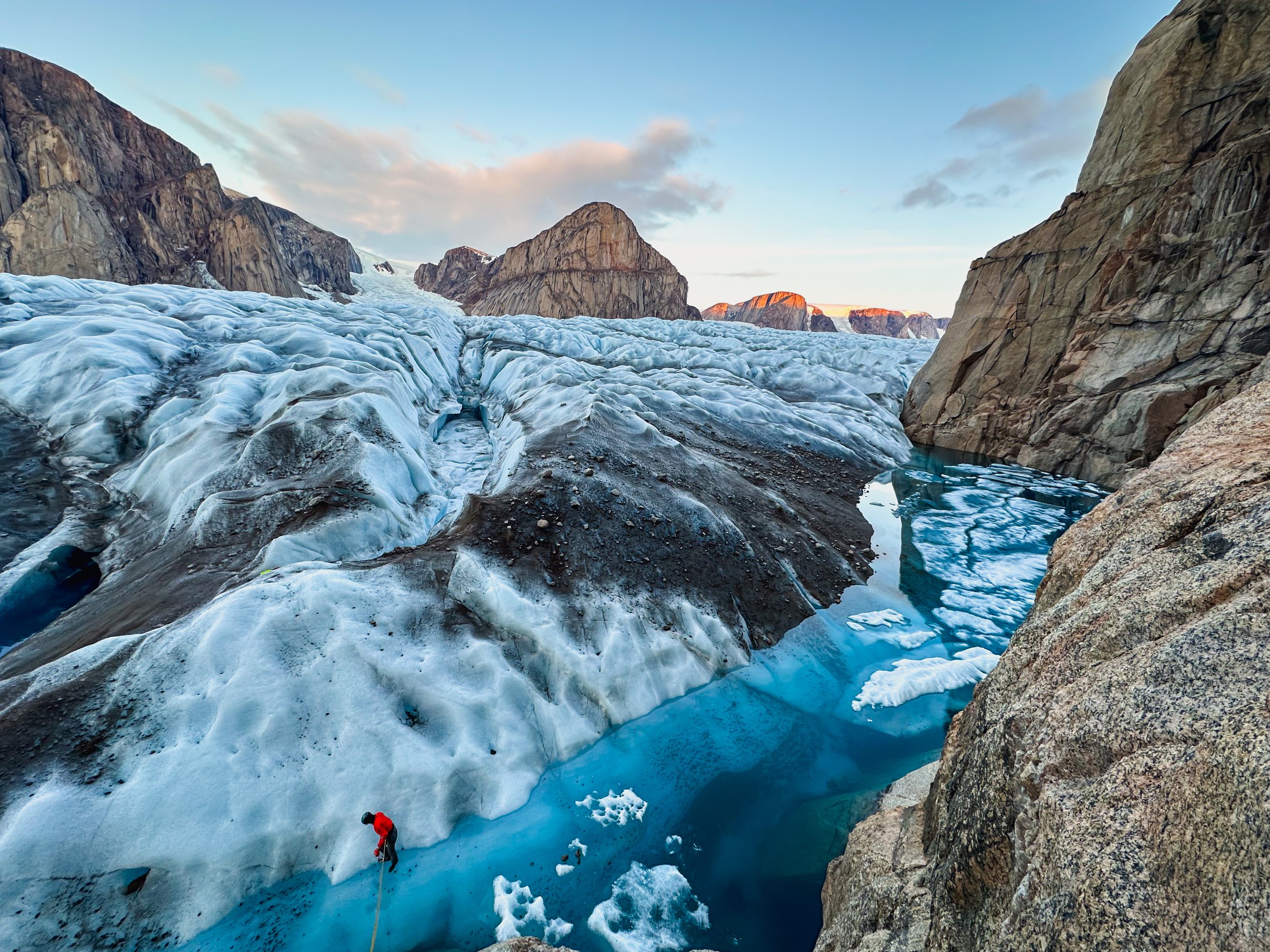
Out for a glacier stroll the day before Alpamayo. PC: Nick Nasca

Adapted from the 2023 trip report by Nick Nasca

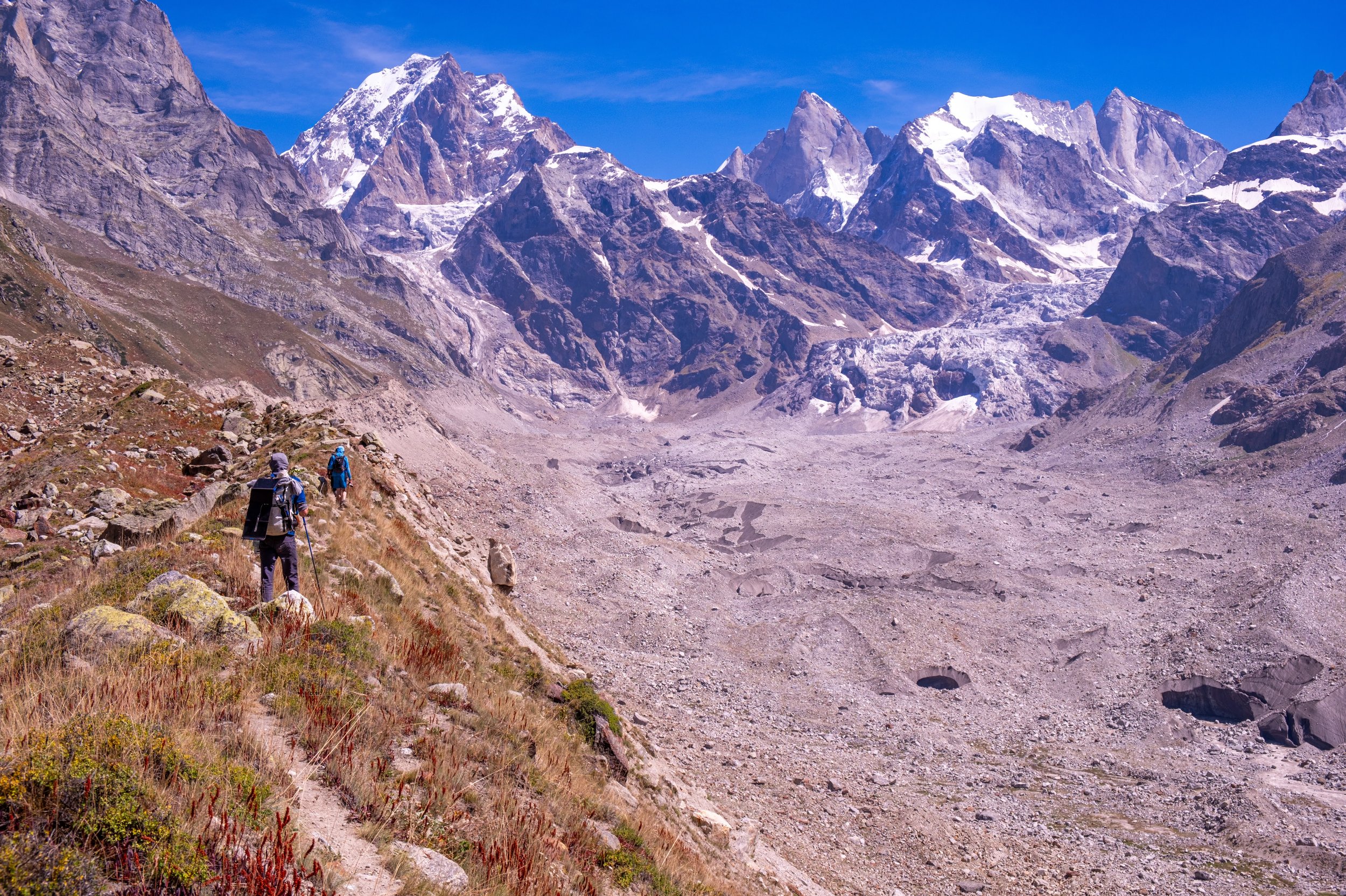
Mike in a meadow with the Husacaran Massif in the background on our first day in the range. PC: Nick Nasca

In the Summer of 2023, I went to the Cordillera Blanca with my friend and climbing Partner Mike Buyaskas. We were supported by the AAC's Live Your Dream Grant and the Loa Fund. We intended to complete an ultra mountaineering link-up. I spent countless hours researching the terrain via satellite imagery and corresponding internet photos, messaging with Peruvian guides via social media, and reading obscure trip reports I'd found from buried corners of the internet. We planned to pre-stock four camps and make a three-week push, summiting eight mountains along the way. In addition to the mental and logistical prep, Mike and I followed a training program for the six months before our expedition.  

On June 18, we landed in Lima with a ridiculous amount of luggage. One bus ride later, we were in Huaraz packing the bags that would be used for our restocked camps. We hung out around the Andean Kingdom and the Casa de Guias to learn about recent mountain conditions. We soon met Manuel Bernuy Ponte, a young Peruvian guide and owner of Peruvian Climbs. He was our most helpful connection in Huaraz. Manuel made himself and his experience in the range incredibly accessible, giving us an accurate picture of what to expect in the stretches where our route departed from the usual trodden paths of the Blanca. He also helped us secure a driver, safely stash our gear in multiple locations, and find fair prices on bulk supplies we needed.

Chopicalqui

We prepared nonstop for two days, then launched into the range with a plan of acclimatizing and stashing resupplies. We were scouting terrain between Huascaran and Chopicalqui five days later when we decided to adjust plans. A snow bridge had collapsed on Huascaran, killing a guide in the process. The prospect of equipping a ladder crossing was on the table, but there was no telling if or when that would occur. Furthermore, our on-the-ground appraisal found that linking Huascaran and Chopicalqui would require traversing extremely dangerous and highly technical terrain. The conditions that would have allowed for a more reasonable attempt simply no longer exist due to the rapid melt-out in this range. Here, we conceded our first route change, deciding to drop the first leg of our ultraneering challenge and to ration our food to stay longer and make an attempt on Chopicalqui's summit while we were at the moraine camp. 

Nick posing for a sunset picture at Chopicalqui base camp. PC: Mike Buyaskas

Knowing how slowly we moved in our barely acclimatized state, we started from moraine camp at 10 p.m. We plugged along the most extensive glacier we had ever walked on all night until we found ourselves 400 feet short of the summit by sunrise. We had fought the effects of altitude for the entire push when they finally caught up to us in the form of a costly miscommunication, which ended in our rappelling. We broke down our camp that afternoon and hitchhiked back to town by night.  

Quitaraju and Alpamayo

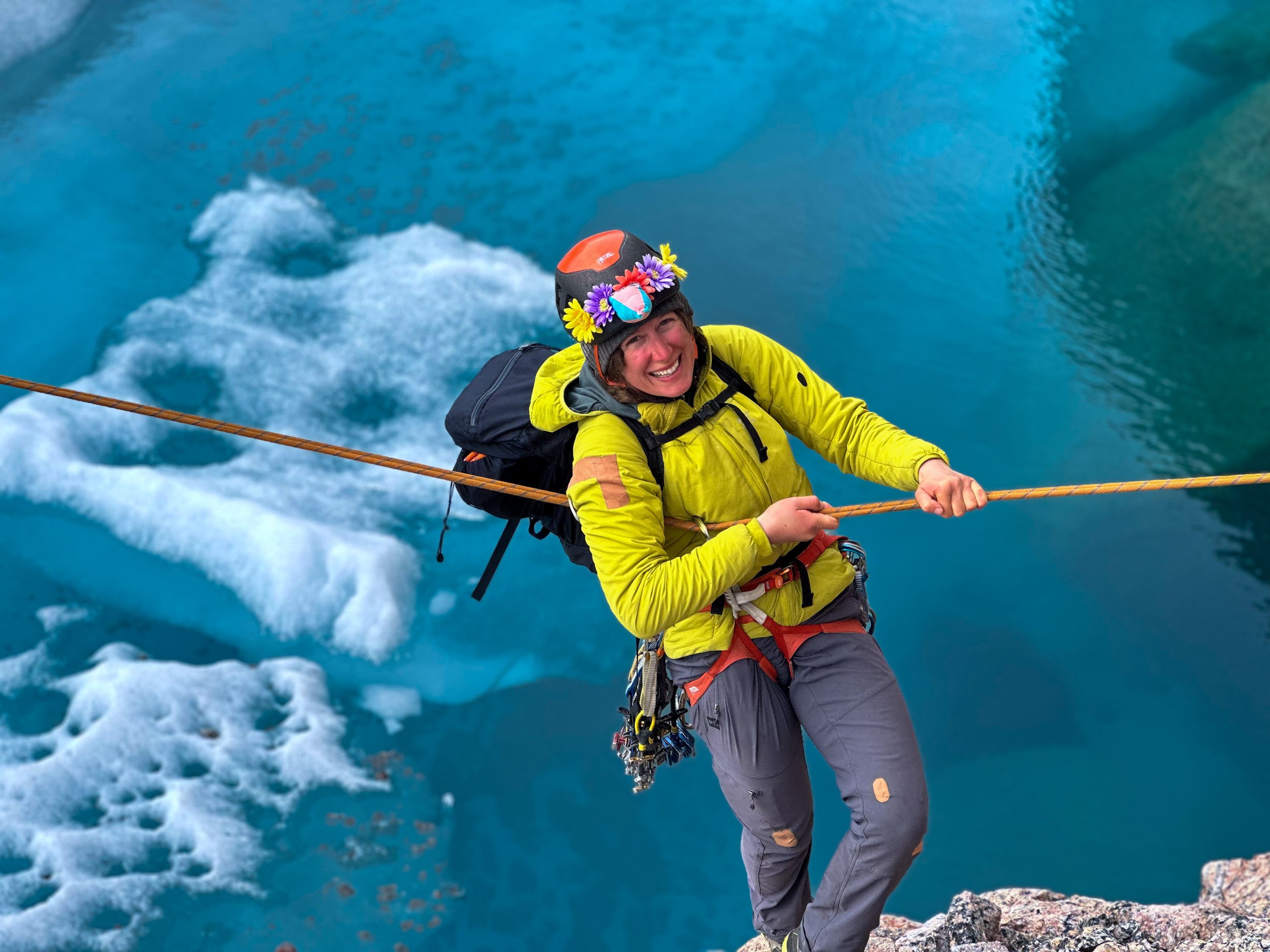
Nick revelling in the sunset and stoke underneath Alpamayos West face. PC: Mike Buyaskas

After a day and a half of rest, we packed enough supplies for a week, intending to climb Quitaraju and Alpamayo. The climb from Moraine camp to the Alpamayo Quitaraju col was strenuous. We climbed two pitches of low-grade alpine ice with heavy packs, which made for a more challenging day than expected. Before we could drop our packs at Col camp that afternoon, a giant ice mushroom cleaved, sending an avalanche careening directly down the runnel that contained our intended climb. These factors combined to make Alpamayo loom in my heart the same way its western face would loom over our tent for the next few days. Unfortunately, the next morning, Mike woke up altitude sick, and we decided to rest instead of attempting Quitaraju. The day after, we climbed Alpamayo. The climbing in the upper runnel was fantastic, and it felt like the whole world rotated on the axis of single moments between swings and kicks. I topped out on the summit ridge, and due to time constraints, we rappelled from there, despite the ridgeline traverse posing no more difficult climbing. 

Rest days

The next day, we got into town, and the day after that, we went for a trail run to celebrate Mike's birthday and take a break from the expedition. We reveled in our further acclimatization and returned to the base of Huandoy and the Pisco refugio, where friends were looking after the bag filled with our first stocked camp. Our ultraneering traverse received the final nail in the coffin when we observed our route up Huandoy's East Face nearly melted out, exposing bands of heinous chossy mixed climbing that otherwise would have been ice and snow. Our route would be too dry when we were poised for a summit attempt. We had yet to make a true summit but now believed ourselves to be acclimatized, so we set our sights on doing Tocllarajus W Face Direct (D+) in a faster and lighter style. 

Tocllarajus

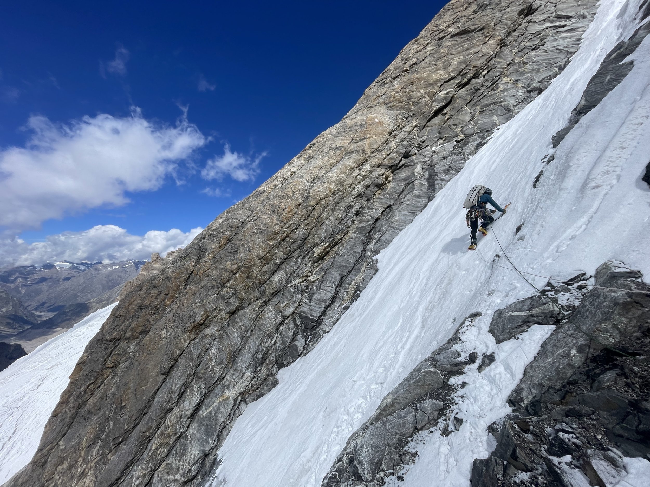
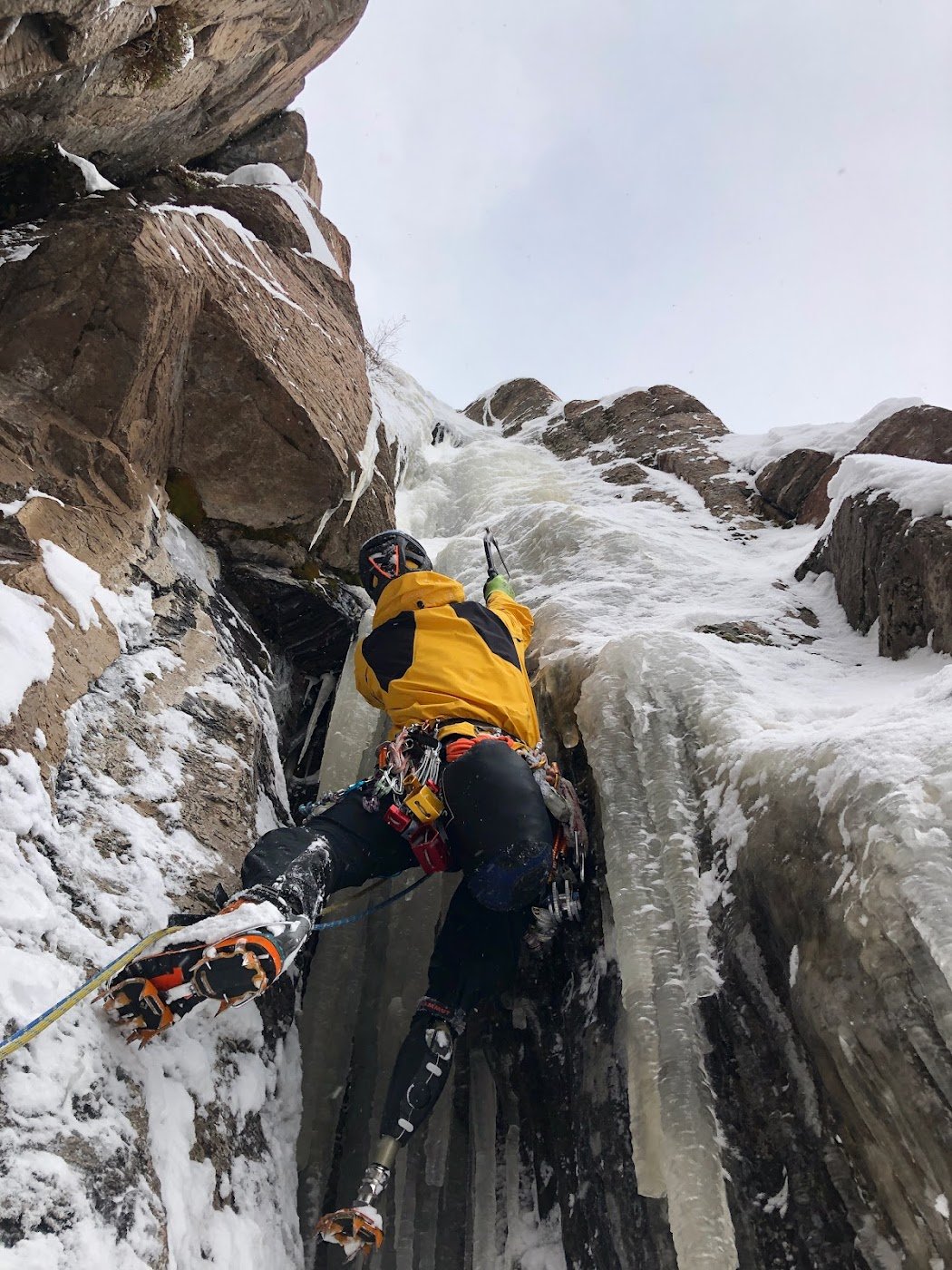
Nick roping up for the hike back from Tocullaraju high camp, The line Nick and Mike attempted on Tocullaraju's W face climbs the icey path directly through the rocky pinch high on the climber's right side of the face.

We approached the base camp in one speedy push the night we returned from our trail run. The next day, we reached glacier camp directly underneath the face. We watched our route for a day and planned a detour from the original line to thread a safer needle between seracs high on the face. We heard the route had just yielded its first successful summit days before, after turning around many this season. We started at midnight this time, and after delicately climbing the giant icey flower petals of the upper bergschrund, we suffered excruciatingly cold and exposed belays up the sheer ice face. About two pitches from the summit ridgeline, as the sun rose, Mike began to feel too altitude sick to continue. Using zero threads, we were able to bail down the face relatively quickly. 

Expedition Changes

Mike had to leave Peru early due to a personal situation developing at home, which greatly limited our options for the remainder of the trip. We now had ten more days, and due to Mike's altitude issues, we eventually settled on a smaller, more technical route. We decided to try what we thought may be an unclimbed line on the south face of Vallunaraju's south summit. It involved 300 feet of 70-80 degree mixed climbing, which gave way to 3-400 more feet of easier mixed terrain. 

Vallunaraju

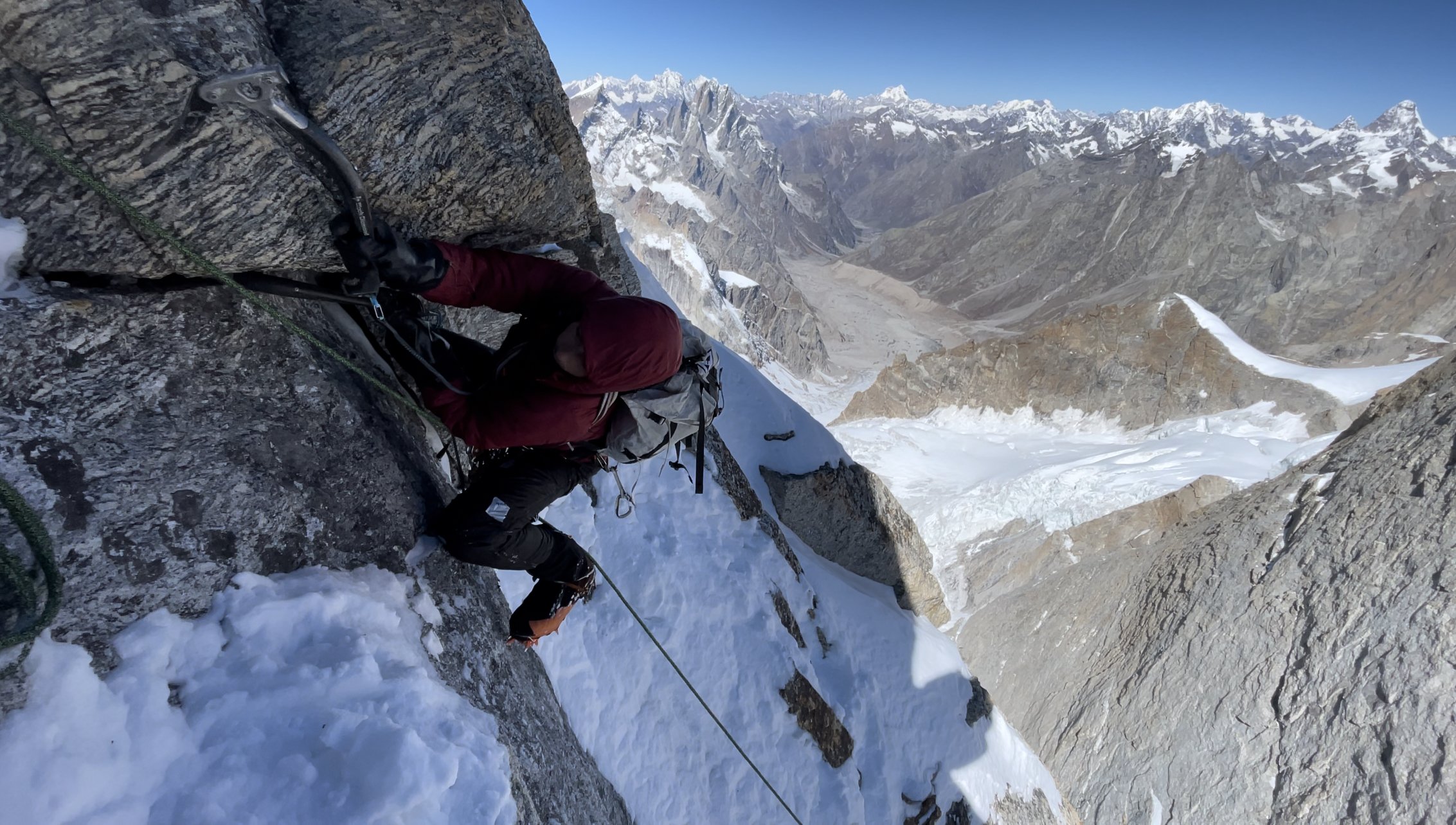
Nick finding the start of the potential new line we attempted to climb on Vallanaraju Sur. PC: Mike Buyasakas

We attempted the peak in true alpine style, starting from the gate for the national park at the mouth of the approach canyon and going gate to gate. I led an awesome M4- pitch at the start of the technicalities on beautifully striated granite. Still, we again bailed due to dangerous deep-faceted snow lurking underneath trapdoors of semi-firm crust on the upper face. Over the summer, we found that the south-facing slopes were the most likely to have that terrifying, completely unstable Peruvian snow.  

Huamashraju

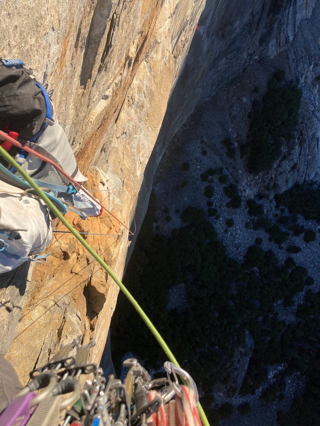
We had time for one more climb before Mike's departure, and we chose to switch things up and try the classic Sins-Hanning route on Huamashraju. It is a five-pitch 5.9 on a splitter granite wall that finishes up a moderate snow ridge to the summit. We approached in the evening and bivied in a boulder cave at the very base of the route. The rapidly melting glaciers in the Blanca have formed a small pool at the base of the wall, allowing us to advance past basecamp and skip out on melting snow. The following day, we led in blocks, with Mike tackling the delicate slabby corner crux of the lower wall while I got the pleasure of pulling a fantastic roof and bumping our only #4 up the back of the offwidth squeeze pitch. We started simuling when we got up high, and once atop the ridge, we found nothing but smooth low-angle granite for another three rope lengths. These 3 pitches are apparently a new development even compared to just two years ago when it was reported that snow was reached at the beginning of the ridge. We transitioned into our crampons and soloed to the summit. Unfortunately due to a crampon malfunction Mike decided to stay behind and set up our first rappel. The final snow ridge included a 100 foot long steep airy traverse across calf high penitiente.  The Penitiente gave way to a final rope length of easy mixed climbing requiring a couple of easy blocky mantles on rock.  At the top I admired Nevado Huantsan for a moment before turning around to start the descent: a snowy down-climb proceeded by 4 rope stretching double rope 70 meter rappels. One very long hike later, we were back at the trailhead around 11 p.m., where the onset of giardia rocked me the minute I sat down on the side of the road.

Leaving the Andes…

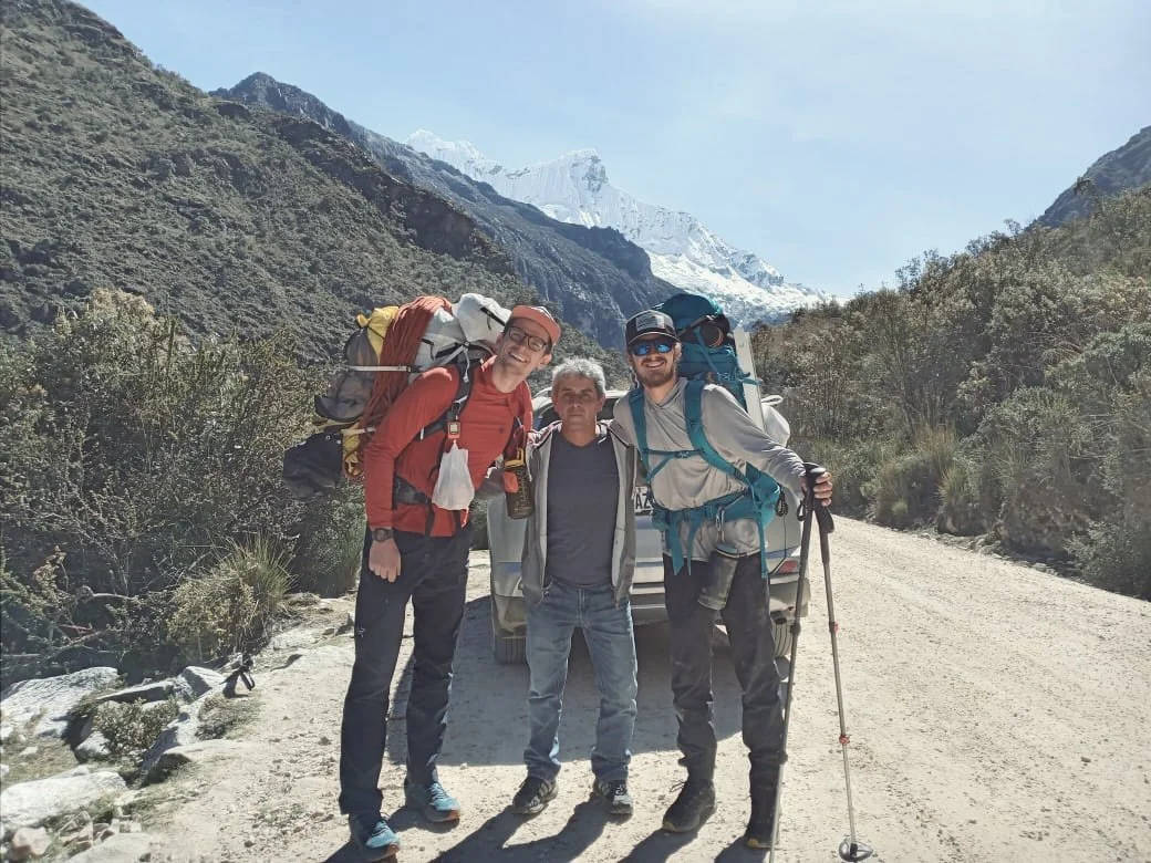
Our driver Freddy, a cousin of our host in Caraz. Freddy enjoys Mountain Biking through the canyons of the blanca, and his company was much appreciated during the few down days we had in Caraz. PC: A Passing Tourist

Mike left the next morning, and after five days of being sick in bed, I finally recovered. For my last adventure in the Andes, I took a long, all-day trail run up a lesser-known Quebrada. I had a hunch of where I might find water ice based on locations where I'd seen some ephemeral smears over the past two months. Right where I was expecting, I found an ice line that was even better than I could have imagined. This line of nearly 1000 ft of steep ice was the best-looking ice climb I'd seen in Peru. There is a small vanishing serac above it, and judging by pictures I found of the same face in 2013, the overhead danger will continue to decrease in the coming years. This experience had me leaving Peru with lots of stoke in my heart for the many lifetimes' worth of adventures to be had here on our planet. Overall, I learned a great deal on this trip. I now understand how to look at prominent, snowy peaks from a distance and estimate where the most sensible weakness may be and what the terrain will entail. I also got my first taste of leading out into entirely unknown terrain and am hooked. 

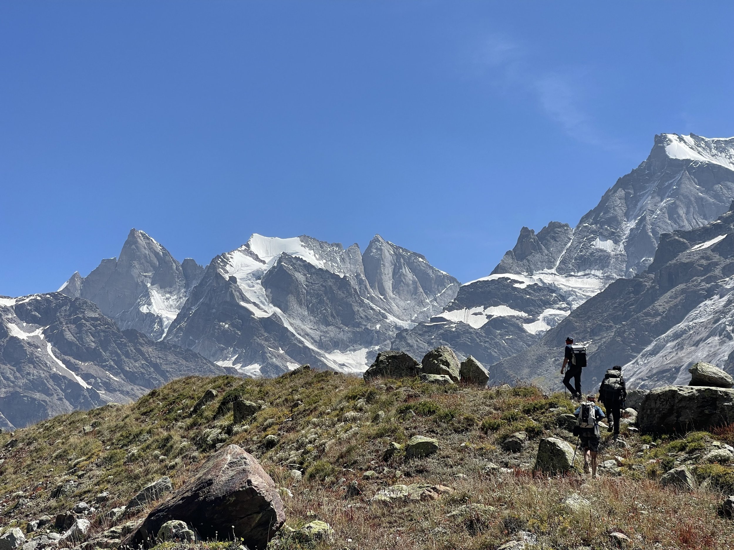
On the upper slopes of Chopicalqui, shedding layers before continuing the descent. That evening we would make it back to the canyon floor and haggle/hitchhike our way back to Caraz. PC: Mike Buyaskas

In terms of our ultraneering challenge, the goal is still accomplishable. I don't know if I will ever attempt it again. It required massive amounts of logistical challenges as well as blue-collar prep work. I underestimated just how demanding the conditions might be between 8 different mountains. Although all of the routes we intended to climb would go at some point during the season we spent there, being able to climb all of them safely in the same three-week window would be a rare occurrence. If one were to fly off the summits of these peaks using a wing, the ultraneering traverse would become much more feasible and enjoyable. Hopefully, one day, I will get the time and resources to begin learning the art of flying, but I must return to the ordinary world via the booter. Thank you, American Alpine Club, for helping me have a once-in-a-lifetime summer in the Andes. 


This could be YOU! Apply for the Live Your Dream grant before it closes, on April 30. Don’t wait, your dream expedition is just an application away!


Powered by:

Immaterial Climbing: A Story From the Catalyst Grant

Reported by Sierra McGivney

Photos by Ben Burch

Ben Burch climbing, featured in Immaterial Climbing. PC: Ashley Xu

In the backdrop of Northern Appalachia, Ben Burch (he/they) drove to nowhere. Like most high schoolers, driving was a source of relief and independence in the wake of an angsty breakup. Eventually, Burch needed to stop at a gas station, and the one they picked happened to be next to a climbing gym. Bored of driving aimlessly in their car, Burch wandered inside the climbing gym, opening the door to climbing and its community.  

Burch continued cultivating their passion for climbing in Philadelphia when he went to college. There, he worked with other queer climbers to create PHLash, a community-based, peer-led group that aims to bring together LGBTQIA+ individuals to climb and socialize. Burch found he loved leading and being a part of that community. It was a space that held community and understanding in a sport that traditionally has not always provided that. 

The mood shifted last year when West Virginia attempted to pass a law banning events based around queer affinity. West Virginia is only a stone's throw from Pennsylvania and hosts Homoclimbtastic, the world's largest queer-friendly climbing festival. Burch and his friends found themselves distressed about the status of Homoclimbtastic. This event, like PHLash, had enriched their climbing experience. It kept Burch climbing and invited others into the community. But now, they didn't know if it would ever exist again. Instinctively, Burch thought, I need to document this. 

"I just needed to have something recorded down so people know that this event was here and that we were here," said Burch. 

Their idea was to take photos from affinity groups and events they attended and post them on Instagram to exist somewhere in the ether. On a whim, Burch applied to the American Alpine Club's Catalyst Grant and was chosen. Their photos would no longer live just online but in a physical book: Immaterial Climbing: A Queer Climbing Photography Zine. 

Burch embarked on an East Coast climbing adventure, photographing and memorializing queer events, meetups, and climbers. 

Ultimately, the version of the bill that would outlaw Homoclimbtastic did not pass; however, the bill that did pass put restrictions on queer events. Minors are not allowed to be involved in any way in drag shows in West Virginia, and drag show organizers are responsible for checking the age of attendees. At the Homoclimbtastic Drag Show, participants had to wear a wristband and have their IDs checked. 

Despite the political backdrop, the high-energy drag show and dance party at Homoclimbtastic was one of the most fun nights Burch had in years. For some photographers, when they capture moments through the pictures they take, their memories bend to how they remember them. That night, Burch took a photo of someone dancing surrounded by a bunch of people, all wearing wristbands, and titled it Armbands Around Salamander because the person dancing in the center has a salamander tattoo on their shoulder. This ended up becoming one of Burch's favorite photos in the book. 

"They're really kind of lost in their moment of dance, and for me, even though it is kind of a reconstructed memory, I really think about that dance party as this moment of freedom and expression regardless of the circumstances that were trying to repress that," said Burch.

In the book, Burch focuses on his home base, too. 

One moment stuck out to Burch. A participant at PHLash wearing a Brittney Spears t-shirt said that climbing in Pennsylvania is like Spears' song …Baby One More Time. The rock climbing in the northeast is generally not friendly. Outside of Philadelphia, one of the main climbing areas, Hayock, is home to Solid Triassic Diabase, a type of rock that requires precision on unforgiving edges. Philadelphia feels like a city that embeds grit and determination in its residents, much like the climbing in the area. The lyric hit me baby one more time embodies the rough climbing and the determination of the climbers in the area. 

Photo by Ben Burch

Burch became interested in the idea that the city you're from—not just the culture–is reflected in the climber. In the book's PHLash section, he mixes photos from living in Philadelphia with climbing photos from the meetup. 

Next, Burch changed their aperture, widened their depth of field, and traveled down to Atlanta, Georgia, to the southeast bouldering scene. 

"[Bouldering in the southeast] is truly this perfect marriage of texture and shapes that force precise body positioning and control, mixed with the raw power to get through the fact that they're all just slopers disguising themselves as crimps," said Burch.

There, he participated in a meetup with the affinity group Unharnessed, an LGBT+ and allies climbing club. At this meetup, Burch was more of a wallflower; he had a couple of friends in the Atlanta area but was not a deep group member in the same way as Homoclimbtastic or PHLash. He listened in on the conversation between climbs and found it was not the idle talk that normally existed at the crag. People would talk about the climb or the person climbing, but then the conversation would shift to asking if anyone had extra food to put in the Atlanta community fridge or about the community resources near the gym. He was so struck by how focused the group was on building community through resources and knowledge. 

It reminded him of a quote by bell hooks, "I think that part of what a culture of domination has done is raise that romantic relationship up as the single most important bond, when of course the single most important bond is that of community."

In their portrait section, Burch created a shallow depth of field, softening the background and pulling queer climbers to the forefront. Andrew Izzo is a crusher. He has recently sent Bro-Zone (5.14b) in the Gunks and Proper Soul (5.14a) in the New River Gorge and is a consistent double-digit boulderer based in Philadelphia. He only came out recently and is featured in Immaterial Climbing: A Queer Climbing Photography Zine. Burch thought that taking and publishing these photos of him almost served as a coming-out party. Izzo felt like there was no better way for him to come out. The intersection of being part of the queer community and part of the climbing community showed all of him. "That was a special moment in taking these photos, serving as a space for someone to embrace all of themselves," said Burch.  

Everyone featured in the book's portrait section was chosen for their excellence in community work or climbing. Burch wanted to highlight these individuals who were balancing so many aspects of their identity and achieving so much within the climbing community.

The book revolves around the community Burch is most familiar with—that he could really speak to without fear of misrepresentation. 

"I think all climbers are in constant chase of flow, of that feeling when you are climbing, and it feels like your body is in perfect response to what it needs to do with the rock—this immovable object that you have rehearsed and understood. For me, the East Coast Climbing Scene feels like that state of flow.

“It feels like a place where you are understood, and people know who you are, even without thinking about the larger circumstances. It's this, like, perfect moment of escape in the larger challenge of—to complete the metaphor—trying to finish the climb," said Burch.


More about Immaterial Climbing: A Queer Climbing Photography Zine and Ben Burch (he/they): 

PC: Ben Burch

Burch is a photographer and climber currently based out of Washington DC. Part of queer affinity groups since they began climbing, he wanted to use this zine as a love letter to the spaces that gave him so much. For more of their photography, please follow them @benjammin_burch on Instagram.

Immaterial Climbing is a photography zine which explores the world of queer climbing. Taken over the course of 2023, this book explores meet-ups, affinity groups, and climbers who are creating their own space of belonging. The project features the event Homoclimbtastic, affinity groups Unharnessed and Phlash, as well as portraits of queer climbers. It is a lovely coffee table book, a book to add to your gym's collection, or a reminder that we'll always be here. Grab your copy.

This project was made possible through the American Alpine Club and the bravery of the queer climbing community.

New Route on White Sapphire

Cerro Kishtwar (center), White sapphire (right). Photo by Vitaliy Musiyenko.

A Story from the 2023 Cutting Edge Grant

By: Sierra McGivney

On October 6, 2023, Christian Black, Vitaliy Musiyenko, and Hayden Wyatt summited White Sapphire, a 6,040m peak in India's Kishtwar Himalaya. The new route was named Brilliant Blue (850m, AI3, M7+). To attempt this mountain, the team received $8,000 from the American Alpine Club's Cutting Edge Grant, made possible by Black Diamond. They climbed the route free and in alpine style. This is the third ascent of White Sapphire.

Pack mules descending the valley on our hike to basecamp. Photo by Vitaliy Musiyenko.

AAC: In 2022, you received the Live Your Dream Grant to attempt a line in British Columbia on Mt. Bute. How did you transition from a Live Your Dream–style expedition to a Cutting Edge–style expedition in just a year?

Christian Black: The funny thing was we just needed an idea. Expeditions are challenging to plan. It all came from our friend giving us the idea—something to dream about, on the other side of the world as opposed to in America or Canada.

AAC: White Sapphire has seen two first ascents previously, via the west face in 2012 and the south face in 2016; how did you choose this peak and, more specifically, the line?

CB: I've always struggled to plan what to do in an area I haven't been to. There's just too much information out there. The story is that I met a guy who had spent his whole life going on expeditions. He had a whole list of unclimbed things he never got around to. He was trying to find people to do them. And he approached me and said: You're a big-wall climber with alpine climbing experience. You should check out this peak. I've got photos of it, and it's pretty cool looking. So, the original intent was to climb the big-wall rock face on White Sapphire, knowing that we had to be flexible to the conditions. We ended up climbing more of an alpine route because we went later in the season, and it had snowed and gotten cold. But to answer your question, it was a gift from someone who has done a lot of cutting-edge expeditions and is out of the game now. He had said: I'm aged out and happy to pass on the torch of ideas if you're interested in going to the Himalayas. The Himalayas are such a large place; you'll never know what to do unless you go once, so you just need a reason to go.

Hayden starting a simul-block up midway up the steep snow and ice of the lower section of the route. Photo by Christian Black.

AAC: Who gave you the idea?

CB: It was Pete Takeda [the editor of Accidents in North American Climbing.] I'm like a bad historical knowledge climber, so I didn't know much about him until later. But, I mean, obviously, he's legendary.

AAC: What type of climbing did you encounter on White Sapphire?

CB: We first encountered 2,000 vertical feet of steep snow and ice with moderate mixed climbing toward the top, anywhere from 60 to 80 degrees snow, and AI3 climbing. Then, it was more like M4 and M5 climbing to the top of the snow part. The upper headwall that goes up the direct north face of White Sapphire Peak ended up being a little over 200 vertical meters of climbing and seven or eight pitches of fairly sustained, steep dry tooling. And so there were about two pitches of M7+, a few of M6 and M5, and some alpine ice and snow mixed in.

AAC: How was the quality of the ice and the rock?

CB: It was really good. The rock up there is not granite; it's a gneiss. I studied geology, so I noticed, but you can't tell from far away. It forms cracks differently. It climbed quite a bit differently, but the rock was very solid. Except for one pitch, all the rock was pretty good.

AAC: Can you walk me through from when you left advanced base camp on October 5 until you returned on October 7?

CB: Yeah, so I might back up a bit because we had two attempts on the peak, the first one thwarted by a broken stove when we were 100 meters from the summit. It adds to the lore of the story. The moral of the story is the fuel mix in India is a little different, so it didn't work well with our stove and caused it to overheat. We learned a hard lesson about not taking a backup stove. That was our first attempt, but I'll fast-forward to the successful second attempt.

Starting to rappel from the notch after first attempt. Photo by Vitaliy Musiyenko.

We came down on that first attempt and had a few days at base camp. The weather looked like it would be good again, so we packed our food and some stoves and hiked up there. We waited about six days of weather for a good window to appear at our high camp. We left around three or four in the morning on October 5 from our advanced base camp at 15,800 feet. Then, we had a two- or three-hour glacier approach to the base. After that, we started simul-climbing the lower, less steep section of steep ice and snow. We did about a 1,300-foot simul-climb pitch. Vitaliy led that, and then Hayden led the second half of the ice and mixed climbing to the notch that day. We camped there that evening in our little corner bivy.

The following day, October 6, we woke up and took our altitude med concoction that gave us superpowers. What we had initially climbed as four pitches of steep mixed climbing the first time—we aided a lot of that and left in some of the crucial pins—this time, I suggested we climb it free. We ended up free climbing all of that terrain and didn't aid climbing anything. We did it in two 50-meter pitches. And that got us to our high point. From there, we continued to the summit. There was no terrain harder than those first two pitches. The headwall pops out directly on the small summit. We ended up being on the summit around 7:45 p.m. It was dark by that time of year, so we spent about an hour up there, melted some water, took photos, and enjoyed our time. Then we rappelled in the dark back to our bivy. The next day, we had a slow morning and rappelled back down to our base camp. It was an uneventful third day, which was nice.

AAC: What do you think was your biggest emotional hurdle on the trip?

CB: Oh, man, there were a few of them. A big one for all three of us was definitely the stove breaking on our first attempt. At that point, we were only ten days into our 26-day expedition and were 100 meters from the top. We thought it would be unbelievable if we did this first try. That would leave us with two weeks to climb whatever else we wanted. Accepting the reality that it was unsafe to go up without water was hard for us. We had less than a liter of water to share between three people, which would have been our ration for the whole day. Especially knowing now what the upper terrain is like, I'm super glad we didn’t go that first time. The climbing was still hard and would have taken a long time. Being dehydrated up there is not a safe thing that any of us would be willing to do. So that was a hard truth to accept.

Excited to be at notch bivy before sunset! Photo by Christian Black.

Luckily, the saving grace is that Hayden, Vitaliy, and I are all close friends. Vitaliy and Hayden didn't know each other before the trip, but I'm close friends with both of them. We all have very similar approaches to safety-related decisions. We were all on the same page about flexing the bail muscle. Other than that, we each had our moments of need, which the other two were naturally able to step in and take care of, which was nice.

AAC: How did you end up picking your team?

CB: Hayden is one of my best friends. We worked on the Yosemite SAR team together for a few years. I met him there, and we climbed El Capitan several times together. We just got along energy-wise. Over the past couple of years, we've gotten to go on multiple, more extensive trips together. One of those trips was to Mt. Bute on the Live Your Dream grant. This summer, we went to the Cirque of the Unclimbables for a month. If you're going to be in gnarly places, you want to be with good people. I only climb with my friends in those scenarios—honestly, in most scenarios.

Vitaliy, I met through messaging online. When I worked in Kings Canyon as a park ranger, he had put up a bunch of routes in the Sierra that I kept seeing his name on and was interested in doing. I messaged him to gather information. We ended up linking up on a climb the following year. We had an epic time. We did The Nose in a day as our first climb, and he took a 100-foot whipper. It was really scary, but we both reacted in a way that felt right. It built a lot of trust between us. Even though we haven't always lived in the same place, we'd casually link up for outings. We know each other as solid partners who know their stuff and are easy to get along with.

Photo by Christian Black.

AAC: That's great it worked out so well. It sounds like you had a good team.

CB: Yeah, that was the best part, for sure. You can't compare any experience to doing this with your two best friends. It's just so fun!

AAC: Do you have any fun anecdotes or funny moments from the trip?

CB: The funniest moments were just like how horrible we felt at various times. That is how we each process hard experiences in the moment. You can't help but laugh at it. And that's why we like each other as climbing partners, because none of us take it seriously.

A funny moment for me was when we made it to the bivy notch on the first attempt. It was pretty late, and I had fallen asleep multiple times on the last two pitches. We got up there, and I was boiling the water. It was dark, I was in every puffy layer I owned, and I was ten times more tired than I'd ever been in my whole life at 19,000 feet. I'm holding the Jetboil upright, and my purpose in life has never been more apparent. I hold the Jetboil. If the Jetboil isn't held, the water spills, and we don't drink water. I had an internal moment of reflection, like, wow, life has never been simpler than it is right now. There are only so many times when your life boils down to doing an incredibly simple task. For 45 minutes, that was my whole life.

The first mixed pitch out of the notch bivy. I'm [Christian Black] contemplating how to navigate the unprotected slab to gain the cracks. Photo by Vitaliy Musiyenko.

AAC: Is there anything else you want to add about the trip?

CB: The only thing I have to add is I feel so appreciative of a good team and good friends to be out there with and make hard decisions with. That was our biggest takeaway. We had a two-part goal going into the trip: A) we obviously wanted to come back alive, and B) become better friends. We achieved those goals through the roof. We have a lot of trust in each other. It's a cool medium to experience friendship in.

*Christian Black is writing a feature article for the 2024 American Alpine Journal about this expedition.

The Cutting Edge Grant is Powered By:


Four New Routes on Baffin Island, Canada

Noah Besen Climbing. Photo by James Klemmensen.

A Story from the 2023 Cutting Edge Grant

By: Sierra McGivney

Noah Besen didn't expect to find the Atlantic Ocean frozen in the middle of July outside of Qikiqtarjuaq, a hamlet on Broughton Island, in the Nunavut territory of Canada, off the coast of Baffin Island.

Billy Arnaquq, a local outfitter and guide, remarked, that there was a lot more sea ice than normal for this time of year. The plan had been to kayak to Coronation Glacier, about 75 or 80 kilometers from town, and then hike up and into the glacier. From there, they would attempt to ascend granite walls accessible from the glacier. Besen and the rest of the team, James Klemmensen, Shira Biner, and Amanda Bischke, wanted the expedition to be as human-powered as possible, but there were apparent limitations. They couldn't unfreeze the ocean…And they had about 1,000 pounds of gear. 

About 20 kilometers south of town, the ice was beginning to break up, so the trip was still very much within reach. Arnaquq snowmobiled them out with a big load of their gear to the southern limit, where they stashed their equipment on a little island. They wanted to start the expedition with a human-powered effort, even if it meant changing their original plan. He snowmobiled them back, and they began their journey, walking across the sun-pocketed ice with day packs back to their stashed gear, seals and icebergs lining the way. 

“That was the first big crux,” said Besen. 

Noah Besen in the front and Shira Biner in the back of the boat. Photos by James Klemmensen.

Once on the island, they decided to wait out the ice breakup, thinking it would only take a couple of days. A week passed, so they took matters into their own hands and planned a “staged gear shuttle.” The 24-hour sun poured over them as they dragged their gear to the ice's edge. Dry suits on and boats packed, they individually heaved their boats until the ice cracked and they plopped in. Four days later, they saw the Coronation Glacier flowing into the ocean.

Ten kilometers up the Coronation Glacier, they made their basecamp, where the glacier splits into two forks, surrounded by huge rock cliffs. They would stay on the glacier for 20 days. Now, the climbing would begin.

The team spent days on the glacier with binoculars in hand, scouting out different possible rock climbs and sometimes hiking for hours to get a better angle on certain features. Klemmensen and Besen found a route near their base camp and “just went for it.” 

“We brought enough stuff that we're like—if it doesn't make sense, we have what we need to … just epic back down,” said Besen. 

Twenty hours of climbing on multicolored alpine granite later, the two put up a new route, Salami Exchange Commission (800m, V 5.10). They slept on the top of the wall and spent the next day returning to base camp. 

Photo by James Klemmensen.

Blank chossy walls near camp stymied Bischke and Biner, so they decided to venture to another section of the glacier. Four thousand-foot walls loomed over them as they searched for a choss-free wall to climb. A lower feature snagged their attention. Psyched, they put up a new route, The Big G (350m, III 5.8 ).  

Storm clouds gathered, and rain descended on the team, staying for a week. The days drizzled by. Once the week was up, the rain cleared, and the walls dried. Besen and Klemmensen started another epic.

From far away, Escape from Azkaban looked heinous; blocky rocks and blank faces seemed to greet the two, but once up closer, perfect splitter cracks formed the route. The route was 650 meters and had the most challenging climbing on the trip, with the grade of IV 5.10+.

“It proved to be the best alpine rock I've ever climbed in my whole life,” said Besen. 

The journey back was the inspiration for the name. After topping out, they descended an easier-looking route involving some scrambling. They popped out on a side glacier that connected to the main Coronation Glacier that their base camp was on. Glaciers are constantly moving, creating, and ever-changing. This side glacier had carved out a canyon with raging river rapids, between 60 and 70 feet deep, completely impassable.

At three in the morning, the two ate the last food, mulling over their unfortunate circumstances. The sun hovered on the horizon—all hours normally considered night appearing like sunset—allowing endless daylight hours for their epics. They journeyed around the river and onto a boulder field with water running underneath it. 

“The name came from us feeling trapped and needing to escape,” said Besen. 

Photo by James Klemmensen.

Bischke, Biner and Besen attempted another route, but unfortunately, had to bail. The rock had become very loose, so they decided to put in a couple of bolts and abandon the project. After returning, both groups finished the trip together on one last attempt.

Cerulean water pooled on the sides of the glacier, forming deep, bottomless basins in between the bedrock and the glacier. Besen, Bischke, Biner, and Klemmensen stared down at the water, the rock on the other side just out of reach, but they started to get to work. Besen had brought his dry suit on the glacier in case they might have to ford a raging river. They constructed an anchor using ice screws and lowered Besen into the water. 

“I didn't have to swim that much. I got into about my chest, and I was able to lean, reach, and scurry up,” said Besen. 

From there, they built a Tyrolean traverse and shuttled across and soon found themselves at the base of a cliff. The crux of their climb brought them to a steep hand crack. They topped out farther from the ocean than their previous climbs, seeing the Penny Ice Cap stretch across the expanse. They called the climb Raise the Drawbridge (400m, III 5.10-).

They rappeled down in the dark; it was the first time Besen had experienced true night the whole trip. The season was changing. Their journey was coming to an end but was not over yet.

Photo by James Klemmensen.

By the time they reached the rock that bordered the glacier, the sun began to rise. They still had one more crux: the glacial basins. Crossing back onto the glacier, the ice was tilted upwards, forcing Besen and the team to climb out of the water. Besen had only brought Crocs with him besides his mountaineering boots. There was only one real solution. Besen donned his Crocs, fitting his crampons to them, and shimmied up the other side. He set up a zipline for the others to come down. 

They strolled into basecamp, the glacial ice gleaming, and watched an unbelievable sunrise.

“It was a beautiful moment, too, because we all had this awesome success on this route together,” said Besen. 

The way back was quiet save for laborious gear shuttles and near encounters with polar bears. Big polar bear footprints were left in the sand at their camp near Qikiqtarjuaq. Luckily, Arnaquq had spotted the polar bear 300 meters from their camp and warned them to go uphill. Nothing was destroyed or taken, just a clear path the bear had taken through camp. Once they made it to Qikiqtarjuaq, the group camped and waited out their delayed flights. 

From right to left Noah Besen, Shira Biner, Amanda Bischke. Photo by James Klemmensen.

“For a lot of climbers, us included, Baffin Island has taken on this sort of mythical sense,” said Besen. 

Recent films featuring climbing adventures on Baffin Island, like Sean Villanueva O'Driscoll’s Asgard Jamming and Dodo‘s Delight, inspired the group. After Googling, they stumbled upon a painting by the late Corey Trepanier of the Coronation Glacier. They studied his reference photo, noting the large granite walls surrounding the mass of ice. From there, the idea of this trip started to take form. 

There is still so much potential for exploration on Baffin Island. “This area is really special. I think that more teams or even stronger teams—because we're not pro athletes by any stretch—should go and check it out because we didn't even do the biggest, craziest things at all. There's a lot more to be done,” said Besen.

If you have a cutting edge idea, apply to the Cutting Edge grant today! 

An Alaskan Dream: A Story from the Mountaineering Fellowship Fund Grant

“The remoteness, the lack of people, and the complexities all work to create an atmosphere of real adventure...The 60-degree terrain had my heart racing and coated with the perfect snow; it made for a moment I could only dream of. I stopped to hammer in a picket 30 meters up and then again at the end of the rope, where I took a seat and belayed. Glory!”

Tanner Josey's dream of an Alaskan adventure turned into a reality in May of 2021. Josey attempted to climb Mount Foraker, the third highest peak in the United States.

Dive into the details and epic photos of his trip report and be transported into the Alaska Range. Face avalanche danger, navigate crevasses, and ascend steep snow slopes alongside Josey.

Mount Foraker, AK

Despite the Obstacles: A Story from the Live Your Dream Grant

Adapted from the 2018 Live Your Dream Grant trip report by Bria Riggs.

Sometimes the dream is adventure. Sometimes the dream is discovery. For Bria Riggs, the Live Your Dream Grant allowed her to pursue both dreams simultaneously.

Bria’s funded trip brought her to the Cordillera Blanca region of Peru, where she spent almost eight weeks mountaineering and collecting scientific field data. Working with the American Climber Science Program, Bria ventured to six different valleys within the region and glimpsed countless beautiful peaks. She summited three major peaks (Villanaraju, Pisco, and Ishinca) and attempted two others. 

This expedition was focused on high mountain environmental science, in which her team combined mountaineering and science in order to investigate the impacts of climate change on the glaciers in the region. Specifically, Bria was studying and simulating the impacts of light absorbing particles on glacial melt. She would then go on to use this data in her senior thesis at Bates College.

As both a lover of the mountains and a scientist, Bria couldn’t have asked for a better research experience or introduction into expedition life. 

Over the course of the eight-week expedition, Bria’s team ran into minimal issues. Overall they had great weather conditions for climbing and were only snowed out of one peak (Maparaju). However, an ice bridge that connects to the summit pyramid of Chopicalqui kept them from attempting that peak, which would have been their highest peak of the expedition. To Bria, it felt ironic that climate change is what kept them from collecting their data on Chopicalqui and also kept some of their team from summiting Tocllaraju due to glacial recession and an increase in crevasse danger. 

Unfortunately, Bria  tore three ligaments in her ankle two weeks into the expedition on their first big climb up Andevite. However, Bria continued to climb as much as she could throughout the remaining six weeks but was unable to summit Urus Este and Yanapacha. While this was upsetting, her expedition was still wildly successful in her own eyes. Bria climbed to a new personal elevation record, collected great field data for her thesis, and fell in love with the people, culture, and landscapes of the Cordillera Blanca. The peaks that she was able to summit were incredible and absolutely humbling. 

Bria remembers coming over the crest to the summit of Villanaraju and being filled with joy and wonder. After weeks of frustration and pain from her injury, she had finally reached a summit and was so overwhelmed at that moment. Bria continued to have this same feeling with all of the team’s other summits, solidifying the fact that this is why she climbs and is fighting to save such beautiful places. 

Bria Reflected: “This expedition has had a tremendously positive impact on my climbing career. Not only did it allow me to climb bigger peaks than I ever have, but the experience also taught me a lot about expedition life. While it would have been great if everything had gone perfectly smoothly, in some ways, I am happy I had challenges and setbacks. I think my experiences showed me that in mountaineering, as in scientific research, there are always obstacles and despite these obstacles, I still loved being in the mountains and climbing for the full eight weeks. As a climber, this expedition opened up my eyes to the amazing life of climbing more than any of my previous experiences. Now, more than ever, I am excited to plan my next adventures and attempt to climb bigger and more technical peaks. 

“I have a lot of ski mountaineering experience, but my time in Peru has allowed me to further enhance my rope, crevasse rescue, and overall glacial travel skills. By solely mountaineering, this experience allowed me to focus on the ascent more than the descent as opposed to my previous skiing adventures. I am also more excited about climbing bigger peaks with technical routes.  This expedition was a perfect stepping stone for me to learn more skills and get ready to chase bigger climbs in bigger ranges.”

For Bria, chasing her dreams of discovery and adventure opened her up to the possibilities of future dreams. That is what the Live Your Dream Grant is all about. 

The Live Your Dream Grant is powered by The North Face.

Off Route but Overjoyed: A Story from the Live Your Dream Grant

Adapted from the 2021 Live Your Dream Grant trip report by Mason Risley.

Horses graze as the sun sets over the Tetons. Our route traverses from the right most prominence (Teewinot Mountain) left along the skyline to Nez Perce which is in the forward most mountain in the center of the skyline.

The Grand Traverse is a committing objective that climbs through the highest mountains of the Teton Range: The Traverse was first done in 1963 by Allen Steck, Dick Long, and John Evans going from south to north. Most modern ascents are done north to south and this was what my climbing partner Cvetomir Dimov and I did. The sequence of peaks traveled are: Teewinot Mountain (12,330’), Peak 11,840, East Prong (12,055’), Mount Owen (12,933’), the Grand Teton (13,775’), the Middle Teton (12,809’), the South Teton (12,519’), Ice Cream Cone (12,405’), Gilkey Tower (12,320’), Spalding Peak (12,240’), Cloudveil Dome (12,026’), and finally Nez Perce (11,901’) before dropping back down into Garnet Canyon and returning to the Lupine Meadows trailhead. All told, the trip we planned would be twelve peaks, nearly 13,000 feet of elevation gain, and 14 miles of travel. 

My partner Cvetomir and I decided to make the attempt over the course of three days because we had not done the route before and wanted to give ourselves the best chance for success. 

This objective pushed our physical and mental limits and left us feeling stoked, stronger and more accomplished in our alpine climbing skills. This route and other alpine climbs like it demand excellent endurance, strong climbing abilities, solid judgment, and a dialed gear system that keeps weight to a minimum. In addition, route finding skills and the ability to recognize and correct mistakes quickly is key. Experiences above treeline such as the Traverse stay with you, make you stronger and more versed in alpine climbing. 

The couple hiccups we ran into each day of the traverse cost us some time and in one case a rope, but fortunately nothing else. The story of our attempt on the Grand Traverse is filled with many close-calls, mistakes, and wasted-time, but that is not unique for this kind of adventure. Nothing ever goes as planned in the alpine, so the obstacles that we encountered were pretty par for the course. But as we learned, pushed through fear, and mitigated risk, the stoke just kept increasing. 

We may have found ourselves off route a few times, but that only made the taste of each summit all the sweeter.


Day 1 Moving Time: 14 hours 17 minutes

0345 hours Sunday, August 15th, 2021. The alarm goes off and I embrace the sore grogginess that comes with getting 4 hours of sleep.  

Cvetomir and I had just done a 5.8 warm up climb in Cascade Canyon called Guide’s Wall the day before. Though we cruised the route in good time, it was a solid day of activity which started at 0600 in the morning to get permits for the Grand Traverse. Due to an incoming storm forecast to hit the Tetons that Wednesday—the end of our 3 day weather window—we didn’t have any time for a rest day before the push. 

We started up the seemingly endless switchbacks by headlamp leaving the van at 0420. 

Gearing up for the sufferfest.

Setback #1: Our packs were as light as we could have managed, each of us carrying about 33lbs of climbing gear, a 50m half rope each, food, layers, and a sleep system that would nominally allow us to stay comfortable enough to actually get some shut eye while on route. As dawn approached however, something we hadn’t expected was becoming visible with the early morning dawn: rain clouds, and the not too distant sound of thunder. Right around dawn we started to feel spitting rain. We sought shelter under the few remaining trees before we passed above treeline on the way to Teewinot—around 10,600 feet. We sat down for a moment, looked at the sky and decided to wait it out. 

With half an hour wasted, we started up the remaining 1,600 feet of 4th class and low 5th class terrain as the sun began to appear past the clouds that had been hanging over us. 

Setback #2: The Traverse comes with many challenges, one of which was getting water on route. There are only a few reliable locations on the Traverse where one can get water: 1) the Owen snow field; 2) the snow melt from the boulder field at the lower saddle; and 3) sometimes a small drip that can be formed from snow melt at the saddle between the Middle and South Tetons. Given the scarcity of the precious resource we stopped at the first sight of a slow drip coming off some ice. It was still early morning and the drip of water was painfully slow, but both Cvet and I had already drank a solid liter or more of water at that point gaining the first 3,000 feet of elevation. We filtered up a couple liters of water each and kept on moving. Unfortunately this water recon cost us another 15 to 20 minutes of valuable time. 

Cvetomir Dimov and Mason Risley on the summit of Teewinot Mountain with the Grand Teton and Mt Owen in background.

Setback #3: While Cvet and I were moving up the Teewinot we were passed by another climber who had no backpack or gear and was merely doing his cardio for the week. He said he had been up there many times. So when he passed us we watched him go towards a gully on the northern side of the east face (climbers right). We assumed he was on the standard route and decided to follow his path, although he quickly went out of sight. Upon reaching the gully he had passed through, we realized we were in steeper terrain and the path we were on was taking us off route. After some tenuous scrambling, we quickly reached the exposed summit of the Teewinot around 1000 hours. This was the first, but not the last, time we would head off-route. 

Setback #4: From the Teewinot we made quick work to gain Peak 11,840. At this point we crossed paths with another team also doing the Traverse over 3 days: Jackson, an arborist from Seattle, and Naphun, who was living in Lander, WY working for NOLS. Jackson and Naphun had a single 50m rope and the route beta indicated one needed a 60m rope to reach the ground on the last rappel off peak 11,840. Cvet and I were climbing with double 50m ropes, so we joined teams and rappelled off the west face in two raps: a single 50m rope followed by a double 50m rope passing the last rap station. In hindsight we should have done 3 raps as the rope got stuck when being pulled because we combined the second and third rap. At this point we ran into another group of climbers also doing the Traverse: On several other occasions during the Traverse we crossed paths with their team and worked together to figure out the route. 

Looking back at the East Prong and Koven Col from the base of Mt. Owen. We down climbed the exposed interface between the snow and shadowed rock face.

Near Miss #1: Scrambling up to the East Prong was pretty straight forward, however descending the East Prong into the Koven Col presented a tenuous problem of down climbing a wet rock face adjacent to a hard frozen 70 degree snow slope. The rock had no viable protection and a fall here would result in a quick slide down the snow slope to one’s death in a boulder field 600 feet below. Cvet and I gingerly soloed down the wet rock and on several occasions had to do foot jams in the gap between the ice and the rock. We had brought a singular glacier ax but the summer névé was so hard frozen that crampons and at least one tech tool would have been necessary to traverse it with any appreciable level of security. 

Setback #5: We scrambled up another several hundred feet from the Koven Col to the east facing Owen snowfields. Jackson and Naphun were ahead of us and had dropped their packs and soloed up the north east face of Owen. Cvetomir and I refilled our water then scouted out where to go next to gain the Koven Chimney route to summit Owen. On the southern side of the Owen summit block we found a notch leading to the west side of Owen’s south ridge with some rap anchors. This gully was our descent from Owen to reach the gunsight notch separating Owen’s south ridge from the Grandstand and north ridge of the Grand. We dropped our packs here and decided to solo up the 5.4 Koven Route which looked easy from where we were standing. However, Jackson and Naphun now came back into sight down-climbing the lower stretch of the Koven Route, they looked uncomfortable and sketched out so Cvet and I decided to bring one 50m rope and rap the route as opposed to down-climb it, which also gave us the option of roping up if we felt we needed it. We soloed up to the top of Owen and at the final summit block missed the small gash that gains the final chimney to the proper summit.  We walked to the north side of the summit block which provided an extremely exposed and unprotected mantle move to the summit. Backing off of this particular move we turned back, preparing to go down the route and keep moving towards the Grandstand when we found the correct chimney and gained the summit.

Awesome bivy site at 12,300 feet on the south ridge of Owen. The North Ridge of the Grand Teton beckons.

Near Miss #2: Returning to our packs after a few raps down the Koven Route we did a double 50m rap down what was probably the worst and most sketchy rap I had ever done. The rappel was through a choss filled death gully and the entire time I was going down I was terrified of the rope knocking a basketball sized block down on top of me. As soon as I was off rappel I ran far out of the path of the gully as Cvet came down knocking rocks down as he went. We continued navigating the terrain towards the gunsight and found a bivy site on the Owen side of the notch. It was about 7pm at this point, we still had about 2 hours of light left but we were both exhausted and decided to bivy there that night as opposed to getting up to the base of the north ridge that evening. This was the right call as the next morning it took us a solid 3 hours from that bivy just to reach the Grandstand which involved several double rope raps into the gunsight followed by a couple of pitches and more scrambling to reach the Grandstand. 

During this first day due to the amount of exertion from the elevation gain and altitude, both Cvetomir and I drank about 6 Liters and were still struggling to stay hydrated. We topped off 3 L of water each from the Owen snowfield with the hope of having 1L for dinner and breakfast and 2L of water for the North Ridge of the Grand the next day. 

Day 2 Moving Time: 13 hours 44 minutes

Starting out from our bivy spot at a leisurely 0640 we moved to the top of the gunsight and proceeded to do three full 50m raps to the bottom before I led up the first pitch out of the notch towards the Grandstand. Cvet swung leads and took point on the second pitch which was fun mellow climbing up large holds on golden granite. Scrambling the remaining several hundred feet of elevation brought us to the top of the Grandstand and the start of the North Ridge. Cvet and I swung leads on the ridge.  We reached a large chossy shelf and decided to take the Italian Crack variation of the ridge as opposed to the classic Chock Stone Chimney. This decision was made in the interest of saving time but ended up likely taking more time to complete than had we stuck with the original route plan. 

Setback #6: We had done our route research for the standard Chock Stone Chimney and didn’t have a solid grasp on where the Italian Crack variation was. Looking at topo’s and route beta for the Italian Crack we thought we saw the correct route. Jackson and Naphun also arrived and between the 4 of us, looking at the same topo and different guide book sources we had brought, we decided we had identified the correct line for the start, which should have been a 5.5 face up to a 5.6 roof. In reality our respective teams put up some interesting variations to the north ridge…neither variation is recommended. Because Jackson and Naphun were moving faster than us we let them lead up the route and figured we would follow them. It cost about 1.5 hours of time and seeing Jackson struggle on their line we took another line to the immediate left of theirs. 

Not The Italian Cracks! Grand Teton North Ridge Jackson-Naphun variation in red and the Cvetomir-Mason variation in yellow. 5.10b; Not recommended.

Cvetomir was taking the lead for this pitch and started up a small rock pillar to gain the face. Moving up the face the terrain quickly entered 5.7 and 5.8 territory before reaching a roof move which we both felt was around the 5.10a/b grade. We were very much off route and our only option was to continue up, as bailing from our position would have been more time consuming and dangerous than proceeding. I took the next lead up bulging 5.7 terrain trending left to a small alcove of dark rock. Out of rope and most of my pro, I finagled a solid anchor out of micro cam, a nut, and a tricam, and brought Cvet up. Cvetomir launched up the next pitch which was a grade more mellow and brought us to the second ledge of the north face. This allowed us to traverse west to resume the proper N. Ridge route. 

I took the next lead up the first set of chimneys trending left then around to a dual chimney system both of which had a chock stone in them. I went to the left for a full 50m pitch. Cvet swung leads and continued up the chimney for another cruxy chock stone feature topping out at a field of steep boulders in 4th class terrain at the top of the chimney. At this point we put the ropes in our packs and scrambled to the summit. Getting off route cost us valuable time and resulted in us taking 8 hours to complete the north ridge.

Despite being on the summit so late in the day, we still were stuck behind a couple parties rapping off after completing the Exum Ridge, they said there were 7 or 8 parties doing the Exum Ridge that day. We finished the raps off the Owen Spalding (OS) route at 1950 and started down the OS gully towards the lower saddle. It took us 1 hour to get down from the upper saddle to the lower saddle and during which time a strong wind and rain storm rolled through with gusts up to 35mph and intermittent heavy rain. We found a boulder bivy spot near the lower saddle water source and passed out for the night after another long day. Neither Cvetomir or I had any appetite and had to force down our dinner rations before turning in. 

Approximate line of route taken on North Ridge of the Grand. The middle section we were off route but made it go. The actual Italian Cracks route goes much further left on the northern aspect of the ridge.


Day 3 Moving Time: 15 hours 15 minutes

The alarm went off at 0430 after another unrestful night of tossing, turning, waking up due to occasional rain pours, gusting winds and later by loud hikers ascending the OS route. As we woke up and looked down from the lower saddle we saw what seemed to be upwards of 30 to 40 headlamps hiking up from the moraines and to the OS gully. I woke up with a decent appetite and ate my breakfast ration and the dessert I meant to eat the night before but couldn't. We forced ourselves to drink a full liter of water and filtered another 2L each before starting up the Middle Teton at 0555. We reached the apex of the notch separating the Bonnie pinnacle from the north ridge of the Middle Teton at 0645 and simul-climbed the North Ridge up to the crux 5.6 crack pitch at the apex of the black dike running through the center of the Middle. 

Setback #7: We reached the summit of the Middle at 0815 and had good momentum going. Jackson and Naphun also caught up with us on the Middle Teton and we started down together. We promptly botched the descent and instead of heading towards the west end of the summit and the correct 3rd class descent, we went due south attracted by rap gear. We did a couple of 50m raps before realizing we were completely off course and cliffed out to our south and eastern aspects. We climbed back up to the summit of the Middle and found the correct descent path but wasted a good 2 hours in the process.  

Cvetomir and I scrambled up the South Teton which was just 3rd and 4th class terrain and then dropped down to the base of the Ice Cream Cone. The Ice Cream Cone had a fun 5.7 pitch which led up to the exceptionally exposed summit spike. We thought we were on easy street for the rest of the day with nothing but 4th class scrambling along the ridge, however route finding issues and the occasional 5.4 to 5.6 X rated move on these exposed ridges kept our progress fairly slow and methodical. 

Peak Number 7 - Cvetomir and Mason on the Summit of the South Teton

Near Miss #3: Between the Ice Cream Cone and Gilkey Tower we opted to rappel down to a notch as opposed to soloing up and over the first gendarme protecting the summit. Cvet saw a rap anchor, I looked over the cliff down into the notch and it didn’t look that bad, but once I rapped into it I found myself on another death slope of hard summer snow terminating in a boulder field 1,000 feet below me. I stayed on rappel as I climbed up the notch to get off the ice and onto chossy, loose death blocks to regain the notch. I should have yelled up to Cvet to go a different way but was too focused on not dying. 

Looking east from the summit of the South Teton, the remaining obstacles for the traverse: Ice Cream Cone and the Gilkey Tower in the foreground, Cloudveil and Nez Perce in upper center. Spalding peak is hidden by Gilkey Tower. The left sloping snow field peaking out from behind the Ice Cream Cone is part of the death gully where the rappel went poorly and we lost a rope.

He followed down on the rappel and did the same. I moved as carefully as I could on the steep loose rock to prevent sending a boulder down onto Cvet. Cvet dropped his belay plate at the rap and came down on a munter hitch. Once off rappel he attempted to pull the rope but due to having to climb up from the ice slope and the twists in the rope from the munter hitch, the rope didn’t budge. We looked at each other and in about 2 seconds both agreed to split the cost of the rope and abandon it, figuring it would easily cost us an hour or two to recover, precious time which we couldn’t afford to lose.  We were climbing on two 50m half ropes and still had one more 50m half rope if we needed to rappel anything else, which we did later on Cloudveil dome.  

After spending hours of solo down climbing and scrambling the 4th and low 5th class terrain on the ridge to Cloudveil dome we reached it’s summit by 1550. We were both fairly tired and I was mentally fatigued more than anything else: being hyper focused while soloing exposed terrain for hours on end really drains you. 

Cvet and I looked at Nez Perce. We looked at our watches. We looked at the sky. 

Setback #8: Clouds were rolling in from the west, we were still at least two solid hours away from the summit of Nez Perce and we only had one of our ropes left. We decided to get off Cloudveil Dome and descend. 

Having successfully hit 11 of the 12 peaks on the Traverse, and survived with minimal gear on the mountains for 3 days, we were satisfied with our effort. That was the right call. Forty minutes into our descent a thunderstorm rolled in with lightning hitting the ridge we were just on and rain pummeling us. 

We got back to the van at Lupine Meadows just as the last light was fading around 2115. By 2200 hours the storm front rolled in with strong winds and heavy rain for the next three days. A solid foot of snow dumped on the top of the Grand with that storm shutting the upper mountains down for the next week. Cvetomir and I met up with Jackson and Naphun the next morning having a late breakfast at Bubba’s in Jackson, celebrating our successful traverse and thinking about the next climb.


Data for Future Success

The main things I wish I had done beforehand was more route research, which possibly could have prevented the slow down on Owen, getting off-route on the Italian Cracks, and descending the Middle. It is a complicated environment and it’s easy to be tempted into following an obvious line which leads you off-route, or a tat anchor that sends you on a dangerous rappel, or another climbing party which may or may not be on the route you intended to follow.

Even with all of the setbacks and near misses, we learned a lot. Mistakes are what give us the data for future success. Making tough gametime decisions in the mountains just sharpened our craving and capacity for safer, more streamlined, epic adventures.

Elevation profile of the Traverse.

The Live Your Dream Grant is powered by The North Face.

A Trip To Remember: A Story From the Catalyst Grant

Adapted from the 2021 trip report written by Adrien Costa.

The Catalyst Grant awards funds to individuals and teams who face barriers in accessing the climbing community and identify with an underrepresented group.


I free-wheeled down the tree-lined road, shaking out the legs that had just taken me up and over Tioga Pass from Lee Vining on yet another 5+ hour training ride. Up high, much higher than the tallest pines, loomed the world’s most famous granite wall. And up on El Cap, one could make out tiny dots stubbornly inching their way up, giving massive scale to the wall. At night, the dots turned into a constellation of stars, almost indistinguishable from the night sky. How I longed to be one of those dots, to feel the air and the wind below my feet, to see the trees in the meadow below as little crowns of broccoli, to have no concerns more pressing than scaling this cliff. But I had other things to do with my life. It was only 2014. My dream of becoming a professional road cyclist was turning closer to reality every day. All I had to do was keep pedaling. This improbable, half-insane climbing desire could find a resting place, for now, in the deepest corners of my brain.  

Seven years later, I whipped my truck into the small pullout below the boulder and scree field leading up to El Cap’s shorter, but ridiculously steep, southeast face. The clock reads 4:46 AM. I step out and stand on one leg of bone and flesh, the other of metal and hydraulics. I am no longer a professional road cyclist. I no longer have two legs. Looking up at the dark  outline of El Cap, I wonder whose life I am now living. I sure as hell never expected mine to look like this.  

The universe has this rather bothersome tendency to remind us that the only constant is  change, the only sure thing is that nothing is certain. I learned this the hard way. Us humans fight this, often subconsciously. We try to fight change by controlling everything we can, including our accomplishments and our material possessions. It can quickly become dangerously difficult to parse the imagined from the real, the tangible from the illusion.

I felt that I needed an adventure to shake myself out of the daze of daily life I found myself trapped in. I wanted to see if I could find a sliver of peace or wisdom up there. But I mostly just wanted to simplify my existence. It would be just me, my gear, and this rock. No illusions. Only, as I was about to find out, a whole lot of work.  

Climbing a full-length, Grade VI route on El Capitan, by myself, was my big goal for the second half of my rock climbing season. I see and feel, on a daily basis, how much assumption goes on in the climbing world around ability and disability. I wanted to shatter this paradigm; to prove that, with the right support, anybody can accomplish anything they put their heart and soul into. I wanted this climb to be a call for much-needed inclusion and open-mindedness in our climbing community.  

For me personally, this climb represented a big stepping-stone in my climbing, moving towards more committing, more involved multi-day objectives as I seek to continue developing myself as a versatile climber, comfortable in all media.  

Zodiac, Adrien’s original plan, was too wet.

I finished shuttling my two loads to the base just as the sun was rising. My original plan was to climb Zodiac (C3), a 16-pitch route of moderate, clean aid that has frequently been referred to as a good introduction to “real aid” on El Cap. But a recent storm had soaked the first few pitches of the route, and I didn’t want to start a 4-day odyssey soaking wet. Luckily, I had a topo and gear for the nearby Tangerine Trip (5.9 C3+), which appeared steep enough to be completely dry. Between its consistent overhang, a huge traverse on the fifth pitch, and the fact that this route sees a bit less traffic than Zodiac, it was all starting to feel much more committing, and exciting, than my original plan.

I decided to start the trip via the first pitch of Lost in America, shown as “C3F Bad Fall” in the  topo, which proved to be one of the cruxes of the route. I built my first anchor, cloved off a couple pieces low, and started up the pitch. My last piece of good protection was only 20 feet off the ground was well aware that blowing any piece on this first pitch could result in a ground fall. Very gingerly I inched my way up, breathing a huge sigh of relief upon regaining moderate terrain. I looked at my phone and realized that close to two hours had gone by. The next couple leads took some time as I got back in the rhythm of “real” aid climbing. I got my ropes fixed to the top of pitch 4, and having found a small ledge system below, decided to bivy there. It was a bit demoralizing to be just a couple hundred feet off the ground after a very long  day of work, but I set my alarm for early and tried to enjoy the opportunity to rest.  

The next morning, I broke down the portaledge, sipped my coffee, pooped in a homemade WAG bag, and jugged and hauled to my high point. Here, I finally joined Tangerine Trip proper for the committing 160-foot leftward traverse pitch. The lead was fine, albeit long, but rapping the lead line, and then cleaning the pitch, was as demanding as leading itself. The next couple pitches went well, but still slower than I would’ve liked.  

I forced down some plain ramen for dinner, and was stoked to be able to hang my prosthetic leg with me inside my small portaledge’s fly to charge its battery for the night. This is something I have to keep tabs on during any overnight adventure, and is something I have paid the cost of being complacent with.  

By the end of the following day, I was really starting to feel the stress simmering. A stuck tag line had cost me a lot of time and mental energy earlier in the day. I was also running out of water and knew I needed to top out the next day. But in order to do this, I’d need to fix one more pitch in the dark. The issue was that my headlamp was running out of juice, and my spare batteries were already dead. The stress and pressure was compounding. I had to act.

So I set off, keeping my headlamp as dim as possible, and hoping I wouldn’t get led astray. I tried to climb as efficiently as possible. It turns out that this pitch is also the route’s chossiest. It’s hard to believe there could be any loose rock up there, but I found it in spades as I quested upwards, always upwards, into the dark.  

This was by far the mental crux of the climb. I felt so alone, so vulnerable, so close yet so far from the top, with very little margin for error. I cannot describe the relief that swept through my body once I could faintly make out the line of bolts of the anchor.  

I tucked into my sleeping bag just before midnight, but was stoked on a good day of work, and confident that I’d be standing on top the next day.  

I definitely had not anticipated the nonstop focus that I had to endure for four days straight. It wore me down, but by the last day I found a good rhythm, and started letting my body move on autopilot through the steps. Stack haul line. Stack tag line. Set up lead anchor. Select gear for pitch. Put on GriGri and Microtrax. Climb the pitch. Tag up anchor and haul kit. Fix lead and haul lines. Rap the pitch. Release the bags. Clean the anchor. Jug and clean the pitch. Haul. And repeat. And repeat. And repeat.

While free-climbing on the last couple pitches, I finally let myself have dreams of pizza.  Touching the tree on top was surreal, and walking felt foreign, but more pressing at that moment were water, food, and figuring out how to get my 100+ lbs of gear, sprawled into various growing piles, off the mountain in one load.  

What ensued was hell. With my haulbag on my back, a light backpack on my chest, a trekking pole in one hand and my portaledge in another, I stumbled and yardsaled my way down the East Ledges descent. I broke my prosthetic foot on the descent—under so much weight, the carbon fiber splintered from nothing more than a little trip. I could still walk (or hobble), but I could hear the fibers crackling with every step.  

Four hours after leaving the tree on top, I walked in disbelief into the El Cap picnic area. The Trip was complete. 

Looking back, I realize that aid soloing is a lot like pressing the fast-forward button on life. Every minute action, every decision you make has consequences that are felt, and must be dealt with, without delay. And these consequences range from a minor inconvenience, and time wasted, to time not really existing anymore for you. The constant low grade stress for days on end was exhausting, and yet there was no room for fear, nor any time to sit back. Only action could push my ropes further up the wall. Perhaps this is indeed an apt metaphor for life.  

I have also come to realize that we have no option but to embrace change and make the most of the circumstances we are presented with. Life has taken me in directions I could never have envisioned as that fresh-faced boy riding his bike through the Valley. But by adapting and trusting the process, I was able to become, for a short little while, one of those tiny dots on that big, big wall.  

A Note of Thanks:

To see the AAC come out with the Catalyst Grant, promoting inclusion and diversity in a sport which needs it so desperately, was incredibly meaningful and motivating. I deeply value what results when we invite more diverse folks into our community. When we do, we strengthen and deepen the human connections we share while recreating in the natural world we all love.  

And I can honestly say that the folks at High-Fives Foundation are changing lives. Their work greatly decreases the barriers to adaptive athletes’ participation in our favorite outdoor sports. Having worked in the adaptive sports world, I cannot overstate the importance of the sense of agency, independence, and community that sport can bring an individual, and how these experiences can transform the course of someone’s life. Rock on!

Researching Glacial Recession in Chilean Patagonia: A Story from the AAC Research Grant

Bernardo Fjord and one of the main locations for Scott’s research. Pictured are Bernardo Glacier (lower left), the refugio or cabin (lower center) and Lautaro Volcano, the highest point in Bernard O’Higgins National Park (top center).

Scott Braddock was awarded the AAC’s Research Grant in 2019 to study glacial recession in Patagonia. Specifically, Scott and his team were studying the Southern Patagonian Icefield. With the Southern Patagonian Icefield contributing a disproportionate amount of ice loss relative to the size of the icefield when compared with other mountain glaciers around the world, better understanding the mechanisms for tidewater glacier retreat in this region are critical for projections of future ice loss. Below is a quick summary of his project, and a report on the initial findings. 

Why This Research? Why now?

Like most glaciers around the world, the Southern Patagonian Icefield (SPI) is retreating in the face of rising atmospheric and ocean temperatures. The SPI is particularly susceptible to a changing climate because of its relative proximity to the equator and the fact that it is made up of low-elevation alpine and tidewater glaciers that are highly sensitive to changes in temperature and precipitation. Past studies have shown that ice mass loss from the Southern Patagonian Icefield contributes a large amount of water to global sea level rise, especially relative to the size of the icefield, with rates increasing in recent decades. However, how quickly the SPI is continuing to respond to warmer conditions and the primary mechanisms behind ice mass loss remain important questions to be answered. Scott’s team is attempting to investigate these very questions.

The research boat, the Aguilaf (bottom left), in Bernardo Fjord. In the background is Bernardo Glacier.

The glaciers of the SPI are located in Chile’s largest protected area, Bernard O’Higgins National Park (BONP), which hosts the largest known population of the endangered huemul deer–a species whose health is connected with recently-deglaciated habitat. Under the supervision of Coporacion Nacional Forestral (CONAF), limited in situ research exists in the BONP due to the frequent inclement weather, poor access, and only a handful of CONAF park guards and scientists to protect and manage a large area. Given the results of studies highlighting the accelerated retreat of the SPI in the past several decades, further work is necessary to better constrain estimates of ice loss and glacier stability as well as impacts on biodiversity in BONP.

The Grant Funded Trip & Moving Beyond Covid

AAC Research Grant recipient, Scott Braddock, in front of Calluqueo Glacier, San Lorenzo Mountain, Chile.

In October 2019, supported by research grants from the American Alpine Club, Churchill Foundation, and the Geological Society of America, Scott’s team traveled to Chilean Patagonia to sample ocean water in contact with several glaciers to understand how this interaction may influence rapid retreat of ice in the region. The team sampled water temperature and salinity at the surface and to depths up to 10 m and collected data on surface reflectance, suspended sediment and plankton in front of two tidewater glaciers, Bernardo and Témpano, in Bernard O’Higgins National Park, Chile. Results show a clear boundary between fresh glacial runoff and warm ocean water around 6 m depth close to the terminus of Témpano Glacier. 

Kristin Schild (left) and Scott Braddock (right) conducting CTD sampling in Témpano fjord. Photo by Fernando Iglesias.

In coordination with sampling efforts, Scott’s team set up time-lapse cameras overlooking both glaciers to track iceberg movement and try to observe sediment plumes and surface currents. Additionally, they witnessed one of the earliest-known glacial lake outburst floods (GLOF) in a summer season at Bernardo Glacier. 

In witnessing this event, it is clear that to fully understand this dynamic ice-ocean system, we need longer duration measurements to capture both episodic events (GLOFs) and persistent forcing (ocean warming). To aid in long-term monitoring of ice/ocean interactions and GLOF events in this region, Scott’s team facilitated an agreement between three organizations participating in this project—Coporacion Nacional Forestral (CONAF), Round River Conservation Studies (RRCS), and UMaine Ice/Ocean group to continue this research in the coming years by sharing logistical support, scientific equipment, and data. 

In the context of Covid, the collaborative nature of this project has been crucial to its continuity. The project included team members from three organizations and many backgrounds coming together to work in such a remote, challenging environment. The glaciology portion of this research project was designed and led by Dr. Kristin Schild, University of Maine School of Earth and Climate Sciences. The marine biology part of the project was designed and led by Raúl Pereda, a Marine Biologist with CONAF. Logistics, help with the science, and local knowledge and expertise were provided by Felidor Paredes, CONAF Park Guard and Fernando Iglesias Letelier, Chilean Program Director for RRCS.

Team members Raúl Pereda (left) and Kristin Schild (right) install a time lapse camera in Témpano Fjord to monitor sediment plumes and ice berg movement. Photo by Scott Braddock.

Like most international research, COVID has disrupted the US team’s return to Patagonia for the last two years. However, to keep the project moving forward, Scott’s team will ship equipment to Chile so that team members from CONAF can continue taking measurements of ocean water in front of these tide water glaciers to monitor how ocean properties are influencing glacial retreat of the Southern Patagonian Icefield as well as impacts retreating glaciers might have on the marine biology. 

A Snapshot of the Science Behind Glacial Recession:

The speed at which glaciers of the Southern Patagonian Icefield (SPI) flow could be driven in two distinct ways: from the top-down, or the bottom-up (Figure 2a-e). How fast the glacier moves or flows influences how quickly it retreats and thins over longer time scales.

In the top-down scenario, warm air temperatures melt the glacier ice and, when combined with precipitation, the glaciers are inundated with liquid water (Figure 2a). This water flows under the glacier, lubricating the interface between the glacier and the bedrock, and accelerates the speed at which the glacier moves due to a decrease in friction (Figure 2b).

In the bottom-up scenario, the warm ocean water melts all contacting terminus ice, undercutting the glacier at the waterline and facilitates iceberg calving, or breaking off more icebergs (Figure 2c,d). This removal of terminus ice decreases the amount of ice that the glacier has to move, thereby also leading to increased glacier velocities due to a decrease in back pressure (Figure 2e). 

Figure 2: Schematic illustrating the two end-member scenarios of glacier acceleration, top-down (a,b) and bottom-up (c-e). In top-down acceleration, water from melting ice and precipitation pools in crevasses and topographic lows on the glacier surface (a) until weaknesses in the ice are exploited and water flows between the glacier and glacier bed (b) reducing friction and leading to glacier acceleration. Bottom-up acceleration is initiated at the glacier terminus with warm ocean water melting away the glacier at the waterline, leading to an undercut terminus (c), which initiates subsequent mass loss through calving (d). This decrease in mass reduces the back pressure (e) leading to glacier acceleration.

While two distinct scenarios are presented above, a combination of mechanisms most often controls glacier acceleration. For example, recent studies in Greenland have shown that ocean warming has been the controlling mechanism in glacier instability while in Svalbard both ocean and air temperatures appear to balance each other in driving glacier change.

However, how quickly the Southern Patagonian Icefield is responding to warmer conditions and the primary mechanisms behind ice mass loss remain important questions to be addressed, that Scott’s project will hopefully illuminate over time.

The research grant awarded by the American Alpine Club and other organizations made it possible for our team to collect preliminary data, create working relationships with CONAF and RRCS to ensure we are working alongside Chilean colleagues, and for us to apply for additional grants that will ensure this work continues for many years. We will be excited to share future results and info in the coming years as we finally are able to return to Chile and continue this important science in a part of the world that is so challenging to reach and conduct research. 
— Scott Braddock

From Ocean to Peak: A Story from the Live Your Dream Grant

Sinclair is a dramatic, 6,800-ft granite peak rising above the Lynn Canal, across the water from Haines, AK. Reaching the top involves kayaking across the canal, landing on the beach by Yaldagalga Creek, bushwhacking to the back of the valley, and scrambling to the ridge where the technical climbing begins.

In this exhibit, Ceri Godinez shares the story of her ascent of Sinclair through the Live Your Dream Grant. The epic pictures will have you begging to climb it yourself.

From Ocean To Peak

The Live Your Dream Grant is powered by The North Face.

Overarching Community: A Story from the Live Your Dream Grant

Adapted from the 2019 Live Your Dream Grant trip report by James Xu.

In November 2019, a team of Americans and Canadians, including AAC Member and Live Your Dream Grant recipient, James Xu, met up with a team of Chinese highliners and embarked on a trip to the Getu River village, located in the province of Guizhou, China. Located south of the provincial capital of Guiyang, it is home to the ethnic Miao Chinese and large karst-limestone mountains with massive caves carved out by ancient rivers. This beautiful rural region of China experienced a boom in climbing development in 2011 with the Petzl Roctrip, and since then has seen more development catering to climbers and tourists. The team’s goal was to connect with the Chinese highline community and to rig an aesthetic line in the Great Arch and another highline between the CMDI Wall and Pussa Yan, as well as climb around the area.

Explore the exhibit below to get a taste of James’ epic trip.

Overarching Community

You can experience James’ trip in video form thanks to Canadian-Chinese slackliner Gerald Situ, who captured a beautiful snapshot of the experience.

The Live Your Dream Grant is powered by The North Face.

Together We Expand: A Story from the McNeill-Nott Grant

Jewell Lund and Chantel Astorga are known for their impressive ascent of the Denali Diamond (7,800’, WI5+ 5.9 A3 or M6 A1/ M7) on the southwest face of Denali in 2015. According to the AAJ, this was the seventh reported ascent of the route and the first time it had been climbed by an all-female team.

A look into the vault of AAC-grant-funded trip reports reveals that Jewell and Chantel’s partnership was truly cemented in 2014, a year prior to the Denali Diamond, thanks to the AAC’s McNeill-Nott Award and their ascent of Polarchrome (5.7 A1) on Mt. Huntington in the Alaska Range.

This is the story of their Polarchrome adventure.

Together We Expand

*This story is best told with the help of vibrant and dynamic photography. Dive into this Spark Exhibit to see these photos come alive alongside this story.

All the Sweeter: A Story from the Jones Backcountry Adventure Grant

A misty morning bike ride to camp. The remains of an earlier avalanche to keep you on your toes. The whisper of a rogue bear roaming the Park...

Backcountry snowboarding in Glacier National Park never felt so good.

In 2018, amateur splitboarders Jaimie Vincent and team members Kaitlyn, Bryant, and Amanda were able to tour Glacier National Park (GNP) via bike and splitboard, thanks to the Jones Live Like Liz Award. Explore epic images and a thoughtful retelling of their adventure below.

All the Sweeter

*This story is best told with the help of vibrant and dynamic photography. Dive into this Spark Exhibit to see these photos come alive alongside this story.

Whiskey-Fueled Hopes: A Story from the TINCUP Partner in Adventure Grant

Our adventure partners are our life-savers, our hype-men, our drinking partners, our mentors and educators. We share rain-soaked tents with them, laugh with them, and trade epic stories with them. Our partners in adventure make it all happen.

Thanks to the Partner in Adventure Grant, sponsored by TINCUP Mountain Whiskey, Jamie and Sam made the adventure happen. The two joined forces to take a ski mountaineering course on Mt. Baker, and though there was plenty of learning happening, shenanigans also ensued.

Explore the exhibit below to experience the shenanigans for yourself!

Whiskey-fueled Hopes

*This story is best told with the help of vibrant and dynamic photography. Dive into this Spark Exhibit to see these photos come alive alongside this story.

The First Ascent of Link Sar: A Story from the Cutting Edge Grant

Photo by AAC Board Member Graham Zimmerman

Link Sar is a 7,041-meter peak in the Kondus Valley of the Pakistan Karakoram, rising above the Kaberi Glacier. By the time Steve Swenson's team arrived in June 2019, at least eight previous expeditions had failed in attempts to make the first ascent of this peak. Finally, in 2019, the dream team of Steve Swenson, Mark Richey, Chris Wright, and Graham Zimmerman made the first ascent of Link Sar, partially funded by the Cutting Edge Grant.

Explore the exhibit below for a first-hand account and breathtaking pictures of the ascent.

The First Ascent of Link Sar

*This story is best told with the help of vibrant and dynamic photography. Dive into this Spark Exhibit to see these photos come alive alongside this story.

The Fine Line of Insanity: Stories from the Mountaineering Fellowship Fund Grant

Mountaineering, like most disciplines of climbing, turns out to be a lot more about failing than success. The Mountaineering Fellowship Fund Grant offers opportunities for young mountaineers to cut their teeth on the extraordinary and bold limits of alpinism. But before the cutting edge can be tested, mountaineers have to come to terms with the immense amount of respect, strategy, grit, suffering, and failure that is central to this discipline. In 2013, Mountaineering Fellowship Fund Grant (MFFG) winners Zach Clanton, adventuring in the Alaska Range, and Amy Ness and Myles Moser, adventuring in Patagonia, each respectively took a long look at the “fine line of insanity” that is the flip side of the coin of adventure alpinism. On one side of the coin is the glory of exquisite rock, ice, and a clear summit. The other side is mortal danger. The cutting edge requires riding this fine line of insanity, and doing so with eyes wide open.

Explore the exhibit below to experience the fine line alongside Zach, Amy, and Myles.

The Fine Line of Insanity

*This story is best told with the help of vibrant and dynamic photography. Dive into this Spark Exhibit to see these photos come alive alongside this story.

Ripple Effects: A Story from the TINCUP Partner in Adventure Grant

Thanks to the TINCUP Partner in Adventure Grant, leadership at Chicago Adventure Therapy are making waves to increase equitable access to outdoor climbing. By putting safe rock climbing knowledge in the hands of an organization that is already getting Chicago youth outside, a simple anchor building class can have huge ripple effects that shape the future of our climbing community.

Explore this exhibit to see how the magic happened.

Ripple Effects

*This story is best told with the help of vibrant and dynamic photography. Dive into this Spark Exhibit to see these photos come alive alongside this story.