American Alpine Journal

The Line—First Ascent of Duality of Man, America’s First 5.15d

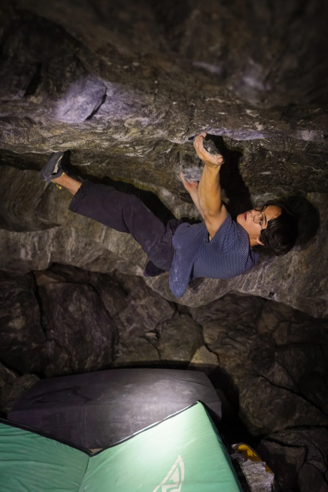
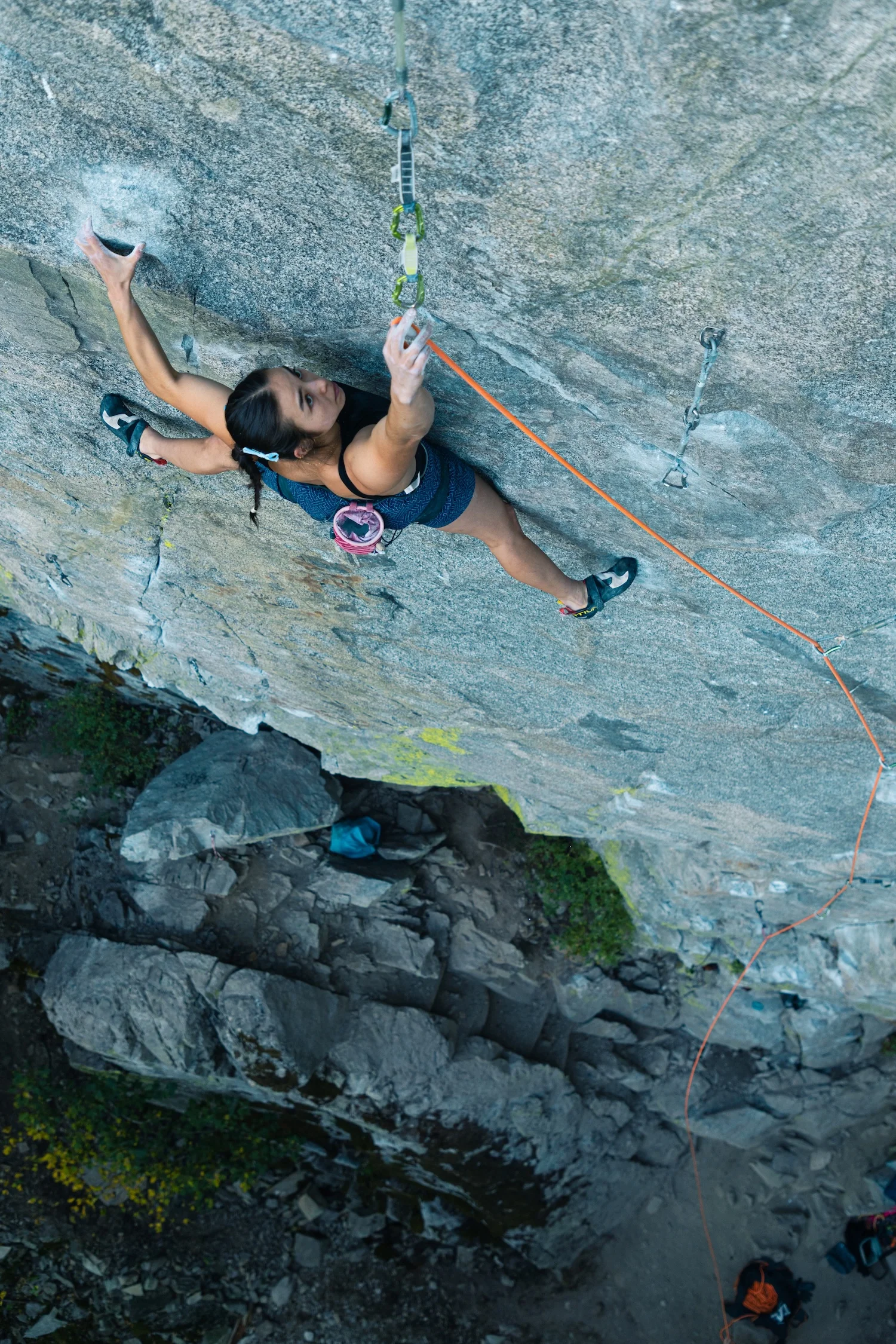
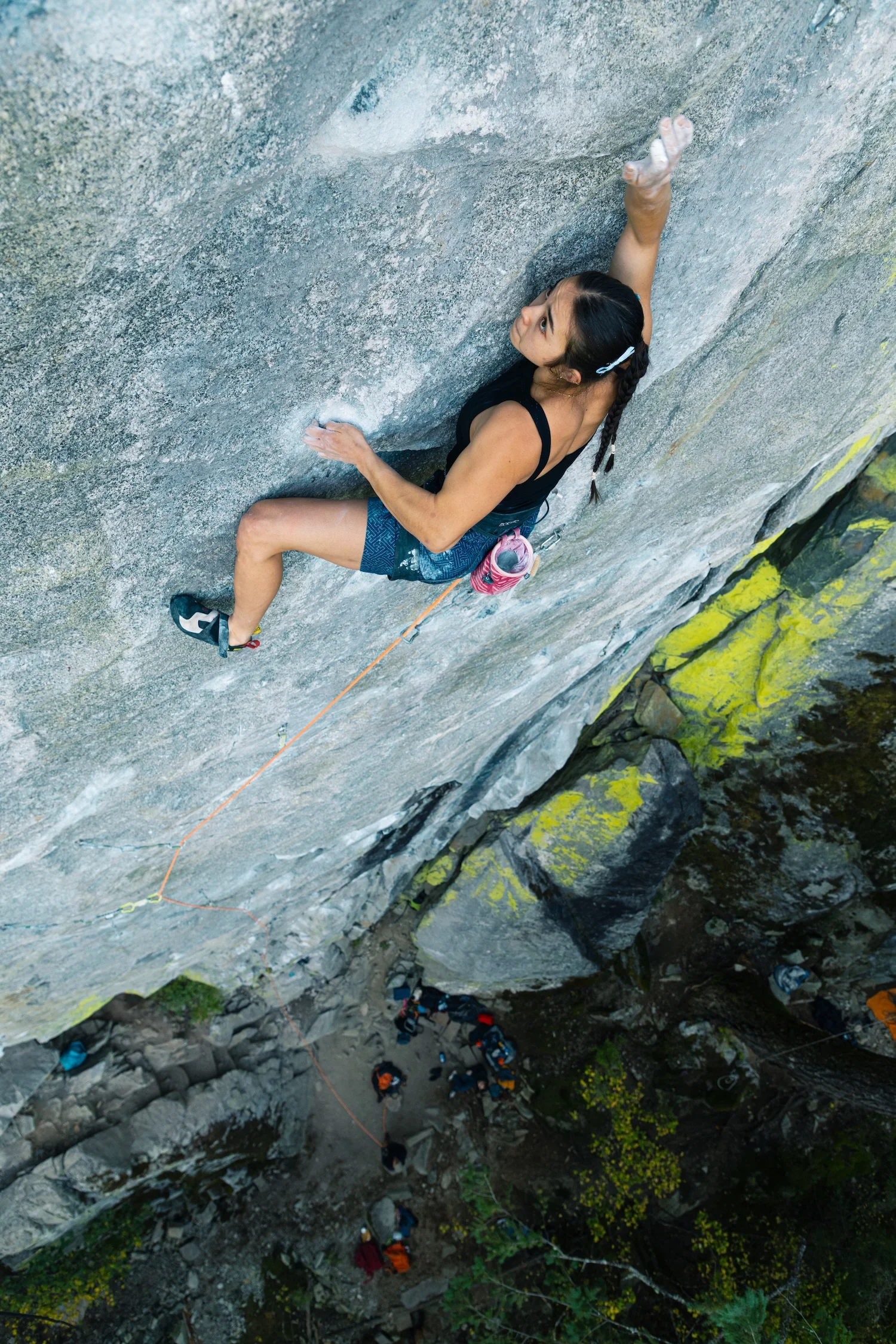
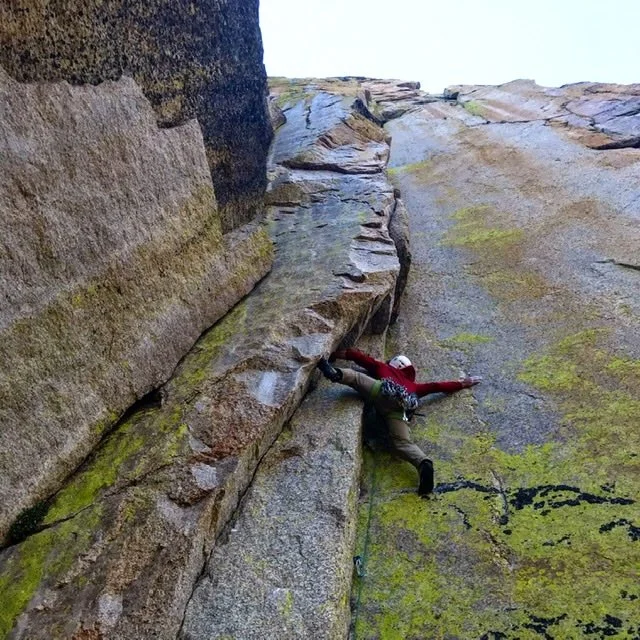
Sean Bailey locked into a wild rose move on the Duality of Man headwall, with its porcelain-hard orange-and-white rock and microscopic handholds. Photo by Ben Neilson (@neilson.ben)

5.15d Comes to America

The Dry Canyon, an hour southeast of Tucson, Arizona, is a forbidding place. Tucked within the sere Whetstone Mountains in the Sonoran Desert, the Dry is comprised of a scarp of limestone running up a sunbaked hill, home to scree, cacti, rattlesnakes…and sometimes sport climbers. The one time I visited, we busted our rental car’s oil pan on the 4x4 road and I got heat exhaustion walking up the hill, albeit in late April, when the crag is well out of season.

With 100-plus mostly attainable sport routes in the 5.10–5.14 range, this remote desert crag hardly seems like a place where you might find America’s hardest sport climb. But it is. It’s here, in the Celebrity Cave at the top of the hill, that you’ll find Duality of Man, a 5.15d freed by Sean Bailey (@seanbailey) in March 2025, a process documented in the inaugural, 2026 American Climbing Journal. 

There are only five total proposed 5.15d’s (9c’s) in the world, beginning with Adam Ondra’s Silence at Flatanger, Norway, climbed in 2017. (The Céüse, France, route Bibliographie, which Alex Megos freed in 2020 and originally graded 9c, has since dropped to consensus 9b+.) The article below gets into the breakdown and unique difficulties with Duality. But perhaps the most notable thing with this 9c and the four others is that they all took huge campaigns by top climbers and they all remain unrepeated, showing just how much dedication—and often specialization—is needed for the world’s hardest sport climbs. 

—Matt Samet, Editor, American Climbing Journal
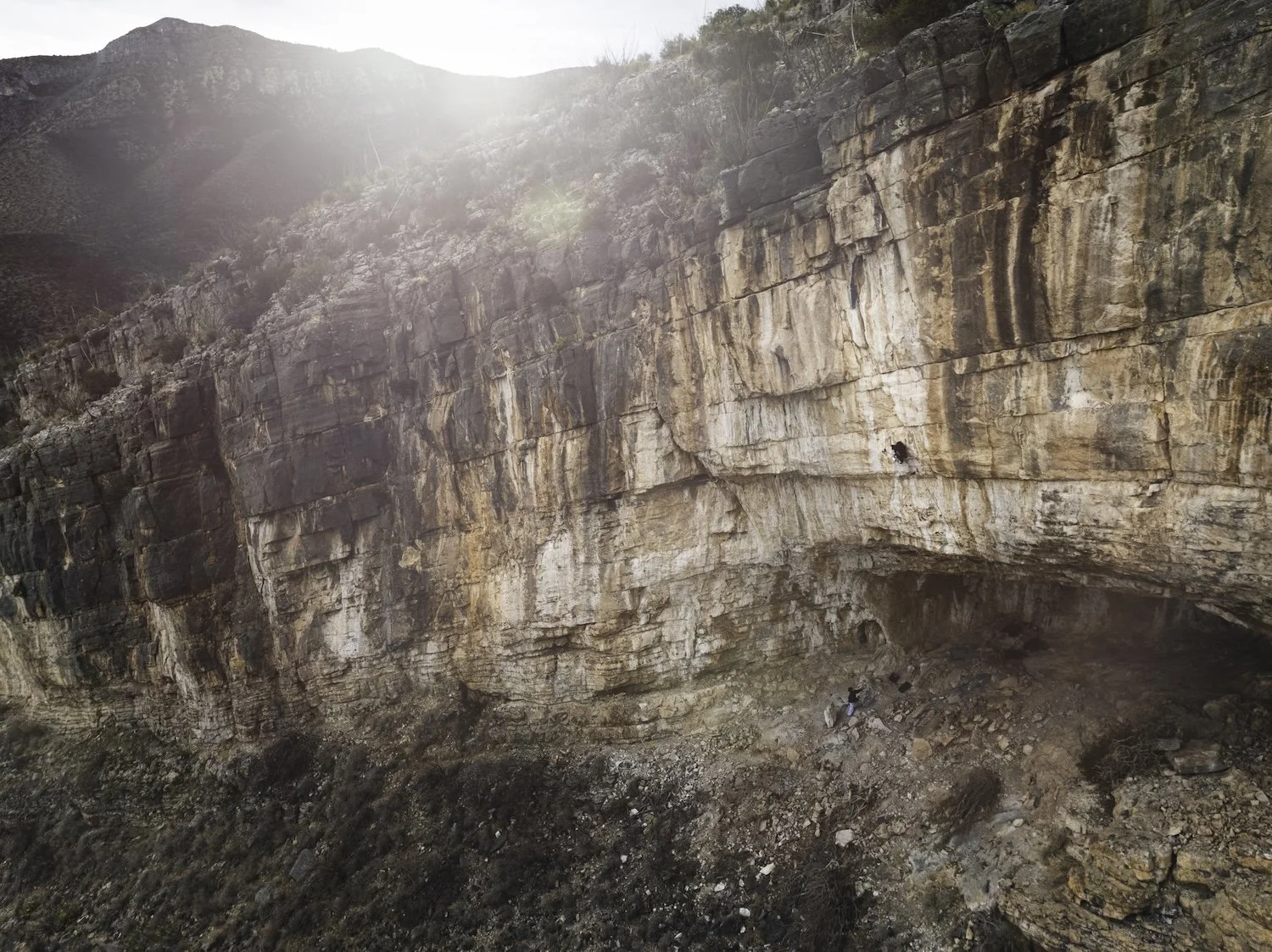

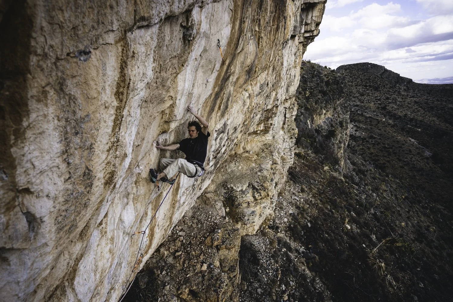
A pulled-back view of Duality of Man. The route was bolted two-odd decades ago but didn’t go free until 2025. Photo by Ben Neilson (@neilson.ben)

How Sean Bailey dug deep to put up the States’—if not the world’s—hardest sport climb

At present, there are only five routes given 9c (5.15d) on Earth, all unrepeated: Silence, put up by Adam Ondra in 2017 in the Hanshelleren Cave, Flatanger, Norway; DNA, put up by Seb Bouin at La Ramirole, Verdon Gorge, France, in 2022; B.I.G., also in the Hanshelleren Cave, its first ascent livestreamed by Jakob Schubert in 2023; Duality of Man in the Celebrity Cave, Dry Canyon, Arizona, freed by Sean Bailey in March 2025; and Café Colombia at Margalef, Spain, completed by Jorge Díaz-Rullo in March 2026.

But here’s the thing about Duality, the first (and so far only) 5.15d on American soil: If you run its discrete sections through the online grade calculator Darth Grader—5.14c to a medium rest to V11/12 to another medium rest to V15—Darth spits out a new grade altogether: “9c+ [or 5.16a] soft.” (For comparison, the only other one of the world’s 9c’s with a crux this hard is Silence, where some have said the upside-down compression and crack boulder might even be V16, though it does come after a no-hands knee-bar.) So, it’s possible that Duality is the world’s first 5.16. However, given that it is way up a hill at the end of a gnarly 4x4 road and faces almost due south in the sere, remote Sonoran Desert of Southern Arizona, it may be some time before the climb sees a repeat. Well, that plus the insane difficulty of the climbing.

Duality’s first half is the existing sport route Lee Majors, a 5.14c cave tackling tufas, pockets, pinches, and tiered roofs via improbable dynos and knee-bars. The line was bolted by CP Little in the Dry’s early days and freed by Nathaniel Coleman in autumn 2018. Above Lee Majors’s anchor is an extension that Coleman bolted after his FA, rapping in off upper anchors placed by Little. As Coleman tried the moves, a key hold broke on the 25°-overhanging headwall, rendering the crux harder. The full climb is outlandish, a massive roof on drippy, Spanish-style limestone to a white- and orange-streaked headwall, its rock porcelain smooth. 
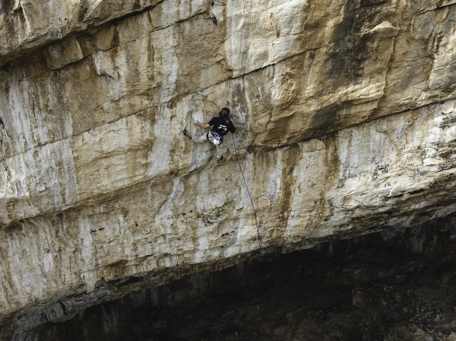
 Sean Bailey on the headwall of Duality of Man, Dry Canyon, Arizona, a 5.15d—America’s first—that he freed in March 2025. The route links the 5.14c cave route Lee Majors (FFA: Nathaniel Coleman) into two extremely difficult boulder problems on the headwall, the final one—the crux—being a complex V15 on terrible holds. Photo by Ben Neilson (@neilson.ben)

It is also remarkable at an area that, with the nearby Farmhouse, has remnants of “90s ethics,” that there’s only one artificial hold, an enhanced gaston on a V11/12 boulder at the start. CP Little clearly saw that the climb could be done by someone, someday, and left it in a nearly 100 percent natural state—which may just be needed to cultivate climbs this hard. (Both of the Hanshelleren Cave routes, on featured gneiss, are natural, while DNA has, as is common on limestone, glue reinforcing at least one hold that broke.)

That someone was Sean Bailey, who spent three seasons on Duality—his final one, according to Climbing.com, being a concerted two-month push with lots of “almost sending”—often committing to evening sessions to avoid the heat and finally figuring out that he had his best burns when there was the biggest delta between the ambient temperature and the dewpoint.

Bailey is an almost deliberately low-profile phenom, having made a rare repeat of the Céüse 5.15c Bibliographie in 2021 and the only repeat, in November 2025, of Aidan Roberts’s mysterious crimp line Arrival of the Birds in Chironico, Switzerland, given 9A/V17 but sometimes speculated to be harder. On Bailey’s send go of Duality, only the second time he’d made it through the middle V11/12 and well into the V15, he told himself, “[All] right, this is finally the fucking moment. I can finally take control of the situation again, and I’m just going to make it happen.”


New Cutting Edge Episode—The South Face of Kichatna Spire

The south face of Kichatna Spire in Alaska was one of the great unclimbed walls of North America. Until July. On their second attempt in two years, young American alpinists Eli Spitulnik and Michael Telstad climbed the 1,000-meter face with a blend of difficult aid and tricky mixed, placing no bolts. In a tight weather window, they blazed up and down the face in a little over three days, with only a four-hour bivy and some catnaps along the way, leading to a level of exhaustion that pushed them to the brink of delirium.
In this episode, host Jim Aikman interviews Eli and Michael about their adventure, explores the rich, colorful history of the Kichatna Mountains with legendary alpinist Conrad Anker and American Alpine Journal Editor Dougald MacDonald, and shares recorded tales from Al DeMaria and Peter Geiser, two members of the very first climbers to enter the Kichatnas, way back in 1965.

The Cutting Edge is sponsored by:



Want More Bouldering and Sport Climbing? Get the American Climbing Journal
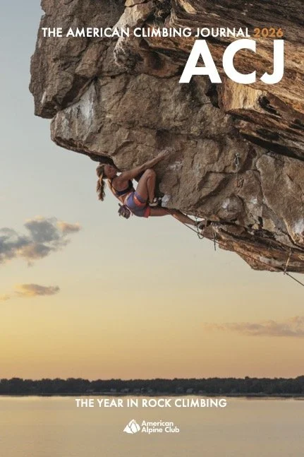
Want more thoughtful, deeply researched writing on the cutting edge of North American and international rock climbing in your mailbox? Then join the American Alpine Club at the Partner or higher level, and opt in to receive the inaugural, 224-page 2026 American Climbing Journal! With stories like Adam Ondra flashing Lexicon (E11), Katie Lamb sending The Dark Side (V16), Connor Herson’s crazy pogo on the first 5.15a trad line—ever—plus other features from or about Sasha DiGiulian, Noah Wheeler, Jonathan Siegrist, Sungsu Lee, Hamish McArthur, Mary Eden, Seb Berthe, Chris Deuto, and so many others, the 2026 ACJ offers the world’s best climbing stories about the world’s hardest and most interesting rock climbs. 
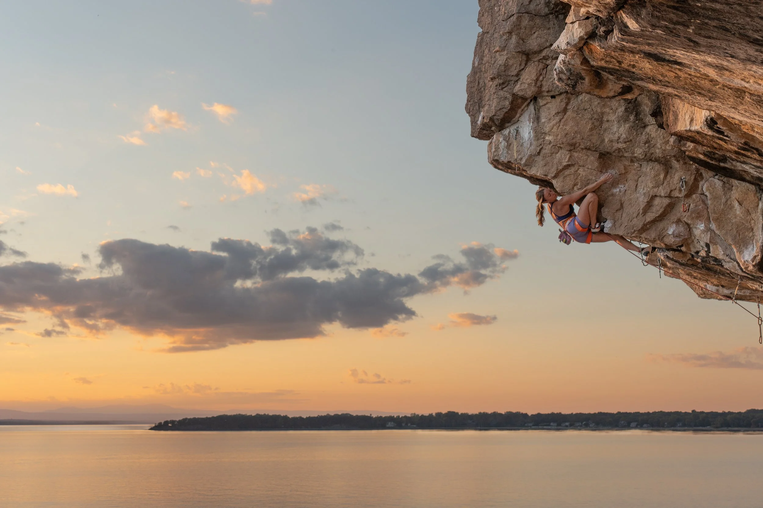

Sign Up for AAC Emails

The Line—The Canadian Rockies Choss Gobbler

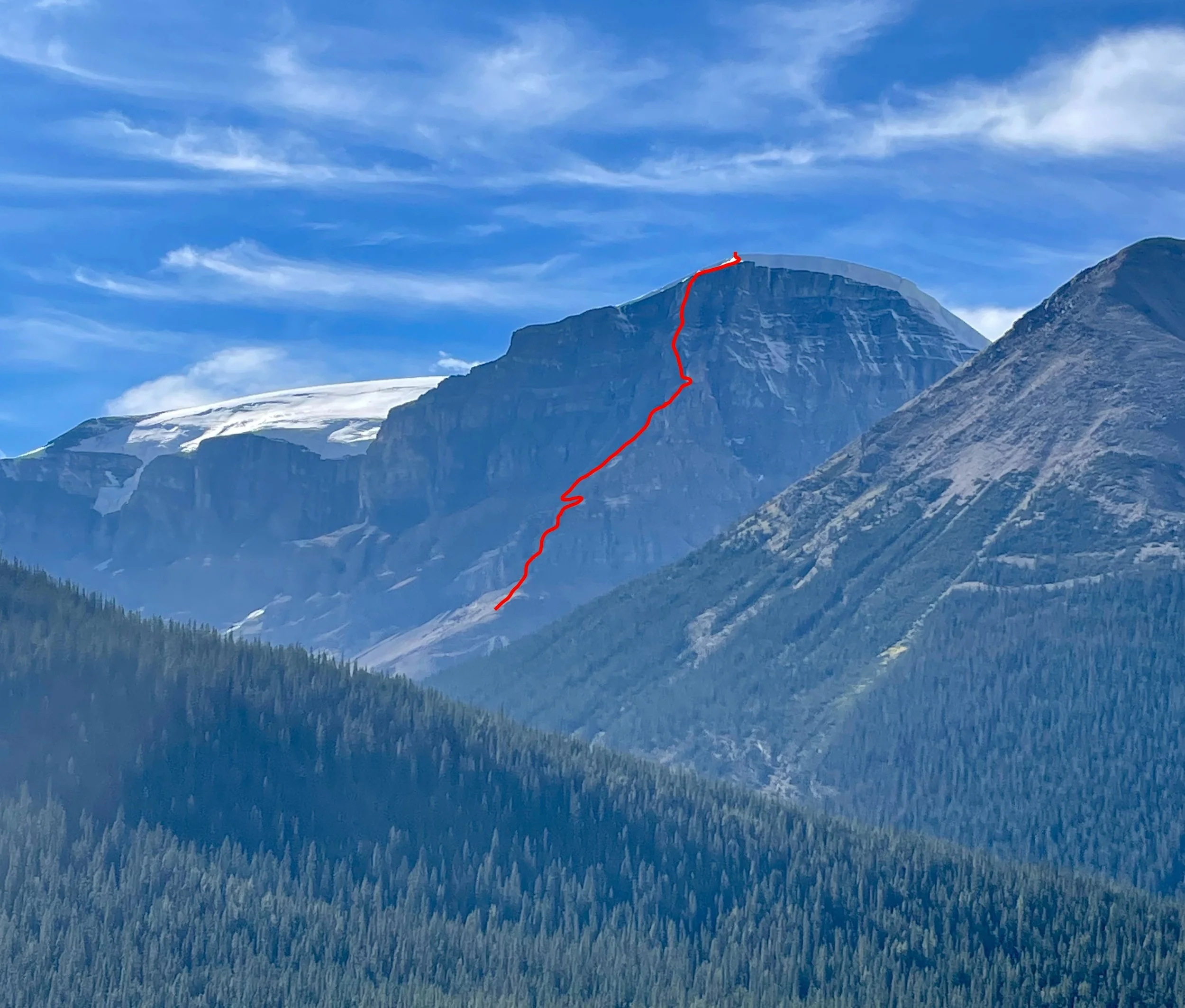
The line of No Fiesta, No Siesta (1,200m, TD- 5.8) on the east ridge of Stutfield Peak East. Photo: Nick Baggaley Collection.

Exploring Canada’s Rockies Chossies

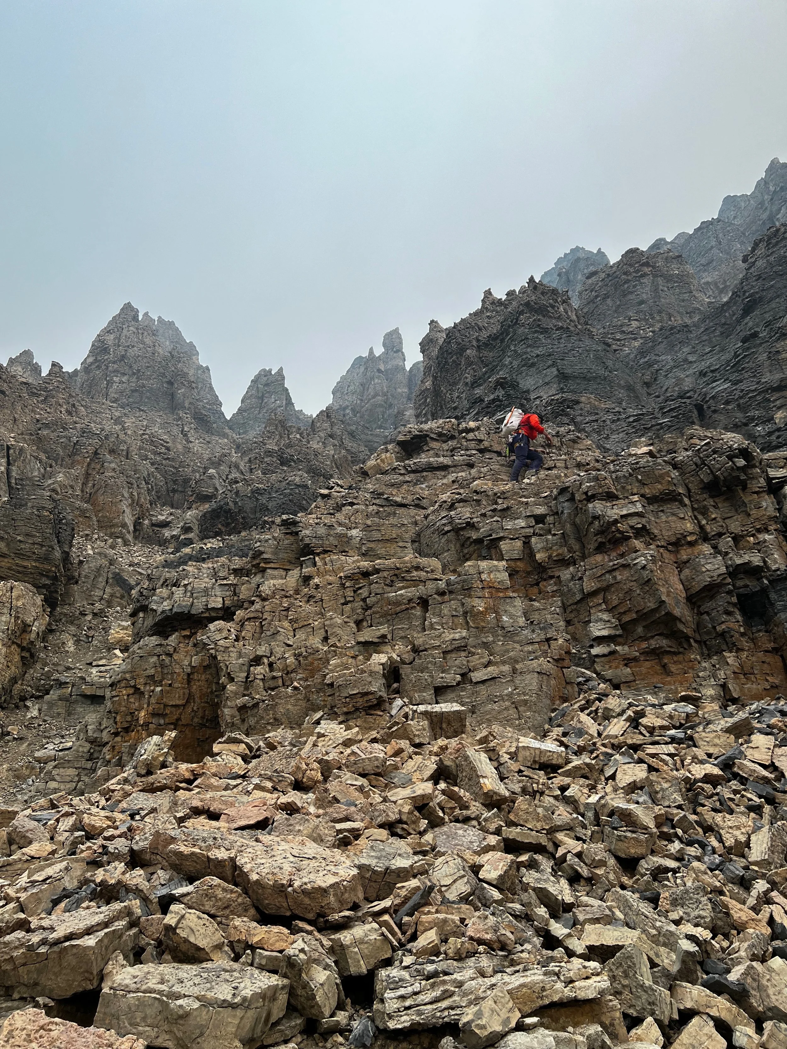
Nick Baggaley scrambling up to the east ridge of Stutfield Peak East during the first ascent of No Fiesta, No Siesta (1,200m, TD- 5.8). Photo by Greg Barrett.

Greg Barrett, a 38-year-old software developer and aspirant alpine guide from Canmore, Alberta, is among the most active climbers currently operating in the Canadian Rockies. Four reports in the upcoming 2026 AAJ cover first ascents on which Barrett was a key player. Barrett and partners keep finding new lines on familiar faces, as well as striking ridges and faces that have never been touched. Almost all of them require a tolerance for—even an appreciation of—the dreaded Canadian Rockies choss. Here, we’re sharing a report that arrived too late for the 2026 edition: Nick Baggaley’s story of the first ascent—with Greg Barrett—of a huge, previously unclimbed, and very chossy ridge on a Rockies 11,000er, where the modest grade of 5.8 only tells part of the story.

Stutfield Peak East, East Ridge, No Fiesta, No Siesta

In the late summer of 2025, after a ton of rain, there were a couple of short weather windows for bigger objectives in the high peaks of the Canadian Rockies. Greg Barrett and I seized the opportunity to get on a route I’d been eyeing for quite some time. The long east ridge of Stutfield Peak East (3,422m/11,227’, a.k.a. Stutfield Northeast) was, as far as I could tell, unclimbed. We didn’t know what to expect but figured that with my alpine guide training over the summer, and with Greg’s recent hot streak of ascents, we’d be able to get the route done in a push. 

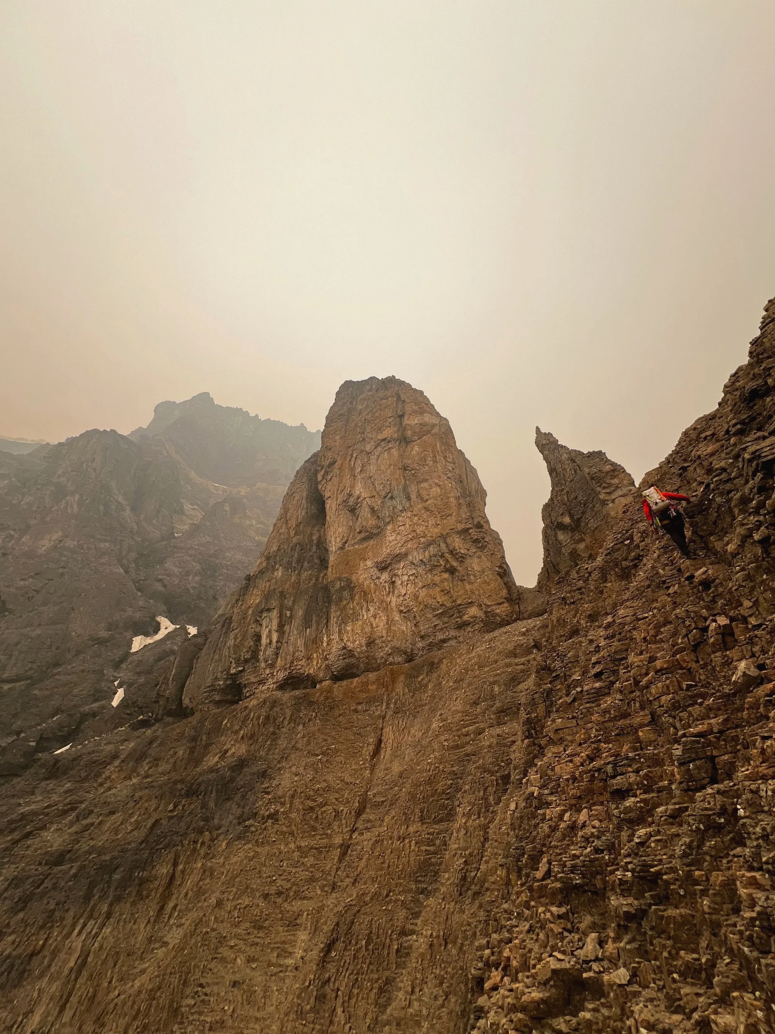
Greg Barrett crawling along a ledge to reach the final tower before the summit of Stutfield Peak East. Photo by Nick Baggaley.

On September 2, we got a late start from Canmore, only to have my Ford Fiesta break down just after passing Banff, with several more hours of driving to go. This delay meant that we only shouldered our packs at the prime alpine-start time of 6:30 p.m. 

A three-hour approach up the Stutfield Creek drainage took us to a bivy on the silty bank of an alpine tarn below the ridge. Having forgotten my sleeping pad, I proceeded to snatch a couple of fitful hours of sleep as Greg happily snoozed away beside me. We got a leisurely start at 7 a.m., under an unexpected and unwelcome pall of wildfire smoke.

The ridge started easily enough, with scree and talus hiking turning into fourth- and low-fifth-class rock on the first step. We soloed up several hundred meters before roping up at the base of the second rock step, and then, after about 40 meters of 5.8 climbing, unroped once more.

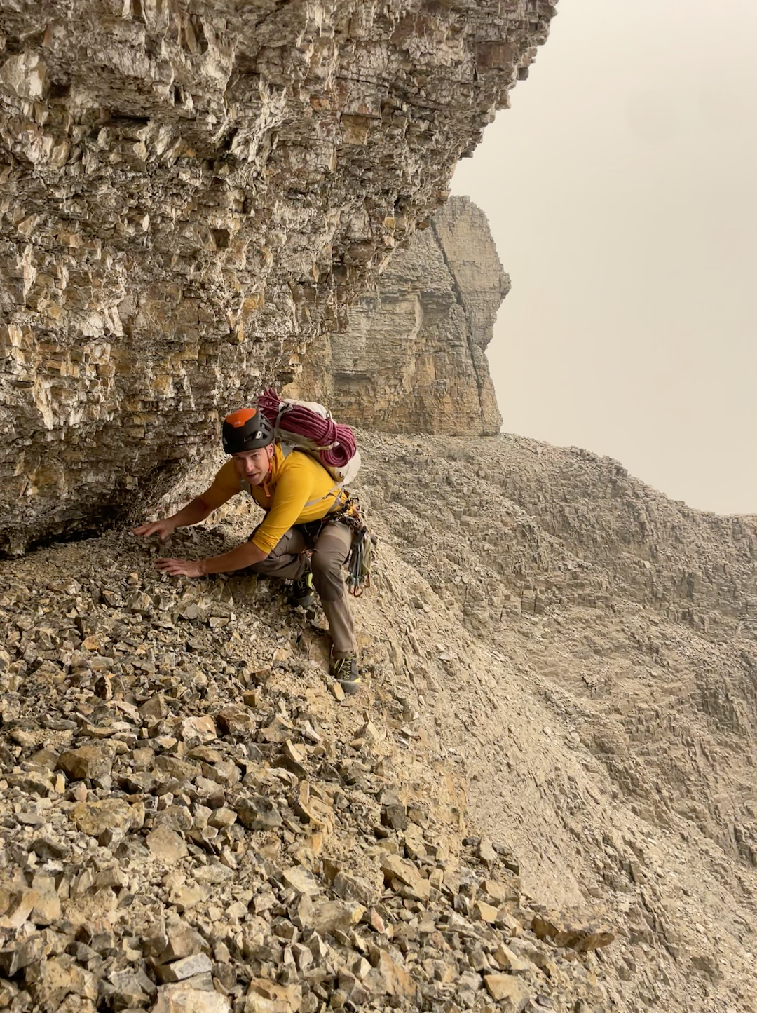
The imposing towers looming out of the smoke above the next step on the ridge prompted us to search for an easier route, and we traversed several hundred meters south along a scree bench before soloing more fourth-class terrain to regain the ridge crest in the middle of the towers. Challenging route-finding eventually forced us back down on the south side, where we found a chimney that took us around the final tower. From here, we found a ledge across which we crawled to the base of the summit headwall.

Nick Baggaley scrambling to the base of the final tower on the east ridge of Stutfield Peak East. Photo by Greg Barrett.

More soloing of low- to mid-fifth-class rock, with increasing exposure and steadily terrible rock quality, took us along a rib on the left side of the headwall and up to the last rock band below the summit cornice. Here, we climbed two pitches of loose 5.8 to a rock bench, then climbed through easy snow to bypass the cornice, gain the glacier, and continue to the summit.

We named the route after my late car and my lack of sleeping pad: No Fiesta, No Siesta (1,200m, TD- 5.8). Overall, we would not recommend it to anyone except the most committed choss aficionados, as the poor to terrible rock quality makes protection difficult for most of the ridge. We chose to solo all but three pitches, but would probably recommend that other parties rope up for more.

—Nick Baggaley, Canada 


Confessions of a Choss Gobbler

Yet another Greg Barrett new route is Confessions of a Choss Gobbler (440m, 5.11- A0), the first ascent of the northwest headwall of Castle Mountain, climbed with Gavin McNamara in July 2025. We asked Barrett what he loves about routes like this and for his words of wisdom on climbing Rockies choss.

Q. Climbers have been exploring the Rockies for more than 125 years. Why aren’t these mountains climbed out?

Greg Barrett leading the intimidating pitch-five crux of Iron Tears (465m, TD- 5.11-), above an old fixed anchor from a winter attempt. Photo by Gabs Clark.

Many of the accessible and obvious routes in the Rockies were plucked long ago. But if you stay curious, read between the lines, and look farther afield, many treasures remain. The required commitment and willingness to be scared keep new alpine rock lines available for those who seek them.

Rockies alpine choss is an acquired taste, like bitter black coffee or peaty scotch. Very few people like their first sip, and many people never learn to enjoy it at all. But for the few of us who grow addicted to it, we can’t live without it. I savor the puzzle and the challenge of methodically working through loose, steep, untouched terrain. Long, scary days are taxing in the moment, but they create memories that last a lifetime.

I sometimes yearn for an earlier era when obvious untouched lines abounded. But I don’t know that I would have had the boldness to push those lines with the gear and tactics of those times. Perhaps the present is perfect for me.

Q. What’s your favorite among the new routes you’ve done in the past few years?

Greg Barrett following the beautiful corner on pitch four (5.10+) of Iron Tears, at the Rimwall. Photo by Gabs Clark.

You’re asking me to pick a favorite child. But perhaps I can choose the one I find most recommendable, which is Iron Tears, on the Rimwall, which I climbed last August with Gabs Clark.

One of my favorite parts of that line was the spontaneity and relative commitment. We were planning to repeat an existing route, but during the approach, a striking corner alongside a rusty-red waterfall caught Gabs’s eye, and we decided to explore it instead. With no drill and only a vague plan, we journeyed upward, knowing retreat could be involved and expensive. In the end, we topped out a magical line and were back home before sunset.

Q. What are the secrets to climbing choss (more or less) safely?

First and foremost, stay within your physical ability. With few exceptions, I’m not out on the sharp end pumped out of my mind and facing a bad fall. If I’m not feeling solid on terrain, I’m downclimbing until I can either find a controlled version of the sequence or protect myself well enough that I’m comfortable taking the whip. The ability to maintain composure and control at 5.10 and 5.11 does more for you in the Rockies alpine than being able to power-scream through 5.13.

Mileage is a huge piece of this. On Yamnuska, the big limestone cliff near Canmore, we have a collection of routes from the first published guidebook called “The Kallen 34.” Some are now classics, some are testpieces, and some are obscure, runout choss. I completed the list last summer, and the climber I became by the last pitch of the 34 bears little resemblance to the climber who started that list. This sort of training pays dividends when you get properly “out there.”

It’s also important to fight for protection. Sometimes it’s easier to just keep climbing, but when things are serious, I’ll take the time to sneak in a knifeblade or clear choss out of a slot with my hammer and wiggle in a cam. It’s a numbers game, and you’re going to fall eventually. If you don’t place the gear, it definitely won’t hold.

I do think it’s important to be honest with yourself about the hazards. I’ve met climbers who seem to manage fear by telling themselves they’re infallible. You can get far with this approach, but, ultimately, hope isn’t a strategy. I think it’s healthier and safer to fully acknowledge the hazards you will face, manage them as best you can, and make an honest decision about whether the remaining risks outweigh the rewards.


Cutting Edge Podcast: Le Bombé Bleu

On February 11, Erwan Legrand—son of the legendary French climber François Legrand—took down one of the longest-standing open sport projects in the world: Le Bombé Bleu (5.15b) at Buoux, France. Bolted in 1991 by Marc Le Menestrel, the 100-foot route features a notoriously difficult precision dyno on its blue-streaked bulge, followed by ferocious tugging on tiny pockets. Famously, Le Menestrel had opened the route as long as it was left in its natural state, a vision—35 years ago—of what climbing might someday become. Join host Jim Aikman as he talks with Legrand about his remarkable barefoot redpoint, as well as chats with UK icon Ben Moon—one of the route’s early suitors—and American Climbing Journal Editor Matt Samet.


Sign Up for AAC Emails

The Line—First Female Ascent of Spirit Quest (5.14d), Squamish

Quinn Mason eyeing down the seventh draw early on in the hard climbing of Spirit Quest (5.14d), Paradise Wall, Squamish, British Columbia. Mason made the route’s first female ascent on October 9, 2025. Photo: Don Mason

Paradise Wall is one of the many gems at Squamish, British Columbia, a granite mega-destination known for its breadth: everything from classic moderates, to cutting-edge single-pitch trad like Drifter’s Escape (proposed 5.15a: FFA: Connor Herson, 2025) and Cobra Crack (5.14b; FFA: Sonnie Trotter, 2006), to endless bouldering, to technical sport. The wild traverse of Dreamcatcher (5.14d) on the Cacodemon Boulder, freed by Chris Sharma in 2005, might be Squamish’s most iconic hard sport climb. But the 5.14d face climb Spirit Quest (2021: FFA by Mike Foley) at Paradise Wall has garnered recent attention, too.

Spirit Quest offers a direct start to Tom Wright’s 2015 classic Spirit of the West (5.14a). “Interestingly. [Spirit of the West] was the first route I ever bolted. And in all of the 35 meters, only one small piece of rock broke off during cleaning. I was thinking, Man, putting up routes is a piece of cake!” says Wright. “It’s an immaculate piece of stone, and I think it’s important to point out that all the routes on that wall are fully natural, including Spirit Quest and Midnight Way—which I think is rare at that level.” (Midnight Way is a 5.15a that breaks left off Spirit Quest, put up by Connor Herson in 2024.)

In autumn 2025, Quinn Mason (@quinn.midori), who contributed both the story below as well as imagery of Hamish McArthur’s bouldering tear through Colorado in 2025 to the inaugural American Climbing Journal, made the route’s first female ascent. The redpoint process, though initially intimidating, ended up being meditative and joyful—a chance for Mason to connect with a beautiful climb in a serene setting amidst friends. May your summer (and fall) projects give you such meaning as well!

—Matt Samet, Editor, American Climbing Journal


First Female Ascent of Spirit Quest (5.14d)

Dan Beland on the classic Spirit of the West (5.14a), Paradise Wall; Spirit Quest takes a direct start to this line, upping the difficulty significantly. Photo: Sonnie Trotter

Spirit Quest (9a/5.14d) snakes up the middle of the sheer, breathtaking Paradise Wall in Paradise Valley, Squamish, BC. The first routes went up on this crag in 2015, making it a relatively new addition to Squamish sport climbing. Paradise Wall is stacked with stellar, all-natural climbing, with about one route per grade from 8a+/5.13c to 9a+/5.15a.

Squamish local Tom Wright bolted Spirit Quest as a direct start to Spirit of the West, a classic 30-meter 5.14a he freed in autumn 2015. After Wright opened up Spirit Quest to the community, it saw its first ascent in 2021 by the talented Mike Foley. Until then, Dreamcatcher had been Squamish’s premier hard sport climb. While Dreamcatcher famously demands bouldery, gymnastic climbing, Spirit Quest stands in contrast, asking for head-to-toe tension and technique combined with powerful closed-hand crimping for 30–40 consecutive moves through its cruxy middle section, with an equal number or more of foot sequences.

I climbed Spirit Quest on October 9, 2025, making its first female ascent after 14 days of effort.

An overview of Paradise Wall, Paradise Valley, Squamish, B.C. Spirit Quest (5.14d) makes its way right up the middle of the wall. Photo: Sonnie Trotter

When I first walked up to Paradise Wall in summer 2023, I was blown away by its aura—in particular by Spirit Quest, the obvious king line following crisp, crystalline fractures up the slightly overhanging, monolithic panel. I waited awhile to try the climb—I didn’t know if I was ready and feared what my first attempt might unveil. What became more apparent during the process, however, is that if you perpetually wait to “feel” ready, that feeling might never come. It became a balance of embracing uncertainty and allowing for doubt while simultaneously fostering the deep belief that I could and would complete the route.     

I fell in love with Spirit Quest’s intricate, dancelike sequences, in which the hand and foot movements played against each other in perfect harmony. The route tempts you with the opportunity to crimp with all of your might, but with over 35 meters of climbing, it also insists you learn to relax into tenuous positions and find harmony with the rock. 

Tackling one of the most infamous moves on Paradise Wall—and the culprit of many a large fall. The move revolves around a left-hand sidepull undercling, settling into an uncomfortable box, and creeping across to a right-hand slimper you could seemingly spend all day readjusting on. Photo: Don Mason

There’s a move shortly after the seventh quickdraw that required me to lock a right-hand edge to my shoulder and pull over an unlikely-feeling left foot to reach a left-hand undercling at full extension. From there, walking my feet through and then bringing the undercling to my waist was one of the most challenging sequences—it not only required the most physicality but was also a barrier to reaching the more sustained climbing above, where I knew the real battle would begin. Two weeks prior to sending, I linked from the fifth quickdraw to the chains, climbing all the difficult sections. This encounter left me grappling with the contrived nature of climbing, and I lost patience and respect for the projecting process. In the following two weeks, I spent time sitting with my thoughts, eventually gaining the equilibrium needed to clip the chain. 

That day, wind moved through the trees of Paradise Valley, a welcome occurrence both for me and the community of climbers who’d spent many a summer morning here. Spirit Quest was my first true project, requiring at least 10 more days of effort than anything I’d done before. Those additional days represented many hours of rehearsing moves in my head, stressing over weather, trusting what was in my hands, and making peace with what wasn’t. I am grateful to have shared the experience of working the route and eventually sending it with so many familiar faces present.

—Quinn Mason

Ascent Info: First female ascent of Spirit Quest (35 meters, 5.14d), Paradise Wall, Squamish, British Columbia; Quinn Mason, October 9, 2025.


Want More Bouldering and Sport Climbing? Get the American Climbing Journal

Want more thoughtful, deeply researched writing on the cutting edge of North American and international rock climbing in your mailbox? Then join the American Alpine Club at the Partner or higher level, and opt in to receive the inaugural, 224-page 2026 American Climbing Journal! With stories like Adam Ondra flashing Lexicon (E11), Katie Lamb sending The Dark Side (V16), Connor Herson’s crazy pogo on the first 5.15a trad line—ever—plus other features from or about Sasha DiGiulian, Noah Wheeler, Jonathan Siegrist, Sungsu Lee, Hamish McArthur, Mary Eden, Seb Berthe, Chris Deuto, and so many others, the 2026 ACJ offers the world’s best climbing stories about the world’s hardest and most interesting rock climbs. 
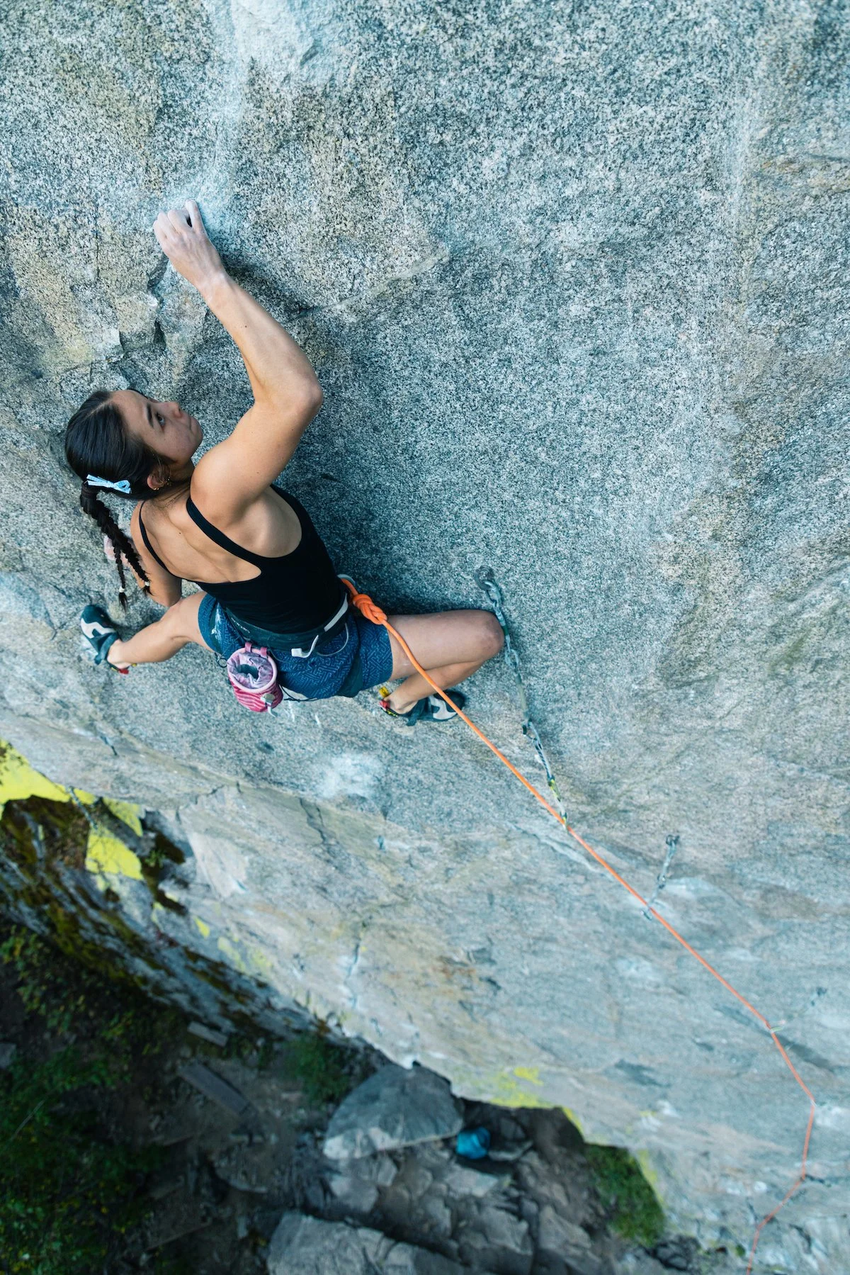

New Cutting Edge Podcast: Le Bombé Bleu

On February 11, Erwan Legrand—son of the legendary French climber François Legrand—took down one of the longest-standing open sport projects in the world: Le Bombé Bleu (5.15b) at Buoux, France. Bolted in 1991 by Marc Le Menestrel, the 100-foot route features a notoriously difficult precision dyno on its blue-streaked bulge, followed by ferocious tugging on tiny pockets. Famously, Le Menestrel had opened the route as long as it was left in its natural state, a vision—35 years ago—of what climbing might someday become. Join host Jim Aikman as he talks with Legrand about his remarkable barefoot redpoint, as well as chats with UK icon Ben Moon—one of the route’s early suitors—and American Climbing Journal Editor Matt Samet.


Sign Up for AAC Emails

The Line—Idaho’s Forgotten Granite Spires

The Bighorn Crags above Ship Island Creek in the Salmon River Mountains are a cluster of towering granite spires that would be crawling with climbers if they were a little closer to the road—or even if they were close to any significant population of climbers. In 1955, climbers—including K2 legend Pete Schoening—briefly explored the area, and a short, alluring description of the cliffs is included in Idaho: A Climbing Guide. But the first reported ascents by modern rock climbers weren’t until 2020, when a team of six made the 13.5-mile trek to the west side of Ship Island Lake and climbed 40 new pitches—with six Grade III and two Grade IV routes—in less than a week. It’s likely few climbers have been there since. Maybe Jim Pace’s story and photos in AAJ 2026 will convince a few more people to brave the steep barrier to entry. The summer is still young, so we’re sharing an abridged version of Jim’s story here.

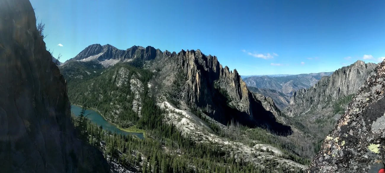
Panoramic view of the crags above both sides of Ship Island Creek, which drains Ship Island Lake at left and flows down to the Middle Fork Salmon River. Photo: Cody Goldberg

The Litner Group: Many First Ascents

For decades, Idaho climbers have imagined what it would be like to climb in the area of the Bighorn Crags surrounding Ship Island Creek, which flows steeply out of Ship Island Lake and down to the Middle Fork Salmon River. The climbs, tantalizingly hard to reach, would ascend long and steep arêtes, faces, and cracks toward summits that didn’t have names, had never been touched by climbers (unless the Sheepeater/Shoshone peoples liked steep rock climbing), and might be made of solid Idaho Batholith granite (but more likely Idaho choss).

In his excellent Idaho: A Climbing Guide, Tom Lopez writes enticingly of the area: “Of interest to rock climbers is a tangled collection of spires, faces, and cliffs at the west end of Ship Island Lake called the Litner Group. Because it is more than 10 miles from the nearest trailhead, little climbing activity has taken place in the Litner Group but, rest assured, the area has high potential for serious rock climbers.” Tom mentions a Litner Peak, but which one is that? No one is sure. The only recorded climbing our group could unearth was detailed in a 1955 expedition report by Lincoln Hales in the Seattle Mountaineers’ annual journal. Hales and Pete Schoening made the first ascent of the “main peak”—presumably the Litner Peak that Tom mentions.

Intrigued, Max Bechdel, Ian Cavanaugh, Cody Goldberg, Brady Johnston, Carolyn Pace, and I made the long trek into the Litner Group in late August 2020, with pack string support, to see what we would find.

From the trailhead—itself three hours from the small town of Challis—we hiked 12 miles and crossed two passes through the Frank Church–River of No Return Wilderness to reach Ship Island Lake. We then bushwhacked another 1.5 miles to the west end of the lake and made camp.

On our first climbing day, we aimed for the obvious face on a twin-spired formation we named the Rabbit Ears, right above camp. Brady and I made the first ascent of Pace Setter (850’, 7 pitches, III 5.9), while 30 meters to our left, Max and Ian opened the Jeff Halligan Memorial Route (850’, 7 pitches, III 5.10), in honor of our horse-packing guide. Both were exceptionally high quality and promised more good things to come.

That same day, Cody and Carolyn established Launch Over It (700’, 5 pitches, III 5.10+), on a formation we called the BFR (Big Fancy? Rocket) after Elon Musk’s Mars ambitions. The BFR lies halfway up the magnificent Mission to Mars massif, just northwest of the Rabbit Ears. The top two pitches of their climb have it all: great cracks, yawning exposure, breathtaking views. 

A rainy day allowed us to explore down the canyon. Jaw-dropping views to the Biggie Smalls Wall (dead vertical, 300 meters) made all of us realize just how extensive the climbing here could be. But looks are deceiving: The splitter hand jam in the spotting scope, we learned, often turned out to be a splitter offwidth, the offwidth turned out to be a chimney, and so on. Scaling took practice.

Lighthouse Tower on Wolf’s Fang Ridge: The five-pitch Idahome (5.11a) ascends near the center of the formation. Photo by Jim Pace.

After a cold night that brought snow above camp, Brady, Ian, and Max traversed the lake-outlet slabs to explore a complex tower at the northwest end of the already-named Wolf’s Fang Ridge and completed the first climb to the top: Idahome (925’, 5 pitches, IV 5.11a).

Brady Johnson stemming on Siren’s Song, a 5.12 variation to the three-pitch Mermaid’s Tale (5.11b), on the Bookshelf. Photo: Ian Cavanaugh | Idahoclimbingguide.com.

Meanwhile, Cody and Carolyn established Geoffrey Chosser (650’, 5 pitches, IV 5.10+) on the Bookshelf, a soaring formation with half a dozen or so summits. Over the next two days, the group put up three more climbs on this face. The first two—Mermaid’s Tail (3 pitches, III 5.11b) and a direct variation called Siren’s Song (III 5.12)—were highlights of the trip. 

In all, with just four climbing days, our group climbed six Grade III and two Grade IV routes—with a couple of other shorter routes—on mostly great granite. Most of those pitches were 50 to 65 meters and ranged from 5.6 to 5.12. We summited on just three routes, but all the other lines could be continued to their respective summits to create Grade IV or Grade V climbs. —Jim Pace
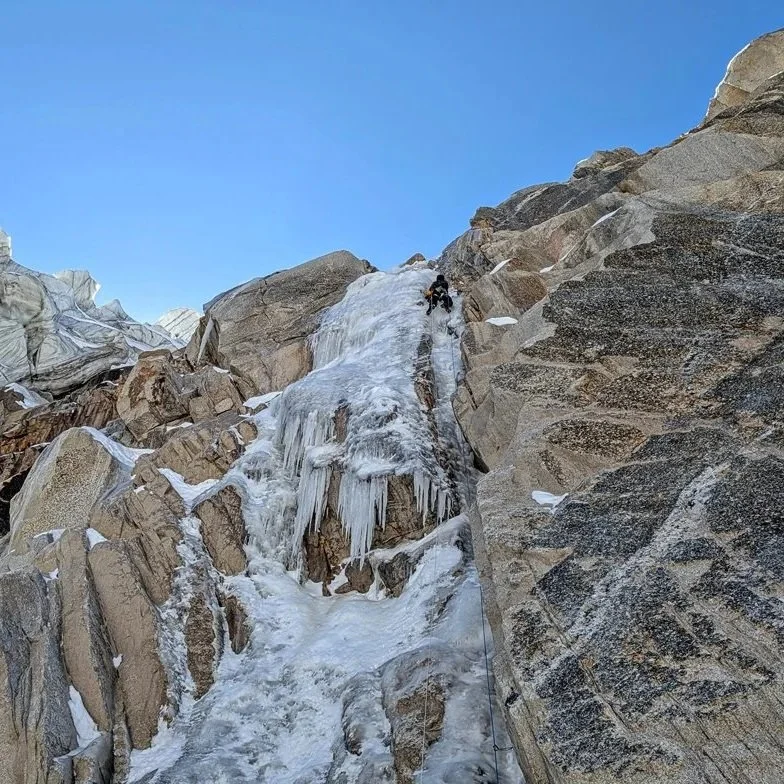
Pace’s full story will be in AAJ 2026, coming this fall, and an extended version will be published at the AAJ website, along with photos and topos of many climbs. In the meantime, climbers can see his earlier article, on which this story was based, at Idahoclimbingguide.com. 
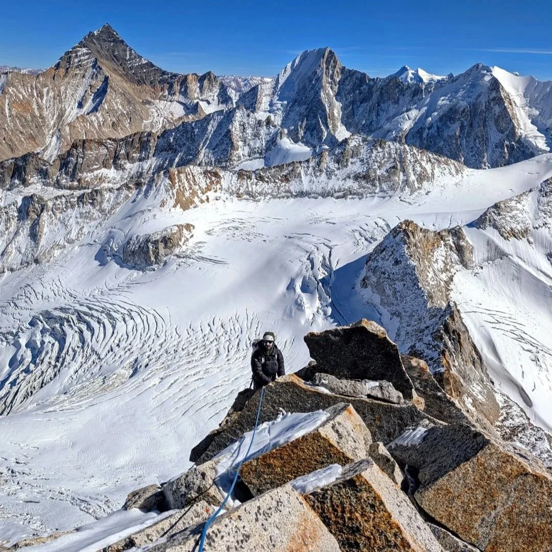

Have You Climbed At Ship Island Creek? Submit a story to the AAJ.

Many Idaho climbers are taciturn and even secretive about their routes, and it’s certainly possible that more climbs have been completed in the Litner Group but never published. If you’ve explored climbs in this area and you’re interested in sharing info, the AAJ would love to help. Contact us at [email protected].


New Cutting Edge Podcast: 24 Hours on the Central Tower of Paine

The east face of the Central Tower in Chile's Torres del Paine is one of the great walls of the world. Recently, Belgian Siebe Vanhee and American Tommy Caldwell completed the third free ascent of the South African Route in remarkable style. On their third attempt, the two climbers raced up the 1,200-meter 5.12 route in exactly 24 hours—in an area where most big-wall ascents take weeks. Host Jim Aikman interviewed both climbers, as well as American Ben Ditto, who was on the first free ascent of the South African Route back in 2009. It's an episode about risk, the ups and downs of multiple efforts on a serious objective, and a partnership that perfectly balances the strengths of two amazing climbers.


Sign Up for AAC Emails

The Line—A Sensational Spire in Pakistan

One winner of a 2025 Cutting Edge Grant from the AAC was alpinist and photographer Tad McCrea, who, along with fellow American Jon Griffin and German climber Thomas Huber, traveled to the Karakoram for their second expedition to attempt two sensational peaks. The first part of Tad’s trip report is shared below. For the second half, you’ll have to wait for your 2026 American Alpine Journal, coming later this year.

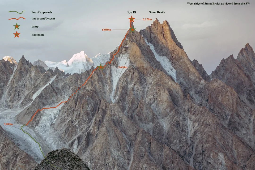
The line of the 2025 first ascent of Eye Ri (Suma Brakk West) by the west ridge. The central and highest peak has been climbed twice. Tad McCrea

Eye Ri, First Ascent, via Northwest Face and West Ridge

Jon Griffin heads toward the astonishing summit tower of Eye Ri, the west summit of Suma Brakk. Tad McCrea

Jon Griffin, Thomas Huber, and I had visited the Choktoi Glacier in 2024, our goals the west summit of Suma Brakk and the southeast pillar of Latok III. Initially, the weather was stunning, but as our preparation was beginning to pay off, we were hit by five weeks of wet and restless weather. Our objectives quickly became out of reach.

On July 14, 2025, the three of us reconvened in Skardu, in northern Pakistan. The approach this time to base camp, at around 4,400 meters on the east side of the glacier, was challenging due to hot weather and raging river crossings. 

Then, five days into our stay at base camp, Thomas and I were called to assist in the attempted rescue of Laura Dahlmeier on Laila Peak. [The German athlete was a two-time Olympic biathlon champion and friend of Huber’s. She was retreating from the peak when she was hit by rockfall, fatally, around 5,700 meters.] Along with Americans Jackson Marvell and Alan Rousseau, who were on another expedition in Pakistan, we were airlifted to the peak, where we located her body from the air and realized any attempt to retrieve her would be futile. We hiked out to Hushe, then were helicoptered back to our Choktoi base camp on August 2. 

Two days later, we made an acclimatization trip to 5,700 meters near Suma Brakk. At 12:30 a.m. on August 9, we set off from base camp for the final climb.

On summit day, Thomas Huber reascends the first pitch on the final tower of Eye Ri. Tad McCrea

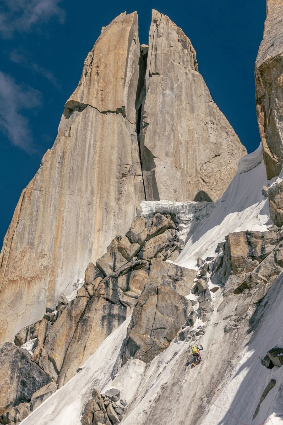
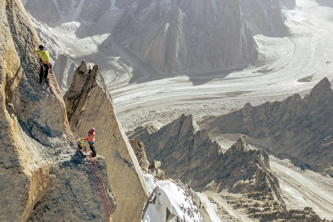
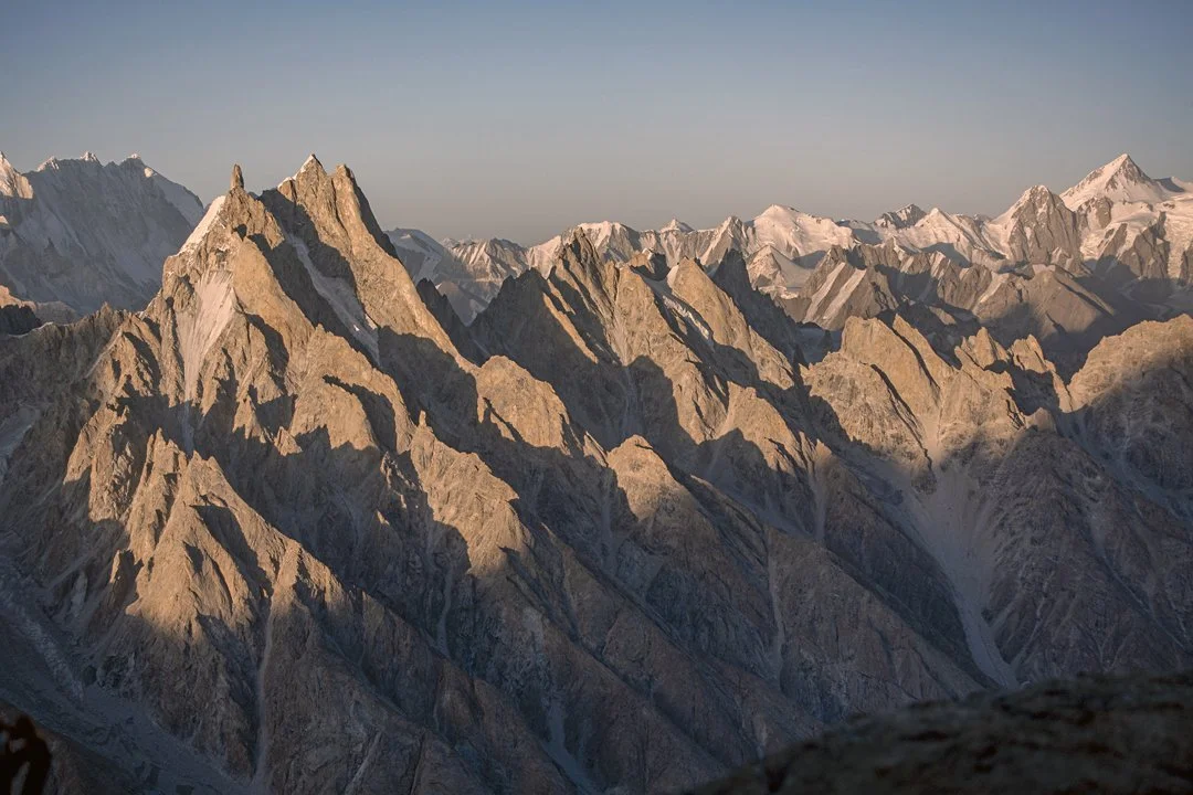
Suma Brakk is a triple-summited peak that has been climbed at least a couple of times by different routes. [The first ascent of the central and highest summit (6,166m) was made in 2007 via the southern slopes and southeast ridge, by Americans Doug Chabot, Mark Richey, and Steve Swenson. In 2018, Fabian Buhl and Alexander Huber—Thomas’s brother—completed the south ridge, with more than 56 pitches of climbing]. The west summit, which we dubbed Eye Ri (6,120m), was unclimbed. It appears as a spectacular needle when seen from the Choktoi side; moving around the peak to the west exposes a gash splitting the entire summit tower. There is a giant chockstone wedged 15 to 20 meters from the top that mimics Sauron's Eye.

Jon Griffin (leading) and Thomas Huber near the top of Eye Ri during the first ascent, with the Choktoi Glacier far below. Tad McCrea

We started up loose ribs and even looser rock gullies just left of a 300-meter icefall blocking access to a hanging glacier at the base of Eye Ri’s northwestern aspect. We had been here the year before, so we knew where to find the best path to the notch leading to the upper glacial basin. The climbing ranged from steep walking to scrambling. A hike up the glacier, then steep snow and névé with occasional stretches of ice and mixed (50°–75°), took us to the previous year’s high point at 5,600 meters on the west ridge, between the first and second gendarmes. While I chopped out a site for the tent, Jon and Thomas took our two single ropes and a tag line and fixed three pitches to the top of the second gendarme. 

After making the first ascent of the triple-topped peak on the left side of this photo, Americans Doug Chabot, Mark Richey, and Steve Swenson gave it the name Suma Brakk, meaning “three summits” in Balti. They climbed the central summit in 2007. The 2025 first ascent of the pinnacle on the left, now called Eye Ri, followed the west ridge, descending to the left. The sea of rock fins and summits below and right of Suma Brakk, all below 6,000 meters, belongs to the Choktoi Subgroup, while the high pyramid at far right is Chiring (7,045m). Tad McCrea.

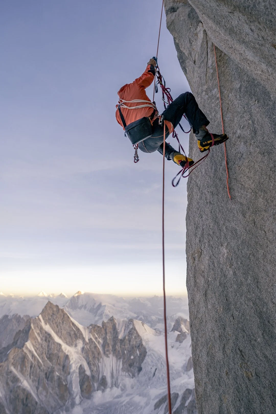
The next day, we continued past three more gendarmes to a bivouac below the final tower. There were a few rock pitches up to 5.10+ on textured golden granite, and ice up to 80°, and we needed the full quiver of alpine tactics and trickery to get our under-acclimatized bodies up to 6,000 meters.

In the morning, we climbed three challenging pitches up the tower, utilizing 12 bolts for protection and anchors. Free climbing up to 5.11, we also employed a variety of aid tactics. At a bus-sized platform four meters below the top of the tower, we fixed lines and rappelled 85 meters to our camp.

On August 12th, we jugged our lines and did a short boulder problem to the summit, for what appears to be its first ascent. We laughed, danced, and cried a little as we soaked in the expansive vista, then descended all the way to our 5,600-meter camp, making at least 15 rappels. With the heat maxing out, we were incredibly thankful to be on a ridge, as the mountain was exploding on all sides. The following day, we retraced our steps to base camp. We named the route HmlaA (1,000m, 5.11 A3 80°).

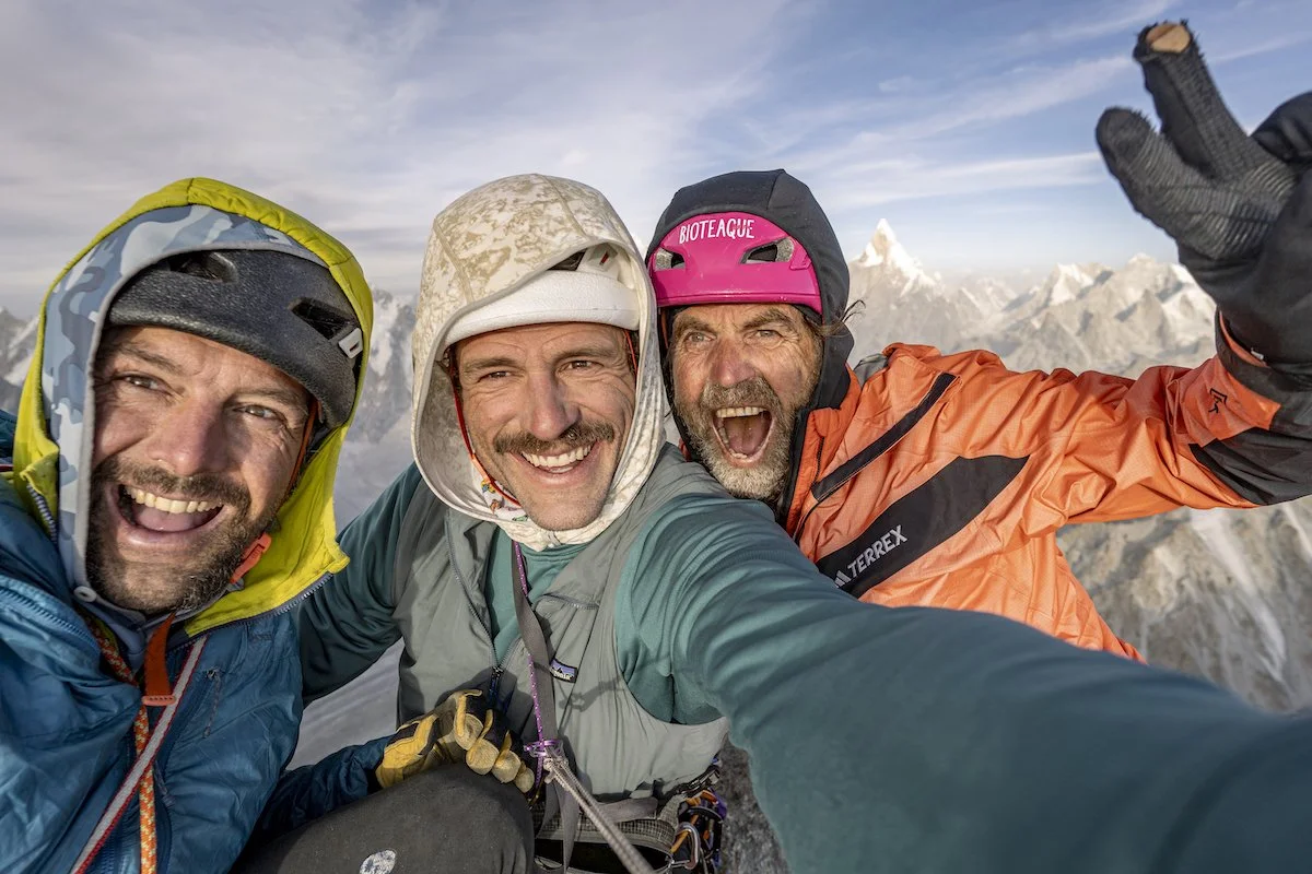
Left to right: Jon Griffin, Tad McCrea, and Thomas Huber.

—Tad McCrea, USA


New Cutting Edge Episode: Massive Climbs and Wild Adventures in Mozambique

The enormous granite peaks of Mozambique are among Africa’s most impressive rock formations, yet fewer than a dozen climbing teams have ever explored them. In 2025, a Spanish and American trio put up a 17-pitch route in Mozambique, and for this episode we spoke with one of the team members—American Dakota Walz—about what they encountered, including a seemingly inscrutable bureaucracy and a night in detention before they could even start the climb. Following the successful ascent, they suffered debilitating illness thanks to ill-advised celebratory ice cream.

In between were glorious days on a unique African mountain, creating a route worth repeating. Host Jim Aikman also chats with Majka Burhardt, a veteran of two climbing expeditions to Mozambique, about navigating the cultural and logistical challenges in a country struggling with a legacy of conflict. And AAJ editor Dougald MacDonald shares insights on southern Africa’s extraordinary granite climbing.


Sign Up for AAC Emails

The Line—From Bozeman to the Baspa

Since 2010, climbers have been exploring the mountains, cliffs, and boulders above the village of Rakchham in northern India’s Baspa Valley, drawn by varied, high-quality climbing and relatively modest elevations in this quiet corner of the Himalaya. Last fall, two Montana-based climbers—Ryan Griffiths and Seth Timpano—spent several weeks in the area. Here’s their story.

The 800-meter northwest face of Peak 5,400m above the Rakchham Plateau. Photo by Ryan Griffiths.

Rocking the Rakchham 

In late October and early November 2025, Ryan Griffiths and I climbed new routes on two unclimbed peaks above the Baspa Valley. We were based out of the village of Rakchham at around 3,150 meters, with a small advanced camp on the Rakchham “plateau” at 4,100 meters. 

After a week of acclimatizing, we spent October 21 and 22 climbing the northwest face of Peak 5,400m. This gave quality moderate ice and mixed climbing, but was not particularly sustained, as the route was split by a small pocket glacier, which we used for a bivouac. The 800-meter ascent had difficulties up to WI4 M5. 

We next tried the east ridge of unclimbed Daboling (ca 6,050m) at the head of the valley. Starting from a high camp at around 5,400 meters, we climbed 13 pitches on mostly good granite, although at times the climbing was tedious and the terrain felt like stacked Jenga blocks. The line was classically alpine in nature, and it is difficult to assign a rock or mixed grade. 

Our high point was around 5,850 meters. Four or five more pitches would have taken us to the summit slopes, but without bivouac gear, and knowing the descent would be complex, we made a conservative call to retreat. Our descent involved a dozen rappels (exclusively on rock anchors), first down the ridge then onto the steeper south face. 

After a short rest in town, we ended the trip by climbing a 200-meter granite tower that tops out at about 5,100 meters. This is the Fourth Pillar of Ray Peak, as defined by the Austrian team that visited the area in 2019 (AAJ 2020). Ryan and I climbed the south face of this tower in five pitches, four of which were 5.9 or 5.10 and composed of perfect granite. We rappelled our route. 

Overall, we found this to be a beautiful area with impressive boulders and excellent alpine rock potential. However, the alpine ice will require very specific—perhaps rare—conditions, as the mountains are losing their perennial snow. 

Seth Timpano on the first pitch of the northwest face of Peak 5,400m. Photo by Ryan Griffiths.

Ryan Griffiths climbs a nice ice pitch to circumvent the icefall on the northwest face of Peak 5,400m. Photo by Seth Timpano.

Ryan Griffiths high on the east ridge of Daboling. The rocky pyramid on the left is Phawararang (6,349m), climbed several times via the south ridge. Photo by Seth Timpano.

Seth Timpano on the excellent second pitch on the south face of the Fourth Pillar of Ray Peak. Photo by Ryan Griffiths.

The south face of the Fourth Pillar of Ray Peak. There are three prominent dihedrals with their right walls in shadow. The 2025 route climbed splitter cracks up the sunny left wall of the rightmost corner, finishing with a long pitch up the southwest face directly to the summit. Photo by Ryan Griffiths.


Bouldering and Beyond

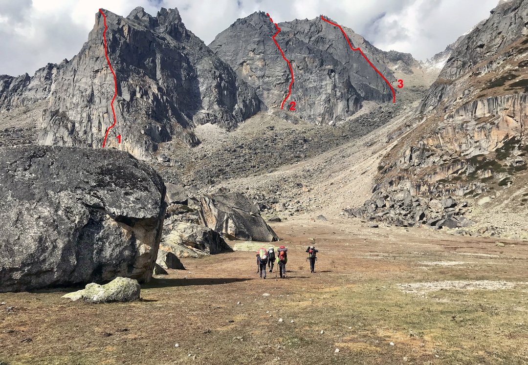
Three routes climbed in 2019, each with about 600 meters of climbing, seen from the boulder-strewn Rakchham Plateau. The reports are in AAJ 2020. Photo by Gebhard Bendler.

Modern climbing in Rakchham and the Baspa Valley has a somewhat unlikely origin story for an alpine zone: It began with bouldering. In 2010, well-known European climbers Elie Chevieux, Frederic Nicole, and Bernd Zangerl explored the Kinnaur district of Himachal Pradesh and discovered the Baspa Valley, “a veritable Shangri-La for the rock climbers,” as Chevieux wrote in AAJ 2012. Their stories about the climbing near Rakchham prompted a steady stream of visitors over the next decade. (Spanish climber Silvia Vidal was another early visitor—she soloed a 1,000-meter wall in the area in 2010.) 

No one was more infatuated with the area than Zangerl: He has traveled from his home in Austria to Rakchham more than ten times. Zangerl also is one of the driving forces behind community efforts aimed at making climbing a sustainable activity that benefits and is welcomed by local residents. He recently published the first guidebook to bouldering in the area and helped spearhead a bouldering festival this past October, along with the locally led Rakchham Mountaineering & Adventure Club. A community website, rakchham.com, is a great resource for climbers considering a visit, providing beta, information on permits that support the local community, and an offer to help alpinists avoid peaks that the local people consider sacred. 

In 2022, Five Ten produced a beautiful 20-minute video, directed by Ray Demski, showcasing Rakchham and the efforts to preserve its beauty and culture while the Baspa Valley develops as a climbing destination.


Last summer, the Women's Young Alpinist Team of the Swiss Alpine Club journeyed to East Greenland—without ever boarding a plane—and climbed six long rock routes, four of them in a fjord that had never been visited by climbers. Team leader Caro North is the main guest this episode, describing the difficulties of organizing such a complex exploratory trip. Just getting there and back involved trains, ferries, cars, and a voyage by sailboat. Even though she was the most experienced climber in this group, Caro deliberately stepped back from the decision-making, letting the younger team members plan and lead their routes—a rewarding tactic for Caro, but also one with some emotional challenges. 

Rounding out this episode, host Jim Aikman interviewed American Mike Libecki, who has done more exploratory rock climbing in southeast Greenland than anyone alive.


The Line is the monthly newsletter of the American Alpine Journal.

Sign Up for AAC Emails

The Line—Unclimbed Baffin

Most climbers journeying to Baffin Island in Canada head to the Weasel River Valley in Auyuittuq National Park, home to the world-famous walls of Mt. Asgard and Mt. Thor, among many others. Yet despite more than 50 years of climbing history in this area, there’s still enormous potential just outside the main valley. In April 2025, an ambitious and creative British team explored the glacier systems east of the Weasel River, finding numerous unclimbed peaks and walls.    

A striking unclimbed peak to the south of Mt. Bilbo, at the head of the Nerutusôq Glacier. Photo by Tom Harding.

Nerutusôq Glacier and Fork Beard Glacier, Seven First Ascents

Unclimbed walls about 25 kilometers from Kingnait Fjord, which is accessible by boat in summer. The photo is taken from the eastern side of the Fork Beard Glacier, looking approximately southeast. Photo by Tom Harding.

In April 2025, a four-person team made up of Leanne Dyke, James Hoyes, Ben James, and I flew into the settlement of Pangnirtung. Our hope was to use spring snow cover to ski the length of the mountains to the east of the Weasel River Valley, ascending unclimbed peaks along the way. However, on April 7, strong winds and lack of sea ice prevented us from accessing our planned snowmobile drop-off in Kingnait Fjord (the next fjord east of Pangnirtung Fjord). After this false start, we changed plans and were dropped on April 10 just below Summit Lake at the head of the Weasel River Valley.

An aerial view to the east over the Fork Bear Glacier complex, showing the 2025 team’s ascents in this area. Photo by Tom Harding.

We had hoped to ski straight up onto the Nerutusôq Glacier, to the southeast of Summit Lake’s outlet, but a lack of snow meant we spent three exhausting days portaging our sleds, food, and equipment up onto the glacier. We made camp three kilometers southwest of Mt. Bilbo (1,842m).

The team on the summit of Uppijjuaq (1,823m). Photo by Ben James.

From this camp, we made two first ascents. On April 14, we climbed the east slopes to the south ridge of a 1,823-meter peak we named Uppijjuaq. The next day, we made the first ascent of Minas Tirith (1,950m) via its three-kilometer west ridge (PD-), passing tricky steps and steeper granite cracks to an impressive summit tower.

We then skied south onto the Fork Beard Glacier, making two more first ascents, the southwest rib of Aqviq (1,860m) and the west face of Inutuaq (1,637m), as well as a failed attempt on a third peak.

Next, we headed south on the Fork Beard Glacier, hoping to find a pass at the top of the Turnweather Glacier that would connect us to the Gateway Glaciers to the south, but after two days of searching, no feasible route was found. Fortunately, this unnamed valley had never been visited by climbers, to the best of our knowledge, and we went on to make three more first ascents: the south face of Ukaliq (1,532m), west to north ridge of Uvingajuq (1,615m), and the south slopes of Atangiijuq (1,600m).

With so many of the peaks in this area of Baffin given Norse or English names, our team thought it would be nice to instead use the Inuit language to name most of the first ascents. Traditionally, the local population gives names for what the peak looks like or what they see in the local area, and we followed this method. For example, Uppijjuaq means “snowy owl,” Aqviq is “humpback whale,” and Uvingajuq means “diagonal,” after the distinctive ramp we climbed.

The team’s camp on the Fork Beard Glacier, with Inutuaq (1,637m) in the center right of the photo. They made the first ascent by traversing around the right side of the mountain and climbing the west ridge. Photo by Ben James.

To end our trip, we skied four days to exit the mountains: first to the west via the branch of the Fork Beard Glacier flowing south of Tirokwa Peak, then south along the frozen Weasel River, and finally to the sea ice in Pangnirtung Fjord. We returned to Pangnirtung village on April 30, having completed seven likely first ascents and skied around 150 kilometers. The weather was surprisingly stable, with many blue-sky days, and although temperatures at the start of the trip dropped to -30°C, it quickly warmed to a comfortable -10°C.

The eastern portions of the Nerutusoq and Fork Beard glaciers still have potential for future teams. Accessing this area in summer would be a long journey, but using the spring snow opens up the area. [This mostly British team received support from the Mount Everest Foundation; their extensive trip report can be downloaded here. They received additional support from the Arctic Club, British Mountaineering Council, Austrian Alpine Club, and the Alpine Club (U.K).]

—Tom Harding, United Kingdom


Last Call for Canada Reports—AAJ 2026

The 2026 AAJ will publish four more reports from Baffin Island, in addition to the one shared above. We plan to wrap up the Canada section of the book in early February. If you or a friend climbed a long new route anywhere in Canada in 2025, and you aren’t already in contact with an AAJ editor, we’d love to hear about it no later than January 31. Reach us at [email protected]. 


New Episode—The Direct Line on El Capitan

In November 2025, Sasha DiGiulian free climbed The Direct Line (a.k.a. Platinum Wall), a 39-pitch 5.13d on El Cap, in a 23-day push, including nine days trapped by a storm high on the route. For this episode, host Jim Aikman explores the history and highlights of this relatively new route (first free ascent: 2017), which is becoming known as one of El Cap’s most sustained and high-quality free climbs. Other guests include Elliot Faber, co-developer of The Direct Line and Sasha’s partner for the climb, and Alex Honnold, who also freed the route in November, with Tommy Caldwell.

Sign Up for AAC Emails

The Line—Desert Towers in Saudi Arabia

Saudi Arabia is nearly ten times the size of Utah, and most of it is desert. Like Southern Utah, the terrain is riven with sandstone canyons and towers, nearly all of them unclimbed. Last January and February, a German trio did a three-week, 4,600-kilometer loop around the desert kingdom, exploring the traditional-climbing potential. So, how did their expedition turn out? It was a mixed bag.…

Gemini Tower, north of Wadi Al Disah in western Saudi Arabia. After the first ascent of the four-pitch formation, the German team was informed that climbing is not permitted in this area. Photo: Daniel Hahn Collection

Wadi Al Disah, Bajdah, Wadi Dham: 12 First Ascents

Excited and somewhat stressed, we plunged into the crazy traffic of the seven million–strong metropolis of Riyadh in our rental car. Excited because a journey into the unknown lay ahead: a search for climbs in a country that has only been open to Western tourism since mid-2019. And stressed because only five of our six pieces of luggage had arrived.

With a day to kill, Michael “Michi” Bänsch, Daniel Hahn, and I first shopped for supplies, then drove out of the metropolis toward the Edge of the World, a rocky escarpment northwest of Riyadh. The traffic was terrible; one construction site followed another. The entire country is being dug up; money seems endless. Due to the construction work, neither Edge of the World nor the stunning sandstone tower of Faisal’s Finger were accessible. But at least we spent a nice first night in the desert, giving us some relief and preparing us for the coming weeks.

The next day, January 20, our last piece of luggage arrived. We took a deep breath and set off toward Wadi Al Disah, 1,300 kilometers to the northwest, fairly near the Red Sea. Settlements were very sporadic, and the closer we got to the Hejaz Mountains, the more fascinating the landscape became. When we entered Wadi Al Disah, our jaws dropped: endless sandstone cliffs, magnificent scenery, and potential for generations of adventurers. Atir Tower, the valley’s landmark, glowed in the evening light. After finding a place to sleep and cook dinner, we went swimming—yes, swimming! A stream flows through the wadi, providing gloriously green vegetation and offering us a welcome cool-off every evening.

Seppo and Michi starting up the first pitch on Hinterhaus, a 200-meter formation in Wadi Dham. Photo: Daniel Hahn

The next morning, we headed straight to the Atir, a 350-meter tower and one of the few Saudi formations with documented routes. It was climbed by a chimney route on the east side in 2013, by a party including Donald Poe, a U.S. oil engineer and Saudi Arabia resident. In 2020, a group led by Leo Houlding from the U.K. found a new line on the west face and named it Astro Arabia (5.11). We climbed the original route (UIAA V or about 5.7), hoping to encounter rock roughly akin to the well-known Wadi Rum in Jordan, about 230 kilometers to the north. In fact, the rock turned out to be quite brittle and dirty. But what a summit!

Over the next few days, we searched for more climbable rock, which was harder than expected: There are endless formations, but upon closer inspection, many turned out to be too difficult, too fragile, or both. The fact that we did not have a drill or bolts didn’t make it any easier. But we soon made the first ascent of a beautiful tower (which had obviously been climbed by locals up to its forepeak), right at the valley entrance. We called it Burg (“Castle”) and the route Uralter Weg (“Ancient Path,” 80m, VI/5.10-).

Further into the valley, another peak tempted us, perhaps 100 meters high and with what appeared to be a climbable route. Soon after we started climbing, however, we heard strange noises from below. The SFES (Special Forces Environmental Safety) rangers had spotted us and were ordering us back down. After a lengthy but quite friendly discussion, we were surprised to learn that climbing is prohibited in the entire Wadi Al Disah. 

We detoured to a nearby canyon just to the north, Wadi Tarban (or Tourpan), where we climbed Gemini Tower (130m, 4 pitches, V+) and Porcelain Tower (scrambling plus 25m, VI), before being informed by friendly locals that climbing was not allowed there either. So, we left the Wadi Al Disah area earlier than planned and continued to Bajdah, a small town farther north, near the city of Tabuk, where we had been told climbing is officially permitted.

Michi in Al Gharameel Nature Reserve, where the climbers ascended five needles up to 20 meters high. Photo: Daniel Hahn

Here, a completely different landscape awaited us: an open plain from which countless rocks rise, some enormous massifs, some picturesque needles. It may be hard to imagine, but deciding where to start in a sea of rock is truly challenging. But we soon found some nice objectives, including a two-pitch needle that we named Stoneman, climbed by a new route called Triumph des Willens (“Willpower,” ca 100m, VII-/5.10). We also reached all five summits of a formation we named Felsenbrüder (“Brothers of Stone”), about 150 meters high, by the route Geschenk der Wüste (“Gift of the Desert,” VII-). The climbing here was challenging, with brittle overhangs that had to be overcome or bypassed, followed by easy scrambles to the summits.

Next, we visited the nearby Wadi Dham (Damh), where we fanned out, eyes upward, looking for opportunities. We chose a pagoda-like formation we called Hinterhaus. Although generally easy, it also had many small overhangs, and one even required aid: Weg des Willens (VI+ C1). Two more days here brought us the first ascent of another small tower and some beautiful hikes in an impressive landscape—simply a wonderful time.

On all of our climbs, we only used cams, nuts, and slings. No bolts were placed. We live in Dresden, near the famed sandstone towers of Elbsandsteingebirge and Adršpach (Czechia), and we are very experienced sandstone climbers. Yet, even though Saudi Arabia seems to offer endless sandstone climbing, the rock is very unpredictable, even when it looks great—sometimes a hold stays put when weighted, sometimes it pops off. With all the dust and coarse sand, the ropes got stiffer every day—all of our gear suffered as much as our nerves.

After two weeks I headed home, while Michi and Daniel stayed for another week. During this time, they visited Al Gharameel Nature Reserve and found countless sandstone needles. They climbed five towers, up to about 20 meters high and UIAA VI (5.9+/5.10-), without seeing a single trace of previous climbers.

During our travels, we met incredibly friendly people, some of whom offered us water or invited us to share tea or coffee, and shared interesting conversations, sometimes in perfect English, sometimes with gestures and Google Translate. We enjoyed a simple life, sleeping out on the sand. On some mornings, our sleeping bags sparkled with frost. We pushed or dug the car out of the sand twice. In all, we summited 13 formations, probably 12 of them first ascents.

—Stephan “Seppo” Gerber, Germany 


Sport Climbing in Saudi Arabia

In addition to the desert towers explored by this team in 2025 and the British group in 2020, a bit of early traditional climbing was reported on granite in the western part of Saudi Arabia, south of Ranyah (AAJ 1989). Of more interest to many climbers will be the sport routes developed in late 2018 at various sandstone, granite, and limestone crags—some of them quite impressive—by Read Macadam (Oman) and various European climbers, who worked with the Saudi Climbing and Hiking Federation. The federation has published PDF guides to these crags, and many of these routes have been posted at Mountain Project.

Overview of the impressive Olympic Crag, which has about 40 routes on steep granite, two and a half hours east of Jeddah, Saudi Arabia.


Astro Arabia

In early 2020, shortly after Saudi Arabia opened to tourism, British climbers Waldo Etherington and Leo Houlding visited Wadi Al Disah and climbed two large towers, leading to a film, Great Sheiks, as part of the Brit Rock series. Here’s the opening segment from the film, covering the first ascent of the 100-meter Leaning Tower of Disah—it gives a good sense of the “acquired taste” for exploring variable Saudi sandstone.


The Cutting Edge Podcast: Cerro Torre Solo in Winter

On September 7, Colin Haley reached the summit of Cerro Torre all alone—a climb that tested this Patagonia veteran perhaps more than any before. It was the first winter solo of the stunning granite needle, and the culmination of a nearly 20-year dream. Don’t miss this extraordinary episode of the Cutting Edge.


The Line is Powered By:


The Line is Supported By:


Sign Up for AAC Emails

The Line—Reward and Risk on Kaqur Kangri

Most of the descent from the 6,859-meter summit of Kaqur Kangri involved exposed downclimbing. Photo by Spencer Gray.

Three teams will be honored with Piolets d’Or in Italy this December, and all three contributed feature articles about their climbs to the 2025 American Alpine Journal (AAJ). Tom Livingstone wrote about his and Aleš Česen’s new route on Gasherbrum III in Pakistan; Dane Steadman described the first ascent of Yashkuk Sar, also in Pakistan, with August Franzen and Cody Winckler; and Spencer Gray told the story of climbing the southwest arête of Kaqur Kangri in Nepal with Ryan Griffiths. 

There’s a lot to love about Spencer’s AAJ piece—it documents an amazing ascent. But we were also struck by the final passage, in which he reflects on the inherent and sometimes insidious risks of Himalayan alpinism. No one got hurt on the climb of 6,859-meter Kaqur Kangri, but afterward Spencer tallied 20-plus incidents that each could have ended very badly. Honest self-assessments like this are essential to a long life in the mountains, so we’ve shared Spencer’s thoughts here for readers to consider in light of their own climbing.


Kaqur Kangri: A Dangerous Game

Objectives like the southwest arête of Kaqur Kangri used to be what most climbing was: trying something kind of hard, an inconvenient distance from home, and relying on imagination as much as effort to turn a thing dreamt into a thing done. There are still plenty of places to contrive that same experience. We just have to look harder—and be willing to court risk in an unpredictable operating environment. 

Our team didn’t have what we’d consider a close call, but in debriefing, I still counted 23 discrete times when the risk ticked up. A mule nearly broke my knee with a kick when I tried to bring it into camp one morning. On our first day of climbing, we hustled up a ramp that was probably at the outside edge of the ricochet zone of the upper serac band. Two days later, Ryan [Griffiths] and I both simultaneously realized that we were pushing our unroped luck on low-angle but hard-frozen talus above the west face. “If we slip here, it’s to the bottom, eh?” I said.

Of four minor rockfall incidents, we mitigated two by our choice of protected belays and bivvies. Another was friendly fire: On rappel, I chucked a baseball-sized rock so the ropes wouldn’t dislodge it. But I misaimed, and the rock bounced down the snow slope and nailed Ryan in the shoulder. I reasoned that Ryan had probably done something in a prior life to deserve getting punched in the clavicle. He was less sure.

On day three, below the snowfield, we pulled through suspended, stacked blocks in a roof that would have chopped the rope had they dislodged. On the upper headwall, my ice tool tethers got tangled behind a cam after I had campused out a diagonal rail. I couldn’t reverse the move, and I couldn’t continue until I had unthreaded the tools. Half growling, half screaming, I locked off on one arm, frontpoints screeching, and freed myself. When he followed, Ryan simply lowered out and jugged. 

On the descent, Ryan and I had probably our riskiest moment when we crossed a 40-foot-wide wind slab partway down the upper northwest face. It appeared suddenly, a shallow pocket of cross-loaded danger in an otherwise stable snowpack. The tension on the slope and the soft, hollow thump as our boots and ice tools pressed through the snow put us both on edge. But with no other signs of failure or propagation, and a morning of downclimbing a similar aspect and angle above us, we each judged it safe enough to proceed.

An hour before we regained the base of the mountain, fed up with navigating the messy corners of the final glacier, we briefly but obtusely committed to soloing steep glacial ice, embedded with crushed pebbles, as we traversed 15 feet above the bottom of a closed crevasse. We were spurred on by our friend Matt’s tiny light in the distance and the promise of fresh Snickers. Perhaps a week on the mountain and the tedious descent had dulled our nose for risk. 

Three days later, we stopped at Chyargo La on the trek back out and took in our final view of Kaqur. I crouched beneath fluttering prayer flags to lounge against a rock, my fingers getting sticky pulling globs of gulab jamun out of a can we’d saved until now for a treat. Kaqur’s summit seracs glinted in the midday sun from what seemed like a very long ways away. Matt and Ryan laughed as I passed them the can for a shot of syrup to wash it all down.

—Spencer Gray

In the decade between 2015 and 2024, 73 individuals received Piolets d’Or to honor alpine-style ascents completed in the prior year. Eight of these highly skilled climbers—about 11 percent—subsequently died in the mountains. It is no secret or surprise that high-level alpinism is a very dangerous game. Nonetheless, Spencer’s words remind us that the hazards are manifold and ever present, and that these often superhuman achievements also come with heavy potential costs. —Dougald MacDonald, Editor, AAJ

Ryan Griffiths rappelling the northwest ridge of Kaqur Kangri. The team exited to skier’s left off the glacier below to return to their advanced base camp. Photo by Spencer Gray.

Spencer Gray on beautiful rock at about 6,000 meters on Kaqur Kangri, below the hanging snowfield that separates the south face’s serac bands. Photo by Ryan Griffiths.

“Climb if you will, but remember that courage and strength are nought without prudence, and that a momentary negligence may destroy the happiness of a lifetime. Do nothing in haste; look well to each step; and from the beginning think what may be the end.”
— Edward Whymper, "Scrambles Amongst the Alps"

New Cutting Edge Episode—Ultar Sar’s Southeast Pillar

Ethan Berman, Sebastian Pelletti, and Maarten van Haeren (left to right) on the summit of Ultar Sar. Photo: Maarten van Haeren.

The Cutting Edge podcast has returned for a new season of in-depth interviews with climbers just back from great ascents. The October episode highlights one of the climbs of the year from the Karakoram: the first ascent of the southeast pillar of 7,388-meter Ultar Sar in Pakistan. Host Jim Aikman interviewed climbers Ethan Berman and Maarten van Haeren, along with Karakoram expert Steve Swenson (more than 20 expeditions to Pakistan!) and AAJ editor Dougald MacDonald. 

New episodes of the Cutting Edge will appear each month during the 2025–2026 season! Subscribe to the feed wherever you get podcasts to ensure you never miss an episode.


The Line is Powered By:


The Line is Supported By:


The Line is the newsletter of the American Alpine Journal (AAJ), powered by Arc’teryx, with additional support from Mountain Project by onX. The line is emailed to more than 80,000 climbers each month. Sign up below to receive future emails. Find the archive of past editions here. Got a potential story for the AAJ? Email the editors at [email protected].

To see The Line every month, sign up below!

The Line: First Ascents and New Routes on Stunning Peaks in Tibet

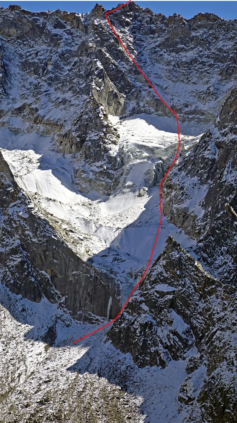
Sir Duk (Golden Dragon, 6,614m) in the Nyanchen Tanglha West mountains. Behind and to the left is the Nyanchen Tanglha Group, with the highest summit, Nyanchen Tanglha I (7,162m), on the left. Three routes have been climbed up the sunlit southwest face and south ridge of Sir Duk, including two summit routes and a line in 2024 that reached the west shoulder. That report is now at the AAJ website. Photo: Fan Rui

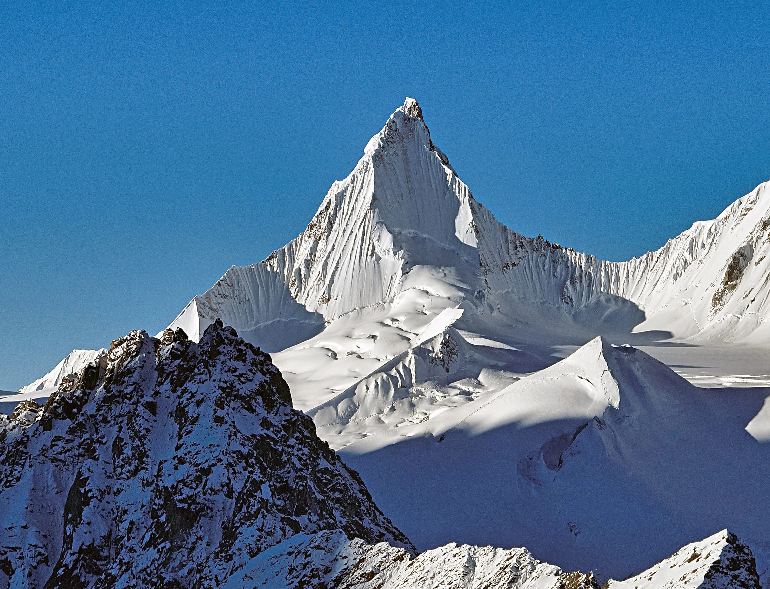
The vast Nyanchen Tanglha (a.k.a. Nyainqentanglha) ranges in Tibet span more than 750 kilometers in an arc north of Lhasa—it’s one of the world’s great collections of unclimbed or seldom-climbed high peaks. In the first decade of the 2000s, the Japanese geographer and photographer Tamotsu Nakamura, an AAC honorary member, published a series of articles describing these mountains, including a three-part opus in AAJ 2003 on mountains “East of the Himalaya” (also the title of Nakamura’s landmark 2016 book), with enticing photos from the Nyanchen Tanglha East range.

A bit of a gold rush followed, with various Western climbers snagging the first ascents of attractive summits in Nakamura’s photos. However, there are major logistical difficulties to climbing in this area, including road access and permits. The last AAJ articles about climbs in the Nyanchen Tanglha by Western climbers were published in 2017.

Into the breach has stepped a cohort of Chinese alpinists who have rapidly gained experience and skill in their home mountains in recent years. Now ready to tackle more difficult and remote objectives, they have made many impressive ascents, aided in part by rapid development of road and rail networks in Tibet. Three climbs from late 2024 are highlighted below. These reports could not be completed in time for the 2025 AAJ, but these ascents and many more in Tibet will be described in detail in next year’s book.

Many thanks to Xia Zhongming, who facilitates and writes AAJ reports from China— including these three—and has contributed greatly to the world’s knowledge of modern Chinese alpinism.


MANAMCHO FROM THE SOUTHWEST

Manamcho (6,264m) from the northwest. The original route (2007) climbed the arête facing the camera. The 2024 route by Chinese alpinists Liu Junfu and Wang Shuai climbed the right side of the sunlit face. Photo: Lai Xingzhu

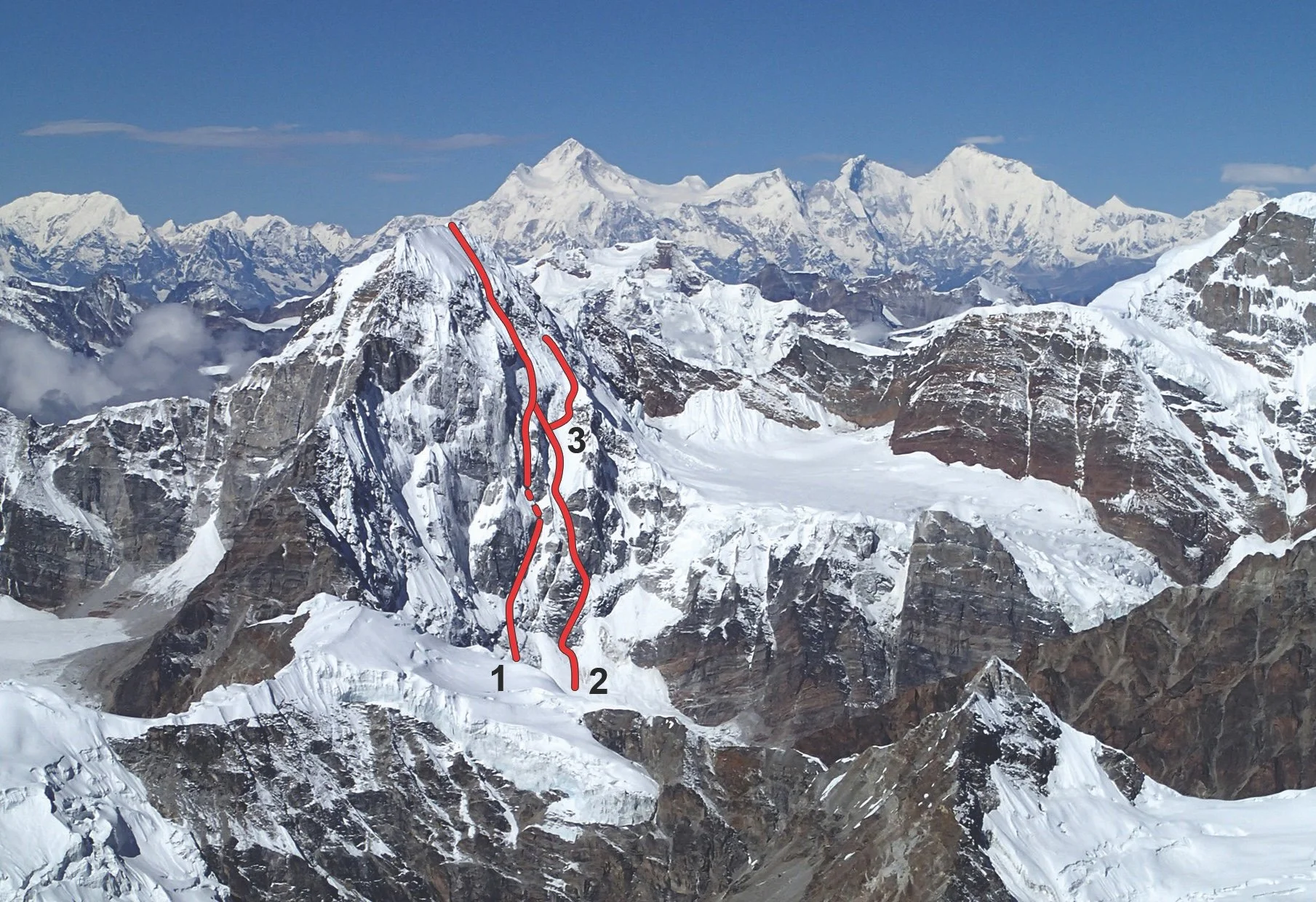
In 2005, British climbers Mick Fowler and Chris Watts made the first ascent of Kajaqiao in the Nyanchen Tanghlha East mountains. Two years later, Fowler returned with fellow Brit Paul Ramsden to climb Manamcho, a spectacular, Matterhorn-like peak nearby, by the northwest ridge. In September 2024, Chinese alpinists Liu Junfu and Wang Shuai climbed Manamcho’s second route, up the southwest side of the 6,264-meter mountain, in one long day from high camp. To overcome a crux rock slab near the top, Liu tied a rope to one of his ice tools and threw it up the rock. After more than ten tries, the tool stuck and Liu was able to batman up the rope and surmount the slab, opening the way to the summit. See the full report.


CHUCHEPO, FIRST ASCENT

Chuchepo (6,613m), with the 700-meter northeast face in shadow. This face was climbed directly to the summit in September 2024. Photo: Tong Haijun/Wang Yongpeng

Wang Yongpeng on the upper northeast face of Chuchepo during the first ascent. The shapely peak in back is unclimbed Sendho (6,252m). Photo: Tong Haijun

In the southwest section Nyanchen Tanglha East lies Nenang (6,870m), the highest of this range’s unclimbed peaks. Around 10 kilometers from Nenang to the west and east stand two spectacular mountains: Chuchepo (6,613m), west of Nenang, and Jiongmudazhi (6,590m) to the east. Both peaks were noted in AAJ 2007, but no known attempts were made on either peak until August 2024, when Tong Haijun and Wang Yongpeng from China climbed Chuchepo by a direttissima on the northeast face.

On August 16, the two began their approach from the Niwu Valley to the north, establishing advanced base at 5,300 meters after an 11-hour day. From there they scoped a feasible line up the northeast face. The next day, the pair spent seven hours crossing the snow-covered, crevassed glacier before camping at 5,900 meters.

On the 18th, the two left camp at 3 a.m., and after a difficult pitch to cross the bergschrund, they continued up easier terrain to reach 6,230 meters before sunrise.

The major technical difficulties now followed. Wang led a pitch where the ice was too thin to place screws and the rock too compact for cams. Tong then climbed a very run-out pitch on snow-covered compact rock. After this, the snow became deeper and the difficulties eased. Wang made a final belay in deep snow a couple of meters below the summit ridge, and Tong then tunneled through the cornice and continued up left to the highest point. The 700-meter route was graded D+ M4 AI3 75°. See the full report.


JIONGMUDAZHI, FIRST ASCENT

The northwest face of Jiongmudazhi (6,590m) and the line of the first ascent in September 2024. Photo: Tong Haijun/Wang Yongpeng

Less than a month after climbing Chuchepo, Tong Haijun and Wang Yongpeng returned to the area in September 2024 to attempt the first ascent of Jiongmudazhi (6,590m). Again, Tong and Wang approached from the north, via the Biyong Glacier, where they spent a very difficult day bypassing an 800-meter-wide icefall surrounded by steep cliffs. On September 8, another big day brought them to their second camp, at 5,855 meters.

The next morning, they left at 3 a.m. The visibility was poor, and it began to snow heavily. They alternated trail-breaking to the foot of the northwest face, left of the fall-line from the summit. Crossing the bergschrund, Tong led a five-meter vertical ice wall followed by deep snow. Wang led both the second and third pitches, slanting right toward a rocky area. Above this, they then began simul-climbing with intermediate protection; at one point, the two pitched a 20-meter vertical section with no protection.

When dawn broke, an ice block the size of two sofas collapsed from a serac barrier less than 50 meters away. They continued, climbing the right side of another serac barrier, when suddenly the mist cleared and they saw the main summit over to their right. This clearing was fortunate, as otherwise they would have continued up to a false summit. They reached the top at 11 a.m. and were back at their first camp by 5 p.m., having rappelled most of their route. See the full report.

We’ll be adding more of these reports and others from China to the AAJ website in the coming weeks. Follow the AAJ Instagram page for updates.


The Line is Powered by:


The Line is Supported By:


The Line is the newsletter of the American Alpine Journal (AAJ), powered by Arc’teryx, with additional support from Mountain Project by onX. The line is emailed to more than 80,000 climbers each month. Sign up below to receive future emails. Find the archive of past editions here. Got a potential story for the AAJ? Email the editors at [email protected].

To see The Line every month, sign up below!

The Line: A Wild and Crazy First Ascent in Idaho

First ascents are as much about imagination as they are about strength and skill: They require seeing a possibility where few had imagined one before. River guide and climber Matt Ward had seen a huge, steep wall above Idaho’s Salmon River many times, and he dreamed of making the first ascent. The wall looked climbable, but how to get there? The wild story of how he and Ky Hart solved that problem is published below. Matt’s story appears in AAJ 2025, which is now starting to arrive in AAC members’ mailboxes. But not everyone reads the AAJ cover to cover, and we didn’t want anyone to miss this unique tale of adventure.

IMPASSABLE CANYON, REDSIDE WALL

“Beavers!” Ky Hart yelled over his shoulder.

“No! Bears!” I yelled back.

Actually, it was three bears. Two small black bear cubs were timidly swimming on an eddy line in the Middle Fork of the Salmon River. The large mama bear was waiting for her cubs to follow her across, and she stood up tall when she saw Ky and me about to swim between her and her babies.

“I’m gonna touch one!” Ky yelled out.

My instinct was to do the exact opposite—swim away from them. But the swift current was quickly moving us both directly at the cubs. Fortunately, our appearance shocked them into action. The cubs swam hard for mama, and the current shot us past them.

Looking back on the experience later that day, it occurred to me that the fact that Ky’s first thought was to swim over and touch a wild bear cub while its mother watched was one of many things that made him the perfect partner for this trip. Unhinged, yes. But our plan to hike 22 miles, swim three and a half miles of whitewater, and climb a new route on a backcountry big wall would require more than a little madness.

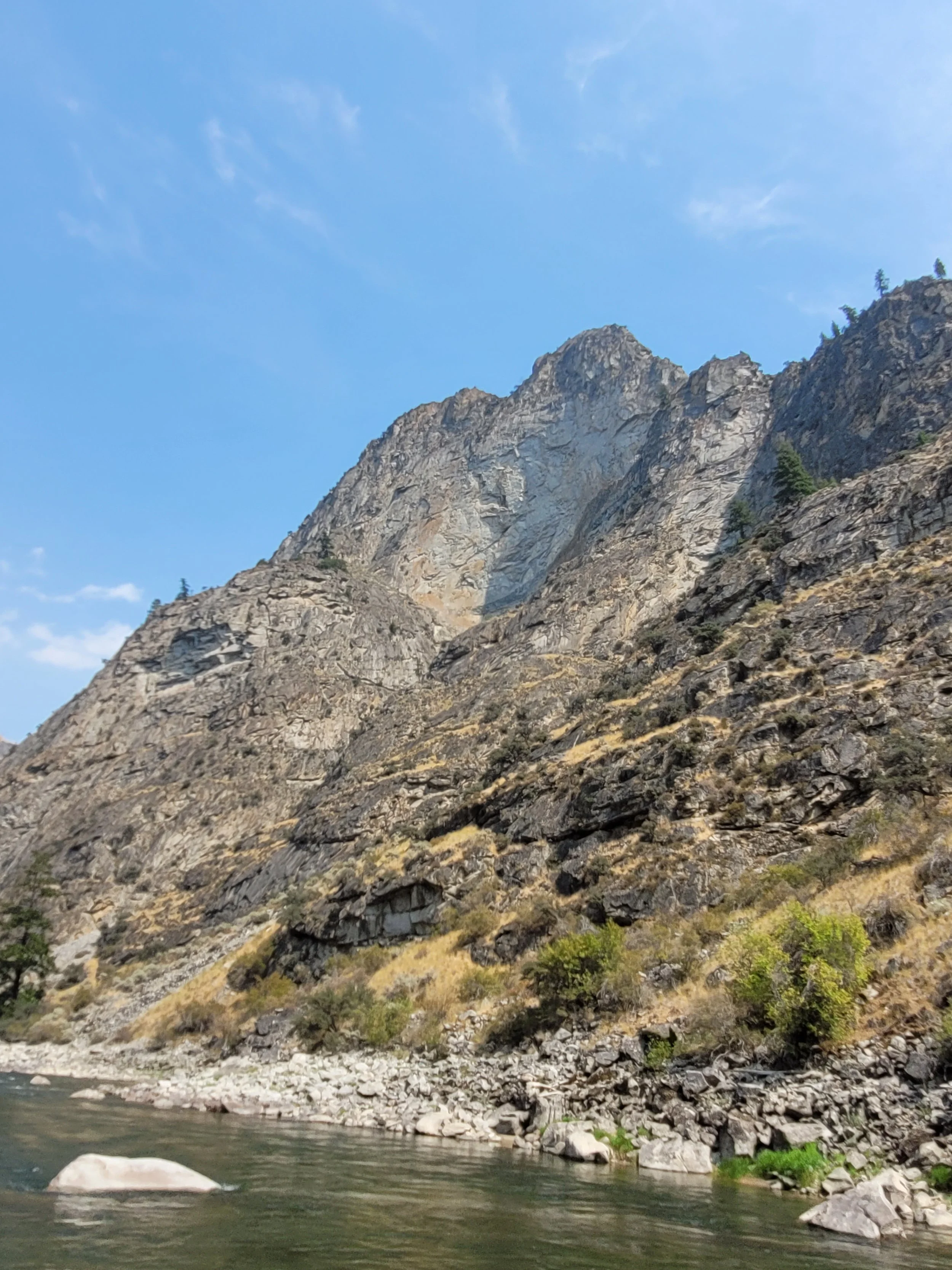
The view of Redside Wall from the Middle Fork of the Salmon River. It would be a challenging first ascent if it were near the road. Eighty-two miles down a heavily regulated wilderness river, Redside would require a novel approach. Matt Ward

Impassable Canyon on the Middle Fork of the Salmon, deep in the heart of Idaho’s massive Frank Church Wilderness, is legendary among river runners and all but unknown to climbers. River permits for the Middle Fork can only be won through a lucky pick in the annual lottery. Once a trip has launched, numerous necessary rules regulate the way that boaters can use the wilderness. One of these prohibits any river trip from camping more than one night in Impassable Canyon.

Over three commercial seasons as a raft guide on the Middle Fork, I had become obsessed with what appeared to be the tallest wall in Impassable Canyon. It’s a landmark for the famous Redside Rapid, and because of this, I’ve always called it the Redside Wall.

The Redside Wall is 82 river miles from the Boundary Creek boat ramp. The nearest trail to the wall crosses the river 3.5 miles upstream, but only after a 22-mile hike down Waterfall Creek. Over years of dreaming about trying to climb Redside, that seemed like the best option—except that those 3.5 downstream miles aren’t walkable at water level; the river often runs against steep, impassable walls. Hitchhiking downstream on river trips would also be illegal, since we wouldn’t be listed on the boat’s permit.

During one of many conversations with river and forest administrators on how to access the area legally, I finally asked the right question. “I don’t need a permit to swim in the river, do I?” The answer was no, I didn’t, delivered with a sideways glance and a chuckle.

At that moment, I hatched a plan. Ky and I would hike the Waterfall Creek Trail into Middle Fork Canyon, descending over 5,500 feet in 22 miles. Then we would swim with our backpacks down 3.5 miles of whitewater, including numerous Class III rapids. Then we would spend three days making the first ascent of a dramatically overhanging wall. Then we would join a friend’s river trip (for which we were listed on the permit) and paddle out.

Ky Hart adds some natural flotation to his waterlogged backpack during the three-mile swim down the Middle Fork of the Salmon River. Matt Ward

On August 29, 2024, we began the hike. After eight hours on the move, we reached the Middle Fork and made camp near the confluence with Big Creek, where a charred hillside across the river was still smoking from a wildfire. We were awoken repeatedly that night by the sound of trees falling and rockfall.

The next morning, we walked until Cutthroat Cove Rapid, where the bank cliffed out. It was time to swim. We eased into the river wearing our PFDs, gasped at the chill of the water, and began the most ridiculous stage of the plan. The bear sighting happened within the first mile. Soon after, our lips were blue, our teeth chattering. Ky found driftwood logs and lashed them to his backpack, which kept him farther out of the water. I opted for walking on sunlit banks when possible; this paid dividends when I found two beers that had been lost by some river trip.

Despite walking past several rapids, we still swam three miles. After the portage around Wall Creek Rapid, we jumped in for the final swim to the wall. Arriving at the beautiful beach beneath it felt a little surreal.

That afternoon, we started up the gully leading to the base of the wall and found the big-wall rack and portaledge I had stashed the week before, while guiding a trip down the river. We began climbing beautiful gray granite, smooth as glass in places. The gully pitches had worried us because they’d looked so polished, but we found enough cracks, bushes, and trees to make good, if dirty, progress.

Matt Ward leads the first difficult aid pitch (A3) on the upper Redside Wall. Ward had cached climbing gear and a portaledge below the wall during a previous river trip. Ky Hart

That evening, we were back on the beach, having fixed our ropes on the first three pitches. With seven river-trip launches a day on the Middle Fork, it was inevitable we would see many boats during our time on the beach. So began the endless answering of questions like, Where’s your boat? And, You didn’t really swim here, right? And, Do you need some beers? I love many things about river people, but especially the ever-present beer supply and the willingness to hand cold ones to suspect characters limping across the beach claiming they’re here to “do a little climbing.”

Hart jumaring after the bivouac on the Redside Wall, with the Middle Fork of the Salmon River about 1,500 feet below and wildfire smoke filling the air. Matt Ward

The next morning we packed the haulbag and committed to the wall. Our progress slowed considerably as the wall reared back and the cracks became seams. Beaks, hooks, and small gear got us to a decent bivy and, just like that, the first A3 pitch was in the bag. Ky went up on the next aid pitch and—long after sunset—kept hooking in the dark. We were, as usual, lost on the wall, but hadn’t found any dead ends yet.

Dawn broke hot. The smoke in the air was dense. We decided to pack a day bag, bring all of the rope we had, and see what happened. Ky swung 20’ away from the wall as he jugged the static line, a reminder of just how steep this thing was.

Looking down from high on the Redside Wall. Matt Ward

We were now in the large open book feature that splits the middle of the face, and the angle eased with every rope length. On the 12th pitch, I left the book and headed straight up with hopes of topping out. A mix of hooking and free climbing brought me onto a ledge covered in huge blocks, with a panoramic view of Impassable Canyon. We could see the Waterfall Creek Trail, most of what we’d swum to get here, Redside Rapid, and much of what lay downstream of us. A short scramble and a 5.8 pitch reminiscent of climbs in the Sawtooth Mountains brought us to the top. Not so much a summit as a high point on a ridge, 1,800 feet above the Middle Fork. We descended to the portaledge by rappelling from natural anchors.

The first lightning strikes happened at twilight but were far enough off to the west not to worry us at first. The Sawtooths and the Salmon River Mountains are both well known for exceptionally violent thunderstorms, and I’ve been pinned down by them more times than I’d like to remember. As the storm came closer, Ky began shooting photos as the lightning illuminated our exposed portaledge. It may have been an illusion, but it seemed we were above the lighting as it shot through the clouds. I pondered whether our 25 beaks could act as a lightning rod. We fell asleep late that night to a soundtrack of thunder, both silently repeating our trip’s mantra: Unkilled once again, so far.

Matt Ward and Ky Hart at the top of the Redside Wall after completing its first ascent via No Rolling Stone (13 pitches, V5.10 A3). Matt Ward

The next day, as we lazed in the shade at the beach, our friends swung by to pick us up, as planned. Our buddy J.P. and the other 13 people on his river trip loaded us up, fed us, and treated us like royalty. We spent another night on the river and the next day drove out to the city of Salmon, ecstatic and shocked that the logistics had all worked out.

Two weeks later in Stanley, Idaho, I married Makayla Hoyt, my best friend and the woman of my dreams, at a beautiful ceremony along the Salmon River. The Redside Wall was my last hurrah as an unmarried man. For the first time in my life, I ain’t No Rolling Stone (13 pitches, V 5.10 A3). 

—Matt Ward


The Line is Supported By:

The Line is Powered By:


The Line is the newsletter of the American Alpine Journal (AAJ), powered by Arc’teryx, with additional support from Mountain Project by onX. The Line is emailed to more than 80,000 climbers each month. Sign up below to receive future emails. Find the archive of past editions here. Got a potential story for the AAJ? Email the editors at [email protected].

The Line: A Climb for Kei Taniguchi

In 2009, Kei Taniguchi from Japan became the first woman to be awarded a Piolet d’Or (along with climbing partner Kazyua Hiraide) for a new route up 7,756-meter Kamet in India. Tragically, neither Taniguchi nor Hiraide is still with us. In AAJ 2025, we’re publishing a story by Akihiro Oishi, Taniguchi’s biographer, who set out to complete a route she had attempted years earlier in Nepal. We’re sharing part of Oishi’s story here.

The photo that started it all: the northeast face of Pandra in October 2013. At that time, the face was unclimbed. Subsequently, the marked lines were climbed or attempted: (1) Peine Plancher (2017, the first ascent of the face), (2) A Piece of the Sun (2024), joining the 2017 route to the summit, and (3) the Taniguchi-Wada attempt (2016). The peak at far left, in the distance, is Chamlang; the Tibetan side of the Makalu-Lhotse-Everest group is in the center. Photo: Hiroshi Hagiwara

PANDRA, A PIECE OF THE SUN

“Mr. Hagiwara, what mountain is this?”

The question was asked by Kei Taniguchi as she looked at a picture taken by Hiroshi Hagiwara, editor of Rock and Snow, in 2013. The photo showed the unclimbed northeast face of Pandra (6,673 meters) in eastern Nepal.

In 2016, Taniguchi attempted Pandra with Junji Wada, retreating from two-thirds height (AAJ 2017). On return to Japan she wrote, “I’ve opened Pandora’s Box. I will definitely go back to check what’s inside.” Tragically, a month later, she fell to her death from Mt. Kurodake in Japan.

I interviewed many people to compile a book about Kei’s life, called A Piece of the Sun. In the final chapter, I hoped to incorporate a scene in which some of us, including Wada, climbed Pandra. However, Wada was seriously injured just before our team was due to leave Japan, and the expedition was postponed. Finally, in 2024, eight years after Kei’s accident, I went to Pandra with Suguru Takayanagi and Hiroki Suzuki to complete Kei’s route. Wada had become a family man, starting a new life.

We arrived at our 5,100-meter base camp on October 12. The approach to advanced base and the face itself had changed significantly in eight years due to global warming: The northeast face looked far drier than in pictures taken by the French team that completed the first route up the face. [In October 2017, one year after the attempt by Taniguchi and Wada, French climbers Mathieu Détrie, Pierre Labbre, and Benjamin Védrines completed Peine Plancher (1,200m, WI6 M6; see AAJ 2018).]

After acclimatization, we left advanced base for Pandra at 7 a.m. on October 25. It took three hours to reach the foot of the wall, after which we climbed to a bivouac site at 5,500 meters, where we pitched the tent using a snow hammock. The climbing to this point, following the line taken by Taniguchi and Wada, had involved crumbling rock and brittle ice.

Early on the second day of the ascent of the northeast face of Pandra, climbing the Pandra Great Icicle. Photo: Suguru Takayanagi

On day two, we climbed three pitches of excellent, steep alpine ice, dubbed the Pandra Great Icicle. Above, a couloir with poor protection and belays cut through the center of the face, and at 5,800 meters we made our second bivouac.

On the 27th, we headed directly toward the summit. [From around this point or below, in 2016, Taniguchi and Wada traversed to the north spur; the 2024 team continued direct and joined the line of the 2017 French route, which came in from the left.] At around 6,000 meters, the French party had found a pitch of M6. Takayanagi, who is about ten years younger than us, onsighted that pitch easily—he should achieve great things in the Himalaya. At 6,200 meters, we found a bivouac site beneath a rock outcrop.

Akihiro Oishi, belayed by Hiroki Suzuki, traverses insecure snow on the fourth day of the ascent of Pandra’s northeast face. Photo: Suguru Takayanagi

The next morning, we left our bivouac gear and headed for the top. Takayanagi climbed an overhang that was much more difficult than the M6 the day before. We then climbed ice and difficult sugar snow, with little meaningful protection, to reach a snow cave at around 6,500 meters after dark. We shivered through the night in just the clothes we were wearing.

With Suzuki in the lead, it took only 30 minutes to reach the top the next morning. Suzuki shouted, “Whoa, we did it!” I’ve been climbing with him for 20 years, but this was the first time I’d heard a serious roar. By 4 p.m. we had returned to our snow cave, and the following day we rappelled to the base.

We named our route A Piece of the Sun. It will continue to burn in our hearts and guide us toward greater mountains.

                  —Akihiro Oishi, Japan, with help from Kaoru Wada, Hiroshi Hagiwara, and Rodolphe Popier


Kei’s Climbs in the AAJ

Kazuya Hiraide (left) and Kei Taniguchi in 2008, leaving base camp for acclimatization before their first ascent of the southeast face of Kamet in India. Photo: Taniguchi Collection

2004 Taniguchi and Kazuya Hiraide complete a new route up 7,027-meter Spantik in Pakistan; partner Kazuo Tobita, who was ill, remained at high camp.

2005 After warming up and acclimatizing with the second ascent of the southeast ridge of 7,546-meter Muztagh Ata in China, Taniguchi and Hiraide complete a partial new route on the north side of Shivling in India.

2008 Taniguchi and Hiraide make the first ascent of the southeast face of Kamet, the climb that earned them the Piolet d’Or. Their alpine-style ascent was completed in a 12-day round trip from base camp.

2011 The same pair climb a new route on 7,694-meter Gurla Mandhata in Tibet and traverse the mountain, bagging the first ascent of the south peak along the way.

Kei Taniguchi and Junji Wada celebrating after 38 days on the Ruth Glacier in Alaska. Photo: Taniguchi Collection

2014 Taniguchi serves as the leader for a small group of female college students from Japan who make the first ascent of Mansail in Mustang, Nepal. The same year, she and Junji Wada climb a number of routes, some of them new, above the Ruth Amphitheater in Alaska.

2016 Taniguchi and Wada attempt Pandra in Nepal, retreating from the north spur after four days of climbing in November.

Less than a month after returning home from Nepal in 2016, Kei Taniguchi died in a fall while descending Mt. Kurodake on Hokkaido. She was 43. Kazuya Hiraide, her main partner for the great climbs of the early 2000s, died on the west face of K2, along with Kenro Nakajima, in July 2024.

Akihiro Oishi, Taniguchi’s biographer and the author of our Pandra report, wrote a feature article about her for Alpinist 68. You can read the first half of the story online.


Request for Reports

Have you or your friends climbed a long new route this year in Alaska, Peru, Bolivia, Kyrgyzstan, or Greenland? We’re working right now on these sections for the 2026 AAJ. Email us about significant first ascents in these locations…or anywhere in the world!


The Line is Powered by:


The Line is Supported by:

The Line is the newsletter of the American Alpine Journal (AAJ), powered by Arc’teryx, with additional support from Mountain Project by onX. The line is emailed to more than 80,000 climbers each month. Sign up below to receive future emails. Find the archive of past editions here. Got a potential story for the AAJ? Email the editors at [email protected].

The Line: Coveted Chinese Wall Finally Climbed

The west face of Seerdengpu, a towering rocky summit of 5,592 meters in China’s Siguniang National Park, had been attempted at least a dozen times without success. Among others, West Virginia climber Pat Goodman tried six different lines during three separate expeditions. In 2024, a Chinese climber finally topped out on the 850-meter face, in his fourth year of attempts. Unable to secure a permit, he climbed alone and in secret in August 2024, completing only the second known ascent of the peak. Below is his story.

SEERDENGPU, WEST FACE

The west face of Seerdengpu (5,592m), approximately 850 meters high. Prior to 2024, the peak had only been climbed once, in 2010, by Americans Dylan Johnson and Chad Kellogg. The west face had been attempted at least a dozen times without success. Photo: Griff.

In 2015, when I first saw Seerdengpu (5,592m) from the west, I never thought that one day I would stand on the summit. The ca 850m west face was one of the great unclimbed walls of Siguniang National Park and had been attempted many times, notably by American Pat Goodman. In 2013, with Matt McCormick, he made unsuccessful attempts on three different lines, then later another attempt with Marcus Costa, and another, more toward the southwest, with David Sharratt. Costa made another attempt with Enzo Oddo. The face had also been tried by Russian, Australian, Polish, and Chinese teams. Loose terrain and objective danger appear to have been a common problem. 

Until 2024, Seerdengpu had only one ascent. In 2010, Dylan Johnson and Chad Kellogg (both USA) climbed the northeast ridge (see note below). Prior to their ascent, four parties had attempted the north face.

I first tried the west face in August 2021 but chose a poor line and retreated after 80 meters. In 2022, I changed to the previously attempted line on the right side of the wall (the line attempted by Costa and Goodman, as well as the Russian and Chinese teams). I retreated after 350 meters. Over three weeks in July 2023, I only reached 200 meters up the same line. I returned in August 2024. 

Unable to get an official permit, I had to work alone, as porters did not dare provide service. [Because of this, the author is using an alias.] I entered the valley several times as a tourist, each time carrying a 40-liter bag. In the end, I ferried a total of 75kg of equipment from the road in Shuangqiao Valley to my base camp at 4,500 meters. 

French climber Enzo Oddo in the ice gully on the west face of Seerdengpu in January 2015. Oddo and Marcos Costa attempted a winter ascent, hoping to avoid the rockfall danger that plagued other attempts. The ice was excellent, but two-thirds of the face still involved hazardous rock climbing. The successful 2024 ascent followed the same gully in August. Photo: Marcos Costa.

After the initial 170 meters of the face, which is 5.7, the route enters a gully. It is always wet. Some previous attempts had failed due to the volume of water, and in 2015 Costa and Oddo tried this route in January, finding the gully nicely frozen but the rock above dangerously loose. They retreated from the Russian high point. I kept mostly in the bed of the narrow gully, which was wet and loose, but easier (5.8 C1+). I made my first portaledge camp at the top of the gully at around 5,100 meters.

On the first day above the portaledge, I climbed 80 meters at 5.9 C1+. When I rappelled to the ledge that evening, I found two holes in the fly, one of them large. A small bag on the ledge had also been hit and damaged. The next day, I climbed up left on loose but easy rock (5.6), found a site for my next camp, and spent all the following day moving my equipment to Camp 2 (5,250m).

On August 24, I aided a horizontal crack and took the only fall of the route. I retreated and took a different line, a corner with a thin crack that evolved into a chimney. It was a brilliant 60m pitch at 5.9+ C2. (I suspect it would go free at 5.11 or 5.11+.) Above this, I traversed left using all my 70m rope, then went back to the portaledge for the night. I found it difficult to sleep due to the cold, and perhaps the excitement of being close to the top. 

On the 25th, I regained my high point and continued up at 5.8 C1+. That day I dropped an ascender, a Camalot, and a sling. I realized that I was losing concentration and needed to be more careful. That night, I didn’t get to sleep until 3 a.m. I was sick and cold. I left Camp 2 again at 8 a.m. on August 26—a total of 27 days since I first started ferrying loads from the road. I reached my high point at 11 a.m. and climbed for a further 150 meters to the top of the face. From there I walked 200 meters over ice and boulders to reach the highest point of the mountain, at 2:55 p.m., for its second ascent. 

Close-up view of the first ascent of the west face of Seerdengpu. The wall is about 850 meters high, and the climbing distance of the route totaled about 1,200 meters. Photo: Griff.

Unfortunately, just 50 meters before reaching the summit, a loose boulder fell onto my left foot and broke a toe. As I started back down, it began to rain. Four hours of rappelling through rain and sleet took me back to the portaledge. My foot was painful and didn’t look good, so I decided I should get off the mountain the next day and called friends to let them know.

On the 27th, I threw some gear and the portaledge off the wall and rappelled from 11:30 a.m. to 5:30 p.m., reaching base camp that day. A few days later I was in a Beijing hospital, having an operation on my toe. My friends later collected my gear from base camp.

I named the route Wild Child. It has around 1,200 meters of climbing up to 5.9+ C2. I did not carry a bolt kit, but there are five bolts in the initial gully, all installed by a 2014 Chinese team for rappel anchors. Higher, there is one bolt at Camp 1, thought to have been installed by the Russian team.

—Ma Fang, China

Editor’s Note: Because he climbed without a permit, the author of this report used a pseudonym for his AAJ story.


Only a Few Days Left—Get the Shirt

The American Alpine Journal is one climbing’s most historic and treasured publications. Get it with your American Alpine Club Membership! For the month of June only, also get the limited edition t-shirt!

Already a member? Donate $30 or renew in the month of June!

Use promo code: DIRTBAG


SEERDENGPU: THE FIRST ASCENT

Seerdengpu from the north, with the line of the first ascent by the northeast ridge (mostly hidden). The "nose", unsuccessfully attempted by several teams, divides shadow and sunlight. The west face, climbed in 2024 for the mountain’s second ascent, is partially in view to the right. Photo: Dylan Johnson.

American climbers Dylan Johnson and Chad Kellogg made the first ascent of Seerdengpu in 2010, two years after climbing a new route up nearby Siguniang. On their third attempt in 2010, the pair climbed the northeast ridge of Seerdengpu in a 34-hour round-trip push from their high camp. It was Johnson’s third summit in the Qionglai Mountains and Kellogg’s seventh. Tragically, Kellogg died less than four years later in a rockfall accident in Patagonia. Johnson’s report about the Seerdengpu climb appeared in AAJ 2011: Read it here.


Powered by:

Supported by:


The Line is the newsletter of the American Alpine Journal (AAJ), powered by Arc’teryx, with additional support from Mountain Project by onX. The line is emailed to more than 80,000 climbers each month. Find the archive of past editions here. Got a potential story for the AAJ? Email the editors at [email protected].

Guidebook XIV—An Interview with Dougald MacDonald

Photo by AAC staff Foster Denney.

How would you describe the scope of the work that goes into making the American Alpine Journal (AAJ)?

Dougald MacDonald: Producing the AA J is a year-round effort that involves literally hundreds of people. The actual “staff” of the AAJ (who are all part-timers and volunteers) includes more than 15 people, and each year we work with roughly 300 individual climbers and photographers to share their stories.

The book goes to press in late April, so the peak of the cycle is in March and April. But the work on the following year’s edition starts immediately, plus we prepare and upload online stories all year round. AND we produce The Cutting Edge podcast and the monthly Line newsletter.

What’s the history of the AAJ? How has it changed over the years?

DM: The AAJ is coming up on its 100th birthday, and unsurprisingly it has changed quite a lot over the years. It started out as much more of a Club publication, telling the stories of AAC members’ adventures. In the 1950s, with the rise of Himalayan climbing, the book started to become much more international. But it was really Ad Carter—who edited the AAJ for 35 years, starting in the 1960s—who created the wide-ranging, international publication it is today. We no longer focus mostly on the activities of AAC members—though we’re very happy to tell those stories when we can—but instead try to document all significant long routes and mountain exploration anywhere in the world, by climbers from every country.

For both the AAJ and Accidents in North American Climbing (ANAC), the most significant changes of the last 10 to 15 years have been 1) the introduction of color photography throughout both books and 2) the launch of the searchable online database of every AAJ and ANAC article ever published.

Dougald questing off in Lumpy Ridge, Rocky Mountain National Park, CO. Land of the Cheyenne people. Photo by AAC member and former AAJ senior editor Kelly Cordes.

What’s an example of a unique challenge the editors have to deal with when making the AAJ?

DM: One challenge is that we come out so long after many of the climbs actually happened. So, readers may have seen something about any given climb several times, in news reports and social media posts and even video productions. But the AAJ has never been in the breaking news business. Instead, we aim to provide perspective and context. Perspective in that we don’t have any vested interest that might slant a story one way or another, and context on the history and geography that helps readers really understand the significance of a climb, how it relates to what’s been done before, and what other opportunities might be out there. Another big challenge is language barriers, since we work with people from all over the world. We’re fortunate to work in English, which so many people around the world use these days. We also use skilled translators for some stories, and online translation tools have improved dramatically in recent years. But there’s still a lot of back-and-forth with authors to ensure we’re getting everything just right.

What’s an example report that was really exciting for you to edit from the last few years?

DM: For me, personally, the coolest stories are the ones that teach me about an area of the world—or a moment in climbing history—that I knew nothing about before starting to work on a story. In the upcoming book, for example, we have stories about winter climbing in Greece (who knew?) and a mountain range in Venezuela that’s gorgeous and has peaks over 16,000 feet. Unfortunately, that range is rapidly losing its snow cover and its small glaciers. AAJ senior editor Lindsay Griffin, who is editing the story, did some cool climbs in the range in 1985, and the difference between his photos and those from today is shocking.

Are there any big differences in process between making the AAJ and ANAC?

DM: The biggest differences are just the scale and scope of the two books: The AAJ is a nearly 400-page book that tries to cover the entire world, and ANAC averages 128 pages and focuses on North America. There’s also a sense of starting from scratch on lots of AAJ reports, since the mountain or area in question may be entirely unfamiliar to the editor handling a story, whereas most of the accident types are all too familiar. Still, there’s always something new to learn in both books, and that makes the work very interesting and rewarding.

What emotions are you wrestling with when you ultimately send off this book to the printer?

DM: One word: relief! But also a lot of pride for what we accomplish.


Friends of the AAJ and Accidents

The American Alpine Journal and Accidents in North American Climbing are more than publications—they are the home to essential climbing knowledge. The AAJ is the sport’s definitive collection of cutting-edge climbing reports, and Accidents is the most in-depth accident analysis available to the climbing community. These publications are some of our most treasured member resources, and YOU make them possible!

By joining Friends of the AAJ and Accidents, you ensure these essential educational tools continue to inform and inspire climbers everywhere.

With a designated gift of $250 or more, you’ll be recognized as a key supporter with your name printed in the corresponding 2026 publication—publicly demonstrating your commitment to the climbing community. Friends of the AAJ also receive a signed hardcover edition of the book! When making your gift, please denote which publication you are supporting. Questions? Reach out to the team at [email protected].

Your support makes these world-renowned books possible every year! Go above and beyond for climbing inspiration and education today!


Sign Up for AAC Emails

The Line— Skiing the Tetons Enduro Traverse

Adam Fabrikant on Teewinot Mountain, the final peak of the Enduro Traverse. Immediately right is the north face of the Grand Teton; the snowy northeast side of Mt. Owen is at far right. Waaayyy in the distance, (B) marks the top of Buck Mountain, the first of the seven summits of the traverse. Photo: Michael Gardner.

In the evening of April 22, 2024, Teton guides Adam Fabrikant, Michael Gardner, and Brendan O’Neill started skinning up Death Canyon in Wyoming’s Teton Range, aiming for Buck Mountain, near the south end of the range. A little over 20 hours and seven peaks later, they skied off Teewinot Mountain and back to the valley floor to complete the Enduro Traverse—an unprecedented ski mountaineering adventure.

Adam’s story about the Enduro will be in
AAJ 2025. We’re offering a condensed version here. You can read an extended story—replete with Adam’s history of Teton link-ups—at the AAJ website.

The Enduro Traverse linked Buck Mountain (far left) and Mt. Wister, continued over the South, Middle, and Grand Tetons (center), then finished over Mt. Owen and Teewinot Mountain (far right). Photo: Michael Gardner.

A 20-Hour Tour of the Tetons Skyline

In 1963, John Evans, Richard Long, and Allen Steck completed the Grand Traverse, a summertime traverse of ten Teton Range summits, from Nez Perce to Teewinot (the opposite direction of how this now-classic traverse is usually done today). In the 1965 AAJ, Steck wrote, “Any route or time of day is acceptable, however, only be sure to finish within 24 hours.” For the Enduro ski traverse of the Tetons that I envisioned, sub-24 hours was our sole metric, as Steck had laid it out for us.

For some years, I’ve been exploring Teton link-ups on skis with various partners, culminating with a day of skiing the Grand Teton, Mt. Owen, and Teewinot Mountain by some of their most technical routes. Sam Hennessey, Brendan O’Neill, and I pulled off this fine adventure in March 2023.

To me it seemed logical to bring all of our experiences together in a much longer traverse—to see how far we could go in under 24 hours. In the Alaska Range, I have enjoyed moving under the midnight sun for 24, 30, hell, even 64 hours—why not see how this would work back home? It gets darker in Wyoming in the spring than in Alaska, but we have headlamps.

The idea of the Enduro Traverse was to enchain the Teton skyline from Buck Mountain in the south to Teewinot, crossing over Mt. Wister, South Teton, Middle Teton, Grand Teton, and Mt. Owen along the way.

Michael Gardner heading up Death Canyon toward Buck Mountain, the first peak of the Enduro Traverse. Starting the tour at 6 p.m. on a warm April evening, the team opted for a "night naked" style, planning to travel throughout the night and carry only the bare minimum of clothing and equipment. Photo: Adam Fabrikant.

At 6 p.m. on April 22, with the day’s heat still in the air, Michael Gardner, Brendan O’Neill, and I started skinning up Death Canyon in wet, sloppy snow. Under an endless sunset, we climbed the east ridge of Buck Mountain (11,938’) and clicked in on top for our first descent at 9:15 p.m. (A full moon allowed us to complete all the climbs sans headlamps, but we did use the lamps for our descents.) We skied down Buck’s hyper-classic east face and used a piece of terrain called the Buckshot to drop into the South Fork of Avalanche Canyon.

The next climb was the South Headwall of Mt. Wister (11,490’), which flows into the upper east ridge. We reached Wister’s summit at 10:53 p.m. This was the lowest peak in our traverse, yet it packed a punch. The northeast face offered up some proper steep skiing—it felt engaging via headlamp—and deposited the three of us in the North Fork of Avalanche Canyon.

Our next ascent took us up the South Teton’s Amora Vida Couloir (much more fun to descend than ascend), and here we encountered our least efficient travel of the day, with heinous breakable crust and soggy snow engulfing our entire legs. From the top of the South Teton (12,514’), the descent by the Northwest Chute was fast and uneventful.

Now in Garnet Canyon’s South Fork, we began our climb up the Middle Teton’s Southwest Couloir, where efficient cramponing put us on the summit rather quickly. The descent down the east face into the Middle Teton Glacier route was harrowing on the refrozen undulating snow left by skiers who had descended in the warm days before us. But we were not there for the ski quality, rather the continuous movement.

From the North Fork of Garnet Canyon, we made quick work of the Ford-Stettner route, topping out the Grand Teton (13,770’) at 6 a.m., 12 hours into our journey. The sun was beginning to rise above the horizon, and it felt great to embrace its warmth again.

Skiing the upper east side of Mt. Owen, peak six of the tour, on the morning of April 23. Photo: Michael Gardner.

With a long block of daylight ahead, the three of us were confident as we descended the Ford-Stettner, with some thoughtful downclimbing in the Chevy Couloir, which is normally rappelled. (To save weight, we did not carry a rope and chose lines that would go without one.) We made our way into the Dike Snowfield and down to Glacier Gulch, where we donned crampons once again and slogged up the Koven Couloir, feeling the heat, as we carried minimal water. We continued up the east ridge and the Koven Chimney to the true summit of Owen (12,928’). After some downclimbing, we were sliding again, down Owen’s east ridge and into the Diagonal. From the Owen-Teewinot cirque, we began our final ascent, with rather benign climbing up the Northwest Couloir to the summit of Teewinot Mountain (12,325’).

After skiing Teewinot’s east face, we finished at the Taggart Lake trailhead in early afternoon, 20 hours and 12 minutes after starting, well within Steck’s 24-hour metric. In all, the Enduro Traverse covered 24 miles and roughly 19,000 to 20,000 feet of vertical gain. (GPS apps often don’t agree in the Tetons’ steep terrain.) A memorable day of walking across the Tetons’ skyline.

Michael Gardner snapped this selfie from the summit of Mt. Owen.

This would prove to be my last day in the high peaks with Michael Gardner, as he would lose his life in October 2024 on Jannu East in Nepal. I am grateful he happened to be home to join us for the day, as we etched our way across the slopes in the twilight. The Tetons were always Mike’s home mountains, and winter and summer he would use his creativity to draw new lines, whether on rock, ice, or snow. His inspiration lives on among the high crags of the range.

IFMGA guide Adam Fabrikant has been contributing to the AAJ since 2021, when he wrote about two first descents on Mt. Owen. In July 2024, he and longtime ski partners Billy Haas and Brendan O’Neill climbed and skied two 8,000-meter peaks, Gasherbrum I and II, in Pakistan.


Powered By:


The Line is the newsletter of the American Alpine Journal (AAJ), powered by Arc’teryx and emailed to more than 80,000 climbers each month. Find the archive of past editions here. Got a potential story for the AAJ? Email us: [email protected].

The Line: Nepali Climbers Exploring Nepal's Mountains

Base camp below Khunjungar (the snowy peak on the right). Prakash Gurung and Pur Bahadur Gurung made the first ascent of Khunjungar in December 2023. Photo by Prakash Gurung.

A prominent trend in international climbing is the rise of local climbing communities and cultures around the world, not least in Nepal. As documented in Bernadette McDonald’s award-winning Alpine Rising book, Sherpas and other Nepali climbers, who long worked in the mountains only as skilled employees, now guide their own paying clients and, increasingly, go climbing for fun, with impressive results—the 2021 first winter ascent of K2 being the most dramatic example.

The 2025 AAJ will have our biggest Nepal section in many years—at least 38 pages of new routes and exploration—and one reason is the number of Nepali climbers exploring their local mountains, from the first ascent of 6,750-meter Khumjungar to success on the huge south-southwest ridge of Cho Oyu after more than 40 years of attempts.

Here, we’re sharing the story of a Nepali expedition to the remote and wild Kanjiroba Himal: Three 8,000-meter guides went on a post-work holiday adventure and succeeded on the first ascent of a 6,500-meter peak.

PATRASI, FIRST ASCENT

Climbers in the remote Chaudhabise Valley of western Nepal, en route to the first ascent of Patrasi. Photo: Pasang Rinzee Sherpa.

In the premonsoon season of 2024, Nepali guides Vinayak Jaya Malla, Pasang Kami Sherpa, and Pasang Rinzee Sherpa worked commercial expeditions to 8,000-meter peaks. After returning to Kathmandu, they enjoyed only a few days of rest before heading to Jumla in West Nepal, arriving on June 4. They were perfectly acclimatized for the adventure ahead: the first ascent of the highest summit of the Patrasi group, situated on the western rim of the Kanjiroba Sanctuary, a trip partially sponsored by the Mount Everest Foundation. None of the climbers had previously trekked or climbed in the area.     

Along with four helpers from Kathmandu, the team drove to Pere (2,700m) on June 5. Adding a local guide and three porters, they then walked four hard days via the Chaudhabise Valley to a base camp at 5,050 meters below the west side of the Patrasi group. Day three involved crossing the Tang Tang Pass (4,950m) and descending to an overnight camp at 4,100 meters in the Changda Valley, where they met an encampment of local people gathering yarsagumba (caterpillar fungus) for traditional Tibetan and Chinese medicine.

At 8 a.m. on the 10th, they began their ascent of Patrasi. They first climbed a 200-meter snow couloir to reach the northwest ridge of Patrasi II (6,471m). After climbing 11 belayed pitches with rock to French 5a (around 5.8), and simul-climbing other sections, they reached 5,700 meters, where they were able to fashion a partial tent site. For safety, they slept that night in their harnesses.

Steep ground on day two of the first ascent of Patrasi I. Photo: Pasang Rinzee Sherpa.

The following morning, they left at 5 a.m. After another 11 pitches (up to M4) and a little simul-climbing, they arrived at 6,000 meters, where they decided to pitch their second camp at around 4 p.m. The climbing had been quite challenging, in cold and windy conditions with intermittent snow showers. The rock was poor, and there were many places where protection points were 10 to 15 meters apart.

At 4 a.m. on June 12, the three set out for a long summit push. Following the corniced ridge, then crossing a section of hard blue WI3, they reached the top of Patrasi II, descended a little to a snow slope, then headed up onto the left flank of the northeast ridge of Patrasi I. They reached the 6,521-meter summit at 4:35 p.m. in cloudy weather.

The route and bivouacs on the northwest ridge of Patrasi I, crossing over the summit of Patrasi II. Photo: Pasang Rinzee Sherpa.

The descent was long and tiring, with their muscles cramping toward the end of the day. Downclimbing and 15 long rappels (they climbed on 70-meter ropes) took them back to the 6,000-meter camp. It was 9:30 p.m., and they didn’t bother to cook, instead falling asleep very quickly.

On the 13th, it took the trio almost 11 hours to descend all the way to base camp. By the 17th, they were back in Jumla. All equipment and nondegradable waste was packed out, and they left only five snow stakes, 10 pitons, and some cord on the mountain.

Commenting on the trip, Pasang Kami Sherpa said, “This expedition added an interesting chapter to my mountaineering journey. It was in stark contrast to my experience on 8,000m peaks, where fixed rope, oxygen, well-stocked camps, and support systems are the norm. Here, we were on our own, a small team carrying only essential things, making our own decisions, and adapting to whatever the mountain presented us.”

For his part, Vinayak Jaya Malla said, “Let me tell you, for passionate mountaineers there’s nothing quite like the pure joy of alpine climbing in one of Nepal’s most remote areas. Far from human settlements and with no communication networks, one must be well prepared. Alpine-style climbing is a whole different game.”

—Lindsay Griffin, AAJ, with information from Vinayak Jaya Malla, Nepal


BE A FRIEND OF THE AAJ

Friends of the AAJ in the 2024 edition.

Love the AAJ? Consider supporting the 2025 edition with a donation—every donor of $250 or more can choose to be listed in the book as a “Friend of the AAJ.” Plus, these donors will receive a copy of our 2025 hardcover collector’s edition, signed by alpinist Jack Tackle. Of course, donations at any level are greatly appreciated.

To make a donation specifically for support of the 2025 AAJ, go to the “Donate” page at the AAC website, choose an amount, and select “American Alpine Journal” from the drop-down menu under “Apply Your Donation to a Specific Program.” The deadline for Friends of the AAJ members to be listed in the book and receive the limited-edition hardcover is April 15, 2025.


AAJ PHOTOS ARE BACK ONLINE

Good news for climbers and researchers: The AAC’s publications website has been repaired, and visitors can once again view all photos and captions posted with stories, and can enlarge photos with one click.

The AAC is working on an entirely new website, which will include the Club’s vast publications archive, slated to be launched this autumn. The site will have several upgrades, including new ways to search every article ever published in the AAJ or Accidents in North American Climbing.


The Line is the newsletter of the American Alpine Journal (AAJ), emailed to more than 80,000 climbers each month. Find the archive of past editions here. Interested in supporting this publication? Contact Heidi McDowell for opportunities. Got a potential story for the AAJ? Email us: [email protected].

The Line: News From the Cascades to the Karakoram

Binocular view of the crux fourth pitch of Borrowed Time on the west face of Sloan Peak. Photo: Michael Telstad.

SLOAN PEAK, BORROWED TIME

The west face of Sloan Peak, about 20 kilometers southwest of Glacier Peak in Washington’s North Cascades, has seen a flurry of winter climbing in the past five years. But one obvious plum remained: a direct route up the center of the face, with an intimidating crux pitch leading past steep rock to a hanging dagger. In January, Northwest climbers Justin Sackett and Michael Telstad picked that plum, climbing nearly 2,000 feet up the west face in a long day. We’re sharing Telstad’s report for AAJ 2025 here.

The west face of Sloan Peak (7,835’) has been at the forefront of my mind for about as long as I’ve been winter climbing. Despite numerous attempts, the main face was unclimbed to the summit in winter until 2022, with the completion of Superalpine (IV WI3/4, Legallo-Roy). In 2023, the Merrill-Minton (a.k.a. The Sloan Slither, 1,600’, IV WI4+) climbed partway up the center of the face, then moved rightward to join Superalpine. A previous winter line on Sloan Peak, Full Moon Fever (IV AI4 R 5.8, Downey-Hinkley-Hogan, 2011), started on the west face then angled up the northern shoulder.

Directly above the point where the Merrill-Minton cuts right to easier ground, a large hanging dagger is guarded by gently overhanging, compact gneiss. Known as one of the biggest unpicked plums in the North Cascades, the direct line past the dagger was going to get climbed sooner or later—it was just a question of by whom and in what style. When a perfect weather window arrived in the forecast, I convinced Justin Sackett to drive up from Portland for an attempt.

The west face of Sloan Peak showing the line of Borrowed Time, climbed in January 2025. The climbers followed the Merrill-Minton Route (2023) up to the middle of the big rock band, then continued straight up where the Merrill-Minton veered right. Photo: John Scurlock.

Early on January 19, 2025, we stepped away from the car and into the rainforest. We reached the base of the route at first light. Following the Merrill-Minton for the first three pitches, we encountered climbing up to WI5 R—a far cry from the moderate ice reported on the first ascent. Below the dagger, we took a short break and got ready for an adventure. I’d chosen to leave the bolt kit behind. This route deserved an honest attempt on natural gear before being sieged.

No bolts on this mixed pitch: Michael Telstad zigzags up overhanging gneiss on the fourth pitch of Borrowed Time, the M7 crux of the route. Photo: Justin Sackett.

After traversing back and forth a few times, I chose my line to the ice and started up. The rock on this portion of the wall is highly featured but compact and fractured. Just about every seam that might take gear was packed full of frozen moss; finding decent protection was a slow, agonizing process. A steep crux near the end of the pitch held potential for a huge fall, but an improbable no-hands rest allowed me just enough of a reprieve to get good gear.

On the summit. Photo: Justin Sackett.

Justin joined me in the sun above the dagger, and we continued up a pitch of perfect blue water ice to snow slopes. Rather than finish via the standard scramble route, we opted for an obvious corner system above us. Reminiscent of Shaken Not Stirred on the Mooses Tooth in Alaska, this narrow slot held steps of water ice broken by sections of steep snow—the ideal finish to an excellent climb.

Arriving on the windless summit around 3:45 p.m., we took a short break and began our descent along the southeast shelf. After what felt like an eternity of steep downclimbing, we post-holed back to the cars, arriving a bit after 8 pm. Our direct new route is called Borrowed Time (1,900’, IV WI5 M7). 


RESCUE ON SLOAN PEAK

In a sad footnote to the Sloan Peak story, a climber was severely injured in a long fall on the mountain about a week after the ascent reported above, apparently attempting one of the initial pitches on either this line or the Merrill-Minton route. The climber was pulled from the face in a dramatic helicopter mission—the five-minute video from Snohomish County Sheriff’s Office is a remarkable window into such rescues. We wish the climber well in his recovery.


The third bivouac on the north pillar of Yashkuk Sar I. Photo courtesy of Dane Steadman.

YASHKUK SAR FIRST ASCENT

Crashhhhh! rang through the perfectly still night. To say this woke up August Franzen, Cody Winckler, and me would be a lie. How could we sleep? We were camped below the biggest objective of our lives, on our first trip to Pakistan, alone in the Yashkuk Yaz Valley aside from our two cooks and liaison officer back at base camp, surrounded by the most beautiful, terrifying, inspiring, and chaotic mountains we’d ever seen. Now, on the glacier beneath Yashkuk Sar I (6,667m), about a mile past our advanced base camp, I poked my head out the tent door to see a gargantuan avalanche roaring down the peak’s north wall, its powder cloud billowing toward us.

“Should we run?” asked August.

That’s the start of the article Dane Steadman has written for AAJ 2025. The new AAJ will be mailed to AAC members in September, but you can hear Dane talk about this climb right now in the latest Cutting Edge podcast. Along with Dane’s interview, you’ll hear alpinists Kelly Cordes and Graham Zimmerman, plus AAJ editor Dougald MacDonald, sharing their insights on this climb and the unique challenges and attractions of climbing in the Karakoram.

The 2024 Yashkuk Sar I expedition was supported by a Cutting Edge grant from the American Alpine Club.


The Line is the newsletter of the American Alpine Journal (AAJ), emailed to more than 80,000 climbers each month. Find the archive of past editions here. Interested in supporting this publication? Contact Heidi McDowell for opportunities. Got a potential story for the AAJ? Email us: [email protected].

The Line: Exploring Zanskar

“In recent years, the peaks of Zanskar have seen increasing popularity with mountaineering expeditions. Despite this, there are still plenty of unclimbed summits from 5,500m to 6,500m….”

That’s the start of a report for AAJ 2025 from Matic “Matija” Jošt from Slovenia, who has completed four exploratory expeditions to Zanskar, in the southwest of Ladakh, India, in the last decade. Jošt’s detailed, photo-rich trip reports have prompted a lot of recent activity (including three additional reports in the upcoming AAJ). Below, we offer highlights from Jošt’s latest exploration, plus a brief Q&A with the man himself.

The view from around 5,200 meters above the Chhogo Tokpo. At left is the south summit of T16, climbed in 2016 by Cosmin Andron and Cristina Pogacean from Romania. The main summit of T16, climbed in 2024 and named Skarma Mindruk Ri, is hidden to the left. At right is unclimbed T13 (6,436m). Photo by Matic Jošt.

Chhogo Tokpo, Four First Ascents

“Uroš Cigljar, Tilen Cmok, Boštjan Dečman, Nejc Škrablin, Tomaž Žerovnik, and I arrived on July 7 at base camp in the Chhogo Tokpo, the eastern branch of the Haptal Tokpo. [Tokpo is a word for “valley” in this area of India.] While several parties had visited adjacent valleys and climbed a few peaks on the watershed ridges with the Chhogo, the only reported climbing expedition to visit the Chhogo valley was an Indian-Romanian team in 2016 that climbed one peak and attempted another (AAJ 2017).

“A very complex 6,431m mountain known as T16 was our main objective. [Peaks above various Zanskar valleys were numbered by Kimikazu Sakamoto, whose teams made exploratory expeditions in Zanskar from 2009 to 2016; Sakamoto published the first climber-friendly topographical sketches of these mountains.] The lower south summit was climbed by Romanians Cosmin Andron and Cristina Pogacean in 2016, but the easiest approach to the main top appeared to lie up the south slopes above the Khapang Glacier, east of the Chhogo valley. The big riddle was finding a suitable passage from the Chhogo to the Khapang, and we decided to devote part of our acclimatization to solving this problem.

The final ascent to Skarma Mindruk Ri (6,431m), the peak formerly known as T16. Photo by Matic Jošt.

“Aiming for a col on the ridge south of T16, we hiked up a side glacier, passing the route climbed by the Romanians, and climbed a 300m west-facing gully (300m, D+ 60° M3) to reach the col (5,836m). From there, it would be easy to descend to the gentle Khapang Glacier and traverse over to T16’s main peak.

“The whole team returned to the col camp on the 14th, and the next day, in perfect weather, we climbed south-facing slopes above the Khapang Glacier and along the east ridge to the summit of T16 (600m, D+ 60°). Our expedition had been organized by a club from the Slovenian town Šentjur, so we named our route Šentjurka (900m, D+). We later encouraged people in the nearest village, Tungri, to suggest a name for the peak, and they came up with Skarma Mindruk Ri. (Skarma is “star,” and Mindruk is a specific star in the constellation of Pleiades.) Maybe the name will catch on.”

Boštjan Dečman and Nejc Škrablin on the upper Khapang Glacier. The col they crossed to reach the glacier is just left of Škrablin. The huge rock fin behind leads to unclimbed T13 (6,436m). In back on the left is unclimbed Peak T11 (6,177m). Photo by Matic Jošt.

Later in this expedition, Jošt and Žerovnik crossed a different col to reach the Korlomshe Tokpo, where a British team in 2015 had attempted what they called a “Matterhorn-like peak.” The Slovenians climbed the east face and south slopes to reach the 6,130m summit. “We named the route Charlatan De Balkan (500m, D+ 60° ice) after an album by a popular Slovenian group,” Jošt writes. “As the peak was absolutely nothing like the famous Swiss mountain, we named it Antimatterhorn.”

Team members also attempted the west face of unclimbed Peak 5,435m, close to base camp, and made the first ascent rock tower east of camp, which was dubbed Ibex (5,321m).

Below the east face of the Antimatterhorn (6,130m). Photo by Tomaž Žerovnik.

By July 24, most of the party had left base camp. “Although I’ve been climbing around 45 years, I don’t have much experience with soloing, but I decided to try the north face of T9 (6,107m), which I had seen from the Antimatterhorn approach,” Jošt writes in his report. “I left base camp at 1 a.m. on the 25th, carrying two axes but no rope. The north face became icier and brittle the higher I climbed, but at 8:30 a.m. I reached the west ridge. The upper section of this ridge was rockier, but in one hour I was standing on the summit.” Uncomfortable with downclimbing the north face he had ascended, he headed down a couloir on the southwest face to a neighboring glacier, traversing the mountain, and made it back to base camp by 3 p.m.

“The locals suggested the name Spao Ri for the peak. It means “brave mountain.” I named the route Old and Abandoned (700m, TD II/III 75° ice). Why? Because I’m not young anymore.”

Jošt’s comprehensive report from the 2024 expedition, including some general notes on climbing in Zanskar, will be available at the AAJ website later this year. To see a copy sooner, email [email protected].

—Matic Jošt, Slovenia


Four Questions

Matic Jošt, 55, first appeared in the AAJ in 1996 as a member of a Slovenian expedition to Gasherbrum I. His expeditions have taken him to high mountains throughout Asia, as well as climbs in Peru.  

Jošt climbing the north face of Planja in the Julian Alps of Slovenia. Photo by in Matjaž Dušič.

Q. Where do you live in Slovenia and what do you do for work there?

A. At the moment, I mostly live close to Celje in the central part of Slovenia. I am a self-employed engineer. In 2021, I applied for the IFMGA guide course and probably will finish this summer. So, last year I earned some money as an aspirant guide, too. I also sometimes do rope access work.

Q. What is it about Zanskar that keeps luring you back? 

A. Easy logistics and some unexplored areas, nice local people. The mountains are not so high, and I can find easily something that fits my ambitions. It is not too expensive, and I can afford it. And after all, I am quite familiar with the geography of the region. 

Q. Are there issues with climbing there?

A. The lack of quality maps in the area has partly been mitigated by navigation applications, but there is still confusion regarding peak names and, over the years, a general lack of systematic recording of activity. The IMF (Indian Mountaineering Federation) has a list of open peaks that includes geographical coordinates and altitudes, but they simply number the peaks; very few mountains on the list have names.

I also think the IMF expedition policy for foreigners and their system based on “peak permissions” is out of date and quite inappropriate for such areas as Zanskar and other mountain ranges north of the main Himalayan divide. A more suitable management model would set boundaries within which climbers could choose any peaks they want to attempt.

Q. Other than your trips to India, what have been your favorite international expeditions? And where is your favorite place to climb at home?

A. All of my expeditions are my favorite. I am happy that from all the expeditions which I have participated in, we all came home alive. We have had some close escapes, accidents, and injuries, but we had luck. At home I really like Ojstrica (in the eastern Kannik Alps). It has nice north face above Logarska dolina (valley) to climb in summer, and nice southern slopes for skiing in winter. I also sport climb as much as I can to keep my fitness. 


The Line is the newsletter of the American Alpine Journal (AAJ), emailed to more than 80,000 climbers each month. Find the archive of past editions here. Interested in supporting this publication? Contact Heidi McDowell for opportunities. Got a potential story for the AAJ? Email us: [email protected].

Sign Up for AAC Emails

The Line: Ascents for the Ages

Babsi Zangerl high on Free Rider during her first flash ascent of El Cap. Photo by Miya Tsudome for Highpoint Productions. 

BABSI ON FREE RIDER—THE PODCAST

Babsi Zangerl’s flash ascent of Free Rider on El Capitan in November—the first flash of any El Cap big-wall free route—was a highlight of the year in climbing. In the new Cutting Edge podcast, the 36-year-old Austrian climber describes her preparation, fears, and the intense effort of her no-falls ascent of the 5.13a wall. Plus, Alex Honnold, Josh Wharton, and AAJ editor Dougald MacDonald add personal perspective and context on Babsi’s historic Free Rider ascent. Listen to the new episode here!


Yawash Sar I (6,258m) in far northern Pakistan. The round-trip from base camp took seven days. Photo: Janusz Majer.

FOWLER-SAUNDERS IN PAKISTAN

Two of the most accomplished and adventurous climbers of the modern era are Mick Fowler, a retired tax inspector for Great Britain’s revenue department, and Victor Saunders, a U.K. architect turned Chamonix mountain guide. The two completed their first major new route in Pakistan together 37 years ago. This past autumn, Fowler, now age 68, and Saunders, 74, completed another big new route: the first ascent of a 6,258-meter peak, also in Pakistan. Read on to learn more about both climbs.
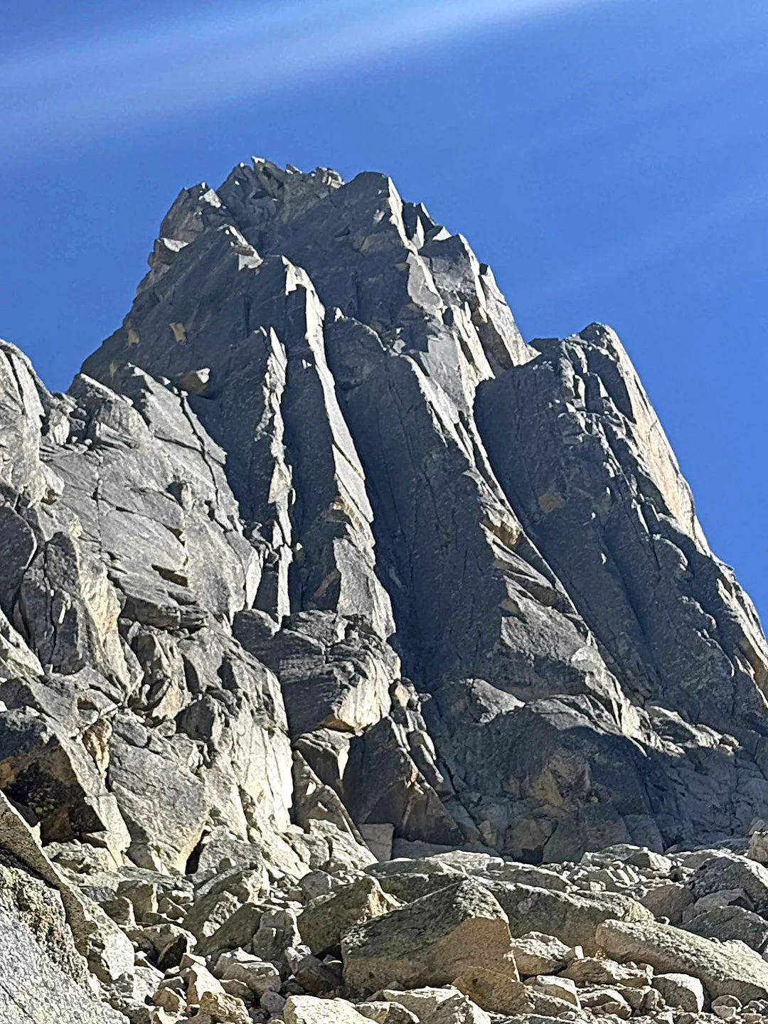
YAWASH SAR I, FIRST ASCENT

Victor Saunders (left) and Mick Fowler in Pakistan. Photo by Mick Fowler.

In September 2024, Victor Saunders and I made the first ascent of Yawash Sar I (6,258m), a shapely peak at the head of the Koksil (a.k.a. Shop Dur) Glacier in the Ghujerab Mountains, very near the frontier with China. [In 2022, a British team made three attempts on the south face and southern ridges of Yawash Sar I, on the opposite side of the mountain. (See AAJ 2023.) No prior attempt from the Koksil Glacier, which drains to the northwest, has been reported.] 

Victor and I met in Islamabad on August 26, flew to Gilgit, spent a night in Karimabad, and arrived at Koksil (ca 4,000m), 12 kilometers west of Khunjerab Pass on the Karakoram Highway, on the 28th. Bad weather delayed us for a day, but on the 30th, after one day of walking, we established a base camp at around 4,600 meters on the highest grassy meadows below the Koksil Glacier.

You call this a retirement home? Fowler at the cramped first bivouac on Yawash Sar I. Photo by Victor Saunders.
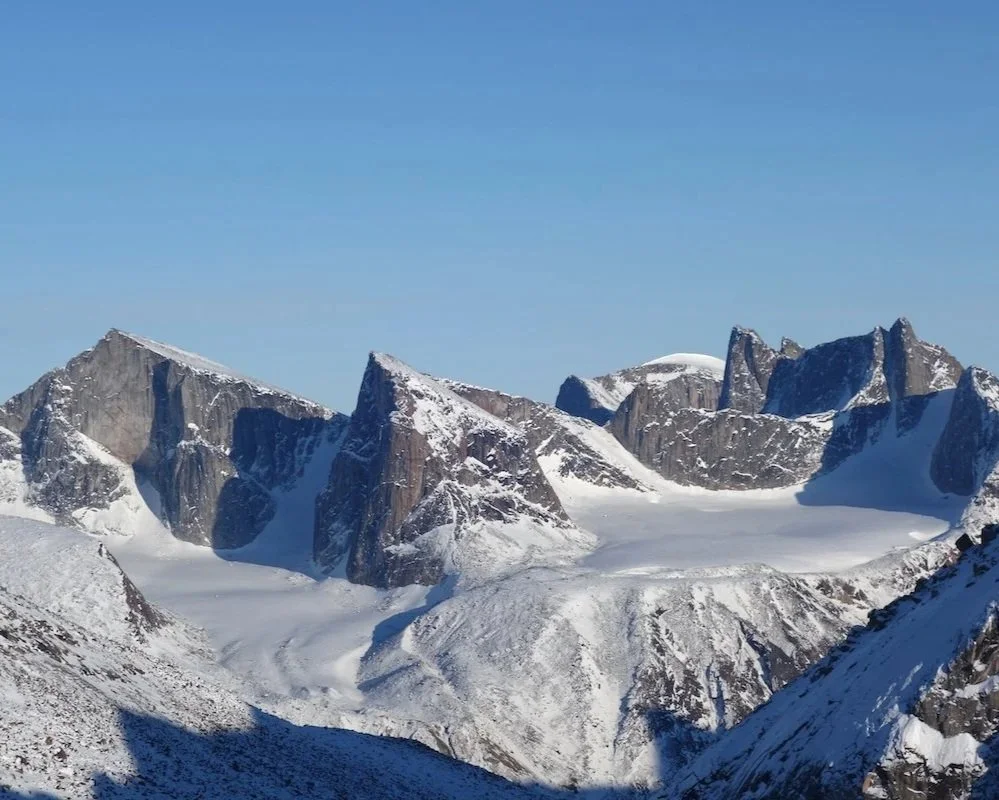
The weather was unstable over the period from August 31 to September 9. However, we were able to make a reconnaissance of the approach to Yawash Sar and get good views of its north and northwest flanks. During this period, to aid acclimatization and get more views of Yawash Sar, we ascended Peak 5,636m, first climbed by a Polish-Italian team in 2011 (see AAJ 2012).
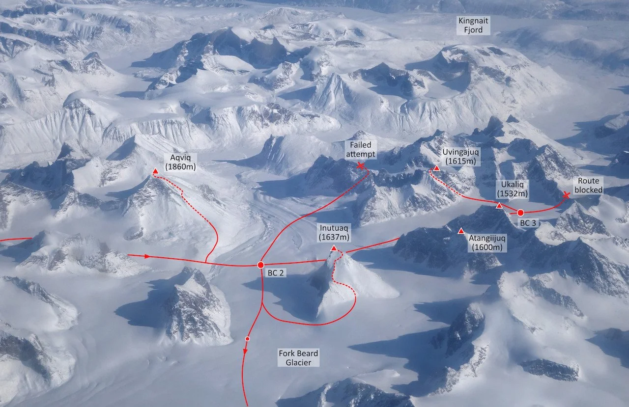
On September 10, we left base camp to attempt our main objective. That day we walked up the main Koksil Glacier to camp at a point below the 5,426m West Yawash Col. On the 11th we climbed through an icefall to gain the previously unvisited glacier basin between Yawash Sar I and Peak 6,072m.

The west-northwest face of Yawash Sar I has three groove/couloir lines. We climbed the central one. On September 12, we crossed the bergschrund and were pleased to find excellent conditions. Once established on the line, we climbed thin ice runnels to a bivouac at about 5,750m. There was a notable dearth of good bivouac sites, and we had to traverse about 35m out of the couloir to a point where we were able to fashion a ledge on a sharp rock crest. On the 13th, we climbed more thin ice streaks and mixed ground to meet the southwest ridge at about 6,050m. Here, we endured a very uncomfortable and windy sitting bivouac.

Saunders arriving at a belay on Yawash Sar I. The high summit on the left is unclimbed Peak 6,072m. Photo by Mick Fowler.

On the 14th the weather deteriorated, and it began to snow. We traversed left across a rock wall (where we’d been concerned we might be stopped) and gained the summit slopes, which we followed to the top, arriving at around 11 a.m. We stayed about five minutes and then rappelled all the way to the bottom of the face, reaching the glacier at about midnight on the same day. On the 15th and 16th, we returned to base camp.

The upper reaches of the Koksil Glacier had only been visited by one previous party, the Polish/Italian team noted above, and numerous possibilities for climbers remain.

— Mick Fowler, U.K.


Much of the Golden Pillar of Spantik consisted of thin ice or powder snow over marble slabs, making for long runouts and very insecure climbing. Photo by Victor Saunders from AAJ 1988.

THE GOLDEN PILLAR OF SPANTIK

If the Piolets d’Or had existed at the time (they didn’t debut until 1992), Mick Fowler and Victor Saunders’ ascent of the Golden Pillar of Spantik (7,027m) in 1987 surely would have earned them a golden ice axe. Their six-day climb of the 2,100m northwest face was a landmark of late-’80s alpinism, with bold climbing in unstable weather on a stunning formation, followed by a nerve-wracking descent on uncharted terrain. Here’s an excerpt from Saunders’ article in AAJ 1988, describing day four of the climb:

Photo from AAJ 1988 by Victor Saunders.

“By midday, we reached a large flat ledge, the top of a giant jammed block. There we made tea and relaxed until it occurred to us to look up. We were completely surrounded by overhangs. Fowler led an aid pitch to gain the lowest of a series of ramps. The lower ramps led to a shield, which was the other area of uncertainty for us. From Base Camp there had appeared to be no line around this feature, but a hidden chimney revealed itself at the end of the ramp. Because it was blank-sided and there was no belay at the top, I had to belay Mick by wedging my body across the chimney and asking him not to fall.

“I do not remember having a more miserable bivouac than the one we had that night. We were benighted and there was no ledge, nor even the possibility of cutting one on the thin ice. We used the tent as a hanging bag, inside of which Mick spent the night in his harness, while I stood in my rucksack. It snowed all night.”

There’s much more to enjoy in this classic AAJ story: Read it here. To see the story in its original format, download the PDF (icon in upper right of the web page.)


FOWLER AND SAUNDERS: FURTHER READING

Fowler and Saunders have published many articles and books, replete with wild adventures and Brit-style self-deprecating humor. For tales from Fowler’s early years, turn to his 1995 book Vertical Pleasure: The Secret Life of a Tax Man. Saunders’ 1990 book Elusive Summits (winner of Britain’s Boardman Tasker Prize) is probably his best. Both books describe the landmark Spantik ascent.


The Line is the newsletter of the American Alpine Journal (AAJ), emailed to more than 80,000 climbers each month. Find the archive of past editions here. Interested in supporting this publication? Contact Heidi McDowell for opportunities. Got a potential story for the AAJ? Email us: [email protected].

The Line: A Great Year for Women in the Mountains

All-women teams have been exceptionally active around the world this year. This month we’re highlighting two of them: a Slovenian women’s expedition to Zanskar, India, and an Italian pair in the Pamir Alai of Kyrygzstan. Two other highly ambitious expeditions in 2024 involved American women: Chantel Astorga, supported by an AAC Cutting Edge Grant, nearly completed a new route up Shivling in India with Fanny Schmutz; and Michelle Dvorak, armed with a McNeill-Nott Grant, got high on the unclimbed southeast buttress of Chaukhamba III, also in India, with Fay Manners, before a rockfall incident forced them down. Just this month, Babsi Zangerl made her extraordinary flash of an El Cap free route. Plenty more women’s climbs will appear in the 2025 AAJ: See the gallery above for a little preview!


Anja Petek on the east ridge of Lalung I during the first known ascent of the peak. Photo: Patricija Verdev.

LALUNG I, FIRST ASCENT, VIA EAST-WEST TRAVERSE

Our all-female expedition to Zanskar, India, was comprised of Ana Baumgartner, Urša Kešar, Patricija Verdev, and me (all from Slovenia). On August 26, we left the road with 18 porters to climb in the Lalung Valley. Our main goal was Lalung I and neighboring peaks. The day after our arrival at base camp, we explored higher up the valley. It took an entire day to make a 20-kilometer round trip on moraine and glacial terrain, and, as the weather was poor, we didn’t see much of the higher peaks.

The four Slovenian women climbed four new routes and dealt with numerous bears at base camp during their expedition to the Lalung Valley in northern India. Expedition Photo.

On August 31, Patricija and I climbed a new route on a granite north-northwest face not far from base camp. This buttress, which starts at around 4,200 meters, lies on the south side of the valley and rises to Peak 5,346m. One route had been climbed previously near the center of this face, by Indians Korak Sanyal and Spandan Sanyal (see AAJ 2018). Our new route, Connection (VI-), took 15 hours and involved around 1,400 meters of climbing.

Before moving up to an advanced base camp, we had a nighttime visit from a bear. It was an unpleasant encounter, with the animal sniffing around our tents for food. All four climbers were happy to relocate to a bear-free advanced base at 4,800 meters. Urša had difficulties with the altitude, however, so after a couple of days she and Ana returned to base camp, where they and our cooks and liaison officer had to deal with a full-on bear saga. After more than 10 nighttime bear visits, resulting in Patricija’s tent being ripped, heaps of food stolen, and the toilet tent demolished, they managed to scare off the bears with fire and enjoy a few peaceful nights.

During this period, Urša and Ana climbed two more new routes on the north-northwest face of Peak 5,332m, finishing on the northwest ridge. Meanwhile, on September 9, Patricija and I left advanced base for the east ridge of unclimbed Lalung I (6,243m), camping a little way above the start. We’d had a forecast for a good weather window, but a snowstorm on the 10th forced us to set up tent in the middle of the day and sit out the bad weather. The storm lasted all the next day, but the 12th dawned clear and we climbed late into the night.

Lalung I (6,243m) from the north. The peak was traversed from left to right, with four bivouacs en route. Photo by Patricija Verdev.

Day five on the ridge required even more determination, and it wasn’t until 1:30 a.m. that we settled down for a rest, having climbed the final difficult mixed pitches. In a moment of carelessness brought on by fatigue, we lost our tent poles to the wind and slept in the open in bivouac sacks. The next morning was foggy, making it hard to navigate, but after some snow slopes, we reached the summit at 9 a.m. on the 14th.

We proceeded with a long descent along the west ridge and then five rappels on the north face to reach the glacier at 6:30 p.m. It took another eight hours to reach advanced base. Next day, we descended to base camp. Just before stepping off the moraine, we saw three silhouettes, Ana, Urša, and Freni, who brought smiles to our tired faces. We named our route Here Comes the Sun (M6+ AI5+, with around 2,000 meters of climbing).

— Anja Petek, Slovenia


 AK-SU VALLEY, PIK 3,850, MESSY DREAMERS

Camilla Reggio (left) and Alessandra Prato in Kyrgyzstan. Photo by Camilla Reggio.

Camilla Reggio and I met on the Eagle Team of the Italian Alpine Club (CAI) and immediately became friends, connected by our huge passion for the mountains. We decided to plan our first expedition together and ended up in Kyrgyzstan, with the intent of climbing on the incredible granite of the Ak-su Valley in the Pamir Alai mountains. We hoped to open a new route. 

Walking up and down the valley in search of possible lines, we were impressed by the 500m south face of Pik 3,850m (a.k.a. the south buttress of Pik Slesova). The following morning, August 12, we brought all our gear up to the wall, walking and scrambling for hours with incredibly heavy haulbags to reach the base. We found a five-star bivy spot—a small cave for two people lying close together—and got to  work. 

Messy Drreamers (15 pitches, 7b) on the south face of Pik 3,850m in the Ak-su Valley of Kyrgyzstan. Two prior routes ascended the same face, one on either side. In back is the well-known Pik Slesova (a.k.a. Russian Tower). Expedition Photo

We opened the first pitches, placing cams and pitons and one bolt for each anchor, and then returned to base camp, as excited as little kids. We returned the following day with food and sleeping gear. The route that followed was amazing, but harder then expected. We mostly opened it traditionally, bolting only when strictly necessary (10 lead bolts in 15 pitches). In all, we spent about a week of effort on the route, with four bivies in the cave, including one night with a terrible storm, trapped in the dripping cave and wondering if we would drown. The very next day, we managed to climb all the wet pitches and open the last ones, reaching the foresummit of Peak 3,850m (about five or six pitches of easy climbing from the true summit) in the dark, screaming with joy after 15 pitches of struggles. 

When we finished the rappels, we had a final night in our luxury hotel and went back to the base camp the following morning, with backs destroyed by the heavy sacks but hearts full of happiness and satisfaction. We called our route Messy Dreamers (500m, 7b). [The two women free climbed all but two pitches of Messy Dreamers during the first ascent; Nordic climbers Elias Annila and Misha Mishin repeated the route soon after and freed the eighth and 12th pitches at 7b and 7a, respectively.]

— Alessandra Prato, Italy


KILIAN JORNET ON THE CUTTING EDGE PODCAST

Born and raised in the heart of the Pyrenees, Kilian Jornet is the GOAT in mountain running and skimo, and he’s an accomplished climber too. This past summer, Jornet used his extraordinary fitness and deep reservoir of mountain savvy to tackle one of the greatest challenges of the Alps: a traverse of all 82 of the range’s 4,000-meter peaks, solely by foot and bike. The fastest previous time for this link-up was 60 days. Jornet did it in 19.

Cutting Edge host Jim Aikman interviewed Jornet about his “Alpine Connections” project—the preparation, the physiological and psychological challenges, and the real dangers of covering hundreds of kilometers of serious alpine terrain at speed, often alone. For context on the history of grand Alpine enchainments and commentary on Jornet’s latest feat, Jim spoke with Colin Haley, elite climber and Chamonix resident; Buzz Burrell, one of the originators of the Fastest Known Time (FKT) movement; and Dougald MacDonald, editor of the American Alpine Journal. Don’t miss it!


The Line is the newsletter of the American Alpine Journal (AAJ), emailed to more than 80,000 climbers each month. Find the archive of past editions here. Interested in supporting this publication? Contact Heidi McDowell for opportunities. Got a potential story for the AAJ? Email us: [email protected].