The Line — Mark Westman’s Long Quest to Climb Mt. Russell

Mark Westman has been climbing in the Alaska Range for nearly three decades and was a Denali Mountaineering Ranger for ten years. He has attempted Mt. Russell, on the southwest edge of Denali National Park, three times by three different routes over 27 years. The third time was the charm, as he and Sam Hennessey raced to the summit in a single day in late April. It was only the ninth ascent of the 11,670-foot peak, and Westman believes the line they followed may be the most reliable way to reach this elusive summit.

Sam Hennessey scales the rime wall just below the summit of Mt. Russell. Photo by Mark Westman.

Mt. Russell, East Face and South Ridge

At 9:45 a.m. on April 27, Paul Roderick dropped Sam Hennessey and me on the upper Dall Glacier, directly beneath the nearly 6,000-foot-tall east face of Mt. Russell—our objective.  

We had in mind a rapid round trip. After quickly setting up a tent to stash food and bivouac gear, we departed half an hour after landing with light packs. We started up the left side of the east face, following the same line that Sam had climbed the previous spring with Courtney Kitchen and Lisa Van Sciver. On that attempt, they carried skis with the hope of descending off the summit. After 3,600 feet of snow and ice slopes, they reached the south ridge, which they found scoured down to unskiable hard ice. They retreated and skied back down to the Dall Glacier.

The route Sam and I followed on the east face steepened to 50° at about mid-height, and the snow we had been booting up gave way to sustained hard névé and occasional ice—much icier conditions than what Sam and partners had found at the same spot in 2023. We continued to a flat area at 9,600 feet, near the base of the upper south ridge of the mountain. Until this point, we had climbed unroped for most of the way.

The line of the Hennessey-Westman Route on the east face and south ridge of Mt. Russell. The first ascent (1962) reached the south ridge from the far side of the mountain. The direct south face and south ridge (2017) is at left, and the original east face (1989) and northeast ridge (1972) are on the right. Photo by Mark Westman.

The upper south ridge was the route followed by Mt. Russell’s first ascent team in 1962 (see AAJ 1963). They accessed it from the west side via an airplane landing on the Chedotlothna Glacier (which is no longer feasible because of glacial recession). This section of ridge was repeated by Dana Drummond and Freddie Wilkinson in 2017 after they pioneered a new route up the direct south face and south ridge of Russell (5,000’, AK Grade 4; see AAJ 2018).

A moderate section of the upper south ridge of Russell. Photo by Mark Westman.

From where we intersected the ridge, there were several tricky sections of traversing across 50° ice and knife-edge ridges. We used the rope for these parts, then continued unroped for several hundred feet, easily avoiding numerous crevasses. Just beneath the summit, we reached a near-vertical wall of rime ice, surrounded by fantastically rimed gargoyle formations that spoke to the ferocious winds that typically buffet this mountain. We belayed the short bulge of rime and minutes later became only the ninth team to reach the summit, just seven hours after leaving our landing site.

Nomenclature

The peak known today as Mt. Russell appears to have been called Todzolno' Hwdighelo' (literally “river mountain”) in the Upper Kuskokwim Athabascan language. This is according to a National Park Service–sponsored study of Indigenous place names written by James Kari, professor emeritus of linguistics at the University of Alaska. Today’s Mt. Russell was named for geologist Israel Cook Russell—one of founding members of the AAC. The California 14er Mt. Russell is also named for him.

There wasn’t a cloud in any direction and not a breath of wind. I had made storm-plagued attempts on Russell in two different decades, and there were many other seasons where I had partners and dates lined up but never left Talkeetna due to poor weather. It was truly gratifying to reach the top of this elusive summit.

Sam and I descended to the landing site in just four hours, making for an 11-hour round-trip climb and the mountain’s first one-day ascent. Paul picked us up the following morning.

While all of the terrain we followed had been climbed previously, the east face and south ridge had not been linked as a singular summit route. Having attempted the now very broken northeast ridge in 1997, and having climbed most of the Wilkinson-Drummond route in 2019, I feel confident the Hennessey-Westman (5,700’, UIAA V with 50° ice and 80°+ rime ice) is the fastest and most straightforward way to the summit of Mt. Russell. There is a perfectly flat bivouac site on the south ridge at approximately 9,600 feet, albeit very exposed to the wind. While the technical difficulties are modest, this route is sustained, serious, and committing.


Alaska Range Top Five

We asked Mark Westman, one of the most experienced modern climbers in Alaska, to name his five most memorable or personally important Alaska Range climbs. In chronological order, they are:

Mark Westman on the Infinite Spur of Sultana (Mt. Foraker) in 2001. Photo by Joe Puryear.

  • South Buttress (1954 Route), Denali, with the late Joe Puryear, April-May 1996. Significant for being my first time to reach the top of Denali, but also for being a month-long true wilderness adventure in total isolation on the mountain. It cemented my partnership with Joe for much bigger things that lay ahead.

  • Infinite Spur, Mt. Foraker, with Joe Puryear, June 2001. One of the most committing routes I ever did, and also the finest achievement I had with Joe after a decade-long climbing partnership that began when we were neophytes.

  • South Ridge of Mt. Hunter, with Forrest Murphy, June 2003. [It] had every sort of challenge one could expect in Alaska Range alpine climbing: difficult mixed and ice climbing, a serious icefall, a traverse of a high and massive mountain, extreme commitment, and, most of all, one of Alaska's most legendary corniced and knife-edged ridges (The Happy Cowboy), one of the most engaging mental exercises I have ever faced. 

  • The Warrior’s Way, Mt. Grosvenor, with Eamonn Walsh, April 2006. How often does one get to make the very first ascent of a big face (the direct east face) on the west side of the Ruth Gorge? This was the last of three new routes we did on the peak (which were also the second, third, and fourth overall ascents), and it takes a king line straight up the middle of the face. Best of all, although run-out in places, it is relatively safe, and although technical, it goes at an approachable grade and has been repeated twice. 

  • Denali Diamond, Denali, with Colin Haley, June 2007. This was a huge step up technically and stylistically for me, marking a multi-year transition from slower and heavier climbing to contemporary lighter and faster alpine-style techniques, with much credit to Colin for his youthful embrace of these methods. Managing this 8,000-foot-plus face in just 45 hours was a step well beyond what I would have imagined possible for myself many years earlier, and it was one of those rare climbs where literally everything goes as perfectly as you planned it back home in the living room.


A Place Among Giants

Lisa Roderick, Westman’s wife (and pilot Paul Roderick’s sister), was the base camp manager on the Kahiltna Glacier for more than two decades. (She attempted Russell with Westman and the late Joe Puryear in the late ’90s.) In early November, her memoir of nearly four years of cumulative time spent on the glacier, shepherding planes and climbers in and out of Denali base camp, will be published: A Place Among Giants: 22 Seasons at Denali Basecamp.


The Line is the newsletter of the American Alpine Journal (AAJ), emailed to more than 80,000 climbers each month. Find the archive of past editions here. Interested in supporting this publication? Contact Heidi McDowell for opportunities. Got a potential story for the AAJ? Email us: [email protected].

Sign Up for AAC Emails

The Prescription—September

The following report describes an accident at Seneca Rocks, West Virginia. This is a longer form version of a report than what will be published in the 2024 Accidents in North American Climbing. If you are a Partner Level Member or above, Accidents will arrive in your mailbox any day.

The book is filled with examples of both good and bad luck—unfortunately, mainly the latter. This tragic accident occurred on the third pitch of a popular route at Seneca Rocks when a climber with three years of experience took an intentional leader fall. The rope was not running over an edge, his gear was in perfect working order, and his belayer made no mistakes. He expected a safe, albeit long fall. Instead, the rope was severed and he tragically fell to his death.

The third and final pitch of Simple J Malarkey climbs through the overlaps and triangular roofs seen here rising above and slightly left of the prominent cave. This pitch was the scene of a fatal rope-cutting accident (marked with a yellow X) in August 2023. Krzysztof Gorny


Fall On Rock | Carabiner Cut Rope

Monongahela National Forest, Seneca Rocks

Arthur Kearns, local guide and owner of The Gendarme Climbing Shop and the Seneca Rocks Climbing School, submitted the following report:

On August 5, a party of two started up Simple J Malarkey (3 pitches, 5.7). The top of the second pitch ends in a corner alcove with overhanging rock above. At the start of the third pitch, the leader, Danny Gerhart (24), placed a 0.75 Camalot just above the belay, before attempting to climb up and left. Gerhart encountered a wasp’s nest and stepped back down to the belay. He then stepped down and to the right on the ramp that ends the second pitch. This was the sequence most used by other climbers.

Gerhart was now about five feet away from the belay. He placed a second 0.75 Camalot before moving up and left to a second alcove, about eight feet above and to the right of the belay. Here, Gerhart placed a number 3 Camalot in a shallow, slightly flaring pocket. (This piece was found with both extended and non-extended alpine draws attached.) At this point, he removed the second 0.75 Camalot to prevent excessive rope drag. 

Gerhart attempted to move up and right from this stance, which is the most used sequence. This crux section requires the leader to move over a roof on a four-foot-high plaque of rock. Though protection is available, the leader cannot see it until they have committed to the crux, and even then, the placement is behind the climber and at waist level. The handholds here could be described as less than inspiring, as water drains onto them from above, adding a polished feel to the rock. Having found no gear, Gerhart stepped back down to the previous stance and discussed options with the belayer. By then, the sun was peeking over the top, making route-finding more difficult. The climbing team discussed options before Gerhart decided to move up and left.

Climbing above the last piece and not finding additional protection, Gerhart called down to the belayer, informing them that he was going to take a deliberate fall (acknowledging it was “going to be a big one”). He then let go and fell around 12 feet before loading the rope. The belayer reported having enough time to take in two to four feet of slack before hearing a very loud “gunshot” as the rope exploded. The belayer never felt the falling climber load the belay, and Gerhart fell approximately 130 feet to the ground. 

While numerous climbing parties immediately responded to give aid, the fallen climber passed at the scene. 

Evidence points to the rope being cut by the rope-end carabiner (a Petzl Spirit) on the extended alpine draw attached to the number 3 Camalot. The carabiner remained attached to the fully extended alpine draw and was situated on a slabby portion of rock just below the Camalot. Fuzzy remains from the rope sheath were found inside the carabiner. No rope sheath material was found on any nearby rock edges or the slabby rock face. Photos from the accident scene show about seven feet of rope extending from the tie-in on Gerhart’s harness. Three to four feet of core was exposed where the rope cut. The individual core bundles were all severed at the same length; this indicates a definitive “cut” versus extended shredding over an edge.

 ANALYSIS

Kearns wrote the following analysis:

How the carabiner cut the rope is difficult to visualize. But here is my attempt to explain it. The rope leaving the belayer moved up through the first piece and past the slightly overhanging rock above. The overhang included a six-to-eight-inch-wide V-slot that likely inhibited the belay strand from moving laterally to the right. At the time of impact, the belay strand of the rope would have been lying on the slabby rock face above before entering the backside of the carabiner, which in turn was clipped to the extended draw on the number 3 Camalot. In the same way the load strand in an ATC Guide locks down on the belay strand, so did the leader’s end of the rope. It wrapped around the carabiner, crushing down on the belay strand and the rock below it, and thus focusing the entire load of the fall onto the small section of rope between Gerhart and the cam.


In this highly unusual accident, the carabiner on the rope-bearing end of an alpine quickdraw appears to have acted like a belay device configured in guide mode. The load-bearing/climber strand (on top) trapped the belay strand (on bottom, under the carabiner) between the carabiner and the rock. The rope was severed. No rock edge was involved in cutting the rope, and no rope sheath material was observed on the rock. Drawing by Foster Denney


In essence, Gerhart took a factor-two fall onto the carabiner. In fact, he may have achieved something greater than a factor-two fall, as the pinched rope effectively reduced the rope in the system to around six feet. I’ll leave it up to someone more qualified to calculate the force load of a climber falling an estimated 9 to 11 feet on around six feet of rope and all that energy being applied at the bend at the carabiner and onto the belay strand. Needless to say, it was enough to instantly sever the rope. 

One tragic fact: It’s quite possible that Gerhart’s extended sling may have perfectly positioned the carabiner at the time the piece was placed, but then tragically the carabiner shifted into the fateful position. Had the carabiner been just two inches to the left or right, it would no longer have been lying on rock but hanging in free space. Would extending the sling on the first piece Gerhart placed have changed the location of the carabiner in question at the time of impact? This is unknown, as the first piece was ultimately removed by the belayer before they rappelled to the ground, so we were not able to replicate exactly how the rope was running. 

Apart from the fact that Gerhart was slightly off route, this was, in my opinion, a freak accident. Two inches of movement in the carabiner could have made the difference between life and death.

(Source: Arthur Kearns, guide, Seneca Rocks Climbing School.)


Editor’s Note from Pete Takeda:

After hearing of this incident, I emailed Kearns—a very experienced local guide. Kearns climbed Simple J Malarkey the day after the accident with a fellow guide. Kearns came to the conclusion above, based on the pair’s observations, discussions with the belayer, and their intimate knowledge of the area and the route.

I also extensively interviewed and eventually went climbing with the belayer. I was assured that the rope was in good condition and had not been exposed to any compromising chemicals.

On @hownot2, Ryan Jenks posted his assessment and wrote, "After testing… it (the rope) seems normal and broke at an acceptable force."

The belayer also sent the intact section of rope to Ryan Jenks of HowNot2 for break testing. Jenks posted his assessment on Instagram. He felt that, “It’s unclear what happened. Be as safe as you can climbing but there are inherent risks. We lost one of the good ones..”

Finally, the belayer wrote to ANAC: “I think about the HowNot2 video where Ryan tested the rope (9.4mm) and how he showed an example of a (different) #3 Camalot that took a lot (an unknown amount) of force and was mangled. The number 3 Danny fell on looked in perfect condition after the accident. I don’t know how much force it would take to deform it (BD website says number 3’s have a 12kN strength), but Ryan implied in the video that if the rope broke due to force alone (in the video it broke at 10.86/11.33 kN) the cam should have deformed. I just think the rope MUST have cut or at least abraded somewhere right around the carabiner. Also, in that video the broken ends looked different than they did from the accident. In the video the core wasn’t sticking out or hiding way back in the sheath. After the accident my end of the rope had a few inches of empty sheath extending beyond the core.”

Note from Rob Chisnall, the ANAC Canada Editor:

Rob Chisnall is a climbing safety consultant and member of the American Academy of Forensic Sciences. He testifies in civil cases involving climbing accidents and also in criminal cases involving homicide, suicide, auto-erotic fatality, and other misadventures involving knots and ligatures. 

Chisnall reviewed Kearn’s report and wrote to ANAC that “the explanation is sound.” He further noted that:

  1. Ropes have been getting thinner, and lightweight carabiners no longer bear a round cross section. Stress-strain analyses have allowed manufacturers to eliminate unnecessary metal from carabiners, giving many carabiners a T or H cross section (sharper edges).  

  2. Sport ropes are now typically less than 10 mm in diameter, the one in question being 9.4 mm. So, whatever pinch point was created, the same force would have been applied to a much smaller surface area compared to decades ago. The carabiner might have momentarily resembled something akin to a blunt cutting edge. And maybe the rock surface at the pinch/cutting point was overtly convex, thus concentrating the force even more.

  3. I've observed people having problems when lowering off slabs, then onto vertical walls or past overhangs. In this case, the angle between the parts of the rope exiting the carabiner might have been reduced to zero, creating a pinch point.

  4. Judging from the description of the damaged rope, it appears the sheath cut first and shifted position, exposing the core strands, which then cut cleanly in one place—they probably instantaneously flattened out.

  5. Ropes [that] cut via lateral movement over a sharp edge do not go “BANG.” The belayer clearly recalled a very loud “gunshot” noise as the rope exploded. In less dramatic breakages, a rope pulled straight to failure usually makes a snapping sound, like an elastic band.


Sign Up for AAC Emails


American Mountaineering Center Update

Photo by AAC member Jon Glassberg

Since 1993, the AAC's office, library, and museum have been located in the American Mountaineering Center (AMC) in Golden, CO. Over the past few years, the AAC and Colorado Mountain Club have evaluated the AMC's future, including the option to sell the building that we have owned, managed, and occupied together. We are pleased to share that we sold the AMC building today, September 10, 2024. The AAC will continue to occupy the building while we work to envision a future location that will help us deliver on our mission and continue to serve our members and donors.

The AAC library and museum will close on September 20, 2024, to allow for cataloging and inventorying.

During this transitionary period, the library will cease new scanning requests, new research requests, and book sales. We remain committed to an inspiring future for the AAC library and mountaineering museum that honors the contributions of past donors and members and modernizes these critical resources for future generations.

We are proud to have partnered with the Colorado Mountain Club to steward this historic building in the heart of Golden for the past 30 years, and we firmly believe the new owner will continue to care for this important building in its next phase.

Lastly, we are grateful to the board of directors, led by Glenn Porzak, who dreamed of bringing the organization to Golden decades ago, and the members and donors who helped make that dream a reality. Your contributions, vision, and foresight brought us to this moment, which presents exciting future possibilities for the Club.

The Line: Global Ambition

Read how a professor of mechanical engineering at Seattle University solved a geographic mystery in Uzbekistan and made the first known ascent of that nation’s highest peak. (This same peak was also No. 141 in the professor’s quest to summit the high point of every country in the world.) Plus: attempting Everest, climbing Kangchenjunga, completing the “Seven ’Stans,” and becoming a Snow Leopard—just a few recent accomplishments in the very busy life of Eric Gilbertson.

Nearing the summit of Alpomish. Photo: Eric Gilbertson.

The following is adapted from a report by Eric Gilbertson for AAJ 2024.

Alpomish:
The First Ascent

Until recently, it was widely accepted that a broad, rocky 4,643-meter mountain in the Gissar Range, on the Uzbekistan-Tajikistan border, was the highest peak in Uzbekistan. This was based on the 1981 Soviet topographic map, the most accurate and recent map of the area. (In recent times, some online sources have called this mountain Khazret Sultan, but this is incorrect.) While researching Peak 4,643, possibly first climbed by Soviets in the 1960s, I realized that a border peak about six kilometers to the south, known as Alpomish, was potentially taller than Peak 4,643. Andreas Frydensberg (Denmark) and I laid plans to carry a differential GPS unit and sight levels to both summits and determine which was higher.

Acclimatized from ascents of Pik Korzhenevsky (7,105m) and Pik Ismoil Somoni (Pik Communism, 7,495m) in Tajikistan, Andreas and I headed to the Uzbekistan border region, and on August 21 we started our approach from Sarytag village. We hiked southwest alongside the Dikondara River, cached a few days of food, and continued south over several glaciated 4,000-meter passes and many talus fields, around 23 kilometers in total. Our base camp was by an unnamed glacier below the steep east face of Alpomish.

The first known ascent of Alpomish, by the east face (5.8). The rock wall is about 400 meters high. Photo: Eric Gilbertson.

The four-spired peak loomed above camp with 400-meter granite faces on each spire. The southernmost spire looked to be the tallest, which I verified with sight levels.

On August 23, we hiked to the east face and scrambled up a big gully on scree until it was blocked by a huge chockstone. I led a rock face then traversed left delicately to reach the top of the chockstone. Above a waterfall in the gully, ice continued all the way up to the notch, and since we’d left our ice gear below, we climbed the rock wall and ridge crest to the left. Once on the gendarmed summit ridge, a final knife-edge brought us to the top.

Using the sight levels, I first verified that all the nearby spires of the peak were shorter—we were definitely on the highest point of Alpomish. I set up the differential GPS, but it had trouble acquiring satellites. So I pointed my sight levels toward Peak 4,643, and with each level measured 10min–20min angular declination looking down at the distant summit. Clearly it was lower. There were no anchors, cairns, or any sign of human passage anywhere on Alpomish, so it seemed very likely we had made the first ascent. Our measurements showed that Alpomish is 25 meters (+/-8 meters) higher than Peak 4,643, giving an elevation for Alpomish of around 4,668 meters.

Gilbertson and Frydensberg on the summit of Alpomish. Photo: Eric Gilbertson.

After rappelling and downclimbing, we staggered back into camp shortly before midnight. Our route was the Upper East Face (300m, 5.8).

To be absolutely certain about the relative elevations, I wanted to take measurements from the top of Peak 4,643, looking back to Alpomish, so the next day we retraced our route over the glaciated passes, picked up our food cache, and hiked to the base of Peak 4,643.

On August 25, we climbed the northeast ridge, with long stretches of 4th-class scrambling on a knife-edge and two pitches of 5.7. On the summit, I used sight levels to measure the angular inclination up to Alpomish. All six measurements showed that Alpomish is higher than Peak 4,643, making it the highest point in Uzbekistan.


Andreas Frydensberg on top of Noshaq, the 7,492-meter high point of Afghanistan, in July 2019, two years before the Taliban takeover of the country. Photo: Eric Gilbertson.

The Seven ’Stans

Breaking trail up massive Pobeda, the highest summit in Kyrgyzstan. Photo: Eric Gilbertson.

Eric Gilbertson and Andreas Frydensberg’s climb of Alpomish was part of a four-year effort to reach the highest point of all seven nations whose names end with “stan.” Most of these were very challenging mountaineering objectives.

In 2019, they climbed Noshaq (7,492m, Afghanistan). In 2021, they tagged the summits of Khan Tengri (7,010m, Kazakhstan) and Pobeda (7,439m, Kyrgyzstan). In 2022, it was K2 (8,611m, Pakistan), without supplementary oxygen. And in 2023 they climbed Ismoil Somoni (7,495m, Tajikistan), Ayrybaba (3,139m, Turkmenistan), and Alpomish (ca 4,668m, Uzbekistan). Gilbertson reported that Pobeda (via the Abalakov Route) was technically and physically the most difficult of the seven (technical climbing at high altitude with no fixed ropes, deep snow, serious objective and frostbite danger) and that Noshaq was logistically the toughest (landmines and kidnapping hazards).

EVEREST & KANGCHENJUNGA

As if climbing two 7,000-meter peaks in Asia last summer weren’t enough, Eric Gilbertson also made a strong attempt on Everest in May (reaching 8,500 meters without supplementary oxygen or personal Sherpa support). He then flew to Kangchenjunga and summited the world’s third-highest peak, thus ticking the high point of India on his list.

Gilbertson, along with his twin brother, Matthew, ultimately hope to reach the high point of every country in the world, a project that started in 2010. As of this month, Eric has climbed 143 of 196 the world’s high points. See the Country Highpoints website for his extensive trip reports.

Having climbed the five 7,000-meter peaks of the former Soviet Union, Gilbertson and Frydensberg applied to be named Snow Leopards, a great honor of Russian mountaineering. In November 2023, Gilbertson became the third American Snow Leopard (after William Garner and Randy Starrett in 1985) and Frydensberg the first Dane, but not without proving their case: The authorities argued that they had climbed the wrong summit of Pobeda. Gilbertson embarked on another geographic investigation and soon settled the matter. The results are documented in The True Summit Location of Peak Pobeda.


How Does He Do It?

How does a 38-year-old assistant professor have the free time and spare cash to complete so many international expeditions? Gilbertson explains:

”I'm a teaching professor at Seattle University. This means I get about three months off every summer for mountaineering, and also winter and spring breaks between quarters. Sometimes I can get permission to overload my teaching schedule in a few quarters and take another quarter off. This was important for a peak like Kangchenjunga, which needs to be climbed in spring.“ As graduate students, Gilbertson and his brother, Matthew, were invited to international engineering conferences, which they paired with climbs.

“I try to be as frugal as possible,” he said. “Most of the European country high points I climbed as part of long-distance bicycle tours, camping in the woods every night, so transportation and lodging were basically free. I generally don’t pay for guides unless required by law. I sign up for airline credit cards to get free flights.” Gilbertson and his partners also maximize their efficiency and success rate during expeditions by paying for custom, satellite-delivered weather forecasts from Denver meteorologist Chris Tomer.

For Everest, Gilbertson hired the relatively inexpensive Seven Summit Treks (SST) for logistics and base camp services, then he climbed on his own above BC and did not pay for oxygen service (the same way he climbed K2 in 2022). As he was shopping for a guiding service, he negotiated for a multi-summit and multi-climber discount.

As events turned out, SST required Gilbertson to hire a Sherpa and use oxygen for his rapid Kangchenjunga ascent after Everest. “It would cost another $11K…and I could just barely afford that if I zeroed out my bank account,” Gilbertson wrote in his trip report. “That would be cheaper than losing all the money I’d already invested and then paying more a future year to come back. So I reluctantly agreed.”


The Line is the newsletter of the American Alpine Journal (AAJ), emailed to more than 80,000 climbers each month. Find the archive of past editions here. Interested in supporting this publication? Contact Heidi McDowell for opportunities. Got a potential story for the AAJ? Email us: [email protected].

The Prescription—August

A Parks Canada rescue helicopter responds to an accident on Mt. Louis on August 20, 2023 (Mt. Edith in the background). Mt. Louis is an iconic limestone tower and home to several popular multi-pitch rock climbs. Though some are moderate in grade, they all offer a Canadian Rockies–style adventure. Photo: Parks Canada

The following report describes an accident in the Canadian Rockies that will be published in the upcoming 2024 Accidents in North American Climbing. While reviewing last year’s accidents, a particularly improbable incident stood out. Almost exactly a year ago, a climber fell, unroped, from the fourth-pitch belay anchor of a 15-pitch climb. After tumbling 35 meters, he came to rest on a ledge three pitches above the ground, having suffered only minor injuries. One might attribute this incident to a form of benign intervention, a guidance bordering on the divine. Or it might have been simple good luck. Read on.


Fall From Anchor | Tether Clipped Incorrectly

Alberta, Banff National Park, Mt. Louis

At 5 a.m. on August 20, 2023, Alistair Hall (34) and I, Adam Laycock (33) started our approach to attempt the Gmoser Route of Mt. Louis. While this 15-pitch 5.9 has bolted anchors, it is also an old-school trad route that would push our limits for climbing on gear. Alistair was confident in his ability to lead the crux pitch. Although it was our first time on this mountain, we were both locals and familiar with the chossy nature of the Canadian Rockies. We did plenty of research and felt confident in the route and conditions that day.

Our ascent was slower than we had anticipated. By the time we reached the top of pitch six, it was midafternoon, and with ten pitches remaining, we decided to back off the climb. The belay stations were bolted, so we chose to descend the same way we had ascended. Rappelling pitches six and five was uneventful.

After I finished rappelling pitch five, I secured myself to the anchor with my personal anchor system (PAS). My PAS was a 120mm nylon sling, girth-hitched through my belay loop, with two knots for length adjustment. The belay stance was narrow, prompting me to shorten my PAS by moving my locking carabiner to a knotted loop closer to my belay loop. I then clipped my carabiner into one of the rappel rings, locked it, weighted my PAS to test it, and took myself off rappel. I spent a few minutes preparing the rope for the next rappel, threading it through the rappel rings, coiling it, and adding a knot for safety.

Then I fell. I was not connected to the wall or rope, and there were four pitches of high-angle terrain beneath me. I tumbled for 35 meters, the full length of the 5.6 fourth pitch. I ultimately came to a halt on a sloping ledge. I was conscious. I screamed, crying out for help from Alistair, who was above me, and the hikers below. Under my legs was one of our half-ropes, in which I tied a figure-8 on a bight and clipped it to my belay loop. I yelled to Alistair that I was alive and secure, but injured, and there was no need to descend to me.

My left ankle was visibly disfigured and unable to support any weight. Clearly unable to self-rescue, I used my inReach device to send an SOS message. Within half an hour of my fall, a Parks Canada rescue helicopter located us on the rock face and began the rescue.

A Parks Canada rescuer attends to Laycock after his 35-meter fall. Laycock recalls, “My pants were shredded from the fall. The ledge was narrow and down-sloping and I imagine if I had been unconscious I could have slid further. When I landed, I was stable enough to secure myself, but it was a precarious position.”  Photo: Parks Canada 

ANALYSIS

Laycock’s accident was eerily similar to another recent incident, suffered by a climber in Arizona. Both fallen climbers had tied overhand knots in a 120cm length loop of 20mm sewn webbing to create adjustment pockets for a home-made PAS. This is a common practice. In both cases, it appears that the tether was not clipped correctly with the carabiner, but instead the knot caught in the bottom, non-gated end of the tether carabiner.

In the August 2023 accident and another in 2021, a tether carabiner of the same model had a bottom basket that was flat enough and shaped in such way as to allow a knot to temporarily hold weight, if only for a few minutes. In this recreation, note that the the jammed knot is pulled up and above the clipping point—almost visually identical to a correctly clipped daisy loop. Photo: Pete Takeda


Detaching and reattaching a carabiner from a daisy pocket or lanyard introduces an opportunity for error. After suffering his potentially fatal fall, Laycock wrote ANAC: “To shorten my PAS at an anchor, I won’t unclip the first (longest) loop anymore. I'll clip an additional locking carabiner in the shorter loop, then clip it to the first locker (Editor’s Note: This is inherently easier to visually evaluate). Previously, and in the case of my accident, I would completely unclip from one loop and reclip the closer knotted loop.” Graphic: Foster Denney

A contributing factor to the accident was that Laycock’s daisy knot was unusually bulky from being unevenly tied. This increased the possibility of the knot sticking in the bottom of the carabiner. He wrote, “Despite weighting my PAS to test it, the poorly dressed overhand knot briefly supported my weight.” He added, “Before the knot slipped through the carabiner, I failed to thoroughly check my anchorage to account for human error.”

It is worth noting that the critical section of webbing was hard to assess. The two strands that created the clipping pocket were of the same color and were flush with each other. Additionally, the rappel station was on a ledge, hampering a full weight test. In the end, sheer luck might have saved Laycock’s life.

He wrote, “During my fall, I tangled myself in the rope below, which was still being used by Alistair to rappel pitch five. This might have slowed my fall enough for me to stop on the ledge. We had two 70m half-ropes that hung 30 or 35 meters below the pitch-four anchor. When I hit the ledge, I was sitting on the tail of the rope, and I was still five to seven meters above the pitch three anchor.

“Also, my helmet, though it ended up broken, allowed me to remain conscious. Considering what could have happened, my injuries were minor: a fractured left fibula requiring surgery, and numerous abrasions.” (Sources: Adam Laycock, ANAC 2022, and the Editors.)


From the ANAC Report Archive:

Here are two incidents from past ANACs indicating ways climbers can be disconnected from anchors. Tragically, both of these ended with fatal injuries.

PAS Disconnected on Half Dome’s Snake Dike (ANAC 2016)

Knotted Sling Comes Undone on Grand Teton (ANAC 2017)

In all of the cases discussed here, a closer look and more vigorous weight-testing of the anchor connection might have prevented a disastrous accident. A common thread: the technical error occurred while the daisy/tether system was unweighted. The fall occurred only as or after bodyweight was applied to the system.

Note that while climbers place much emphasis on anchors themselves, there are numerous and equally consequential errors to be made while attaching and detaching oneself from the anchor. It is critical yet often ignored step, to triple check your connection.

From the ANAC Essentials Archive:

For more detail on making a clear weight transitions from one piece of cord, rope, or webbing to another, see outdoor educator, and climbing author Molly Loomis’ 2017 Essentials: Clear Weight Transitions.


Get Accidents in North American Climbing Mailed to You!

Published annually since 1948, Accidents in North American Climbing documents the year’s most significant and teachable climbing accidents. Each incident is analyzed by experts to show what went wrong in order to help climber avoid similar problems in the future.

When you sign up for AAC membership, you get this publication delivered to you annually in late summer.


Sign Up for AAC Emails

PROTECT: Amity Warme and a YOSAR Climbing Ranger Weigh In on The Yosemite Credo

Its another Yosemite episode! And with some of the most in-the-know climbers, pro Amity Warme and Climbing Ranger Jesse McGahey, who weigh in on what’s been happening in Yosemite, both climbing wise, and in terms of community discussions about the future of climbing ethics and style there.

In this episode, we get to know crusher Amity Warme, and her perspectives on going ground-up on El Cap, how she’s recently been toeing the line between pushing her limits versus being in over her head, and how she views her role in the climbing community. We also chat about her ascent of Book of Hate (a 13d heinous stem corner ) and Pineapple Express (which is the fully free version of El Nino) last fall.

We also have Yosemite Climbing Ranger Jesse McGahey back on the pod, and chat about what’s been going on in Yosemite recently regarding rising temperatures, recent accidents due to using technology, the origins of the new Yosemite Climber’s Credo, and how a local climbing community came together to agree on shared values and guidelines. Amity also weighs in on the Yosemite Credo, and why she believes in the Credo and wants to help lead the way on the best practices for climbing in this iconic location.

Dive in to hear about some crucial conversations happening in one of the hubs of the climbing community.


The Line — July 2024

AMERICA THE BEAUTIFUL

It’s prime season for climbing in the high peaks of the western United States, so we’re sharing six brand-new mountain routes from six states around the West.

AAC Members: Get a Sneak Preview of the AAJ right now! AAC members can now download a PDF of the complete 2024 AAJ. Log in at your member profile and click the Publications tab to download your sneak preview. Physical copies of the 2024 AAJ will start going into the mail next month.

Bluebell (Cascade Range, Washington)

The line of Bluebell (21 pitches, 5.13-) on the North Norwegian Buttress of Mt. Index. Photo by Nathan Hadley.

Nathan Hadley and friends spent more than 25 days establishing and free climbing Bluebell (2,000’, 5.13-), the first free route up the North Norwegian Buttress of Mt. Index. About one-third of the bolt-protected route’s 21pitches are overhanging. Hadley believes it’s one of the steepest long free climbs in North America (“Imagine two of Yosemite’s Leaning Towers, with sections of slab before, in between, and after.”) Hadley’s AAJ report describes the arduous effort to establish the climb and also offers a touching tribute to one of his partners on the route: Michal Rynkiewicz, who died in a rappelling accident soon after this climb was completed.


Aiguille Extra (Sierra Nevada, California)

James Holland following the second pitch (5.10+) of the new direct start to the East Buttress of Aiguille Extra. Photo by Cam Smith.

The East Buttress of Aiguille Extra, a 14,048-foot satellite of Mt. Whitney, was first climbed in 1978 with a bit of aid. Forty-five years later, James Holland and Cam Smith freed the 10-pitch route at 5.10+, adding a three-pitch direct start. In AAJ 2024, Smith writes, “James and I hope the free version of the East Buttress (1,230’, IV 5.10+) will encourage others to check out [Aiguille Extra], an unsung gem of the Eastern Sierra.”


Takin’ ’Er by the Tusks (Sawtooth Mountains, Idaho)

Benj Wollant finishes the crux sequence of pitch three (5.12a R) on Takin’ ’er by the Tusks. Photo by Greg Rickenbacker.

A rare new route up the beautiful Elephant’s Perch was completed in September by Greg Rickenbacker and Benj Wollant. Takin’ ’Er By the Tusks (625’, 5.12a R A3) combines challenging aid and stout free climbing on the southeast face of the granite formation. A bolting ban in Sawtooth National Forest ensured plenty of exciting climbing. Wollant, who grew up in the nearby town of Stanley, wrote in his AAJ report that establishing a route on the Elephant’s Perch was “a longtime dream come true.”


Spirit Animal (Rocky Mountains, Colorado)

The line of Spirit Animal on the 1,500-foot northeast face of Chiefs Head in Rocky Mountain National Park. Photo by Bill Duncan.

“Given that I’d never stepped foot into Glacier Gorge [in Rocky Mountain National Park], you might say my plan to rope-solo a new line up the 1,500’ northeast face of Chiefs Head (13,577’) was ambitious,” writes Nathan Brown in AAJ 2024. But that’s what he did. Brown, a prolific new-router who earned his ground-up chops in North Carolina before moving to Colorado, spent two summers establishing Spirit Animal (10 pitches, 5.11), all alone, on the remote and steep Chiefs Head wall. Brown finished work on the route last September, but had not yet redpointed the full route in a continuous ascent. Just this month, he made the trek into Glacier Gorge yet again and rope-soloed the route completely free, with a bivouac in the middle.


Directissima (Mt. Owen, Teton Range, Wyoming)

(A) The Grand Teton. (B) Mt. Owen. (1) The original North Ridge Route (1951). (2) Directissima (2023). Both routes continue up the long ridge to the summit of Mt. Owen. However, the FULL north ridge, continuing over Mt. Owen and up the north ridge of the Grand, may never have been linked. Photo by Acroterion | Wikimedia.

Tetons guide Michael Abbey had long imagined a more direct route up the north ridge of Mt. Owen, hewing closer to the ridgeline than the original North Ridge Route (Clayton-Emerson, 1951), which slants in from the left. It took a couple of attempts, but in 2023 he and Karen Kovaka completed Directissima (V 5.10) over two days in August. In his AAJ report, Abbey notes that another North Ridge Direct was climbed in 2001, but the key pitches of the new line were most likely unclimbed before last summer.


Ménage Trout (Beartooth Mountains, Montana)

Jackson Marvell climbing the sixth pitch of Ménage Trout, high above East Rosebud Creek in the Beartooth Mountains. Photo by Austin Schmitz.

Until 2023, the Bear’s Face had only one known full-length route: Ursus Horribilis, established in 1998 by Andrew McLean and the late Alex Lowe. Last summer, Chantel Astorga, Matt Cornell, and Jackson Marvell, along with photographer Austin Schmitz who was shooting images of The North Face team members, completed a line started by Cornell, Marvell, and Justin Willis three years earlier. Ménage Trout has 13 pitches and went at 5.10+ R A2+. Astorga wrote in her AAJ report that the team hopes to return to free the climb.

Bear’s Face also got its first winter ascent in 2023, when Adrien Costa, Charlie Faust, and Paul Shaughnessy completed Dancing Bears (310m, WI5 M6 R) on the left side of the face, on the last day of the year, after multiple attempts.


Explore These Peaks

Take a closer look at all six of the peaks and ranges highlighted here with this interactive map from onX and Mountain Project.


The Line is the newsletter of the American Alpine Journal (AAJ), emailed to more than 80,000 climbers each month. Find the archive of past editions here. Interested in supporting this publication? Contact Heidi McDowell for opportunities. Got a potential story for the AAJ? Email us: [email protected].


The Line is supported by:

Educate: Search and Rescue Helicopter Evacuation in the Black Canyon of the Gunnison

Photo by AAC member Jon Glassberg.

This year, the featured winner of the Rocky Talkie Search and Rescue Award is the Black Canyon Search and Rescue team, who performed an incredibly technical rescue in 2023 in the Black Canyon, after a climber took a bad fall that left them unconscious, needing medical attention almost 2,000 ft down into the canyon. In this episode, we sit down to chat with Sean Hart, one of the SAR team members at the scene that day, who walks us through the unique challenges of climbing and rescuing in The Black, the harrowing rescue by Blackhawk helicopter, how critical communication is in rescues, and how to always have a plan B.

Learn more about the Rocky Talkie Search and Rescue Award, watch the film about this incredible rescue, and get the chance to give back to your local search and rescue team AND win some incredible gear by going to https://rockytalkie.com/pages/sar-award


Announcing the 2024 Rocky Talkie Search & Rescue Award Winners

We’re thrilled to partner with Rocky Talkie to announce the winners of the 2024 Search & Rescue Award. Through this grant, Rocky Talkie is donating $75,000 to six underfunded SAR teams across the nation. Read their stories and watch a film by Jon Glassberg about the Featured Rescue of the Year on Rocky Talkie’s website.

You can also enter to win $5,000 for your local Search and Rescue team plus a safety prize package for yourself through Rocky Talkie’s SAR Award giveaway when you visit their website.


Pay What You Can (PWYC) Toolkit

At the AAC, we believe that addressing equity issues in climbing is not mutually exclusive from best business practices. That is why, in partnership with The North Face, we designed a Pay What You Can (PWYC) toolkit, a free resource for gyms who want to offer alternative payment models alongside—or in place of—traditional membership structures. Although much of our work at the AAC is outdoor-centric, we recognize that many climbers are introduced to the sport through a gym, and therefore a holistic approach to climbing access requires us to consider challenges across the climbing spectrum, including indoor climbing. Our hope is that with our toolkit, gyms can implement sustainable PWYC models that offer a product that is attainable for those in under-represented income brackets, with the added benefit of increasing these gyms’s memberships and maintaining a profitable business.

We examined 47 existing Pay What You Can (PWYC) programs within the climbing gym industry, interviewing 16 program leaders for further study, in order to analyze the viability and best practices of PWYC programs. While PWYC programs take on many forms, they all share an essential goal: to provide financial options for individuals and families who are otherwise unable to afford a gym’s day pass or membership at “standard” rates.

In this toolkit you will find:

  • Analysis of the nine (9) components that comprise PWYC programs

  • Two (2) case studies based on the experience and outcomes of real gyms

  • Insights and Best Practices

  • FAQs

  • Resources, including a grant to support the one-time cost of implementing a PWYC program, a peer-to-peer directory of gyms implementing PWYC programs, and an example application (if the model you are considering utilizes a “proof of need” application).


In the climbing gym industry and looking to start your own PWYC program at your gym? Explore the PWYC grant to get started!


Powered By:

The Prescription—July 2024

Summer has officially arrived and climbers are turning their attentions to northerly latitudes, higher elevations, and lofty peaks. This month we feature two accidents that took place last summer on Teewinot (12,330 feet) in Grand Teton National Park, Wyoming. While these accidents differ in immediate cause and final outcome, they share a common origin: the use of hiking-specific applications for selection, preparation, and route-finding, versus the use of climbing-specific resources.

Last year, Grand Teton National Park was the eighth most-visited U.S. national park. The year 2023 also saw a disturbing trend in which technical climbs were listed on popular hiking-specific apps. This contributed to several rescues and one fatality. Photo: Acroterion | Wikimedia

Stranded | Inexperience With Snow Climbing

Grand Teton National Park, Teewinot Mountain

On July 14 at 3:45 p.m., National Park Service personnel received a cell phone call from two young climbers stuck on Teewinot (12,330 feet). The male climbers, aged 19 and 20 years, reported that they were on a snowfield north of the Idol and Worshiper rock formations. They were carrying ice axes but did not know how to use them. They also reported that the snow was soft and they were unable to descend any further. The incident commander coached them on proper descent practices. The climbers then reported over the phone that, despite this assistance, they still needed a rescue.

Two NPS climbing rangers were deployed, and rescuers got to the stranded climbers at 6 p.m. The distressed climbers were lowered on rope systems until they reached the bottom of the snowfield and a dry trail at 7:30 p.m. After resting and rewarming for 45 minutes, the climbers requested that they be allowed to descend at their own slower pace to the parking lot.

The East Face of Teewinot (yellow line) was the scene of several rescues and one fatal fall in 2023. A late start, the large team size, and reliance on a popular hiking app contributed to this tragedy. Photo: Acroterion | Wikimedia

ANALYSIS

There have been multiple similar instances of climbers in the Tetons being unprepared for their objectives, both during 2023 and in previous years. The summer climbing season in the range often starts with snow-covered peaks and ends with almost exclusively rock climbing terrain. During transition periods, climbers need to be prepared for the current conditions and not the ideal conditions.

In recent seasons, rangers have noticed an increase in technical climbing routes being listed on hiking-specific applications and websites. Many 4th- and 5th-class rock climbs with high risk and fall potential are listed incorrectly as hikes. Climbers are reminded to gather their route information from fellow climbers and climbing-specific resources.

(Source: Grand Teton National Park Search and Rescue Report.)  


An NPS rescuer and climber being short-hauled from an accident on Teewinot (background) in August 2023. Photo: Dave Weber

Fatal Fall | Climbing Unroped

Grand Teton National Park, Teewinot Mountain

On August 10, a team of nine climbers were attempting to climb Teewinot via the East Face (low 5th class). Upon nearing the summit, a 47-year-old female climber in the group fell about 150 feet to her death. The team decided to send one climber down to get help, while the rest stayed in place and called for help via cell phone. NPS personnel were contacted at 7:30 p.m.

After a helicopter reconnaissance, given the late hour and waning daylight, the decision was made to send a ground team to assist the stranded climbers. Four climbing rangers were deployed at 10:30 p.m., and they arrived on scene at 2:15 a.m. and spent the rest of the night with the climbers. During the morning of August 11, three helicopter shuttles brought the rescuers and climbers back to the valley. A short-haul operation then retrieved the deceased climber.  

ANALYSIS

Several factors contributed to this unfortunate accident.

  1. Late Start. The team started their ascent in the afternoon, well after most climbers would recommend. An NPS volunteer who was descending the peak at 2 p.m. informed the team on the lateness of their ascent and that other climbers were already descending from the summit. The volunteer also pointed out the lack of necessary equipment to safely continue. Despite this, the team continued up.

  2. Large Team. Having nine climbers in the group likely contributed to this accident. Larger teams almost always move slower than smaller teams, as rest breaks and decision-making can be prolonged.

  3. Use of Hiking Apps. This team relied on information taken from a popular hiking application (as previously discussed in this Prescription). This climb in particular is listed on several platforms as a hike. Interviews with survivors revealed they were under the impression that the East Face of Teewinot was a traditional hike. It is a fifth-class climb.

    (Source: Grand Teton National Park Search and Rescue Report.) 

Fig 1: Screenshot of the AllTrails.com Teewinot page taken on July 7, 2024.

EDITOR’S NOTE:

While preparing these reports for the soon-to-be-released 2024 Accidents in North American Climbing, I found several popular hiking apps featured the East Face of Teewinot. The most disturbing representation was on AllTrails.com. On the page for Teewinot, the climb was referred to as a “trail” not once, but three times (See Fig 1.). The strongest warning given was to “proceed cautiously” on a “highly challenging” route that “should only be attempted by experienced adventurers.” In contrast, the Teewinot trail reviews posted by members revealed a different reality. A few are listed below:

  • Alissa Cooke wrote on September 23, 2022:
    **THIS IS NOT A REAL TRAIL AND REQUIRES CLASS FIVE MOUNTAINEERING*** 
    I did not hike this trail, but friends of mine attempted it two days ago and required search and rescue to come get them. They spent 24 hours on the mountain and at least 12 of which were in severe storms. As per the ranger who coordinated the search and rescue, there are no real “trails” to go up this peak (or the Grand Teton) even though it’s listed on AllTrails.

  • Caroline Berlin wrote on September 6, 2022:
    We came across 4 separate parties that were way off trail, one of which created potentially deadly rockfall at the choke point of the mountain. They neglected to yell rock as they sent down 30-pound boulders onto parties coming up below them.

  • Tadami S wrote on February 9, 2022:
    This trail is for experienced climbers. Be sure to bring your own helmet and rope. My friend slipped and fell on this mountain and died in September 2021. 

  • Tim Reddy wrote on August 18, 2023:
    This is not a hike. This is a technical (~5.4) rock climb. Most parties should plan to rope up on the ascent and on the descent. If you do not know how to place protection, set anchors, belay, and rappel, then you should hire a professional guide who does. Many people have died or been seriously injured climbing unroped on this route. 

I went further and downloaded the AllTrails.com iPhone app. It appears that the description on the app has been updated. The webpage description remains the same. On the iPhone app, Teewinot was appropriately described as a route requiring “technical mountaineering skills and equipment…” This was accompanied by a statement that the route is “the most dangerous in the Teton range…” I don’t know when the content update was made, but I infer that it changed after the 2023 accidents and was probably introduced by the same description still seen on the AllTrails.com webpage (Fig 1.).

My email queries to AllTrails.com have remained unanswered. On the app, the updated route description reads like a ChatGPT-derived synthesis of crowd-sourced user comments. What it lacks in human nuance, it compensates with a tinny stridency. Unfortunately for the two parties above, the corrections come a bit too late. The take-away: Use these non-climbing specific apps with discretion and understand the experience level and tools that are required. Seek out route information/conditions from fellow climbers and climbing-specific resources.

An earnest, honest, and accurate comment regarding Teewinot was posted on Mountainproject by Max Morgan:

Fourth class and easy snow, my @$$. Classic old school Teton sandbaggery, resulting in close calls and several deaths. Statistically, this has been the most deadly climb in the Tetons. At least four people have died on it over the course of the last few years. I've climbed it at least a dozen times. When snow free… [it] entails difficult route-finding and several trails that vary widely in difficulty and exposure. The easiest route up I've ever encountered has at least a couple of 5th-class slab moves. I'd call it 5.5. Maybe there's an easier route, but if I haven't found it in12 tries, you probably won't either.

As always, thanks again to all our volunteers, regional correspondents, and editors who make our efforts a reality. In particular I’d like to thank ANAC Senior Editor Dave Weber. Besides reporting from far-flung national parks, Dave is a climbing ranger in the Grand Tetons and flight paramedic/hoist rescuer for Intermountain Life Flight. He provided extensive reporting and images for both this Prescription newsletter and the upcoming 2024 Accidents.

In addition, I give deep thanks to those who take the time to submit accident reports. I can’t say this enough. If you spend enough time climbing, you will experience or witness an accident. While accidents are inevitable, reporting one is your choice.

Finally, if you have an AAC Partner membership or above, you’ll soon receive a copy of Accidents and the 2024 American Alpine Journal. Be safe out there.

—Pete Takeda, Editor

Must-Read Ascents On Great Trango Tower From The American Alpine Journal

By: Sierra McGivney

A wonderful panorama looking southeast over Great Trango Tower from the summit of Trango II. (A) K7 (6,934m). (B) Yermanendu Kangri (7,163m). (C) Masherbrum (7,821m). (D) Mandu East (7,127m). (E) Mandu West (7,081m). (F) Urdukas (6,320m). (G) Seemingly unnamed. (H) Liligo Glacier. (I) Great Trango northeast (6,231m). (J) Great Trango Main (6,286m). (K) Great Trango southwest (ca 6,250m). (1) Great Trango normal route. (2) Top section of Krasnoyarsk Route. The lower left foreground is the summit of Trango Tower. PC: Jakob Schweighofer

"The impressive rock spires of Great Trango Tower and Trango (a.k.a. Nameless) Tower create one of the wonders of the Earth, capturing the imagination of everyone who travels on the Baltoro Glacier. Great Trango resembles a giant castle flanked by steep walls. On top of nearly a mile of sheer rock, four magnificent summit turrets comprise the East, West, Main (middle), and South summits," writes John Middendorf. 

Will it hold? Marek Raganowicz starts pitch 26, Bushido, Great Trango Tower. Photo by Marcin Tomaszewski.

Great Trango Tower is located in the Baltoro Glacier region of the Karakoram Range of Pakistan. The Karakoram is located mostly in northern Pakistan but also reaches into Tajikistan, China, Afghanistan, and India, creating a diverse ecosystem. Cutting-edge alpinists travel to the area to test their skills by climbing new routes on some of the biggest walls in the world. Great Trango Tower, which sits at 6,286 meters, offers challenging granite face-climbing and unforgettable rock features. The climbing history of the mountain runs deep, so we have compiled a list of must-read ascents on Great Trango Tower from the AAJ. 

Don't worry! We haven't forgotten Trango Tower (AKA Nameless Tower), the other famous monolith in the Trango Towers group. Our next dive into the AAJ archives will focus on the legendary ascents on Nameless Tower, so be on the lookout. Until then, dive into these epic stories from Great Trango Tower. 


1. The First Ascent of Great Trango Tower

Great Trango Tower. Climb Year: 1977. Publication Year: 1978. Author: Dennis Hennek.

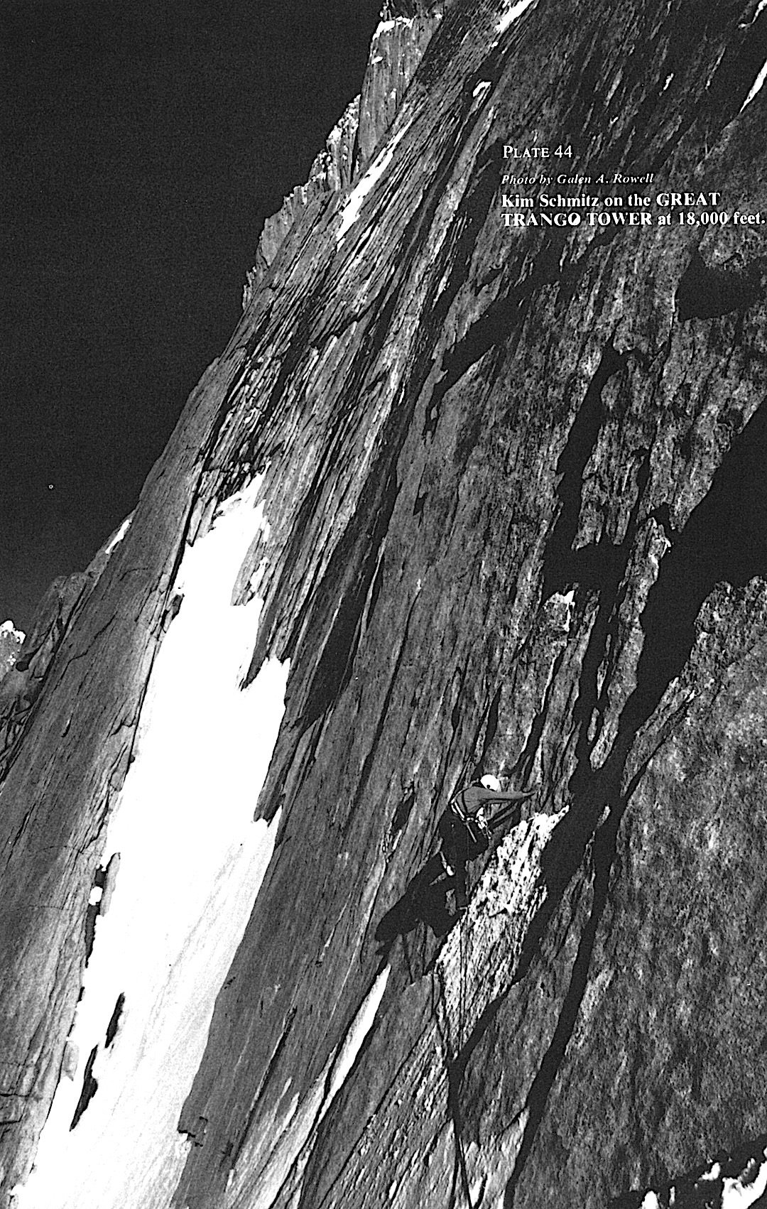
Kim Schmitz on perfect granite at 18,000 feet on the Great Trango Tower. Photo by Galen A. Rowell.

This list wouldn't be complete without the first ascent of Great Trango Tower. After rerouted and canceled flights, Galen Rowell, John Roskelley, Kim Schmitz, Dennis Hennek, and Dr. Lou Buscaglia began their trek through the Shigar Valley up the Braldu River Valley, where they met up with the final member of their team, Dr. Jim Morrissey. Once they established basecamp on Trango Glacier, a four-day storm settled over them, causing debris to fall on their proposed climb.

Telephoto view of Gasherbrum IV and Hidden Peak over Baltoro Glacier from the summit of Great Trango Tower. Photo by Galen A. Rowell.

"The scene greeting us at the base of the gully brought us back to reality and the seriousness of the next 3,500 feet."

On the first day of climbing, Hennek, Rowell, Schmitz, and Roskelley witnessed an avalanche filling the gully they had just ascended, where they believed Buscaglia and Morrissey to be. But "luck stayed with us"— the two had scrambled to the side of the gully to check out a waterfall, the avalanche narrowly missing them. This was only the first day, and it wouldn't be the only hurdle in their journey. Yet the rewards were great. "The afternoon was warm and clear, with an unobstructed, unforgettable view in all directions. We all agreed that there could be no better view of the Baltoro Karakoram." Read about the first ascent while looking at black and white photos from their expedition here

2. Suffer Well: Thirst and Hunger On The Azeem Ridge

Great Trango, Pakistan. Publication Year: 2005. Author: Kelly Cordes.

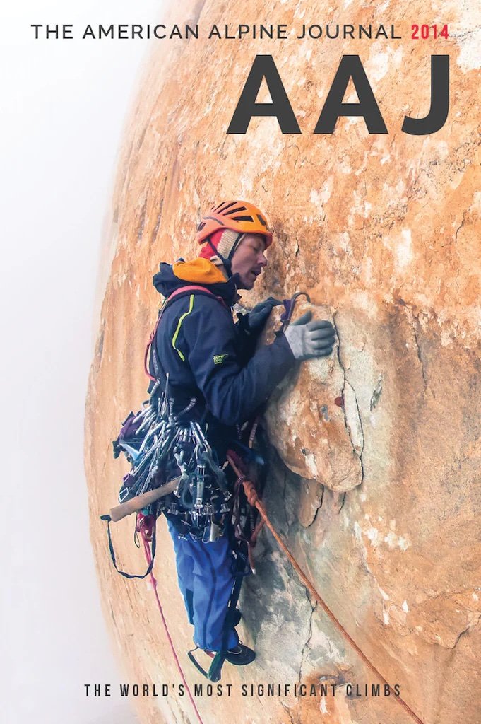
The cover of AAJ 2005: Josh Wharton traversing (5.10+ A1) into the headwall on day 3, about 1,500m up the Azeem Ridge, Great Trango, Pakistan. Photo by Kelly Cordes.

This article stands out in the AAJ archives because of what a saga this ascent turned out to be. Josh Wharton and Kelly Cordes climbed Great Trango’s southwest ridge, which they called the Azeem Ridge (7,400' vertical, 5.11R/X A2 M6), in what they deemed "delusional optimism," "disaster style," and "safety fifth!" climbing. Cordes and Wharton climbed 54 pitches, facing many challenges. On the second pitch, one side of their jury-rigged double-gear slings came undone, causing about a quarter of their cams to fall. Then, halfway up the wall, the two ran out of fuel, leaving them with only one option, sucking on snow in place of drinking water. Cordes wrote: "When we reached the bivouac where our last fuel sputtered out, we never spoke of retreat." On the fourth morning, Wharton's headlamp slingshotted out of his hands and was lost to the tower. Soon after, Cordes’ belay device suffered the same fate. At this point, their only option was up and over. Continue reading about how Cordes and Wharton kept heading up, even against all odds

3. Climbers vs. Technology

Great Trango Tower's Northwest Face. Publication Year: 2000. Author: Jared Ogden. 

Alex Lowe and Mark Synnott with computers at Camp I. Photo by Jared Ogden.

This article was written at the turn of the century when technology and climbing began to clash. Jared Ogden, Mark Synnott, and Alex Lowe faced moral dilemmas about filming and hosting a live internet site during the expedition for their sponsor, Quokka Sports Inc. Quokka.com was one of the only virtual adventure sports websites near the dawn of the internet, until they went bankrupt in the spring of 2001. Ogden, Synnott, and Lowe brought "all assortments of cyberspace technology," including computers and video cameras, and fixed more than 3,000 feet of rope. Foreshadowing today's day and age of viral climbing videos on TikTok and Instagram, this article launched a discussion of technology and its place in climbing. But once on the wall, the team's technology worries disappeared, and they became engrossed in the ethereal alpine world of the Karakoram.

Alex Lowe Cleaning Pitch 30. Photo by Jared Ogden.

The team faced challenges with group dynamics, fever, and "storm-ridden suffer-fests." Through hard-earned adventure, the team produced  Parallel Worlds (VII 5.11 A4, 6,000'). "Our…route combined all the elements of rock climbing: a long free climb up a 3,400-foot slab to a vertical and overhanging headwall that stretches over 2,000 feet, finishing on a knife-edge ridge for 1,000 feet to the West Summit," wrote Ogden. Read about this harrowing adventure and Ogden's tribute to Alex Lowe, who died in an avalanche just a few months after this climb.

Want to read more discourse about technology and its place in the mountains? Read Steve House's hot take on "business climbing" and media regarding the ascent of Parallel Worlds here

4. The Russian Way

Author: Yuri Koshelenko, Russia. Publication Year: 2000.

Parallel worlds: the American (left) and Russian teams hard at work on the headwall pitches on Great Trango's northwest face. Photo by Yuri Koshelenko.

While Jared Ogden, Mark Synnott, and Alex Lowe were putting up Parallel Worlds, Yuri Koshelenko, Alexander Odintsov, Ivan Samoilenko, and Igor Potankina climbed a line to the right of them—parallel up the Northwest Face of Great Trango Tower. The two groups worked hard next to each other for a time, developing genuine mutual assistance, "I was unexpectedly seized by the warm hospitality of the American team. I took huge gulps of piping hot tea from Alex's cup while thinking about the condition of the wet rock," writes Koshelenko. On July 24, after ascending shared fixed ropes, the two groups split apart, and so began the Russian team's arduous journey up dangerous 5.10 to 5.11 free climbing and difficult A3 and A4 sections. Two days later, while climbing a roof, Odintsov ripped off a huge block, tumbling down the face, caught by a well-placed cam but suffering hip and shoulder injuries. Odintsov's fall was just the beginning of their intense battle up the wall. The group faced unstable weather, including snowstorms, multiple uncomfortably close lightning strikes, a dropped haul bag, and dwindling food supplies. Read the epic tale of the ascent of The Russian Way (VII 5.11 A4, 2675m), written beautifully by Yuri Koshelenko, here

"The mountains always accept the tribute, though sometimes the price may seem excessive. But humanity cannot exist without extremes—such is the law of evolution." 

5. Epic Attempts on the Trango Towers

Great Trango Tower and Trango Nameless Tower, Attempts. Publication Year: 2001. Author: Timmy O'Neill 

Miles Smart on the last headwall on Great Trango Tower during the second attempt to climb the southwest ridge. Photo by Timmy O'Neill.

Funded by the American Alpine Club's Lyman Spitzer Climbing Grant, now the Cutting Edge Grant, this trip report chronicles two attempts of the southwest ridge of Great Trango, now the Azeem Ridge, by Timmy O'Neill and Miles Smart. O'Neill and Smart spent almost 50 days on the Trango Glacier waiting out bad weather. During one of their three brief weather windows, they attempted the southwest ridge of Great Trango, an effort "ended with a forced bivy at 18,000" after climbing for 12 hours through 4,000 feet of 4th class to 5.10. They tried again to no avail, despite climbing to within 300 meters of the summit, and moved on to a potential ascent of Eternal Flame on Nameless Tower. Their first attempt on Eternal Flame, "a one-day, single-push climb," ended with a difficult decision to descend six pitches from the summit. Three days later, they "blasted" from the col, ready to summit Eternal Flame. After eight hours of climbing, "the hand of Allah came to catch me and then subsequently thwack me into the wall," writes O'Neill. O'Neill had fallen 100 feet after he short-fixed his rope. Read about the epic attempts on the Trango Towers here

6. Triumph and Tragedy on Great Trango Tower

The Norwegian Buttress, 1984. 

Robert Caspersen, pitch 34. Photo by Per Ludvig Skjerven.

In 1984, a Norwegian team of four, Hans Christian Doseth, Finn Daehli, Stein P. Aasheim, and Dag Kolsrud, attempted the first ascent of the East Face of Great Trango. Due to a lack of food and slow progress up the wall, the team decided to split. Aasheim and Kolsrud rappelled off safely, reaching the Dunge Glacier, while Daehli and Doseth continued on. From the ground, Aasheim and Kolsrud watched via telephoto lenses as their friends reached the summit. Tragically, Daehli and Doseth fell to their deaths during the descent. Their bodies were later spotted at the foot of the climb, but soon after, an avalanche buried them. Their magnificent line was named the Norwegian Buttress. "The triumph had turned into a total tragedy." Read more about the Norwegian Buttress in an article in the 2000 AAJ, which also describes another new route on Great Trango, the Norwegian Trango Pulpit Direct (VII A4 5.11, ca. 2200m).

7. The Grand Voyage

Great Trango Tower, East Face, Swiss-American Expedition, Second Ascent To The East Summit. Publication Year: 1993. Author: John Middendorf. 

Xaver Bongard on Great Trango Tower. Photo by John Middendorf.

We picked this article because of the challenging climbing featured in it and because it was written by the one and only John Middendorf. The recent passing of John Middendorf deeply saddens us, and we invite you to read our tribute to him here.

The Grand Voyage (the Bongard-Middendorf route). This photo doesn’t show the 1984 Norwegian route, which climbed the same buttress, making the first ascent of Great Trango’s East Summit. Grand Voyage started far to the left of the Norwegian route, joined it for three pitches above the big midway ledge, and finished to the right of the Norwegian route. Photo by John Middendorf.

The Swiss-American Expedition, comprised of Swiss Xaver Bongard, Ueli Bühler, François Studiman, American photographer Ace Kvale, and John Middendorf, sought to establish a new line on the east face of Great Trango Tower: The Grand Voyage (Grade VII, 5.10, A4+), which started to the left of the original Norwegian Route and finished to the right. Bongard and Middendorf climbed capsule-style, moving their high camp upward and creating "safe havens" on the wall; they established five camps on the wall, four hanging and one at the snow ledge halfway up. This style of climbing resulted in almost a month on the wall. Ice, snow, and rock fall were high objective hazards for the group. In turn, this created belay stations that were "in suicidal positions." The group climbed the last five pitches below the snow ledge through vertical ice climbing, "rotten aid," and free climbing up a "dangerous steep corner system"—dubbed "Gollum's Gully"—at night due to high objective hazards. "Occasionally, huge sections would exfoliate off the wall and pound down around us." Continue reading about the legendary The Grand Voyage (Grade VII, 5.10, A4+) here

8. Pitch by Pitch, Move by Move: The Other Side of The Grand Voyage 

Great Trango Tower. Publication Year: 1995. Author: Xaver Bongard, Club Alpin Suisse.

John Middendorf and Xaver Bongard on Great Trango Tower. Photo by Ace Kvale.

If you're like us, you can't get enough of the epic story surrounding The Grand Voyage (Grade VII, 5.10, A4+). In 1995, the AAJ published Xaver Bongard's extensive trip report about the expedition, complementing Middendorf’s shorter report. If you love the nitty-gritty details and play-by-play of expeditions, this story is for you. "Pitch 23 was now behind us. To belay, I jammed into a narrow chimney. John, who was larger than I, had no chance of fitting in and continued up the outside. Hauling the sacks, I got up to his level and squeezed back into the crack, first removing my helmet, which was too big to fit in. John continued to climb on the exterior. I was resting from my efforts when I saw him fall and swing in an impressive pendulum." Read about The Grand Voyage from Bongard's perspective here. Tragically, Xaver Bongard was killed in April 1994 in a BASE-jumping accident. This story appeared in the 1995 AAJ as a tribute to him and to provide more information about the landmark Great Trango climb.

9. Stay Tuned: The First Ski Descent of Great Trango

The most recent news surrounding Great Trango Tower involves the first ski descent. On May 9, 2024, Chantel Astorga, Christina Lustenberger, and Jim Morrison skied down the west side of Great Trango Tower. The 2024 AAJ is already off to the printers, and we are eager to get the book into members' hands, so look out for the story in the 2025 AAJ!


Want to learn more about the history of Great Trango Tower and Trango Tower? Read John Middendorf's The Trango Towers in Review article from the 2000 AAJ. Stay on the lookout for our upcoming deep dive into the archives around Nameless Tower and more! 

Want to catch up your reading before the 2024 AAJ comes out?

Outdoor Alliance and American Alpine Club Working Together to Protect Rock Climbing Landscapes 

Will Plantz trys hard as the sun fades on Johnny Cat in Indian Creek, within Bears Ears National Monument. Photo by AAC member Will McKay

Climbers have a meaningful relationship with the landscapes they love, and advocating for public lands is a critical piece of that relationship. Outdoor recreationists have a powerful connection to place, and that connection makes us a powerful force for conservation. Outdoor Alliance is a national coalition of outdoor recreation advocacy groups that American Alpine Club has been a part of for six years, and together, we work to protect public lands and waters and advocate for climbing and other outdoor recreation. The AAC is the largest community of climbers in the country, and is dedicated to advocating for climbing landscapes and resourcing climbers with essential climbing knowledge and rescue coverage.

Since Outdoor Alliance started ten years ago, the coalition has helped protect 40 million acres of public land and water, secured $5.1 billion in funding for the outdoors, and has converted hundreds of thousands of outdoor enthusiasts into outdoor advocates.

Here are some of important victories that the American Alpine Club (AAC) and Outdoor Alliance (OA) have notched together:

Passing the EXPLORE Act in the House

Climbing on the Diamond of Longs Peak. Photo by Louder Than Eleven

The EXPLORE Act is a first-of-its-kind package of outdoor recreation policy that has been a priority for Outdoor Alliance for many years; the package recently passed the House. It includes sections that will directly protect rock climbing experiences on public lands, a big priority for the AAC. 

The Protecting America’s Rock Climbing (PARC) Act is a significant piece of the EXPLORE Act, and has been a focus for the AAC, Access Fund, and the wider Outdoor Alliance coalition. The PARC Act is intended to ensure safe and sustainable access to rock climbing in designated Wilderness areas. It requires federal agencies to recognize recreational climbing as an appropriate activity in accordance with the Wilderness Act of 1964, which states that the placement, use, and maintenance of fixed anchors is appropriate, and ensures that a public comment period is made available to stakeholders prior to any final climbing management guidance being issued.

The AAC has also educated their members about the SOAR Act, joining the AMGA who is one of the principle long-time supportess of the SOAR Act. This is another piece of the EXPLORE Act which will streamline recreational permitting for outfitters and guides, benefiting other Outdoor Alliance members like The Mountaineers, Mazamas, and Colorado Mountain Club.  

Now that The House has voted to pass EXPLORE, the AAC and OA are advocating for the Senate to also get it across the finish line. Learn more and write your lawmakers about it here

Restoration of Bears Ears National Monument 

In 2018, the Trump Administration rolled back protections for the Bears Ears National Monument by more than 80% and Grand Staircase-Escalante by nearly half. Since then, the AAC and its partners at Outdoor Alliance have been continuously educating outdoor enthusiasts about the fight to preserve Bears Ears. This included a lawsuit led by Access Fund against the Trump administration, advocating for the monument to be restored, and participating in a public comment on a new management plan for the restored monument.

In 2021, the Biden-Harris Administration restored protections for Bears Ears and the Grand Staircase, which honored the voices of Indigenous communities, climbers, and conservationists alike. The coalition work led by Outdoor Alliance was hugely impactful in bringing outdoor recreationists together on this issue. The AAC is committed to keeping their members updated on future management plans and staying active in this ongoing discussion. The AAC will continue advocating for the role of climbing and responsible conservation by sharing their expertise on land management issues pertaining to climbing, and interfacing with land management agencies, the BLM and USFS, as well as other partners and local and national climbing organizations, to continue to refine the Bears Ears National Monument Draft Resource Management Plan and Environmental Impact Statement. 

Advocating for the National Environmental Policy Act (NEPA) 

Photo credit: Grey Satterfield

In 2020, the American Alpine Club, and another Outdoor Alliance coalition member, Winter Wildlands Alliance, joined forces to sue the Trump administration for making devastating changes to NEPA. For the past 50 years, the National Environmental Policy Act (NEPA) has ensured that climbers and skiers have a voice in how the federal government manages our public lands. Whether it’s issues like climbing regulations in forest planning, balancing recreation with cultural preservation, or accounting for impacts to the climate from energy development on public lands—NEPA ensures that the federal government incorporates science and public outreach in the decision-making process. NEPA assures that the federal government operates with transparency and is held accountable for the decisions made on public lands. Having transparent decision making and accountability is particularly important to the climbing community as many of our cherished climbing areas are located on federal public lands across the country. The AAC and Winter Wildlands Alliance also petitioned the Biden administration in 2021 to take action to repair the law by restoring critical regulatory requirements that were removed in 2020.

The White House Council on Environmental Quality heard our requests, and began a two phase process to reverse the damaging 2020 changes to the regulations that implement NEPA. The final rule restores critical pieces of NEPA, and the AAC and other Outdoor Alliance members will continue to defend NEPA and ensure strong environmental protections and public comment periods. 

Amending the Colorado Recreational Use Statute (CRUS)

Photo credit: Grey Satterfield

Recreational Use Statutes across the United States protect private landowners from liability when they open up their land to the public for outdoor recreation. But a gap in Colorado’s Recreational Use Statute was causing landowners to feel insecure about the liability they faced, and therefore unwilling to accept the risk of keeping their land open to the public for activities like hiking, mountain biking, and climbing. This gap resulted in the closure of such Colorado hiking icons as Mount Lindsey, Mount Democrat, Mount Cameron, and Mount Lincoln. Outdoor Alliance and the the AAC both joined the Fix CRUS Coalition to activate Colorado recreationalists and advocate to update Colorado’s Recreational Use Statute. In 2024, the Fix CRUS Coalition successfully updated the Colorado Recreational Use Statute, when the CO Congress passed SB-58, ultimately strengthening protection for landowners, ensuring Colorado’s recreational opportunities that exist on private lands remain available to Colorado’s outdoor enthusiasts. 

Get Involved with Outdoor Alliance

Outdoor Alliance is a nonprofit coalition of organizations that includes American Whitewater, American Canoe Association, Access Fund, International Mountain Bicycling Association, Winter Wildlands Alliance, The Mountaineers, American Alpine Club, the Mazamas, Colorado Mountain Club, and Surfrider Foundation. For 10 years, Outdoor Alliance has united the human-powered outdoor recreation community to achieve lasting conservation victories. Our work has permanently protected 40 million acres of public land, secured $5.1 billion in funding for the outdoors, and has converted more than 100,000 outdoor enthusiasts into outdoor advocates. 

For more information, visit www.outdooralliance.org


Protect: First Ascents, Ground Falls, and the AAC Rescue Benefit in Action

In this episode, we sit down with Jarod, a long-time AAC member, to discuss a crazy accident he had at his home crag in Missouri, and how he utilized the AAC’s rescue benefit to cover the cost of his medical expenses. If you’ve been wondering if the AAC’s rescue benefit is for you, Jarod’s story helps explain how it works. We dive into the quirky concept of “girdle traverses” or mulitpitches that go sideways, and analyze his accident— the decisions he made, how traversing complicates gear placements, and the close calls he had. Funnily enough, Jarod also did a FA on that same wall—putting up Missouri’s potentially longest rock climb with Jeremy Collins, and this FA made it into the American Alpine Journal! We discuss the vision behind this 8-pitch traverse, what went into making it happen, the silliness of climbing, the unique belay tactics for traversing, and more!


The Climb that Inspired the Novel that Inspired the Climbs: The Many Stories of the Brenva Face of Mont Blanc

From the AAC Library Collection.

By: Katie Ives 

Each book in the American Alpine Club Library is a portal to another world—of golden spires feathered with rime, fluted snow beneath indigo skies, or red-granite aiguilles above a sea of ice. Beyond these worlds, there are countless layers of other worlds encountered by readers inspired to seek their own adventures and return with their own tales. For climbing is an act of storytelling: we trace the arc of a narrative with our bodies and our minds, rising from the base of a mountain toward a climactic point and descending to a resolution. And the history of mountaineering is also the history of reading and imagination, of old dreams endlessly transforming into new ones.   

The Climb 

On July 15, 1865, English alpinist Adolphus Warburton Moore found himself on the edge of a ridge that looked like something from a fantasy novel. The slender crest of blue ice seemed to rise for an eternity. Sheer voids dropped off on either side. Neither the iron tips of their alpenstocks nor the hobnails of their boots stuck to its flawless surface.  

It was inconceivable to climb. No one had yet established a route on this aspect of Mont Blanc, where the Brenva Face rose for 1,400 meters in a chaos of cliffs, towers, and buttresses, fringed by unstable seracs and swept by avalanches and rockfall. 

From the AAC Library collection.

Still, the Swiss guide Jakob Anderegg kept going, and the rest of the team, including Moore, cautiously followed. As the crest narrowed, they shuffled along à cheval, one leg on either side, aware that any fall might be catastrophic [1].

Long after they finished the first ascent of the Brenva Spur and descended by a safer route, the ice crest lingered in the imaginations of those who read Moore’s memoir, The Alps in 1864. In 1906, British author A.E.W. Mason located the climactic scene of his crime novel Running Water on the Brenva Spur—a point of no return that appeared perfect for an attempted murder of one climber by another, “a line without breadth of cold blue ice” [2].

The Novel

Mason’s Running Water, like its author’s inspiration, begins with reading. Riding the train to Chamonix, his young protagonist Sylvia Thesiger becomes immersed in an old copy of the British Alpine Journal, published more than two decades prior to the novel. All night, she couldn’t sleep, remembering her first glimpse of the Mont Blanc massif beyond the curtain of a train window, recalling her sense of inchoate longing for its moonlit towers of ice and snow. 

Although women climbers had taken part in numerous firsts by the time of the novel’s plot, they weren’t permitted to publish in the Alpine Journal under their own bylines until 1889, when Margaret Jackson recounted her epic first winter traverse of the Jungfrau. And there’s no female author or character in the story Thesiger reads about the first ascent of an aiguille near Mont Blanc. Yet she longs to enter its world, and when she arrives in Chamonix, she hires guides to take her on her own first climb, up the Aiguille d’Argentière. As an ice slope tilts upward, sheer and smooth as a pane of glass, she rejoices, feeling as if she’s finally dreamed her way into a scene from mountain literature, “the place where no slip must be made.” Astounded at her fearlessness and intuitive skill, a guide tells her she bears an uncanny resemblance to a famous climber from the Alpine Journal story she’d just admired. 

“I felt something had happened to me which I had to recognize—a new thing,” she recalls. “Climbing that mountain...was just like hearing very beautiful music. All the vague longings which had ever stirred within me, longings for something beyond, and beyond.” Later, after she falls in love with a climber, the memory of that day suffuses their bond with a steadfast alpine glow—“ice-slope and rock-spire and the bright sun over all.”   

By the end, however, the novel shifts from her journey of self-discovery toward an outcome more conventional for its era. Newly wed, Thesiger is relegated to waiting below the Brenva Spur while the male hero and villain confront each other above that narrow blue crest. Readers don’t find out, for certain, whether she’ll climb any mountains again. A sense of incompleteness remains: the mysterious promise of her alpine epiphanies and of her suppressed and inmost self seem to flow beyond the narrative’s abrupt conclusion, like the recurring dreams she has of running water. 

The Next Climbs

After the publication of Running Water, the ice crest reemerged in a real climber’s recurring dreams. During World War I, Scottish physiologist Thomas Graham Brown took refuge in fantasies inspired by the novel. Night after night, in his sleep, he left behind the horrors of grim battles and shell-shocked men [3] for his own imagined version of the Brenva Face amid a wonderland of shining mountains. The geography seemed so “vivid,” he wrote in his memoir, Brenva, “that a map might be made of the country” [4].

After he recovered from the war, Brown sought the Brenva Face again and again, though its actual topography proved different from what he’d seen in his dreams. Between 1927 and 1933, he established three new routes there, some of the hardest of his day: the Sentinelle and the Major with fellow British climber Frank Smythe; and the Pear with Swiss guides Alexander Graven and Alfred Aufdenblatten. During the last climb, under the shadow of the full moon, Brown felt as if the Brenva had become, once more, “an unknown land,” a flood of dreams subsuming all the real lines he’d climbed. 

As they descended from the summit, light flashed along the running water of a stream, and like Thesiger, he heard an unearthly music cascade through his mind. In his sleep, long afterward, Brown continued to explore the dream version of the Brenva Face, its enigmas unresolved. And for the rest of his life, he kept Mason’s Running Water close by [5].

A Real-Life Sequel to the Novel

Meanwhile, currents of Sylvia Thesiger’s story flowed on through another real alpinist’s life. In 1920 a budding English climbing writer, Dorothey Pilley, strained to see the Alps through the window of a crowded train. She was so overwhelmed with long-held imaginings that her own first glimpse of the range seemed like a chaos of snow-reflected light. 

Since reading Running Water, Pilley had felt spellbound by the unearthly ice arête of the Brenva Spur, but also by the ice slope of the Aiguille d’Argentière, where Thesiger steps into the world of her dreams. The scenes blended in Pilley’s mind with those of other, mythic peaks into “a strange, now unrecapturable farrago of fantasies…perhaps a vague haunting background to all my mountain experiences” [6].        

Like Thesiger, Pilley felt a new self emerge when she climbed, free of the constraints of her society. As if echoing the novel, when she attempted her own early mountain writing, she found herself trying to capture images of running water over stone. Pilley, too, fell in love in the hills, and the awe and light of the mountains remained at the heart of her subsequent marriage [7].

From the AAC Library Collection.

Beyond that point, Pilley’s life story continued along one of many paths that Thesiger might have taken after the novel’s ending—if Thesiger’s author proved bold enough and feminist enough to compose such a sequel. Following a similar yearning for the mysterious, Pilley completed first ascents around the world, often with her husband, Ivor (I.A) Richards. On their most famous new route, the North Ridge of the Dent Blanche, with French guide Joseph Georges, the couple encountered a surreal crest of their own, “as though a dream had got out of place.” Its smooth and at times overhanging rock required “a leap into the void,” they recalled in the Alpine Journal [8].

Pilley also joined the early movement of women taking part in manless, guideless ascents, demonstrating they could be fully independent leaders. And she wrote down her adventures in a book of her own, Climbing Days, which became one of the great classics of literary alpine memoirs. In one of his poems, her husband I.A. Richards quoted her words, “Leaping crevasses in the dark, / That’s how to live!” [9].

The Next Novel?

Mason’s novel haunts me, too. I also fantasize of the imaginary and the real, at times obscuring each other like shadows and moonlight, cascading in unending, luminous streams from ascent to tale to ascent and tale again. Thesiger’s longings appear so vivid they seem to transcend fiction or illusion like the topography of Brown’s recurring dreams. And I wonder what she might accomplish if she were released from the pages of Running Water: Could she return to climb the Brenva Spur herself? Could her life unfold with the same wild audacity that Pilley’s had, taking leap after leap over the voids? Given the intensity of Thesiger’s love of the Alps and her inherent talent, could she, too, write down her own adventures instead of merely reading stories by men? Most of all, could she venture even deeper into the ecstatic communion with the mountains that she’d encountered on her first climb, amid the light, the stillness, and the ice? 

We live in a new era now, when alpine literature is expanding and diversifying, with the influence of new voices and new ideas. It seems past time for someone to write a new novel that could be a sequel to Running Water or else a complete reenvisioning—to find new possibilities within that “line without breadth of cold blue ice.” 

Perhaps one of the readers of my story, now, will write the next book, one that might inspire as yet unimaginable climbs and dreams. 

[I have also explored the story of the Brenva Face in a Sharp End column for Alpinist 75.—Author.] 


More From Katie Ives

Imaginary Peaks: The Riesenstein Hoax and Other Mountain Dreams


This article was made possible with research assistance from AAC Library Director Katie Sauter.


Endnotes

[1] Adolphus Warburton Moore, The Alps in 1864: A Private Journal (Edinburgh: David Douglas, 1902). Although the book states “1864” in its title, the 1865 climb is included. 

[2]  A.E.W. Mason, Running Water and The Guide, with introduction and notes by Roberta Grandi (London Academic Publishing, 2021). 

[3] For a biography of Thomas Graham Brown, short-listed for the Boardman-Tasker Award, see Peter Foster’s The Uncrowned King of Mont Blanc (Langley, UK: Baton Wicks Publications, 2019). 

[4] Thomas Graham Brown, Brenva (London: J.M. Dent & Sons Ltd., 1944).

[5]  See Robin N. Campbell’s “Graham Brown’s Eulogy,” in the Edinburgh University Mountaineering Club Online Archives, eumarchives.files.wordpress.com, 1965. 

[6]  Climbing Days, Dorothy Pilley (London: Secker & Warburg, 1935). 

[7] As Pilley’s nephew, Dan Richards, wrote in his biography of her, also called Climbing Days (London: Faber & Faber Ltd., 2016), “Ivor and Dorothea were both, first and foremost, mountaineers. They met in the mountains on an equal footing and returned there whenever they could for the rest of their lives…. United climbing companions on a rope, their apparently eccentric union founded in the wild landscape of the mountains.”

[8] Dorothy Pilley and I.A. Richards, “The North Ridge of the Dent Blanche,” Alpine Journal 35 (1923). 

[9] As cited in Dan Richard’s biography of Pilley.

The Line — June 2024

FAMILY TIES

With Father’s Day just past, we’re sharing a few stories of multi-generational climbing families that are featured in the upcoming 2024 AAJ (plus one from the archives).

The Uriostes of Red Rock

Joanne and Jorge Urioste are legends of Red Rock Canyon, Nevada, having established many classic routes (Crimson Chrysalis, Epinephrine, Dream of Wild Turkeys, Levitation 29, and on and on). Their son Danny is also a climber, and in recent years he too has been putting up big new routes in the sandstone canyons west of Las Vegas, often in the company of prolific new-router and AAJ contributor Sam Boyce. In December 2023, the two teamed up with Kyle Willis for a new route on the Aeolian Wall: Salami Wand Kenobi (14 pitches, V 5.11- R C2).

Coincidentally, the new route incorporated three pitches of Woman of Mountain Dreams. That route, Urioste explains in his AAJ 2024 report, “was first climbed in 1997 by my parents, along with Dave Krulesky and Mike Morea, and then freed by my mother and Aitor Uson in 1998.”

Danny Urioste and Sam Boyce climbed another route on Aeolian Wall, a long direct start to the classic Resolution Arête, in November 2022. You can read about that climb, the Evolution Arête, on Mountain Project.

Watch the AAC Legacy Series interview with Joanne and Jorge Urioste!


The Millers of Juneau

Mt. Swineford (6,841’) from the northwest. The first ascent was by the west face, partially hidden in clouds. Photo by Dylan Miller.

Dylan Miller has been a frequent AAJ contributor in recent years, with many new routes and winter ascents in the mountains around Juneau, Alaska. He has three reports in the upcoming AAJ, including the story of the first known ascent of Mt. Swineford a few years back, which Dylan completed with his dad, Mike, along with Makaila Olson and Ben Still. Dylan says he owes his love of the mountains to his father: “He has definitely been a big inspiration in my life. He took me on my first adventures, and he has done so many first ascents in the area.”

In AAJ 2019, Dylan described a classic Alaska adventure with his dad: the first ascent of Endicott Tower, about 50 miles northwest of the capital city. “From Juneau we flew to Gustavus, jumped on a Glacier Bay tourist catamaran, cruised up the east arm of Glacier Bay, and got dropped off in a sandy cove at the base of Mt. Wright, near Adams Inlet,” Miller wrote. “We inflated our rafts and waited for the incoming tide to suck us into the 14-mile Adams Inlet. We waded and crisscrossed the Goddess River delta, sometimes crossing swift, waist-deep rivers, and made camp for the night. We then hiked a full day…to Endicott Lake, the headwaters for the Endicott River. Here we stashed our water gear and tromped 2,000’ up through the Tongass rainforest to a pristine hanging alpine valley, where we made our base camp.”

Mike Miller during yet another Southeast Alaska adventure: the first ascent of Snow Tower. See AAJ 2016. Photo by William Wacker.

A few days later, from a higher camp, the two climbed snow, mixed terrain, and rotten rock to complete the first ascent of the 5,805-foot peak. “From the top we looked southeast to Juneau and pointed out our home, which put into perspective how far out there we really were,” Dylan wrote. After a rest at base camp, during which a friend flew in to pick up their mountain gear, they packrafted down the Endicott River, bushwhacked past a deep gorge (climbing another peak along the way), and returned to the river to float out to the sea.


Huayna Illampu (5,940m) from the south, showing (1) the approximate line of the 1973 Mesili-Sanchez Route and (2) Via dei Nembresi (700m, ED AI4 M5). The climbers in 2023 continued up Illampu (6,368m), which is hidden behind Huayna Illampu. Photo by Daniele Assolari.

The Nembrinis of Nembro

“In 1973, an expedition led by Carlo Nembrini climbed Illampu (6,368m) in Bolivia and then moved to Illimani,” begins a report in AAJ 2024. “After climbing that peak, they joined a search for the bodies of Pierre Dedieu (France) and Ernesto “Coco” Sanchez (Bolivia), who had been killed on the mountain. Sanchez had been considered the best alpinist in Bolivia at the time…. The Italians located the body of Sanchez, but tragically, during the evacuation, Nembrini fell to his death.”

A book written about Carlo Nembrini, a leading Italian alpinist of his era, after his death. The book can be seen at the AAC Library but is not available for check-out.

In 2022, Rosa Morotti, a niece of Nembrini’s, wrote to the guide Daniele Assolari, an Italian who lives and works in Bolivia, “about her dream of opening a new route on Illampu, 50 years after the death of her uncle.” Assolari put together a trip with Morotti and Maria Teresa Llampa Vasquez (the first female IFMGA aspirant guide from Bolivia), and in late June of 2023, the trio climbed a new line up the south side of Huayna Illampu, a 5,940-meter peak on the southwest ridge of the main summit, then continued up the higher peak. “Rosa dedicated the route to…all the people of Nembro (immediately northeast of Bergamo), where her father and Carlo were born: Via dei Nembresi (700m, ED AI4 M5).”


Three George Lowes on the Grand

George Lowe III in Tanzania in 2015. Wikipedia Photo.

The 1981 AAJ carried one of the shortest stories in the journal’s history, a one-sentence report on a notable event in the Tetons. Here is the report, in its entirety: “In July three George Lowes, grandfather, father and son, all climbed the Exum route of the Grand Teton together, which may be some kind of a new record.”


The Line is the newsletter of the American Alpine Journal (AAJ), emailed to more than 80,000 climbers each month. Find the archive of past editions here. Interested in supporting this publication? Contact Heidi McDowell for opportunities. Got a potential story for the AAJ? Email us: [email protected].

Remembering John Middendorf

Wind River Ranger, 1991 // Photo by Wikimedia/John Middendorf

We are deeply saddened by the loss of the incredible climber, mountaineer, inventor, writer, and historian of climbing gear John Middendorf. John (nicknamed the "Deuce") was a true friend to the American Alpine Club, and his insatiable curiosity and kindness made an impression on everyone he met. 

Although his contributions to climbing are many, some in particular changed the sport forever. John’s ascent of the East Face of Great Trango Tower in 1992 with Xaver Bongard epitomized his elite climbing skill—The Grand Voyage was a performance of a lifetime on one of the biggest and remotest big walls in the world, and was one of the first Grade VII climbs. John also put up new Grade VI routes on Half Dome and El Cap, along with many first ascents in Zion National Park. He was otherwise a prolific contributor to the American Alpine Journal with exploratory climbs all across the world. John, an engineer and inventor, started a hardware company, A5 Adventures, in 1986. His innovations in portaledge design, as well as Birdbeak pitons, aiders, haul bags, and other gear, unequivocally changed the big-wall game. He sold A5 to The North Face in 1997. His 1994 book Big Walls, co-authored with John Long, was the crucial reference for many wall-climbing novices.

But besides being a great man in climbing, he also was a dear friend of the AAC. We deeply appreciate the generosity and knowledge he shared with the Club, his support of the AAC Library, and his contributions to the Legacy Series and the 2023 Cutting Edge Grant

The AAC’s Library Director, Katie Sauter, reflected: “[John’s] insatiable curiosity led him to research so many avenues of climbing, often sending me questions about the most obscure references. He was very knowledgeable and wrote blog posts about a wide variety of topics pertaining to climbing history and the evolution of gear. He was generous with his time, and when he was visiting, he'd identify historic climbing gear for our collections. His enthusiasm was infectious. He was so interested in how gear was made that he even wanted to test the composition of some of our historic pitons to see what kind of metal was used.”

The AAC will truly miss John Middendorf, and our thoughts are with his wife, Jeni, his children, and his other family and friends as they grieve and celebrate him. 

All Aspects

The AAC DC Chapter hosts a New Ice Climber Weekend in the Adirondacks with Escala

PC: Colt Bradley

Grassroots: Unearthing the Future of Climbing

By: Sierra McGivney

The sun peeked over the Pitchoff Quarry crag, hitting the ice and creating an enchanting aura. The cool February air was saturated with people laughing and ice tools scraping against the ice. If you listened closely, you'd notice that the conversations were a beautiful mix of English and Spanish. 

PC: Colt Bradley

The New Ice Climber Weekend (NICW), hosted by the AAC DC Chapter, has become an annual event. Piotr Andrzejczak, the AAC DC chapter chair and organizer of the New Ice Climber Weekend, believes mentorship is paramount in climbing. The weekend aims to provide participants with an opportunity to try ice climbing, find ice climbing partners, and have a starting point for more significant objectives. Above all, it aims to minimize the barrier to entry for ice climbing. 

Last year, Andrzejczak approached Melissa Rojas, the co-founder of Escala and volunteer with the DC Chapter, about partnering to do a New Ice Climber Weekend with Escala. Escala is part of the American Alpine Club's Affiliate Support Network, which provides emerging affinity groups with resources in order to minimize barriers in their operations and serving their community. Escala “creates accessibility, expands representation, and increases visibility in climbing for Hispanic and Latine individuals by building community, sharing culture, and mentoring one another.”

Climbing can be a challenging sport to get into. It can require shoes, a harness, a gym membership, and climbing partners. Ice climbing requires all that plus more: ice tools, crampons, and winter clothing. 

"There's a lot more complexity to ice climbing," said Rojas.

PC: Colt Bradley

Ice climbing can be limited not only in quantity but also in quality. Due to climate change, the ice in the Adirondacks loses its quality faster than previous decades and the climbs are only of good quality for a limited amount of time. DC climbers are at least seven hours from the Adirondacks, plus traffic and stops, so ice climbing for them has unforeseen logistical challenges. During the NICW, participants can focus more on the basics of learning to ice climb and less on logistics.

Rojas and Andrzejczak hosted a pre-meetup/virtual session so that participants could get to know each other and ask questions ahead of time. "We wanted to give folks an opportunity to ice climb in a supportive environment where they felt like they were in a community and were being supported throughout the whole process, from the planning stage to the actual trip," said Rojas.

Another focus of the weekend was creating a film. Colt Bradley attended the New Ice Climber Weekend in 2023 as a videographer and as a participant. Bradley volunteers with the AAC Baltimore Chapter and is also Andrzejczak's climbing partner. Last year, he created four Instagram videos that captured the excitement of ice climbing for the first time. When asked to film the Escala x NICW this year, he wanted to do something longer and more story-focused. Bradley and Rojas talked beforehand about focusing the film on the Escala community and highlighting the bond made possible through its existence. 

Rojas has worked hard to build up this blended community of Spanish-speaking climbers. Spanish has many flavors, as it is spoken in many different countries with different cultures—all unique in their own way. The film focused on reflecting and representing the vibrant community of Escala. 

Soon, they all found themselves at Pitchoff Quarry in the Adirondacks. While the participants learned how to swing their ice tools and kick their crampons into the ice, Bradley sought out community moments. He wanted to put viewers in the moment as participants climbed, so he mic'd some participants; including Kathya Meza. 

Meza spoke openly during interviews and had a compelling story that Bradley thought would resonate with the viewers. 

PC: Colt Bradley

In the film's final scene, viewers can hear Meza swinging her tools into the ice, see her smiling, and experience her problem solving as she pushes herself outside her comfort zone. Bradley filmed this scene the first day before they even identified her as a focal point of the film. 

Bradley continued to capture the essence of the Latino influence over the weekend. On the second day, the group headed to Chapel Pond. Despite the cold 21-degree weather and whipping wind, the energy was high. Mentors taught mentees how to layer correctly, and folks danced salsa at the base of the crag to stay warm. Later, feeling connected and energized from this incredible trip, the group salsa danced on the frozen Chapel Pond with the iconic ice falls that makeup Chounaird's Gully and Power Play in the background.

"For the twenty-some-odd years I've been going to the Adirondacks to ice climb, I've never even thought that maybe one day I'll be dancing on Chapel Pond, hosting a new Ice Climbing weekend with Escala" said Piotr. 

For Rojas, it was some of her best salsa dancing. She was so focused on staying warm that it freed her from overthinking her dancing skills. The dancing didn't stop at Chapel Pond. After dinner, the group returned to the inn and fired up the woodstove in the recreation room. The sound of salsa dancing and glee filled the room. 

The NICW isn't about going out and sending, so naturally, this isn't the type of climbing film where climbers try hard on overhung climbs overlaid with cool EDM music. Every climber remembers the moment they got hooked on climbing, whether sport, trad, ice, or alpine climbing; they remember the thrill of reaching the top of a climb for the first time, out of breath but more excited than ever. Climbing is a multifaceted sport, and climbing films should be reflective of that. Showing the first-time-swinging-an-ice-tool moments at the NICW inspires someone to take that first step toward something new or nostalgic for the longtime climber.

PC: Colt Bradley

"I think the thing about Escala is it's more than just a climbing group. It's a community," said Rojas.

Escala is a place where Rojas can be all parts of herself. Rojas has four children and refers to Escala as her fifth baby. She doesn't have to explain why she climbs or her love for Sábado Gigante–a famous variety show in Latin America. Everyone in her community recognizes all aspects of her. Her identity as a climber and as a Latina can be one. 

One participant of the NICW approached Rojas and said it was the best experience of their life. 

PC: Colt Bradley

"He said it with such sincerity that it was really humbling in the moment," said Rojas. 

Leading an affinity group can often feel like running on a never-ending treadmill of organizing event after event, where reflection takes a backseat. However, according to Rojas if she can positively affect just one person, it makes all the work worth it. 

Salsa music playing over Chapel Pond, smiling faces red from the winter frost, and dancing in crampons are the mosaic of moments that make up the heart of Escala, the DC Chapter, and the New Ice Climber Weekend. 


Watch Escala En Hielo Below

EDUCATE: The Climbing World's Best Books about Accidents and the Cutting Edge

This year’s editions of Accidents in North American Climbing and the American Alpine Journal are off to the printer! We had the editors of these world-renowned books, Dougald MacDonald and Pete Takeda, on the podcast to discuss all the details of what goes into making these books: including how stories get selected, the challenges of investigating how accidents happen, how these books fit into the larger climbing media landscape, and the long history of these books. Our editors also chat about what it’s like to edit over 100 stories about climbers hurting themselves and then still go climbing. We cover how these books have been translated and utilized across the globe, as well as trends in accidents this year. If you’re looking for more details about how the AAC produces such robust reporting on cutting edge climbing and accident analysis each year, you’ll have to hear from the editors themselves!


United We Climb? Or United We VIBE?—The June T-Shirt Is Here

Pack your boombox and rigid-stem cams, it's time to vibe out. This June, we're offering this bodacious limited edition t-shirt when you join the Club, renew your membership, donate $30 or more. If you’re obsessed with the climbing vibe, this 80’s inspired t-shirt is for you!

Use promo code VIBE24 during the month of June only.

AAC Submits Comment on Proposed Bears Ears Climbing Management Plan

PC: Jeremiah Watt

On March 8, 2024 the Bureau of Land Management (BLM) and U.S. Department of Agriculture Forest Service (USFS) opened the public comment period for the Bears Ears National Monument Draft Resource Management Plan and Environmental Impact Statement, notably impacting the world-renowned climbing of Indian Creek, UT. The BLM and USFS held open-house style public meetings with opportunities to speak with resource specialists, as well as provided virtual meeting options to attend. The public comment period closed Tuesday, June 11th, and the AAC submitted the comment below which supports tribal co-management of the Monument, makes recommendations on zoning/area designations, asks questions regarding proposed permitting and closure criteria, and other topics of interest to the climbing community. Read on to learn more about the draft management plan and the AAC’s perspective on it.


June 11, 2024

Bureau of Land Management

Bears Ears National Monument

Monticello Field Office

P.O. Box 7

Monticello, Utah 84535

Email: [email protected]

RE: Public Comment, Draft Resource Management Plan (RMP) and Environmental Impact Statement (DEIS) for the Bears Ears National Monument (BENM)

The American Alpine Club (“AAC”) appreciates the opportunity to provide comments on the Draft Resource Management Plan and Environmental Impact Statement for the Bears Ears National Monument. The BENM, and more specifically Indian Creek, is a world-class destination for rock climbing and attracts many of the AAC’s 26,000-plus members nationwide to climb and enjoy the recreation and cultural resources in BENM. The AAC looks forward to continued engagement with the Bureau of Land Management (BLM) and U.S. Forest Service (USFS) in regard to climbing management and values the efforts of the BLM and USFS to steward the abundant and unique resources of BENM. This RMP will be critical in managing the ecological, cultural, and natural resources of the BENM, especially as more people recreate in the outdoors in all forms of activities. The AAC would like to be considered a resource for the BLM and USFS in helping steward these important resources for generations to come and support the BLM’s and USFS’s effort to create an informed and enduring RMP.

I. The American Alpine Club

The AAC is a 501(c)(3) non-profit organization based in Golden, Colorado, with over 26,000 members nationally. Founded in 1902 to support the research and exploration of mountainous regions, the AAC remains committed to supporting the climbing and human-powered outdoor recreation communities over a century later. Grounded in community and location, the AAC’s mission is to share and support members’ passion for climbing and respect for the places they climb. Through education, community gatherings, stewardship, policy, advocacy, and scientific research, the AAC strives to build a united community of competent climbers and healthy climbing landscapes.

II. Alternative E

A. Tribal Co-Management. The AAC supports the recommended tribal co-management of BENM found in Alternative E1 [1]. Recognizing that this is a precedent-setting methodology of management that may serve as a model for future co-management opportunities, we seek several points of clarification within Alternative E that we hope will be addressed prior to or in conjunction with any implementation plan. While we find points of merit in all the alternatives presented in the Draft RMP, we believe that any plan which does not include a component of tribal co-management would be a missed opportunity to recognize Traditional Indigenous Knowledge (TIK)[2] as a valuable resource in decision-making regarding conservation, environmental, and cultural resources. We support utilization of the Bears Ears Commission (BEC) established in 2016 [3], as described in the Presidential Proclamation creating BENM, stating:

“In recognition of the importance of tribal participation to the care and management of the objects identified above, and to ensure that management decisions affecting the monument reflect tribal expertise and traditional and historical knowledge, a Bears Ears Commission (Commission) is hereby established to provide guidance and recommendations on the development and implementation of management plans and on management of the monument.” [4]
— from the Presidential Proclamation Creating BENM

B. Zones. Alternative E proposes the management of recreation through a zoned approach, designating four zones consisting of Front Country, Passage, Outback, and Remote [5]. This zoned approach would largely remove existing recreation management designations (such as Recreation Management Zones (RMZ) and Special Recreation Management Areas). The Indian Creek area, as an area of primary interest to the climbing community, would be largely located in the Outback and Remote Zones [6]. Indian Creek is currently designated as a Special Recreation Management Area (SRMA), and subject to the regulations associated with that SRMA [7] such as dispersed camping regulations, regulations regarding interaction with archeological sites, wild species avoidance guidance, trail usage regulations, and more.

The novel zone designations as written and applied to the zoning proposed for Indian Creek are unnecessarily restrictive and do not allow for future management flexibility. In Remote Zones no “new sites/facilities/trails would be developed”[8] and in Outback Zones no “new sites/facilities would be developed”[9] except for the possibility of “minor recreation facilities such as trails, trailhead markers, and informational kiosks” [10] when deemed “necessary.” These in toto exclusions do not provide land managers with the flexibility for future management concerns, which are easily accounted for in the existing SRMA and can be tailored in future SRMA or RMZ designations. We recommend utilizing a hybrid zone/designation system such as that utilized in the 2020 Grand Staircase-Escalante National Monument Management Plan [11] which allows for the development of SRMAs and RMZs that are more tailored within any zone, or sub-component of a zone, to address the specific management concerns of that zone and accounting for BEC collaboration in that decision-making process. The SRMAs and/or RMZs would be managed in accordance with the distinct recreation-tourism market for which they were created and in conjunction with the BEC.

C. Permitting. The proposal to develop a Monument permit system that would require a permit for all “private overnight and day use in all canyons”[12] is a dramatic departure from current practices. If the intent is to simply account for the general number and whereabouts of visitors on a no-cost basis then the AAC supports that proposition provided it has varying methods of registration accommodating various ability levels (i.e., in-person, web-based, etc). If the recommendation is for a permit fee structure, we would request an opportunity to see the specific proposed permit fees prior to making recommendations on a permitting plan. However, we do generally support increased management of the resources at BENM and understand permitting may be a requisite component of efficient management of the resources.

D. Approval Process for New Routes. The AAC appreciates the agencies. recognizing that the climbing in BENM located in and around Indian Creek is “world famous”[13] and important to the local recreation economy [14]. The climbing activity specific management proposal [15] is of particular interest to our membership and impacts climbers worldwide. We support the recommendation that, “replacement of existing bolts, anchors, and fixed gear would be allowed on existing climbing and canyoneering routes as needed for safety reasons without prior authorization”[16]. In regard to the approval of new routes which require fixed anchors we recommend that, where appropriate, the agencies in collaboration with the BEC and delegated climbing organizations/representatives consider programmatic approval of routes for specific zones when considering the overall new route approval process. We also recommend that an interim process of route approval be developed prior to implementation in order to ensure that new routes can be considered by land managers and the BEC while the new process is under consideration, avoiding a de facto moratorium on new route development. For both the interim and final climbing management plans we recommend that local climbers and climbing organizations be engaged in the process for substantive input to inform those plans.

E. Closures. The draft plan states that, “Existing access points, trails, and climbing routes that are consistent with the protection of BENM objects would remain available for use. If site-specific impacts exist, climbing routes can be closed and access trails and staging areas may be closed or rerouted”[17] and that, “Climbing closures would be identified in accordance with applicable law” [18]. The AAC asks for clarification on what criteria would be utilized in the determination of “consistent with the protection of BENM” as well as the criteria that would be utilized to determine “impact.” We understand that the criteria could be dependent upon whether the closure is aimed to protect an ecological/biological resource such as raptors, or a cultural resource such as an archaeological site. We also seek clarification of the factors or criteria to be considered for determining a “resource rest” is appropriate to justify a closure, as well as how the length of time for a resource rest would be calculated.

F. Commercial Filming. Under Alternative E no commercial filming would be allowed [19]. We believe that a wholesale prohibition to commercial filming on BENM could be a missed opportunity to promote the cultural, biological, and ecological relevance of the Monument, as well as amplifying best-practices through the media arts. The agencies should consider reviewing commercial project proposals in conjunction with the BEC through the existing film permitting system [20] and consider those that may enhance and/or promote the image of BENM.

III. Conclusion

The American Alpine Club values this opportunity to represent over 26,000 members, and the collective climbing community, on the future of climbing management in the Bears Ears National Monument. In summary, the AAC would like to reiterate our strong support of this historic tribal co-management opportunity through the BEC. We ask that consideration be given to preserving the current SRMA in Indian Creek, or future SRMAs/RMZs, in order to remain flexible for current and future recreation needs. We seek clarification on matters concerning permitting and fees, new climbing route approval processes, and criteria for area closure and rest periods. Additionally, we ask that consideration be given to the outright prohibition of commercial filming on the Monument.

The AAC will remain committed to instilling the ethos of utilizing the best low-impact climbing techniques and practices, and staunchly supporting appropriate recreation on our Nation’s public lands. The AAC is ready and willing to assist the BLM and USFS to develop a plan that sustainably manages the climbing resources of Bears Ears National Monument, while protecting the culturally significant resources of the Monument. The AAC looks forward to continuing to work with the agencies in the interim and through the implementation of this plan.

Respectfully,

Byron E. Harvison

Director, Policy and Government Affairs

The American Alpine Club


1–U.S. Department of the Interior, Bureau of Land Management, U.S. Department of Agriculture, U.S. Forest Service, Bears Ears National Monument, Draft Resource Management Plan and Environmental Impact Statement, Volume 1: Executive Summary and Chapters 1-4, 2.1.6, March 2024.

2— Ibid, 3.3.

3—Presidential Proclamation 9558, Establishment of the Bears Ears National Monument, 82 Federal Register 1139, December 28, 2016.

4—Ibid, page 1144.

5—See U.S. DOI, U.S.D.A., BENM at ES-4.6.

6–U.S. Department of the Interior, Bureau of Land Management, National NEPA Register, BENM Draft RMP/EIS Interactive Map, BLM UT BENM Zones Alt E Draft, release date March 13, 2024, accessed June 5, 2024. https://eplanning.blm.gov/EPLCommentMap/?itemId=f11acb57f3f64bbf922335ad796faa20

7— See https://www.blm.gov/visit/indian-creek-bears-ears-national-monument#:~:text=The%20Indian%20Creek%20Special%20Recreation,of%20Bears%20Ears%20National%20Monument. Accessed May 29, 2024.

8— See U.S. DOI, U.S.D.A., BLM, BENM at 2-82.

9— Ibid.

10— Ibid.

11— U.S. Department of the Interior, Bureau of Land Management, Record Decision and Approved Resource Management Plans for the Grand Staircase-Escalante National Monument, 85 Federal Register 9802, February 2, 2020.

12– See U.S. DOI, U.S.D.A., BLM, BENM at 2-102.

13— Ibid at 1-3.

14— Ibid at 1-3, and ES-24.

15— See U.S. DOI, U.S.D.A., BLM, BENM at 2-115.

16— Ibid.

17— Ibid at 2-80.

18— Ibid.

19– Ibid at 2-75.

20— https://www.blm.gov/programs/lands-and-realty/leases-and-permits/filming-on-public-lands/film-permitting-process, accessed June 3, 2024.

The Prescription—June

It’s June and we’ve been busy wrapping up edits on the 2024 Accidents in North American Climbing. If you have an AAC Partner membership or above, you’ll receive the best kind of mail soon–a copy of Accidents, the 2024 American Alpine Journal, and other neat things in a few months. I give thanks to all our volunteers, regional correspondents, and editors, who made this year’s book a reality. I also give deep thanks to those who took the time to submit accident reports. Whether one has personally experienced an accident or is reporting an incident, it is never an easy thing to do.

In closing out the year’s edits I’m reminded of a few things. As with any elective passion, climbing gives us what prudence itself can’t provide—our humanness. While climbing promises a glimpse of the unimaginable and the ineffable, it can also visit us with mishap or tragedy. Gravity constantly teaches us that no matter what gear we use, how much we practice, and how many precautions we take, climbing is dangerous. Stay safe out there.  

This month we feature an accident that will appear in the 2024 ANAC. It took place last September and reminds us that not all climbing misadventures occur while actually climbing.

—Pete Takeda, Editor


(L to R) Mt. Darwin and Mt. Mendel seen from the north near Lamarck Col. These are two of nine 13,000+ foot high peaks that comprise the massive Evolution Traverse (VI, 5.9). The col was the scene of an unusual accident in which a climber was pinned by a large boulder while descending. Photo: Will Keightley | Wikimedia

Pinned Under Boulder

Inyo National Forest, Lamarck Col

Around 12:40 p.m. on September 28, Larsen Tormey (28) was pinned under a large boulder while hiking out after an attempt on the Evolution Traverse (VI, 5.9). His climbing partner, Jacob Ireland (35), was able to free him after several hours, prior to the arrival of SAR.

Ireland wrote to ANAC:

The accident took place five miles from the trailhead. Lars was hiking ahead of me. I was at the top of Lamarck Col when I heard someone yelling. I figured this was Lars, but I couldn’t spot him. As I headed toward the sound the cries grew louder, and I knew that an accident had occurred. When I was directly above his voice, I could hear clearly, “I’m stuck! There’s a rock on me! Please help!”

Larsen Tormey, three hours after being pinned by a large boulder near Lamarck Col. This photo was taken shortly before his partner, in a display of tenacity and prolonged heroics, managed to pull the boulder off. Photo by Jacob Ireland.

I hit the SOS button on my Garmin inReach and started down the broken 4th-class terrain. When I made it to Lars, he explained that, because he carried no traction devices nor ice axe, he had been downclimbing through a small tunnel or cave in the rock to avoid a steep section of hard-packed snow. A boulder the size of a city trash can he had been using as a hold came free. The rock was angled and sharp and plugged the slot so his leg was pinned just below his groin.

The boulder was in the way, so I couldn’t see his injuries and had to rely on what he told me. From what I could tell, one leg was pinned near his groin. It’s hard to recall, but the rock was maybe three feet by three feet and one foot wide.

There was no blood, but Lars believed he was bleeding internally and could not feel his leg. He was lying partly on the ice and was cold and shaking. I did my best to drape a puffy over him. I tried to move the boulder, but this only made him scream. The back of the rock was the obvious place to try moving it, but I quickly realized it wasn’t going to move by hand. I told Lars I was going to try the climbing rope and gear we had brought.

He pleaded with me to just try by hand again, and I did my best to assure him that the rope would be better. I frantically unpacked my gear. I jammed a cam into a crack above us, wrapped the rope around the front of the boulder, and set up a hauling system with my harness and two Micro Traxions.

The next hour was a blur. We tried multiple configurations of the rope and hauling methods. Nothing worked beyond a small amount of movement. One method from the side caused Lars to cry out, “Stop! You’re making it worse!” Between all my attempts, poor Lars begged me to keep trying. Every now and then we made eye contact, and I could see his horror and pain. I’d exhausted myself and started needing longer breaks between tries. My hand was bleeding, so I wrapped it with climbing tape. I had to cut the rope multiple times to quickly fix jams when I’d reset a system. Everything was failing.

I realized my phone had been getting messages. I had cell service and called 911 and relayed information. Lars was screaming at me to keep trying. He didn’t believe help was going to come fast enough. Part of me believed him, so I did my best to talk on the phone and work on the boulder at the same time. Someone from the Inyo SAR team called back and I sent them photos and exact coordinates. They assured me they were on the way.

It had been almost three hours since the boulder fell on Lars, and I was beginning to lose hope. Every failed attempt was devastating. I felt weak and my hips were raw and bruised from the harness. Then, in one adrenaline-fueled attempt, I clipped my harness directly to the rope around the boulder via a sling and pulled to the side. The boulder started to move. My foot gained a bit of new leverage and the boulder moved more. Lars began yelling that he was able to move. “Keep going!” I found a hold in the back of the wall and pulled as hard as I could, screaming from the adrenaline and pain in my waist.

Lars slipped down and behind the boulder to a larger ledge below. He was free and I was ecstatic. I used the rope to swing down to him. He was shaking, cold, and couldn’t feel his leg. I got him flat and bundled up with both sleeping bags and an air mattress under his body. He was in and out of consciousness, but his breathing remained stable. I checked his wound, and to my astonishment it didn’t look worse than a large bruise. Of course, I had no idea what was happening internally.

An hour and a half later, a helicopter appeared and I felt massive relief. The U.S. Army had been flying training missions in the area, and the SAR team was able to use their Chinook helicopter to reach us. They landed at the bottom of the snowfield. An hour later Lars was in the chopper heading for Fresno. He suffered abrasions, major impact trauma, nerve damage, and internal bleeding. He still has trouble making large upward steps, but he is out hiking, biking, and getting back to normal.

Members of the Inyo County Search and Rescue Team package Lars Tormey for helicopter extraction. Photo: Jacob Ireland

ANALYSIS 

I think the main factors in this accident were:

  1. Lack of gear for snow travel: We should have had Microspikes or crampons and an ice axe. With those items, we would have directly descended the snow in Lamarck Col and avoided the loose rock.

  2. Getting separated: With our technical objective behind us, we became complacent. Had we stuck together, we might have chosen a different way or at least been able to help each other sooner. Lars spent almost an hour under the boulder before I found him. Had he been unconscious, I might have passed by and not realized he was missing until hours later.

  3. More knowledge of hauling systems and pulleys: I tried a number of techniques with the climbing gear on hand. A few of these systems moved the boulder, but not enough to free Lars. If I had more knowledge, I could have rigged something to free him faster.

(Source: Jacob Ireland.)


Join the Club—United We Climb.

Get Accidents Sent to You Annually

Partner, Leader, and Advocate level members receive the Accidents in North American Climbing book every year. Detailing the most noteworthy climbing and skiing accidents each year, climbers, rangers, rescue professionals, and editors analyze what went wrong, so you can learn from others’ mistakes.

When you join the Club in the month of June, you’ll receive our limited edition shirt! Use promo code: VIBE24.


The Prescription is the monthly newsletter of Accidents in North American Climbing. The Prescription brings you monthly unpublished accident reports, tech tips, links to new online educational resources, and much more—all aimed at helping you become a safer climber.

Sign Up for AAC Emails