Colorado

Durango Climbers Join Forces

A Cornerstone Conservation Grant Story

By Luke Mehall, Publisher of The Climbing Zine

& Taylor Luneau, AAC Policy Manager

This article originally appeared in Summit Register 005.

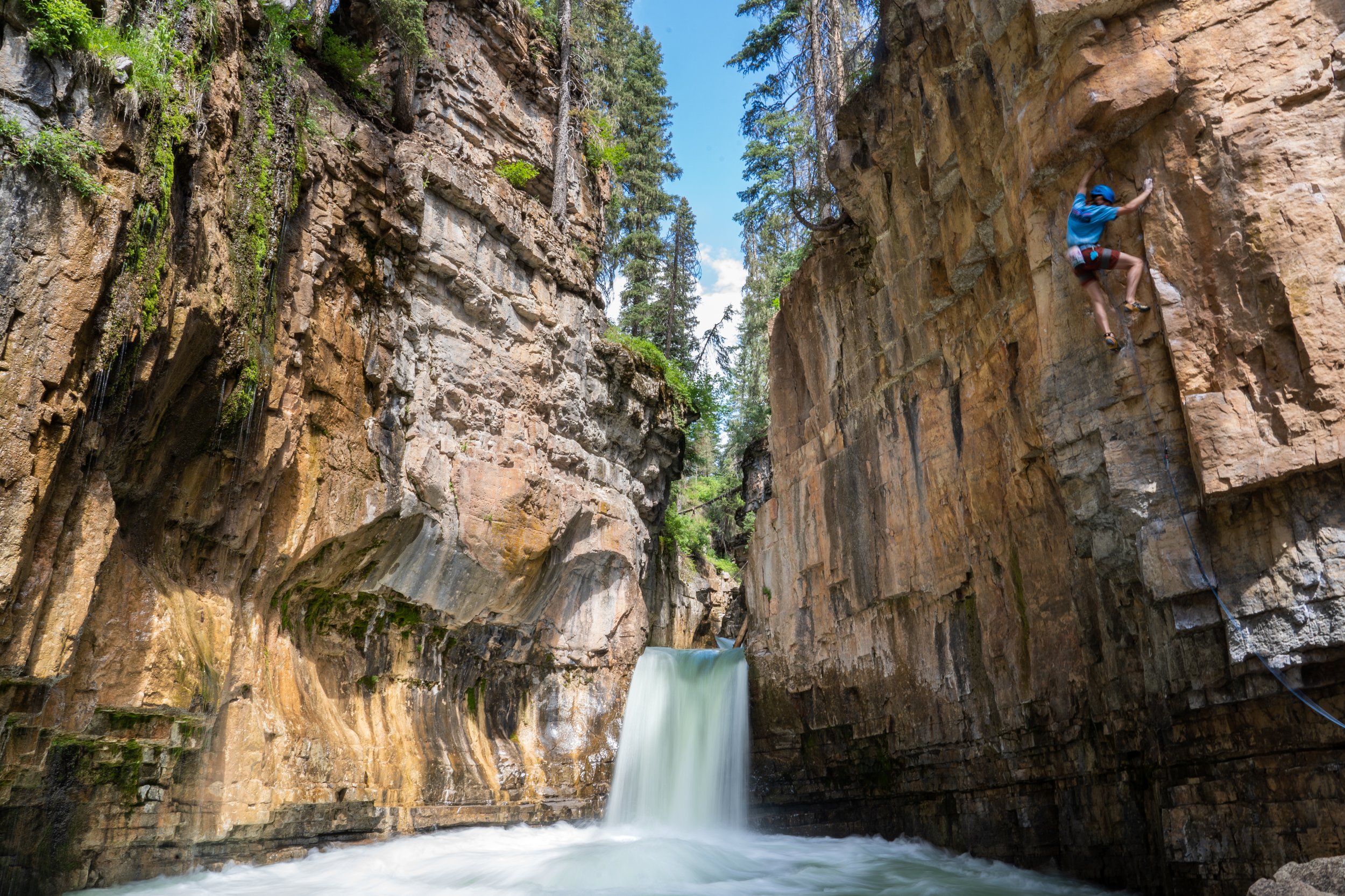
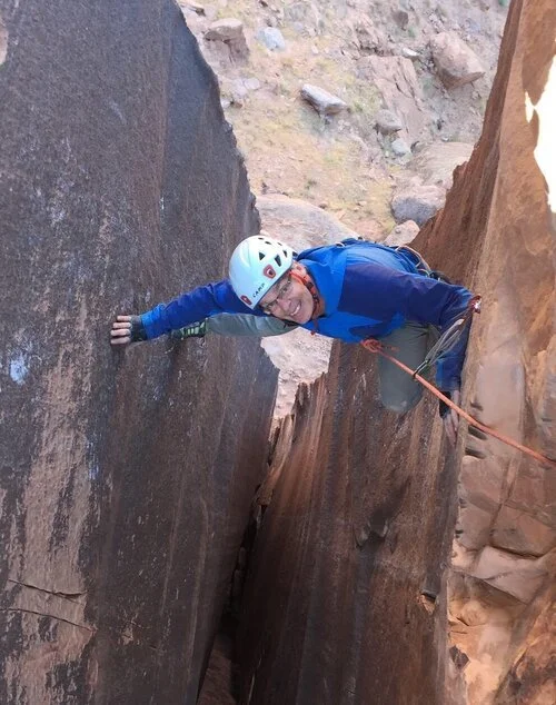
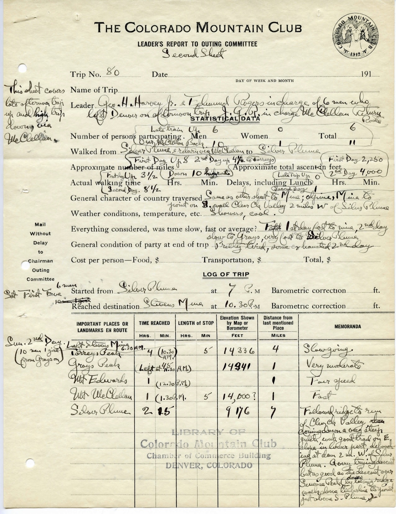
Grant Perdue feeling the water below on Close to the Edge, 5.11+ at Cascade Canyon. AAC member Will McKay

The Durango Climbers Coalition (DCC) started with a single issue: we wanted to secure a local beloved sport and ice climbing crag called Cascade Canyon. We had learned that the land—which contains challenging limestone sport climbing, our only local ice climbing, and a beautiful waterfall—was located on private property.

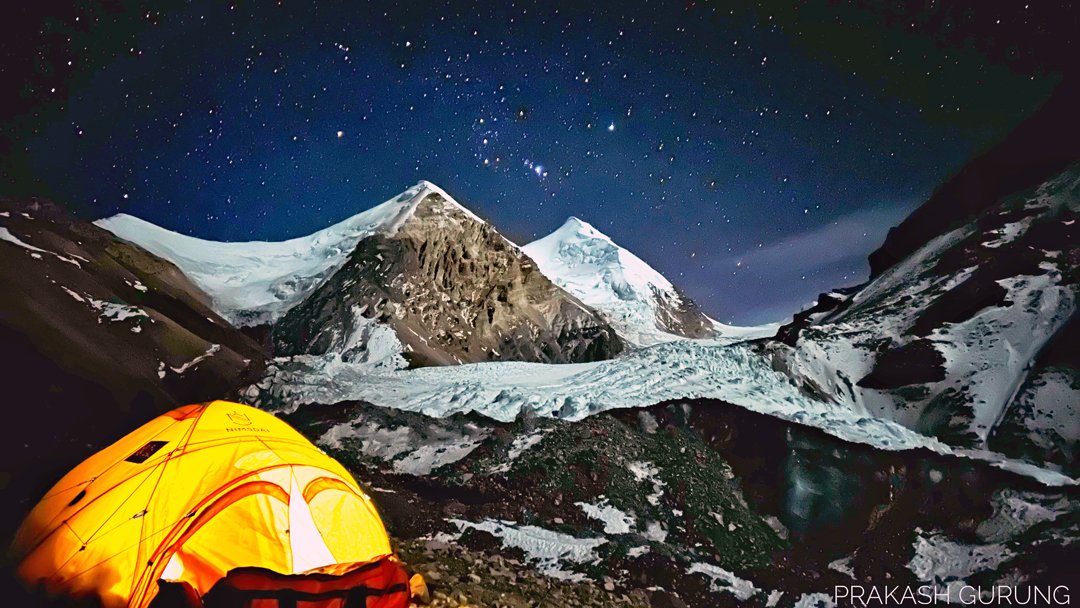
Cascade Canyon is home to one of the most aesthetic climbs in Southwestern Colorado: Close to the Edge. Climbers drop into the deep canyon before traversing under a wide collection of technical roof climbs until eventually reaching Cascade Creek, where the pumpy 11c emerges from the water. In the winter, climbers cross the frozen creek to a small but challenging group of ice pillars and mixed climbs. On the best days, you can lace up your ice boots for a few pitches of ice before crossing the river once more to round out your day with a couple rock routes, basking in the Coloradan sun. Few climbing areas offer such a bounty for the climbing community—no matter the season.

How could we secure this land for public use forever? This question led us down a rabbit hole of climbing activism.

Since then, we’ve realized that the Durango climbing community has several issues that need to be addressed, ranging from trail work needs to organizing cleanups of graffiti and trash. But for local climbing organizations like the DCC to successfully manage these kinds of concerns, they need ample resources. Enter our application for the American Alpine Club Cornerstone Conservation Grant.

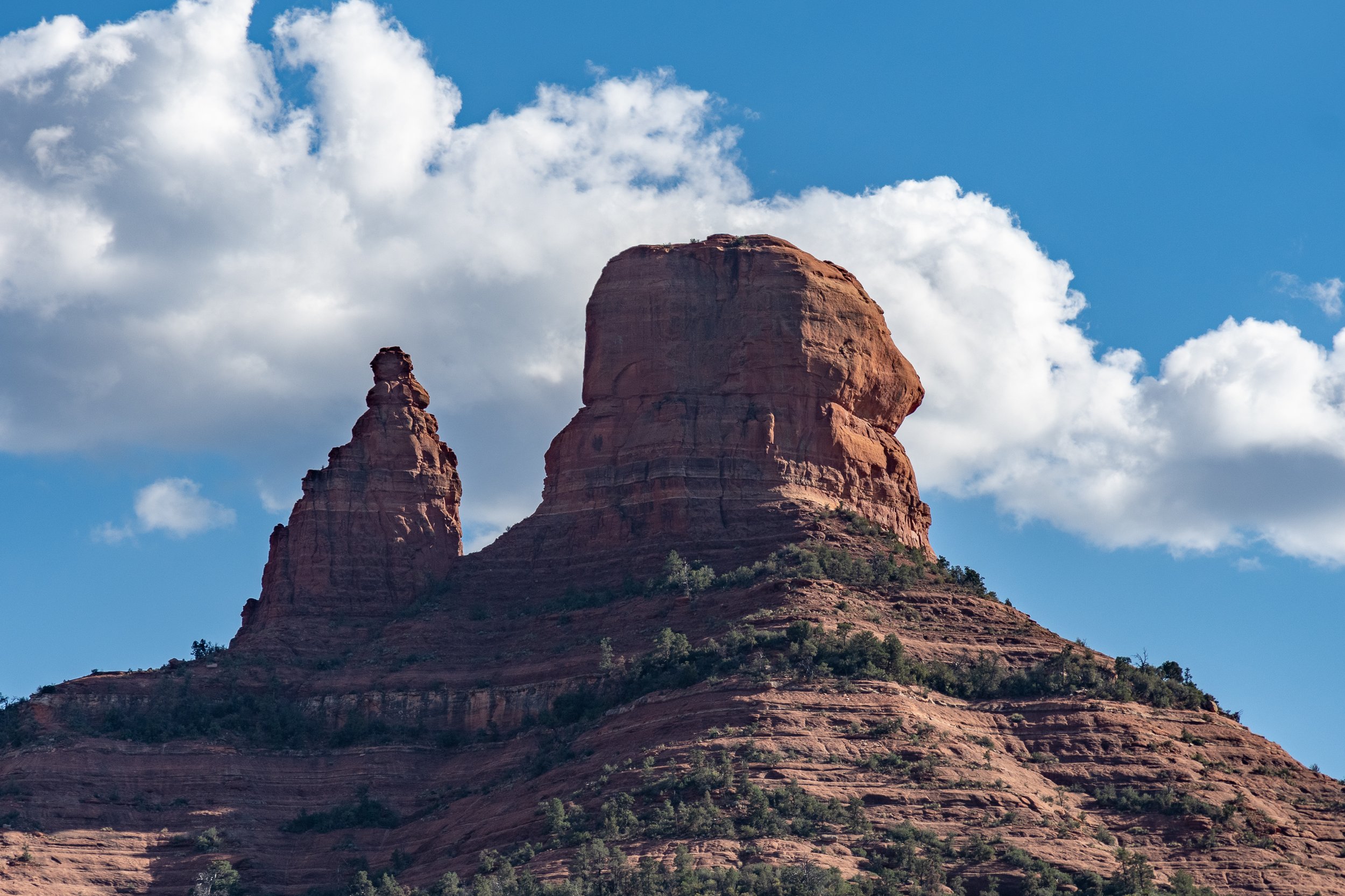
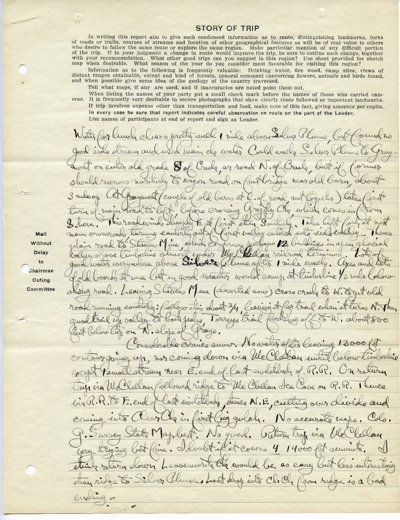
As much as Cascade Canyon needs protection, some of our other local climbing areas need some love. Animas Mountain, which contains several different climbing zones, and is a mere five minutes from downtown Durango, is at the top of the list. Bouldering is the main attraction with hundreds of blocks scattered in a zone climbers call Sailing Hawks. On the opposite side of the mountain rests X-Rock, containing an assortment of introductory routes and home to Durango’s local sandstone tower, perched high above the Animas River Valley. Excellent running and mountain biking trails provide access to the mountain’s summit and some of the city’s most aesthetic viewpoints.

Anika Bach enjoying her climb up X-Rock in Durango, CO. Land of the Diné Bikéyah, Pueblos, and Ute peoples. Grumpyhighlander photography

Last year, X-Rock was vandalized with several hundred square feet of graffiti, which led to a mobilization of the climbing community to clean it up. We’d previously teamed up with the City of Durango to clean up graffiti at Sailing Hawks, so we had a little bit of experience. This incident sparked action and built community, and the DCC led the way. After eight hours of effort, we restored the sweeping red walls of this scenic climbing area with the help of 18 local climbers, city and county officials, and a Colorado Springs based non-profit, Keeping Colorado Beautiful.

The problems with X-Rock were not over after the cleanup. Irresponsible public lands users have been trashing the area, leaving behind used needles, other forms of trash, and in one case, a gun.

The need for the grant was clear. Trail work and signage would be crucial as we fight to keep this public land safe and sustainable for climbers and other nature lovers. The 5k grant from the AAC will significantly assist with this endeavor. We will formalize the area with a climbers’ kiosk, reinforce eroded approach trails, and direct new climbers to their day’s objective with additional tail signage. This effort would not be achievable without the AAC’s support, along with the City of Durango and La Plata County.

We’ve had some progress on assisting with securing future access to Cascade Canyon. At the same time, we’ve realized the need for the Durango Climbers Coalition as an organization. This need will outlast any current member, and we are here to do the good work, with a lot of help from our friends at the American Alpine Club!


Colorado Policy Update: Protecting the Thompson Divide

Climbers stand up for the CORE Act, protecting the state’s outdoor heritage

by Lea Linse

*this article originally appeared in the AAC Summit Register, Issue 001

Tucked between the Rocky Mountains to the East and red deserts to the West lie 200,000 acres of quiet land known as the Thompson Divide. With its rolling hills, scrub forests, picturesque cattle pastures, and dusty sagebrush, the Divide lacks the grandeur and snow capped summits that you find in the nearby Maroon Bells-Snowmass Wilderness. It also lacks the throngs of summer hikers and incessant busy roads, instead offering meandering trails, trickling streams, and only a few quiet roads. Though it sits within an hour drive of the internationally renowned sport climbing mecca Rifle Mountain Park as well as the granite paradise of Independence Pass, I see why the Thompson Divide isn’t on climbers’ radar. It hosts only one small sport crag (a local favorite however), and the quality boulders, sport crags, and ice climbs around the tiny town of Redstone are just beyond the border of the Divide. While rock climbing isn’t going to put the Thompson Divide on the map, the Thompson Divide remains relevant to all of us.

In the last decade, the Thompson Divide gained notoriety as the centerpiece of a fierce grassroots campaign showcasing the importance of public land resources, and the value of citizen engagement in public land management.

The threat to development on the Thompson Divide has been long contested by Western Slope locals. Land of the Ute peoples. EcoFlight

The vast majority of the Thompson Divide is public land, managed by the Bureau of Land Management (BLM) and the US Forest Service (USFS) for “multiple uses.” This land supports a wealth of agriculture, tourism, and recreational opportunities like hiking, climbing, biking, and hunting. The Thompson Divide has been at the heart of the Roaring Fork Valley ranching community for more than a century, supporting 30+ successful farms and cattle ranches that graze animals on this rich land.

As a kid growing up in Carbondale, I understood early on that my quality of life was greatly improved by the access we had to the outdoors. This meant building forts, going sledding (the Thompson Divide had the best sledding hill around), and eating cheeseburgers from grass-fed beef raised fifteen minutes up the road in the Thompson Divide. In high school, at a time when I was itching for more independence and an escape from teenage drama, the safe and accessible public lands on the Divide allowed me to satisfy those needs through outdoor recreation. There, I learned to backcountry ski, went on my first no-adults backpacking trip with friends, and led my first sport climb.

In the late 2000s, rumors surfaced that a Houston-based company wanted to drill for natural gas in the Thompson Divide. The company owned several natural gas leases there, but had yet to develop them. When leases are developed the impact is noticeable. Development includes the building of new roads, frequent use of heavy machinery and subsequent truck traffic, and multiple wells with automated pumps. The expansive spider web of infrastructure required to service these leases is evident in nearby towns along the I-70 corridor, where, if driving from the Front Range of Colorado to Utah, you could see numerous natural gas wells and related facilities. This sprawling network is even more visible from the air. This development falls mostly within Garfield County, home to Rifle Mountain Park. This county produced more natural gas than any other county in Colorado—sometimes more than twice as much as other leading counties—from 2007-2014.

Natural gas development in the Divide quickly became the talk of the town in Carbondale. There were new articles in the paper almost daily about the topic, which my mom would clip and save for me to read. I remember reading about the newly formed Thompson Divide Coalition (TDC) in 2007, a group that would become the soul of the grassroots effort to conserve the Divide. TDC is governed by a diverse volunteer board of local stakeholders like ranchers, small business owners, and community leaders who all agree on one thing—the Thompson Divide is a place too special to drill for natural gas. They made clear from the start that they weren’t against natural gas development on the whole, and many of them even cringed at being called “environmentalists.” Rather, they simply wanted what was best for their community.

Around the time that the TDC was formed, natural gas development in Garfield County was exploding as a result of technological advances and federal policies that encouraged rapid development. As natural gas wells became more numerous in rural communities such as Parachute, Silt, and Rifle, public health concerns associated with natural gas development were frequently reported by residents.

For example, in 2010, Garfield County released a Health Impact Assessment specific to a drilling plan in the nearby community of Battlement Mesa finding that, “[this] development plan is likely to change air quality and produce undesirable health impacts in residents living in close proximity throughout the community...”. Additionally, in 2011, the nonprofit Global Community Monitor found elevated levels of “22 toxic chemicals,” including hydrogen sulfide in the air near natural gas drilling sites (and rural homes) in Silt. And in 2013, there was a notable benzene leak confirmed in Parachute Creek, near several residential water wells.

Thompson Divide Coalition members speak with a Forest Service representative to encourage the preservation of the Divide. Land of the Ute peoples.

With this backdrop of contamination reports and health complaints, residents near the Thompson Divide were extremely concerned about the impacts of drilling near their homes. Still, research on the topic remained scarce and sometimes conflicting, such as in a 2017 study conducted by the Colorado Department of Public Health and the Environment that claimed “the risk of harmful health effects (was) low for residents living near oil and gas operations” but called for further research on exposure risks. We know now, however, following the updated report in 2019 by ICF, that emissions near drilling and hydraulic fracturing sites can cause serious negative health impacts.

In addition to health and pollution concerns, one of the strongest arguments for protecting the divide were the economic benefits. Benefits the community argued, relied on the land remaining undeveloped.

An economic impact analysis completed in 2013 found that recreation, agriculture, and tourism—activities that locals argued would be most negatively impacted by natural gas development—collectively contribute nearly 300 jobs and $30 million to the local economy each year. In a town of only 6,500 people in 2013—those numbers make a big difference. These uses of the Divide are also sustainable. They’ve provided for the community for generations and would continue to, so long as the Divide was left free of development. This was an argument that helped to rally a broad base of supporters, well beyond those whose health or property might be affected.

There are many other benefits to not allowing oil and gas in the Divide. Extracting carbon rich fuels and leaching methane into the air is counterproductive to combating climate change. Leaving fossil fuels in the ground is truly a form of climate action. In addition, several of the areas up for lease at the time were federally designated roadless areas. By cutting roads into these pristine areas, natural gas development would disrupt wildlife like deer and elk, pushing them out of critical winter ranges and disrupting their migration and calving grounds.

Five years after the Thompson Divide Coalition formed, the area was as threatened as ever. I knew I had to add my voice to the fight so I started a student led initiative aimed at engaging young people in this local issue. I spoke at a town hall meeting in front of nearly 300 people and later helped organize a student delegation to deliver 1,152 letters from concerned citizens to the BLM headquarters in Silt, CO, asking them to let the leases expire.

These experiences opened my eyes to the challenges of grassroots activism, and the importance of local land managers and government officials. In the case of mineral leasing, almost all of the key decisions that we were concerned about were being made right down the road, in local BLM offices, at county commission meetings, and in town halls by people who lived in our communities, not politicians in far away places. Because of the proximity of decision makers, and our efforts to engage them, I feel we made a significant difference, not only in our community, but in the trajectory of the Thompson Divide debate.

What would be a key decider for the fate of several leases on the Thompson Divide would be the environmental impact analysis the BLM was forced to conduct in accordance with the National Environmental Policy Act. As it turned out, the BLM’s first analysis was improperly conducted resulting in their issuing of the leases illegally.

When the BLM released the updated draft EIS in November 2015, they received over 50,000 comments—most in support of protecting the Divide and doing away with the illegal leases. For reference, the population of Carbondale and Glenwood Springs combined amounted to less than 20,000 people in 2016, demonstrating the widespread nature of support from all surrounding communities and businesses. On top of that, the BLM hosted 3 public meetings for citizens to raise concerns. One meeting in Carbondale turned out a whopping 240 people on a Wednesday night!

With the consistent outcry from the public, and the updated environmental analysis, the BLM decided to cancel 25 undeveloped leases in the heart of the Thompson Divide—a reality that would not have emerged without the NEPA process.

Though several of the leases in the Thompson Divide have been cancelled, the area has yet to be removed from future leasing. The hope of permanent protection was introduced in a bill sponsored by Senator Bennett in 2017 called the Thompson Divide Withdrawal and Protection Act, which has since been lumped into a larger package called the Colorado Outdoor Recreation Economy (CORE) Act.

The CORE Act could have economic and ecological benefits for regions in CO beyond the Thompson Divide.

The CORE Act, recognizes the economic and ecological benefits provided by public lands like the Thompson Divide, and would permanently withdraw the Divide from new leasing. The Act also introduces protections for recreational opportunities in other locations across Colorado—designating wilderness in the San Juans, protecting climbing areas in the 10 Mile Range and preserving climbing history by establishing a first-of-its-kind National Historic Landscape to honor Colorado’s military legacy at Camp Hale.

The CORE Act, however, has met significant political resistance from certain actors. Representative Tipton, for instance, introduced a similar bill of his own, the REC Act, which is nearly identical to the CORE Act except that it doesn’t include protection for the Thompson Divide. Reportedly, this omission was due to concerns from some of Tipton’s constituents, mainly the Garfield County Commissioners, who have consistently opposed protections for the Divide and sided with oil and gas companies. The Thompson Divide Coalition has implored residents of Garfield County to write to their commissioners and tell them to support protections for the Divide, but with seemingly little result.

It is frustrating to see this resistance continue to perpetuate from Garfield County to higher levels of the government. For example, citing Tipton’s concerns (which drew on Garfield County’s concerns), Senator Cory Gardner is now mounting resistance to the CORE Act in the Senate.

I believe the outpouring of community support, and especially its sincerity, is what distinguishes the Thompson Divide and earns it a place in federal legislation. Not only did residents take every opportunity to provide comments, attend community meetings, speak to their local government face-to-face, and write letters of support; they did so with a unique non-partisan sincerity that is difficult to ignore.

Supporting the protection of the Divide didn’t mean you were against oil and gas development in other areas where the impacts to the community and the local environment were less demonstrable. Nor did it mean you were an “environmentalist.” Supporting the Divide meant you cared deeply about the land, the wildlife, and the well-being of a healthy ecosystem, and that even development of essential mineral resources had to be sensitive to local and environmental needs. As one rancher famously quipped in an interview, “I ain’t no granola-crunching hippy,” but he shared the community belief that the Thompson Divide was too special of a place to drill.

While the Thompson Divide may not be home to one of our nations’ classic climbing areas, the protections afforded by the CORE Act preserve world class recreation all across Colorado. It preserves our climate by keeping carbon in the ground, safeguards public health and protects critical wildlife habitat by maintaining unfragmented forests. Land management challenges like that of the Thompson Divide are not unique, although the landscape is. Agency officials all over the country are making decisions about the future of our public lands and the energy development that occurs on them. Without the continued support of citizens like you, and the leadership of elected officials who share our concern for these places, they won’t receive the protections they rightfully deserve. There’s no time to be a silent bystander, we need to use our voice, go vote and spark the change we want to see.

The Prescription - August 2021

Belayer is carried to a helicopter landing zone by Hellgate Cliffs in Utah, using a rope bag as an improvised litter. She had borrowed the leader’s helmet for belaying the pitch, which likely saved her from a much more serious injury. Photo courtesy of Salt Lake County Search and Rescue

The Prescription - August 2021

HEADS UP!

Below are two reports from the upcoming edition of Accidents in North American Climbing that share many similarities. Both involved climber-caused rockfall that hit belayers standing on the ground. Both were at sport climbing areas, where many belayers decide not to wear helmets—though, very fortunately, one of these belayers had borrowed the leader’s helmet because of concern about loose rock. In both cases, the belayer was using an assisted-braking belay device (ABD), and, in one case, this very likely saved the leader from a ground fall and significant injuries. Though rare, these incidents should make climbers think about the value of ABDs—and helmets—for belaying single-pitch climbs.


Belayer Hit by Rockfall

Utah, Wasatch Range, Little Cottonwood Canyon

On August 7, Avery Guest (female, 20) was climbing with her partner for the day, Jake Bowles (21), at Hellgate Cliffs, a limestone area high in Little Cottonwood. It was Avery’s second time climbing/belaying outdoors. Jake is an experienced climber.

They chose Monkey Paw (5.9), a single-pitch sport climb, for their first route of the day. Jake was leading, and he got about four bolts up the route (approximately 50 feet off the ground) when he reached for what looked like a good hold. When he weighted the hold, a torso-size rock detached from the wall. It split into three pieces, and one of them landed on Avery, knocking her unconscious. Jake fell approximately 10 feet, pulling Avery about a foot off the ground. She was using a Grigri, which caught Jake’s fall.

Avery regained consciousness quickly and noticed she had an open fracture on her right arm. She managed to lower her partner with her left hand, and he untied her from the belay system. She had post-traumatic amnesia, repeating questions multiple times. They called 911 at about 10:20 a.m. United Fire Authority paramedics and Salt Lake County Search and Rescue responded to the scene within 30 minutes. They gave her pain medication and improvised a litter with Jake’s rope bag in order to carry her about 100 feet down and away from the base of the rock, where Lifeflight could hoist Avery and transport her to the hospital for treatment.

She had two broken bones in her right arm that needed surgery, plus lacerations on her forehead and leg. She also had bleeding in her brain, but managed to avoid brain surgery. Jake suffered only minor scrapes and bruises during the fall.

ANALYSIS

Avery did not have a helmet, so Jake let her use his, knowing there might be rockfall in the area. If Avery had not been wearing Jake’s helmet, her head injuries could have been much worse and possibly fatal. The belay stance for this route was small and surrounded by steep, rocky slopes. Otherwise, she may have been able to move out of the way of the falling rock. (Source: Avery Guest.)

Rockfall Onto Belayer

Colorado, Rifle Mountain Park, Ruckman Cave

At approximately 4 p.m. on September 26, a climber started up The Promise, a 5.12c sport route on the left side of the Ruckman Cave. Just before a ledge at the start of the steep climbing on the route, the climber pulled onto a chalked-up jug that ripped out of the wall. The broken jug, along with more rocks and debris, rained down on the belayer. The climber’s fall was held at the first bolt of the route, and he slammed into the wall sideways, from which he sustained soreness and bruising. The belayer narrowly avoided being hit in the head or upper body by the debris and took all of the damage to his right leg. Fortunately, a visit to the emergency department confirmed no broken bones. (Source: Climber’s report at MountainProject.com.)

ANALYSIS

This incident highlights a paradox often seen at sport climbing areas: The climbers who choose to wear helmets while sport climbing more often are the ones leading or top-roping the climb, not necessarily the belayers and bystanders below the route. Yet, arguably, the belayer is much more likely to be hit by rockfall, which is fairly common in Rifle Mountain Park. More common than helmets at Rifle’s crags are assisted-braking belay devices, which can be a lifesaver in accidents like this one, when the belayer may be severely distracted or even incapacitated by rockfall. (Source: The Editors.)


Granite Peak from the south, showing A) Location of climber after fall from the Snowbridge, the saddle directly above; B) site of rappel anchor failure; and C) Position of fallen climber. Photo by Gallatin County Search and Rescue

MONTANA’S DANGEROUS HIGH POINT

In the two most recent editions of ANAC, we’ve published reports about numerous incidents on Granite Peak in Montana. One of the more difficult state high points, Granite Peak has semi-technical and technical climbs on several of its faces and ridges. Summer is peak season for the mountain, and it’s worth reading our reports before heading up there.

Rockfall, Anchor Failure (2021 ANAC): Natural rockfall during an attempt on the Notch Couloir and north ridge destroyed a belay anchor, with nearly disastrous results. 

Fall on Snow and Anchor Failure (2021 ANAC): Two falls occurred on September 5 on the east ridge, the standard route up Granite Peak, one of them resulting in a fatality.  

Unroped Falls in Class III/IV Terrain (2020 ANAC): Two falls occurred within the same week in August on the Southwest Ramp route of Granite Peak.

Fall on Ice | Inadequate Gear, Failure to Self-Arrest (2020 ANAC): Two climbers became disoriented after summiting by the east ridge, bivouacked below the summit, and then rappelled the north face to the Granite Glacier, for which they were ill-equipped.

DON’T BLAME THE ROCK

In the June Prescription, we posted a short list of tips for optimizing cam placements, originally published in ANAC 2019. Several climbers from Devil’s Lake in Wisconsin took exception to our generalization about cam placements in the Lake’s “clean but slippery” cracks. AAC member Matthew Clausen elaborated in the following letter to the editor, making some great points about the dangers of blaming the rock for cams that don’t hold.

Devil’s Lake, Wisconsin. Photo by Matthew Clausen

Like many climbers, I pay attention to the AAC’s Accidents in North American Climbing. I value the continued learning required to climb safely. While reading June’s “Prescription,” I felt concerned about this warning: "Numerous reports document that well-placed cams can pull out of wet or dirty rock or even perfectly clean but slippery stone like Yosemite granite or Devil’s Lake quartzite."

In more than a decade of climbing at Devil's Lake, I have never seen a cam slip out of a good placement. All reports of this happening, that I am aware of, were better explained by bad placement upon review. Most often, the failed cams were in an outward flaring crack or without the lobes properly engaged.

I agree with the AAC recommendations that climbers continue to learn more about what makes for a good placement, seek qualified instruction and mentoring, and remember to back up crucial placements. The learning process and experience help us tell fact from myth.

Myths about climbing skills are potentially dangerous. If climbers wrongly believe cams are unsafe in the Baraboo Range’s hard, smooth quartzite, they may feel compelled to:

1) Use less efficient gear for protection, or 
2) Commit to unnecessary runouts, or 
3) Become lax about the subjective hazard of poorly placed cams because they don’t believe a good placement is even possible.

Rather than blaming the geology, we need to combat the complacency of cam placements: These are not magical devices that will hold a fall in any crack. We will bear responsibility for the quality of our decisions.

Sincerely,

Matthew Clausen, Madison, Wisconsin

THE SHARP END VISITS COLORADO

Listen to Episode 67 of the Sharp End Podcast for the story of a helicopter rescue on the long Ellingwood Ridge of La Plata Peak, a Colorado 14er.


WANTED: CLIMBERS WITH INJURED KNEES

Researchers at Rutgers New Jersey Medical School are seeking climbers to participate in a research survey looking at climbing-related knee injuries. You are eligible to participate in this study if you are 18 to 89 years old, climb at least four times per year, and have sustained a knee injury in a climbing-related incident. The anonymous online survey asks injured people about how much they climb and where they climb, how the knee injury happened, and how they recovered. The survey takes about 10 minutes to complete.


The monthly Accidents Bulletin is supported by adidas Outdoor and the members of the American Alpine Club.

The Prescription - June 2021

Rescuers in Banff National Park heli-sling a patient to a staging area below Mt. Louis after a failed protection placement led to a very long fall. Photo: Parks Canada

The Prescription - June 2021

Leader Fall – Inadequate Protection (Banff National Park, Alberta)

This report will appear in the 2021 edition of ANAC. It highlights a problem that climbers occasionally experience: seemingly well-placed cams that unexpectedly pull out of cracks.  


On August 28, 2020, an experienced party set out to climb Homage to the Spider (5.10a) on Mt. Louis, near Banff. The route is an alpine rock climb with a three-hour approach. It starts with a few hundred meters of third- and fourth-class scrambling to reach a bolted anchor. From this anchor, there is a short descent into a gully, where the technical rock climbing starts.

The first pitch is 5.9 and includes a corner that is often dirty or wet. The leader started up this first pitch and made an extra effort to place some smaller pieces in the lower part of the pitch. The upper part consists of a wide crack that can be protected with number 4 cams. In an effort to keep packs light, the climbers had brought only a single number 4, intending to bump that cam up the wide section. The leader had climbed the route several times before and felt comfortable with this tactic.

High on the pitch, the leader set the big cam and committed to the final moves up to the anchor. During a layback move, one foot slipped and the climber started falling. The number 4 cam pulled out of the rock, and the climber kept falling before being stopped by a smaller cam lower down. The climber’s body contacted some ledgy terrain, and at least one ankle was broken. The belayer lowered the injured leader to the bottom of the climb, and the party called for help using their Satellite Emergency Notification Device (SEND).

Banff Visitor Safety personnel responded via helicopter and assessed the scene. The gully where the patient was located was too tight for helicopter access, but rescuers were able to move the injured climber and partner to the anchor above the pitch, from which the climbers and rescuers could be slung out to a staging area in the valley below.

ANALYSIS

RESCUER REQUEST: Another party was on Homage to the Spider on August 28, ahead of the injured party. Rescuers worried that rockfall from the party above might threaten the climbers and rescuers below. As a general rule, if you are above an accident scene, stop moving while the rescue is in process. This will greatly reduce the chance of knocking rocks, ice, or other objects onto the scene below. — Ian Jackson, Visitor Safety Technician

The leader was very experienced and had climbed Homage to the Spider six times. The route and gear requirements were known in detail. The leader also had a lot of experience placing trad gear and described the number 4 cam that pulled as “90 percent good.” In hindsight, the leader thought the cam pulled because the sides of the crack were coated with fine dirt and limestone dust. Meltwater from snow high up on the route funnels down the corner on pitch one, and this pitch is always covered in varying degrees of dirt. The leader felt that dirt on the sides of the crack decreased the friction between the cam lobes and the rock and made the placement, which otherwise appeared to be good, inadequate.

This is a common problem on alpine routes and even more so in winter with ice and water ever present. Cams are highly suspect if the friction of the cam lobes on the rock is inadequate. Passive protection that has a tighter fit—such as nuts, hexes, or pitons hammered into cracks—might inspire more confidence when the friction of the side walls is an issue.

On previous ascents of this route, the leader often had not placed the smaller cam that actually caught the fall. The leader made an effort to place more pieces this time and was very glad to have done so. That small cam had been deemed a much worse placement than the larger cam that pulled—but you never know what can happen. If you are relying solely on one piece and it pulls, the outcome could be very bad. (Source: Ian Jackson, Visitor Safety Technician, Banff, Yoho and Kootenay National Parks.)

CAMS IN SLIPPERY ROCK

A cam placed in a constriction often will have greater holding power in wet or dirty rock.

Numerous reports document that well-placed cams can pull out of wet or dirty rock or even perfectly clean but slippery stone like Yosemite granite or Devil’s Lake quartzite. What can be done to minimize this hazard?

• Lubricate cams and fix or replace units with sticky lobes or bent trigger wires to maximize their holding power. This report from the New River Gorge shows what can happen when cams are sticky.
• Choose the right cam for a placement—it should fit in the unit’s optimum range.
• Orient the placement in the direction of anticipated load, and extend it with a quickdraw or sling to maintain the correct orientation.
• Look for constrictions in the crack that will increase a cam’s holding power.
• Use more passive pro: A well-placed nut may be more resistant to pulling out of slick rock than a cam.
• Never say “good enough.” If a placement doesn’t look great, fix it or find another. Consider doubling up on protection before cruxes. (Source: ANAC 2019, p. 102.)


THE RED ROCK POOPACALYPSE

By Stefani Dawn

In January 2021, Erik Kloeker and his climbing partner were minding their own business when someone dropped theirs.

Erik was belaying in one of the middle chimney pitches of the super-classic 1,500-foot route Epinephrine at Red Rock Canyon, Nevada, when he heard something fly past him and crash into the rock about a pitch down, just below his climbing partner and just above their friends in the following party. There was an explosion and then multiple ricocheting hits of what appeared to be a Nalgene bottle and its contents flying everywhere. But it wasn’t Gatorade spraying the walls of Black Velvet Canyon. It was human feces.

The climber that "dropped the deuce" explained that after pulling the bulge on the route’s final 5.9 pitch, he realized he couldn't resist the call of nature one minute longer. He attempted to go into a plastic Diamond almond bag, with the intentions of carrying it out, but the opening wasn't wide enough. The poopetrator got out a Nalgene water bottle to wash the resulting mess off his hands and the ledge, and to place the offending material inside, again with the intent of carrying out the waste. But as he was maneuvering on the ledge, his foot accidentally kicked off the feces-filled bottle—a moment that will live in infamy in the annals of Red Rock climbing.

Funny, yes…sort of. But such accidents create genuine hazards, not just from falling “objects” but also from the unsanitary conditions that will be encountered by dozens of climbers a week on a popular route like this. An excellent solution is to carry an appropriate poop bag, such as Restop 2 or Cleanwaste Go Anywhere (formerly Wag Bag), which have convenient large openings and contain odor-absorbing material, TP, and a handy wet-wipe. They weigh about three ounces and slip easily into a pack or coat pocket, so there’s no excuse not to have one at the ready.

If you'd like to support the "poopacolypse prevention" cause, the Southern Nevada Climbers Coalition, which helps stock poop-bag dispensers at Red Rock, is currently conducting a waste-bag fundraising campaign. Find the donation link at the bottom of this page.

Stefani Dawn is a Las Vegas–based regional volunteer for ANAC and editor in chief of the online magazine Common Climber, which celebrates the fun in climbing and all climbers wherever they are in their climbing journey. 

THE SHARP END

Matt and Trevor had plenty of experience hiking 14ers in Colorado, so when Matt's dad was in Colorado for a visit, they decided to take him up Mt. Bierstadt so he could check off his first 14er to celebrate turning 70. On May 8, 2021, the group was nearing the top when the weather changed dramatically. They and another group of hikers suddenly found themselves in a lightning storm with extremely low visibility and rapidly dropping temperatures.

In this episode of the Sharp End, find out what Trevor and Matt learned about making decisions on the fly and how that extra gear we keep with us "just in case” might actually come into play. The Sharp End podcast is sponsored by the American Alpine Club.


The monthly Accidents Bulletin is supported by adidas Outdoor and the members of the American Alpine Club.

The Prescription - April 2021

Just tie the darned knot! Photo by Ron Funderburke.

The Prescription - April 2021

LOWERING ERROR – NO STOPPER KNOT

A PERSONAL STORY FROM THE EDITOR IN CHIEF

One of the most common incidents reported in Accidents in North American Climbing is lowering a climber off the end of the rope (specifically, allowing the end of the rope to pass through a belay device, causing the climber to fall to the ground). As the editor of Accidents for the last seven years, I am all too familiar with this accident type. Yet late last year, I allowed it to happen to me.

In sharing this story, the last thing I want to do is blame my belayer. I firmly believe that climbers are largely responsible for our own safety, and, as I’ll explain, I had enough information and know-how to make much better decisions before starting up this route.

The climb was our warm-up on a sunny October day at Staunton State Park in Colorado. The Mountain Project description of this 5.9+ sport route said it was 95 feet high and that you could lower with a 60-meter rope with care. We had brought a fairly new 60-meter rope to the crag. The pitch was obviously long: I couldn’t see the anchor over a bulge up high, and the description said there were 14 protection bolts. But all these clues didn’t prompt me to tie a stopper knot in the belayer’s end of the rope before heading up.

During the long pitch, I made a mental note to tell my belayer to keep an eye on the end of the rope as I lowered off, and I thought the same thing as I rigged the anchor for top-roping. But I couldn’t see the belayer on the ground until I had lowered for 35 or 40 feet, and by then I’d forgotten my plan to warn the belayer to watch the ends.

Photo of the author by Mark Hammond

Three or four feet off the ground, as I was backing down ledges at the base of the climb, the rope end shot through the belayer’s device and I tumbled to the ground, knocking over the belayer and rolling across a stony belay platform. Fortunately, neither of us were injured, but we were both badly shaken.

Did I feel stupid? You bet I did. I can’t tell you how many times I’ve written some form of this sentence in the pages of Accidents: “A stopper knot in the end of the rope would have prevented this accident.” I even urged readers to make a pledge to tie stopper knots in an editorial a couple of years ago. How could I have neglected this basic step? It was complacency, plain and simple.

No one is immune to mistakes. The only way to ensure you’ll have a stopper knot when you need it is to tie one every time. (Or you can tie the belayer’s end to a rope bag, or the belayer can tie in to close the system.) Every time. It feels silly for short pitches, but it forms a routine, so you’ll be prepared when it really counts. Tying the knot also subtly influences your climbing partners and other climbers at the crag; hopefully, they’ll develop their own good habits.

The Mountain Project description for that climb at Staunton has been revised, and now it should be clear that a 70-meter rope (or some easy downclimbing with a 60m) is needed. But ropes shrink, ropes get cut, your partner might have forgotten which rope he brought. A stopper knot is the ultimate shield against bad beta. It’s also a wonderful antidote to complacency.

I got off easy last October, and I’ve finally learned my lesson. Closing the belay system takes only seconds, and there is no downside. So, please, don’t repeat my mistake. Just tie the darned knot.

— Dougald MacDonald, Editor

THE SHARP END PODCAST

Back in 1982, Jean Muenchrath and her partner summited Mt. Whitney as the culmination of a winter ski traverse of the John Muir Trail. On the summit they were caught in a severe snow and lightning storm. During their attempt to escape the mountain, her partner took a long sliding fall, and then Jean, trying to get down herself, also fell and bounced down through rocks for more than 150 feet, enduring massive trauma. Listen to this episode to hear a true story of tenacity and survival. The Sharp End podcast is sponsored by the American Alpine Club.

MEET THE RESCUERS

Dr. Christopher Van Tilburg, medical director for Mt. Hood rescue teams, gives us an update on climbing and COVID-19.

Home town: Hood River, Oregon

Christopher Van Tilburg near Everest Base Camp, Nepal.

Volunteer and professional life: I’m a rescuer and medical director for Hood River Crag Rats and medical director for Portland Mountain Rescue, Pacific Northwest SAR, and Clackamas County SAR. Basically all the areas around Mt. Hood. My day job is working for Providence Hood River Memorial Hospital in clinic and the emergency room, but also at the Mount Hood Meadows ski resort (21 years!). Finally, I’m the Hood River County medical examiner and public health officer, which is a good complement for public safety and SAR work. 

How did you first become interested in search and rescue?

I grew up with parents who spent lots of time volunteering in the local community and abroad. They were involved in the Friendship Force, a person-to-person exchange program, and Christian Medical Society. Initially I became interested in wilderness medicine through doing medical relief programs. Then, in medical school, I realized it was a way of merging my passion with the outdoors, medicine, and my interest in volunteering. 

Any personal climbing accidents or close calls?

I almost died on Mt. Hood in an inbounds ski accident. One weekend we had six inches of rain followed by freezing temps, so the snowpack froze solid. Then we had a foot of snow. I fell and ended up having emergency surgery. It put things in perspective: Things can go bad at any time, in an instant. 

What sort of work are you doing with SAR teams in relation to COVID-19?

I put together or assisted with most COVID-19 protocols for the teams where I am medical director. It was particularly challenging because recommendations changed as the pandemic evolved. 

Given that most of our readers are climbing outdoors, how worried do they need to be about catching or transmitting the virus?

Outdoor activity is very low risk. Probably the biggest risk is driving in a closed vehicle to the mountain or crag or sharing a tent. I’ve been vaccinated since very early, but I—and my ski buddies—still wear a mask on the commute up the mountain. Vaccination limits risk, wearing a mask limits risk, washing hands and trying to keep your distance limits risk. Employ these three things and you’ll be much safer. 

What other precautions can climbers and mountaineers take?

Forming a pod of people with whom you climb regularly will help. Then, do a quick safety check before leaving the house to pick up your buddy: Are you sick? Have you been exposed to someone sick? 

With vaccination increasing and so many states opening up, even as COVID variants are spreading, how should climbers adjust their risk assessment during the spring and summer months?

Right now, keep wearing a mask. We don’t know yet about variants, how effective the vaccine will be. We also have many cases of people vaccinated but still getting COVID-19. So, I’d say, don’t be too eager to stop wearing the mask. 


Share Your Story: The deadline for the 2021 edition of Accidents in North American Climbing is April 30. If you were involved in a climbing accident or rescue in 2020, consider sharing the lessons with other climbers. Let’s work together to reduce the number of accidents. Reach us at [email protected].

The monthly Accidents Bulletin is supported by adidas Outdoor and the members of the American Alpine Club.

The Prescription - October 2020

A severe storm on the first full day of summer caught two climbers high on 14,197-foot Crestone Needle in southern Colorado. After descending the Ellingwood Ledges route for about 1,000 feet, the two spent a cold night on a tiny ledge (circled). Photo: Patrick Fiore.

The Prescription - October 2020

EPIC ON ELLINGWOOD LEDGES

STRANDED | Storm, Darkness, Inexperience

On Friday, June 21, 2019, two climbers from Kansas (ages 23 and 30) drove up to the east side of the Sangre de Cristo Range. Their goal was the Ellingwood Ledges (a.k.a. Ellingwood Arête) on the east side of Crestone Needle, one of the “Fifty Classic Climbs of North America.” The 2,000-foot route ends at the summit of the 14,197-foot peak.

The next morning, under sunny skies, they started climbing at 9 a.m. via the route’s direct start. Their iPhone weather app showed a forecast of “partly cloudy with a 20% chance of showers.” Enjoying warm weather and dry rock, the duo made good time cruising the easy 5th-class pitches at the bottom and the 3rd- and 4th-class ledges in the middle of the route. However, at the route’s crux, just a few hundred feet below the summit, the 5.7 to 5.9 cracks (depending on exact route) were filled with ice. Clad in rock shoes and with no ice axes, they couldn’t climb past the thin ribbons of ice. Meanwhile, the sky turned gray as, unbeknownst to the pair, a strong winter-like storm was barreling in from the west.

Around 4 p.m. the storm hit, with intense snow showers along with thunder and lightning. The pair put on their light fleece jackets and waterproof jackets. With visibility dropping to 30 feet, they kept trying to climb, thinking safety would be gained by going over the top and descending the standard route. (In fact, the 3rd-class normal route up and down Crestone Needle is exposed and tricky to follow, and has stranded climbers even in the best weather.) Eventually, realizing they could not go up, the pair called the Custer County Sheriff’s Office to request assistance. It was about 5:30 p.m.

Custer County Search and Rescue (CCSAR) began planning for a technical rescue. The climbers started down, building rappel anchors and occasionally downclimbing, a descent they described as “terrifying.” They made steady progress and continued to give updates to CCSAR. (Cell service is very good high on the Crestones.) At approximately 9:30 p.m. and at 13,030 feet, soaked and shivering hard, and nearly out of gear to build anchors, the pair grew concerned their fatigue could affect their safety if they continued. In a call with CCSAR, a senior member told them not to continue down if they were not completely confident in their anchors. They decided to stop and wait for morning on a snow-covered ledge about as wide as a lawn chair. 

Rescuers staging below Crestone Needle in the Sangre de Cristo Range in southern Colorado. Photo courtesy of Dale Atkins.

Given the complexity of the situation, CCSAR began planning a parallel rescue effort: one ground-based and another by helicopter hoist. Members of various other rescue teams started toward the area to help, and a line of communication was opened with the Colorado Army National Guard (COANG). 

High on the mountain, light snow continued to fall until about 1 a.m., and then, as the skies cleared, the temperature dropped into the lower 20s (F). Their sodden clothing froze hard and their joints turned stiff. They had found no gear placements, so they had no anchor. Afraid to even stand up for fear they might fall, they stayed put. The two were so miserable and scared that they each called parents and siblings to say good-bye, thinking they might die before sunrise. 

By 3 a.m., rescue teams started to arrive at CCSAR’s base in Westcliffe. An hour later, over 20 mountain rescuers from four counties were hiking toward the base of Ellingwood Ledges. All the while, CCSAR liaised with the National Guard to coordinate a helicopter extraction utilizing two Alpine Rescue Team hoist rescue technicians. Weather conditions were questionable, and it was not until well after sunrise that the helicopter mission became a “go.” After a 130-mile flight, Black Hawk 529 out of Buckley Air Force Base arrived overhead at about 9:45 a.m. and determined a hoist insert and extraction was possible.

Two rescue techs were lowered to the stranded climbers. Other than being very cold, stiff, hungry, and thirsty, the climbers were in remarkably good condition. The morning sun had thawed and dried their clothes, and warmed their spirits. The two were helped into rescue harnesses, and when the Black Hawk returned, the climbers and rescuers were hoisted two at a time and flown to CCSAR’s base in Westcliffe. By 2:45 p.m., all the ground teams had returned safely to Westcliffe, ending a 22-hour mission. 

ANALYSIS 

The two climbers were capable multi-pitch crag climbers who aspired to do their first alpine or big-mountain route. They had the skill to climb this route in summer conditions; however, the preceding winter had been one of Colorado’s snowiest in many years. Though the calendar said early summer, snow and ice on the high mountains was similar to mid-May. The arrival of the storm only worsened the situation. 

The storm had been well forecasted for the mountains, but the pair did not get the right forecast. Many phone apps present weather for nearby towns, so the climbers got the forecast for Westcliffe, located in the valley to the northeast of the mountain. Then they typed in “Crestone” and another benign forecast popped up—however, this forecast was for the hamlet of Crestone, low in a valley on the west side of the peak. Seeing two good forecasts, the climbers were confident. But there was a very different forecast for the peaks 6,000 feet higher. [Editor’s Note: 14ers.com links to NOAA spot forecasts for each of the Colorado 14ers.] 

The climbers had a good alpine rack but left nearly all of it as they rappelled and downclimbed nearly 1,000 feet of snow-covered rock and grass. In their packs they carried shell jackets, beanies, gloves, and good socks—barely enough protection. They climbed in rock shoes and carried light trail shoes for the descent. In a typical summer, these shoes would have been fine, but had they reached the summit, their descent off a very snowy and icy Broken Hand Pass would have been difficult. 

To their credit, these climbers kept their wits and survived a miserable night in a very exposed spot. They tried very hard to self-rescue and did a phenomenal job to descend as far as they did. 

The role of luck—good and bad—plays a much larger role than we often acknowledge in such situations. In the Sangre de Cristo Range, the weather cleared soon after midnight, leaving the climbers with drying conditions. Further north, in Colorado’s central and northern mountains, the storm continued all night, and upwards of two feet of snow fell. These two put themselves in a place to be lucky when they wisely decided to stop. Surviving a miserable night is always easier than surviving a fall. (Sources: Dale Atkins, Alpine Rescue Team and Colorado Hoist Rescue Team, and Jonathan Wiley and Patrick Fiore of Custer County SAR.)  

THE SHARP END: EPISODE 57

Brian Vines was a high school senior and a budding climber in the 1990s when he and some friends went to Sand Rock, Alabama, for a day of top-roping. On their last climb, a simple mistake led to a damaging ground fall. More than two decades later, Brian and hostess Ashley Saupe look back at that day for the Sharp End podcast. Brian has returned to climbing, and his 14-year-old son, J.T., now leads many of their climbs. But the lessons from that day at Sand Rock still guide their every move.

30 YEARS OF ACCIDENT DATA

The September issue of Rock and Ice features an article by AAC member Eliot Caroom presenting a unique analysis of reports in the last 30 years of ANAC (more than 2,700 accident narratives in all). Eliot created a database of keywords to examine the characteristics of accidents in ways not possible with our annual data tables. The results are very enlightening. For example, it’s well-known that many accidents happen during descents (about 32 percent in Eliot’s sample), but his method also reveals that rappel errors were a factor in 29 percent of descent accidents, and another 14 percent involved strandings. Moreover, nearly one-third of all accidents involving a rappel error led to a fatality. Eliot has offered to share his one-of-a-kind database so other researchers can mine this information. Read the story and learn more here.

TECHNIQUE TO TRY: PRE-RIGGED RAPPELS

Two rappellers ready to go. Photo courtesy of Alpine Savvy.

Pre-rigging or “stacking” rappels is a technique that is used most often by guides but it also offers multiple safety and speed benefits to any experienced climber. Pre-rigging is when each member of the climbing team attaches an extended device to the ropes at the rappel anchor before anyone begins to rappel. The technique allows everyone to check each other’s rappel setup, and it provides other safety and efficiency benefits, including the fact that only one stopper knot is needed at the end of the rappel ropes. The pros and cons of this technique are well explained in this article at Alpine Savvy.

Pre-rigging is not appropriate for every rappel, and expert instruction is recommended. Once you learn the technique, however, you may be surprised how much you like it for long series of rappels.

ROPE RECALL

Petzl is recalling a number of low-stretch kernmantle rope after a report that a defective rope was discovered earlier this year. No accidents or injuries have been reported. The recall is a follow-up to a July request for inspection issued by Petzl. The voluntary recall notice, issued by the U.S. Consumer Product Safety Commission, is dated September 30 and covers more than 15,000 ropes sold in the United States and Canada, mostly for professional access work and rigging, as well as some caving and climbing applications. The owners of ropes with certain serial numbers are asked to inspect their ropes and contact Petzl if specific problems are discovered.

MEET THE VOLUNTEERS

Lindsay Auble, Regional Editor for Kentucky, Arkansas, and Tennessee

Years volunteering with ANAC:

Home crag: Red River Gorge, Kentucky

Lindsay at home in the Red. Photo: Johnny Nowell.

Favorite type of climbing: Single-pitch sport. Each season I choose a few routes to project at the very edge of my ability. I love the process of breaking down a climb and training each move. It can be frustrating at first; I can’t count the number of times I’ve said, “I can’t do that move.” But after weeks of problem-solving, training, and engraining muscle memory, the moment it comes together is that much sweeter because of every failed attempt.

How did you first become interested in Accidents

I started climbing outside in the Red River Gorge and was very lucky to have a strong community of climbing mentors . When I was relocated for work, I asked one of them for suggestions on how I could continue my climbing education, and he pointed me to the AAC and the Accidents publication. Now, every incident I edit is a research project. After I gather the details of the accident, I consult with experienced climbers, guides, and first responders to fully understand why it occurred. We have even set up several situations on practice anchors in the house. In the process of unpacking the “why?”, I have greatly expanded my knowledge of climbing gear and techniques.

Why do you think accident reporting is important?

For a decade, I worked as a chemical engineer, mostly with the construction industry, which is constantly working to improve safety metrics. They found that companies that continuously discuss safety incidents and near misses have significantly fewer accidents. It reminds people of the potential consequences and pulls them out of autopilot, especially when the activity is repetitive. Almost all of the climbing accidents I have analyzed have been at least partially attributable to human error.

Personal scariest “close call”?

While I’ve had an off-route moment with potential consequences that scared every molecule in my being and a low fall that resulted in an injured tailbone, I feel the scariest moments have been a bit more innocuous. Once I hung near the top of a route and then noticed that my knot had threaded only the waist loop tie-in point. I thought, “Huh, this somehow made it through all our safety checks.” Or lowering from a route and realizing that I didn’t remember cleaning it. Kind of like arriving somewhere and not remembering the drive, because you’ve done it hundreds of times. So scary!!

Personal safety tip?

After an accident that devastated our community, we are getting in the habit of weight-testing the system before leaving the ground. After our regular safety checks and stick-clipping the first bolt (a must in the Red), both climber and belayer lean back and weight the system, loading the knot and engaging the belay device. In addition to serving as a demonstrative check of the system, this method has the added bonus of tightening the knot and removing a little stretch in the rope to better protect a low fall.

What is your favorite thing to do when you are not climbing?

I’m a huge fan of puzzles and games. If there is such a thing, I might have a clinical sudoku addiction. When my boyfriend and I traveled to Las Vegas, I think we were close to splitting our time equally between climbing and the Pinball Hall of Fame—my boyfriend wins free games and then I use them up when he moves on to a different machine. In fact, we even created a game ourselves: Crag Crushers.

Share Your Story: If you’ve been involved in a climbing accident or rescue, consider sharing the lessons learned with other climbers. Let’s work together to reduce the number of accidents. Contact us at [email protected].

The monthly Accidents Bulletin is supported by adidas Outdoor and the members of the American Alpine Club.

AAC Volunteer Major Byron Harvison joins state Governors & OREC Directors at the Outdoor Recreation Learning Network

Major Byron Harvison (center in green) at the 2018 Hill to Crag in North Carolina.

Byron Harvison is an active duty Army major, an avid climber, and a passionate member of the American Alpine Club. He has also played a leading role in the AAC’s Hill to Crag campaign which is an annual event series that brings together veterans, active duty service members, AAC volunteers, state offices of outdoor recreation, and local, state, and national policymakers for a day spent climbing at local crags. This past week, Byron had the opportunity to represent the AAC at the National Governors Association (NGA) Outdoor Recreation Learning Network held in Salt Lake City. The network’s mission is to “advance the outdoor economy and workforce, conservation and wellness” and was created to “help governors and their staffs explore strategies to leverage their unique natural, cultural and historical resources and help promote economic, social and environmental benefits”.

The inaugural meeting was held at the Natural History Museum in Salt Lake City, UT, with governors from UT, MT, OR, VT, ME, and NV in attendance. Each state’s respective Director of the Office of Outdoor Recreation was in attendance as well. Eric Artz, the CEO of REI, David Weinstein, OIA’s state and local policy director, and Jessica Wahl, Executive Director of the Outdoor Recreation Roundtable attended the event and shared closing remarks following the governors. After the media event, select invitees from the outdoor recreation community walked the Red Butte Gardens to carry on discussions and hear from Dr. David Strayer about the behavioral health benefits of time spent outdoors.

Byron had the opportunity to speak substantively with several Outdoor Recreation Directors about hosting future Hill to Crag events in their states as well as build connections with potential sponsors and attendees. Following an extremely successful partnership with REI on the 2018 North Carolina Hill to Crag event, the AAC is excited to launch into another year of Hill to Crag events very soon. Stay tuned to see this event coming to a state near you!

In the meantime, check out this video highlighting the Hill to Crag event held in Colorado in 2018.


Colorado Outdoor Recreation & Economy (CORE) Act: The bill that Could protect 400,000 acres of public land in Colorado

You can find more interactive mapping options here in the GMUG National Forests Planning Revision GIS database created by the Outdoor Alliance GIS Lab.

The Colorado Outdoor Recreation & Economy (CORE) Act, H.R. 823 was recently introduced by Colorado U.S. Senator Michael Bennet (D-CO) and U.S. Congressman Joe Neguse (D-CO-02). The CORE Act “protects approximately 400,000 acres of public land in Colorado, establishing new wilderness areas and safeguarding existing outdoor recreation opportunities to boost the economy for future generations. Of the land protected, about 73,000 acres are new wilderness areas, and nearly 80,000 acres are new recreation and conservation management areas that preserve existing outdoor uses such as hiking and mountain biking” [1]

This legislative package was created by Coloradans though over a decade of collaborative effort and a rigorous process of compromise. As such, the bill has broad support from the outdoor recreation community, conservation groups and local businesses. For instance, the Access Fund has been involved in the vetting of the bills components over the past decade. The CORE Act also tactfully designates Wilderness while using other designations where more appropriate. Louis Geltman, Policy Director at the Outdoor Alliance points out the uniqueness of the strategy stating, “This approach is essential…” and, “should be considered a model for other protective designation efforts around the country.”

 The AAC strongly supports the protections embodied in the CORE Act. The Bill conserves outstanding outdoor recreation opportunities, safeguards water resources, preserves key public lands and complements the values associated with our state lands. This legislation places a high value on recreation and conservation, and supports the $28.0 Billion outdoor recreation economy in Colorado and the 229,000 jobs associated with it. Coloradan’s largely agree too. According to the 9th annual Conservation in the West Poll, 73% of Coloradans say “the ability to live near, recreate on, and enjoy public lands like national forests, parks, or trails was a significant reason they live in the West.”[2] The proximity to amazing cragging, big alpine objectives and steep backcountry ski terrain was certainly a driving factor in my fiancé and I’s relocation to Colorado last October. Public lands are the infrastructure for Colorado outdoor recreation and are a critical component to the state’s economic well-being. The CORE Act will only enhance those recreational resources which Coloradan’s value.

Over the past year, the AAC advocated alongside our partners at the Outdoor Alliance, for the passage of the Public Lands Package, which was recently signed into law. Of the 2.5 million acres of public lands across the country that received lasting protections in that bill, only a few hundred acres were in Colorado. The CORE Act gives Congress a second chance to take care of those overlooked opportunities.


The CORE Act unites and improves four previously introduced bills:

1.     Continental Divide Recreation, Wilderness, and Camp Hale Legacy Act

  • Designates 100,000 acres of wilderness, recreation, and conservation in the White River National Forest along the Colorado Continental Divide.

  • Designates the first ever National Historic Landscape around Camp Hale to preserve and promote the Army’s 10th mountain division’s legacy. 

2.     San Juan Wilderness Act

  • Provides protections for nearly 61,000 acres of land in the heart of the San Juan Mountains in Southwest, CO including Mount Sneffels and Wilson Peak.

  • The bill designates 31,000 acres of Wilderness, 21,000+ acres of special management and 6,500+ acres of mineral withdrawal.

3.     Thompson Divide Withdrawal and Protection Act

  • Withdraws approximately 200,000 acres from future oil and gas development.

  • Creates a program to lease excess methane from nearby coal mines to address climate change.

4.     Curecanti National Recreation Area Boundary Establishment Act

  • Establishes the boundary for the Curecanti National Recreation Area.

  • Improves coordination among land management agencies.


Climbing and Skiing resources that would be protected:

A preliminary analysis conducted by the Outdoor Alliance GIS lab has identified over 200 climbing routes spanning terrain from the crags at Camp Hale to alpine rock routes in the 10 Mile Range. In the San Juans, the Sheep Mountain Special Management Area conserves backcountry ski terrain near Lizard Head Pass while the “Liberty Bell and Whitehouse Wilderness additions protect world class hiking and climbing opportunities in the iconic Mt. Sneffels range.”[3] In the Continental Divide bill, the Tenmile Wilderness and Recreation Management Areas provide opportunities for long ridgeline technical traverses and challenging backcountry ski terrain. Check out the interactive website below to explore the crags and mountains that would be protected by this legislation:

Click on image above to access and interactive map prepared by the Outdoor Alliance GIS Lab. 2017.


How We Can Help Move The CORE Act Forward:

1.     Cultivate Bipartisan Support for the Bill

While the CORE Act has received support from Colorado Democrats, opposition was expressed by some Republican members at a recent US House Natural Resources Committee hearing. Concern was raised that some Coloradans, “such as the Garfield County’s commissioners, who oppose the permanent withdrawal of oil and gas leasing in the Thompson Divide area west of Carbondale – were not being heard.”[4] A number of other groups raised opposition to the bill “due to limits it posed on certain recreational and work activities, such as motorized vehicle use.”[5] Because wilderness designations require an act of Congress to create, it is critical to build bi-partisan support for this legislation if it is to go anywhere. 

2.     Participate in the GMUG Forest Planning Process 

Chris French, Acting Deputy Chief of The US Forest Service provided testimony during the hearing and pointed out that the USFS supports the bill where it is consistent with the applicable Forest Plans and have broad based local support. This is a relatively expected response as the Forest Plan, which acts similarly to zoning for the forest, partially governs the decision making within the unit. So, where wilderness is proposed by the Forest Plan and aligns with the CORE Act designations, the Forest Service will support the proposal. This is an important reminder to participate in the GMUG Forest planning process and to let your local land managers hear your opinion about wilderness designations in Colorado.  The GMUG is currently being update and your opinion is needed!


A Closer Look At The CORE Act Designations:

National Historic Landscape: 28,700 acres

  • Camp Hale was the former base of the U.S. Army 10th Mountain Division and would receive the first national historic landscape designation in the country. The Camp was dedicated to training military climbers, skiers and mountaineers for combat during WWII and had a massive impact on shaping the climbing and skiing community. This designation would instruct the responsible agency to manage the area for its historical purposes including performing restoration and enhancement of its resources.

 Special Management Area: 50,200 acres

  • Special management areas are “federal public lands designated by Congress for a specific use or uses. Typically, special management legislation is contained in individual wilderness acts and directs the responsible agency to manage the area in accordance with the congressionally designated purposes. Included among the special management areas are backcountry areas, reserves, conservation areas, wildlife areas, fish management areas and national recreation areas.” [6]

 National Recreation Area: 43,000 acres

  • This designation generally includes areas that have outstanding combinations of outdoor recreation opportunities, aesthetic attractions, and proximity to potential users. While not as restrictive as wilderness, it is considerably less resource-exploitive than traditional multiple-use designations and requires the agency to manage the land to serve its recreational use.[7]

 Mineral Withdrawal: 206,600 acres

  • A mineral withdrawal refers to a statute, executive order, or administrative order that changes the designation of a parcel of federal land from “available” to “unavailable” for location, settlement, selection, filing, entry or disposal, under the mineral or non-mineral public-land laws.[8] This designation closes an area to new mining claims and requires existing claims to be demonstrated as valid before beginning mining activities.

 Wilderness: 73,000 acres

  • An area of Wilderness is defined as “an area of undeveloped federal land retaining its primeval character and influence, without permanent improvements or human habituation, which is protected and managed so as to preserve its natural conditions…”[9] This is the most stringent preservation mechanism on Federal public lands.


Citations:

[1] Geltman, Louis. Outdoor Alliance Testimony Re: Legislative hearing on H.R. 823, the “Colorado Outdoor Recreation and Economy Act.” April 2, 2019. Available here.

[2] Dutta, Deepan. “Colorado Outdoor Recreation & Economy (CORE) Act gets day in Congress, supporters and opponents testify about act’s merits” Post Independent. April 6, 2019. Available here.

[3] Dutta, 2019.

[4] 8 Pub. Land L. Rev. 61 (1987)

[5] Coggins et. al. “Federal Public Land and Resources Law.” 7th edition. Foundation Press. 2014.

[6] Coggins et. al.

[7] The Wilderness Act. Pub.L. 88-577. 1964.

[8] CORE Act summary. Available here.

[9] State of the Rockies Project. “Conservation in the West Poll.” January 31, 2019.


2018 Hill to Crag Report

2018 Hill to Crag Report

By: Maria Povec & Byron Harvison. American Alpine Club | December, 2018


The 2018 Hill to Crag series has been a remarkable success, and the AAC is grateful for REI’s support in launching this initiative. Led by AAC member and Army Major Byron Harvison, our three Hill to Crag events brought together veterans, active military members, AAC volunteers, state offices of outdoor recreation, and local, state and national policymakers to connect via a day of rock climbing.

These Hill to Crag events shift the paradigm of standard advocacy meetings. Rather than visit offices on Capitol Hill or at state capitols, AAC’s Hill to Crag series brings lawmakers to our office-- the great outdoors. In Colorado, Wyoming and North Carolina, the AAC spoke to elected officials (and/or their staff) about the power of the outdoors to address PTSD and other combat-related struggles. Also discussed were the economic benefits of public lands, stewardship, special use permitting issues and the role of state offices of outdoor recreation. The opportunity to connect as a large group, and then in smaller climbing teams, deepened the discussion and fostered meaningful connections amongst participants.

The positive impact of our 2018 events was amplified by the participation of Access Fund, Black Diamond, Petzl, local climbing organizations, state offices of outdoor recreation, Outdoor Industry Association, land managers and other partners.

We believe that we have created a formula that can be used across the country to build fruitful relationships with lawmakers and shape the discourse around public lands.

Below are more detailed recaps from each of the three events.


Golden, CO – October 12, 2018 On October 12th, the Veterans’ Section of the American Alpine Club (AAC), in coordination with the Front Range and New Mexico Chapters of the AAC, took staff from the offices of Senator Gardner (R-CO) and Senator Bennet (D-CO) climbing at North Table Mountain in Golden, CO. Also in attendance were members of Veterans Expeditions (VetEx), James Rein from the Outdoor Industry Association, and state legislator Owen Hill (Air Force Academy Grad, and representative of northern Colorado Springs). Following introductions and a tour of the American Mountaineering Museum, the group headed outside. Conversations ranged from climbing fundamentals to the benefits of outdoor recreation and climbing, in particular, for veterans. The day together opened the doors to important relationships that AAC will leverage as we advocate for public lands and access to them.


Vedauwoo, WY – October 19, 2018 On October 19th, the Veterans’ Section of the American Alpine Club (AAC) took members of the State of Wyoming Department of State Parks and Cultural Resources, Wyoming Conservation

Corps, and Representative Liz Cheney’s state director climbing at Vedauwoo, WY, followed by a tour of Curt Gowdy State Park. Maj. Harvison spurred conversations by speaking to the benefits of outdoor recreation and work for veterans with PTSD, noting a statistic from 2016 that 22 veterans attempt suicide per day. He also spoke to the group about the local and national economic benefits of outdoor recreation, which was highlighted by a later conversation between this group and a number of out-of-state climbers who were gearing up at the trailhead. All participants expressed interest in remaining involved in upcoming initiatives and information exchange opportunities.


Chimney Rock, NC – November 16, 2018 On November 16th the Veterans’ Section of the American Alpine Club (AAC) in coordination with the Sandhill chapter of the AAC took Jordan Barnes of North Carolina Senator Thom Tillis’ staff, David Knight (Outdoor Recreation Industry Business Development Manager, Dept of Economic Development NC), Mary Jaeger-Gale (GM, Chimney Rock State Park), Landdis Hollifield (Event Mgr, Chimney Rock State Park), and several members of the local media climbing at Chimney Rock State Park, NC. Also in attendance were Fox Mountain Guides (facilitating equipment and climbing programming), Ron Funderburke of the AAC, and ten military veteran members of the AAC who are currently stationed at Ft. Bragg, NC. Due to some premature weather considerations, we had three legislative representatives cancel. Additionally, the Asheville REI marketing rep and store manager let us know the morning of that they were no longer going to be able to attend due to some emergent work obligations.

This event drew a number of local new stations. AAC Sandhill Chapter chair and active duty Army officer Matthew Arevian gave a powerful interview about how climbing helped his family reconnect following deployments. A member of the Golden Knights parachute team shared how climbing helped him post-deployment and following a parachute accident that will soon have him leave the Army medically.

After several hours of climbing and instruction (especially on the finer points of hard slab climbing by Ron), we gathered on top of Chimney Rock for a group pic with the gorgeous valley as a background. Everyone left with a high level of stoke, looking forward to more events, and hopefully networking with each other to see how they can get fellow veterans interested in what we do.

Thanks to the generous support of REI, the AAC was able to hire Vince Schaefer from Coldhouse Media Productions. He is currently working on a 3 minute video piece about the NC event. We will share it with you when it’s complete.


Media Coverage:

American Alpine Club Press Release. “The American Alpine Club Engages The Veteran Community With New Membership Options And Outreach.” Nov. 8, 2018.

Outdoor Journal. “Crag Caucus: Veterans and Politicians Rock Climb Together with American Alpine Club.” Nov. 12, 2018.

Teton Gravity Research. “American Alpine Club To Introduce Outreach For Veterans And Active Duty Military.” Nov. 12, 2018.

Chimney Rock coverage from Charlotte’s FOX affiliate broadcast on the evening news. Nov. 16, 2018.

Outdoor Retailer Newsletter, “Veterans in Action.” Nov. 20, 2018.

Chimney Rock coverage from ABC affiliate broadcast on the evening news. Nov. 22, 2018.


2019 World Cup Ice Climbing Finals in Denver

February 22-24, 2019
Civic Center Park, Denver

The American Alpine Club is hosting the USA World Cup Ice Climbing Finals in Denver. This event is free and open to the public to attend and watch over 120 athletes from over 20 countries compete in Lead and Speed competitions. 

At-A-Glance
Friday, February 22: Athlete Registration, Opening Ceremony, Dinner
Saturday, February 23: Speed Climbing Qualifying & Semi-Finals, Lead Qualifying
Sunday, February 24: Speed Finals, Lead Finals, Award Ceremony, Ticketed VIP Party

Athletes interested in competing in this, or any World Cup competition must fill out an application by September 25 by midnight MST.

Information and the application can be found here.

2019 World Cup Schedule

January 11-13 South Korea
January 18-20 China
January 24-26 Switzerland
February 1-3 Italy
February 8-10 France
February 22-24 USA

The Colorado Mountains: View from the Archives

Atop Mount Audubon, circa 1916-18.

Now more accessible than ever! Thanks to a grant from the Colorado Historical Records Advisory Board, we were able to process and digitize a portion of the Colorado Mountain Club Archives.

Located in the American Mountaineering Center, the Colorado Mountain Club (CMC) Archives are maintained by the staff of the American Alpine Club (AAC) Library. From April 2017 to May 2018, with a dedicated group of enthusiastic CMC & AAC volunteers, we organized, inventoried, rehoused, and digitized much of this collection. The most painful part was organizing the huge duplicate collection of Trail & Timberline back issues and flattening summit registers. Interested in purchasing back issues of the T&T? Contact us at [email protected]. Proceeds will go towards archives maintenance.


What's in the Colorado Mountain Club Archives?

The archives date back to before the founding of the Colorado Mountain Club in 1912. There are trip reports, photographs, lantern slides, scrapbooks, old gear, 'Save the Wildflowers' posters, and much more. Currently, most of the early trip reports (over 1,150) have been digitized and eight photo scrapbooks. We are gradually adding them to our Digital Collections website. As we create and catalog finding aids, you can find them in our catalog here.


Putting It All Together

Having all of these records inventoried and cataloged makes it so much easier for researchers to find information. For example, you can now find photographs from the 1915 Clear Creek Outing on our Digital Collections website, with a selection seen below.

By searching the inventories, you can pair those photographs with the Song Book written by the Club members, the Grays and Torreys trip report and the summit registers that were signed by the CMCers when they climbed Grays and Torreys on August 20, 1915. 


There are many more great records. Feel free to drop by the library and take a look. Keep an eye on our Digital Collections website as we are constantly adding more photographs and records.

This project was supported in part by an award from the Colorado Historical Records Advisory Board, through funding from the National Historical Publications and Records Commission (NHPRC), National Archives Records Administration. This project would not have been possible without the volunteers that inventoried, sorted, boxed, re-foldered, and scanned. Many thanks to Donna Anderson, Karyn Bocko, Dan Cohen, RoseMary Glista, Ann Hudgins, Peter Hunkar, Mike Lovette, Jan Martel, Barbara Munson, Roxy Rogers De Sole, Linda Rogers, Lin Wareham-Morris and Pat Yingst.